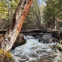
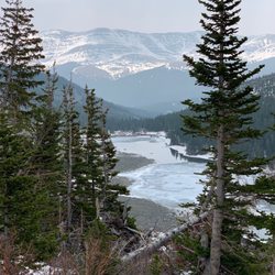
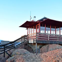
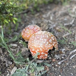
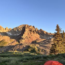
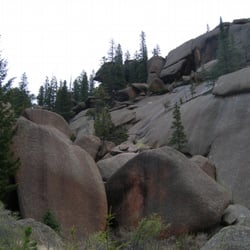
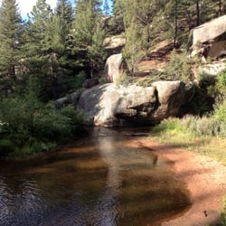
Mount Sherman Photos


You might also consider
More like Mount Sherman
Recommended Reviews - Mount Sherman
Start your review...

Reviews With Photos

8/23/2023 the 10-11 mile drive on the dirt road is a little rough. The last mile or so especially. The first section was just grated and bumpy. Saw a moose and her baby crossing the road on the way in be sure you SLOW DOWN on this road and dont fly on it. Wildlife does live here. Arrived at 605 am. Only a few cars in the lot but there was a long line of cars following me driving in. There is no bathroom and no trash cans at the parking lot. Be sure to go to the bathroom BEFORE you arrive and if you need to go on the trail or at the parking be sure to bring a baggie with you so you can put your TOILET PAPER IN THE BAGGIE! Do not leave your toilet paper in the bushes! Gross! and other people come here to enjoy! We dont want to see that! and wildlife lives here. Be respectful of th space and pack out what you pack in. If you may need to go #2 they sell wag bags at REI for under $3. This is a very secure way for you to go to bathroom and then pack it out. This would be ideal to carry in your packs just in case. Again be respectful of the space. Trail is on an incline from the get-go. It is rocky. I would personally have the all trails map downloaded and also pictures from 14ers.com downloaded. It is not totally clearly laidout as to which is the right way to go and could be easy to get off the trail. There is one section of the ridge that is a little narrow and could make someone scared of heights nervous. Put your pole on the side closest to the ledge though. At no time did anyone in our group feel unsafe on this. For most part the ridge is plenty wide. We could not find a geological marker at the top. Trail is dry and in summer conditions. Thankful it was a non windy day and the sun was shining! Bring poles for the way down. The scree definitely is loose and slides around. We had a couple of people slip in our group even with their poles.

My first 14-er, and I think it was a good one to start with. The drive from Denver took about 2-2.5 hours, a good chunk of which was spent on a very rocky dirt road. Thank goodness we were in a rented SUV with relatively high clearance; definitely would not take my own sedan. Of note, there's no bathroom so make sure you're prepared after that long and bumpy road. There's no real signage marking the trailhead or trails, but we figured we'd just get out where the other few cars were parked. Parking was very easy on a Friday morning in August. The hike itself was beautiful and very scenic. Pretty tough in the middle portion of it, with some pretty steep inclines. But if you take it slow and steady, you'll make it. There were also lots of false summits, which was a little disheartening but at least the view was spectacular the entire time. Took us about 3.5-4 hours to complete the whole hike (which is about 5 miles round trip). Would highly recommend everything except the drive on that rough rocky road.


Colder and snowier than I wanted it to be in June, it was about what was expected. The main trail is straightforward, having only three or so major turns. I recommend starting before sunrise so you have decent parking and can see the sunrise, but this day we started a bit later. For the first time, I had to glissade down the snow because, even though I tried not to, I ended up slipping and going for that ride anyway. It was very controllable, so no issues. The walk is very very rocky and people struggle to breathe, which is to be expected. Views from above include a lot of the surrounding mountains, Leadville, some lakes/reservoirs, and more. read more


The mosquito range is a great way to bag a bunch of 13ers Much less crowded than the popular 14ers Edwards, Bierstadt Rosalie etc Easy to get both Horseshoe and Peerless in less than 4 hours. Easy to add ( well not too easy) Sheridan and or Sherman. read more


3 years ago
8/23/2023 the 10-11 mile drive on the dirt road is a little rough. The last mile or so especially. The first section was just grated and bumpy. Saw a moose and her baby crossing the road on the way in be sure you SLOW DOWN on this road and dont fly on it. Wildlife does live here. Arrived at 605 am. Only a few cars in the lot but there was a long line of cars following me driving in. There is no bathroom and no trash cans at the parking lot. Be sure to go to the bathroom BEFORE you arrive and if you need to go on the trail or at the parking be sure to bring a baggie with you so you can put your TOILET PAPER IN THE BAGGIE! Do not leave your toilet paper in the bushes! Gross! and other people come here to enjoy! We dont want to see that! and wildlife lives here. Be respectful of th space and pack out what you pack in. If you may need to go #2 they sell wag bags at REI for under $3. This is a very secure way for you to go to bathroom and then pack it out. This would be ideal to carry in your packs just in case. Again be respectful of the space. Trail is on an incline from the get-go. It is rocky. I would personally have the all trails map downloaded and also pictures from 14ers.com downloaded. It is not totally clearly laidout as to which is the right way to go and could be easy to get off the trail. There is one section of the ridge that is a little narrow and could make someone scared of heights nervous. Put your pole on the side closest to the ledge though. At no time did anyone in our group feel unsafe on this. For most part the ridge is plenty wide. We could not find a geological marker at the top. Trail is dry and in summer conditions. Thankful it was a non windy day and the sun was shining! Bring poles for the way down. The scree definitely is loose and slides around. We had a couple of people slip in our group even with their poles. read more


4 years ago
My first 14-er, and I think it was a good one to start with. The drive from Denver took about 2-2.5 hours, a good chunk of which was spent on a very rocky dirt road. Thank goodness we were in a rented SUV with relatively high clearance; definitely would not take my own sedan. Of note, there's no bathroom so make sure you're prepared after that long and bumpy road. There's no real signage marking the trailhead or trails, but we figured we'd just get out where the other few cars were parked. Parking was very easy on a Friday morning in August. The hike itself was beautiful and very scenic. Pretty tough in the middle portion of it, with some pretty steep inclines. But if you take it slow and steady, you'll make it. There were also lots of false summits, which was a little disheartening but at least the view was spectacular the entire time. Took us about 3.5-4 hours to complete the whole hike (which is about 5 miles round trip). Would highly recommend everything except the drive on that rough rocky road. read more


4 years ago
This was my wife and I's first Colorado 14er. It was a really nice warm up and re-introduction to 14ers. I loved the 360 degree views from the top. As well as the wild flowers and scenery along the way. This is a nice hike, and I would recommend it! read more


Super challenging hike and definitely wouldn't stay this is an "easy" 14er by any means. The beginning of the hike is nice and scenic but once when it starts getting steep it's steep with lots of loose rocks and gravel. There are multiple false summits which was disheartening and made it even more difficult. Made it to the too and was so worth it but definitely take your time and bring lots of water. The dirt road was bumpy but is doable in a normal passenger car. We were in a rav 4 and we just parked behind the other cars on the rod since the last few hundred feet up to the lot started getting bumpier with bigger holes. We saw some smaller cars parked up there so it's doable with any vehicle in my opinion. You also reach the summit of a 13er mount Sheridan with this trail. Great hike! read more


More info about Mount Sherman
18 County Rd
Fairplay, CO 80440
Directions
Hours
Outdoor Amenities
Ask the Community - Mount Sherman


Why does Yelp recommend reviews?
1 review that is not currently recommended
The reviews below are not factored into the business's overall star rating.
3 years ago
Mount Sherman - hiking - Updated June 2026
Best of Fairplay
People found Mount Sherman by searching for…
Trending Searches in Fairplay, CO
Amusement Parks near Mount Sherman
Black Owned Nail Salons near Mount Sherman
Boat Rental near Mount Sherman
Cliff Jumping near Mount Sherman
Dog Friendly Trails near Mount Sherman
Fishing Spots near Mount Sherman
Jet Ski Rental near Mount Sherman
Outdoor Activities near Mount Sherman
Pick Your Own Farms near Mount Sherman
Public Pools near Mount Sherman
Public Shower near Mount Sherman
Running Trails near Mount Sherman
Scenic Drive near Mount Sherman
Strawberry Picking near Mount Sherman
Sunrise View near Mount Sherman
Swimming Holes near Mount Sherman
Swimming Lakes near Mount Sherman
Swimming Pools near Mount Sherman
Watch Sunset near Mount Sherman
Browse Articles
Browse Nearby
Browse Brands
Related Searches in Fairplay, CO
Affordable Kayak Rental Services in Fairplay, Colorado
Best Fishing Locations and Guides in Fairplay, Colorado
Best Nature Trails for Hiking in Fairplay, Colorado
Best Places for Horseback Riding in Fairplay, Colorado
Best Sledding Spots and Fun in Fairplay, Colorado
Best Spots for Star Gazing in Fairplay, Colorado
Discover Dog Friendly Trails to Explore in Fairplay, Colorado
Discover Popular Bike Trails in Fairplay, Colorado
Discover Popular Photo Spots in Fairplay, Colorado
Discover a Hiking Trail in Fairplay, Colorado
Discover the Best Night Hike Trails in Fairplay, Colorado
Dog-Friendly Hikes With Dogs in Fairplay, Colorado
Enjoy Camping Adventures Around Fairplay, Colorado
Enjoy Exciting Mountain Biking Adventures in Fairplay, Colorado
Enjoy the Best Tubing Experiences in Fairplay, Colorado
Enjoy the Best Walking Trails in Fairplay, Colorado
Experience Stunning Sunset Views in Fairplay, Colorado
Explore Beautiful Parks and Green Spaces in Fairplay, Colorado
Explore Bike Rentals Throughout Fairplay, Colorado
Explore Easy Hikes Perfect for All in Fairplay, Colorado
Explore Family-Friendly Zoos and Wildlife in Fairplay, Colorado
Explore Free Things to Do Around Fairplay, Colorado
Explore Fun Activities to Do in Fairplay, Colorado
Explore Popular Campgrounds Near Fairplay, Colorado
Explore Popular RV Parks Around Fairplay, Colorado
Explore Scenic Lakes to Visit in Fairplay, Colorado
Explore Secret Spots Worth Visiting in Fairplay, Colorado
Explore Top Dog Parks in Fairplay, Colorado Near You
Explore the Best Swimming Holes Around Fairplay, Colorado
Explore the Best Trail Options in Fairplay, Colorado
Family Friendly Hiking With Kids in Fairplay, Colorado
Find Beautiful Views in Fairplay, Colorado
Find Popular Ziplining Spots Around Fairplay, Colorado
Find Top Dog Swimming Spots in Fairplay, Colorado
Find Top-Rated Disc Golf in Fairplay, Colorado
Find the Best Playgrounds to Visit in Fairplay, Colorado
Find the Best Swimming Pools in Fairplay, Colorado Today
Hiking Trails With Waterfalls in Fairplay, Colorado
Locate a Public Shower Facility in Fairplay, Colorado
Off Leash Dog Hiking Trails in Fairplay, Colorado
Plan a Scenic Drive Route Near Fairplay, Colorado
Popular Kids Activities in Fairplay, Colorado
Popular Things to Do in Fairplay, Colorado
Relax at Natural Hot Springs Near Fairplay, Colorado
Top Paddleboarding Activities in Fairplay, Colorado
Top Running Trails to Explore in Fairplay, Colorado
Top Swimming Lakes to Enjoy in Fairplay, Colorado
Top Things to Do With Kids in Fairplay, Colorado