Mount Olympus Trailhead Photos


You might also consider
More like Mount Olympus Trailhead
Recommended Reviews - Mount Olympus Trailhead
Start your review...

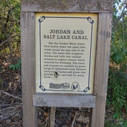
OH the stairs, the stairs. They can be a blessing or a curse. Stairs were put in to help with the very steep elevation gain going up to Mount Olympus or Bonneville Shoreline Trail. Personally I like hiking just on the dirt trail, even though there is a very steep elevation. Because it has been so dry this trailhead is very slippery. I didn't use any poles coming up here, and thought maybe I should have to help me from slipping every which way. This is another busy, busy trail, and is narrow in parts which makes it hard to pass. There is no shade on this trail if you turn off on the BST, except if you hike all the way down to the subdivision right towards the end there is a bit of shade, but for the most part there is none. This is also a very noisy trail, and you hear traffic all the way along the trail, unless you go further up closer to Mount Olympus. There has been no parking for years except on the street, so I was glad to see that there is a small one being built right by the trailhead. **Dogs are allowed on this trail, but please pick up after them. ***No bathroom available read more


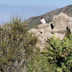
"What was I thinking?" That phrase went through my mind over and over again on this hike. This was hard. 1) Bring a lot of water. I went on a day that was about 90 degrees in the valley, so I thought I was prepared by taking 3 liters of water in my camelbak and then another 16 oz Gatorade. I ran out of liquid. I was sooo dehydrated by the end. I typically carry around a 40 oz hydroflask everywhere, so I do drink more water than most people... but still... be prepared. 2) Trekking poles are a good idea for this hike. Definitely not needed, but lots of people had them and I was grateful for mine. My upper body was able to take a lot of the stress off of my quads and knees. 3) Bring snacks. I ate an apple, some fruit snacks, some almonds, half a protein bar, and some Clif Shot Blocks. I also brought tuna, but didn't touch it. You're working hard for an extended period of time. You need some fuel to keep you going. 4) Head up early, if you can! It seems like this hike typically takes people 3-8 hours. I was right in the middle with being just shy of 6 hours. I did go all the way to the top and I took a few good sit down breaks. 5) Last, but definitely not least. The scramble to the top? It's hard. You are climbing up big rocks. It's fairly technical. WEAR GOOD SHOES! Leave the worn out tennis shoes at home. Wear your best, most grippy trail shoes for this. I was terrified of this scramble. Almost turned around. But I made it up, and if you take it slow on the way back down, it's not too bad. You can do it. Just be safe, smart, slow. read more


9 years ago
8 years ago
This trail was challenging but definitely worth the reward after finishing it. My wife and I came to Salt Lake City, Utah for our honeymoon, looking for different trails, this one hands down was the best. If you are looking for a little challenge but not impossible for the average Joe I would go with this one. read more


11 years ago
13 years ago
10 years ago
More info about Mount Olympus Trailhead
5789 Wasatch Blvd
Holladay, UT 84121
Directions
Hours
Indoor Amenities
Outdoor Amenities
Ask the Community - Mount Olympus Trailhead
Review Highlights - Mount Olympus Trailhead
You might also consider


Why does Yelp recommend reviews?
1 review that is not currently recommended
The reviews below are not factored into the business's overall star rating.
8 years ago
Mount Olympus Trailhead - hiking - Updated May 2026
Best of Holladay
People found Mount Olympus Trailhead by searching for…
Sunrise View in Holladay, Utah
Beautiful Views in Holladay, Utah
Sunrise Hike in Holladay, Utah
Scenic Overlook in Holladay, Utah
Hiking Trails in Holladay, Utah
Watch Sunset in Holladay, Utah
Running Trails in Holladay, Utah
Walking Trails in Holladay, Utah
Dog Friendly Parks in Holladay, Utah
Stair Climbing in Holladay, Utah
Dog Friendly Hiking Trails in Holladay, Utah
Free Things to Do in Holladay, Utah
Stairs Workout in Holladay, Utah
Lookout Points in Holladay, Utah
Off Road Trails in Holladay, Utah
Hikes With Dogs in Holladay, Utah
Trending Searches in Holladay, UT
Bird Sanctuary near Mount Olympus Trailhead
Botanical Gardens near Mount Olympus Trailhead
Bounce House Rentals near Mount Olympus Trailhead
Cheap Plants near Mount Olympus Trailhead
Cliff Jumping near Mount Olympus Trailhead
Flower Delivery near Mount Olympus Trailhead
Flower Fields near Mount Olympus Trailhead
Free Picnic Areas near Mount Olympus Trailhead
Garage Sales near Mount Olympus Trailhead
Garden Center near Mount Olympus Trailhead
Golf Driving Range near Mount Olympus Trailhead
Golf Lessons near Mount Olympus Trailhead
Lakes & Ponds near Mount Olympus Trailhead
Nurseries & Gardening near Mount Olympus Trailhead
Outdoor Activities near Mount Olympus Trailhead
Outdoor Furniture Stores near Mount Olympus Trailhead
Parks near Mount Olympus Trailhead
Party Equipment Rentals near Mount Olympus Trailhead
Pedicure near Mount Olympus Trailhead
Photo Spots near Mount Olympus Trailhead
Places To Take Pictures near Mount Olympus Trailhead
Pokemon Go near Mount Olympus Trailhead
Rock Quarry near Mount Olympus Trailhead
Scenic Drive near Mount Olympus Trailhead
Scenic Night View near Mount Olympus Trailhead
Strawberry Picking near Mount Olympus Trailhead
Sunrise View near Mount Olympus Trailhead
Swimming Holes near Mount Olympus Trailhead
Browse Articles
Browse Nearby
BEST of Holladay, Utah Coffee near Mount Olympus Trailhead
BEST of Holladay, Utah Restaurants near Mount Olympus Trailhead
BEST of Holladay, Utah Things to Do near Mount Olympus Trailhead
BEST of Holladay, Utah Breakfast near Mount Olympus Trailhead
BEST of Holladay, Utah Walking Trails near Mount Olympus Trailhead
BEST of Holladay, Utah Parks near Mount Olympus Trailhead
BEST of Holladay, Utah Hotels near Mount Olympus Trailhead
BEST of Holladay, Utah Sledding near Mount Olympus Trailhead
BEST of Holladay, Utah Campgrounds near Mount Olympus Trailhead
Browse Brands
Related Searches in Holladay, UT
Affordable Kayak Rental Services in Holladay, Utah
Best Fishing Locations and Guides in Holladay, Utah
Best Places for Horseback Riding in Holladay, Utah
Best Waterfalls and Swimming Holes in Holladay, Utah
Check Out Off Road Trails in Holladay, Utah
Discover Dog Friendly Trails to Explore in Holladay, Utah
Discover Scenic Waterfall Spots in Holladay, Utah
Discover Top Scenic Spots to Visit in Holladay, Utah
Discover Top State Parks to Visit in Holladay, Utah
Discover a Hiking Trail in Holladay, Utah
Discover the Best Night Hike Trails in Holladay, Utah
Enjoy Camping Adventures Around Holladay, Utah
Enjoy Kayaking Adventures in Holladay, Utah
Enjoy River Tubing Adventures in Holladay, Utah
Enjoy Tent Camping Spots Around Holladay, Utah
Enjoy Water Activities and Fun in Holladay, Utah
Enjoy a Beautiful Waterfall Hike in Holladay, Utah
Enjoy the Best Picnic Spots and Ideas in Holladay, Utah
Enjoy the Best Walking Trails in Holladay, Utah
Exciting Cliff Jumping Spots in Holladay, Utah
Experience Thrilling White Water Rafting in Holladay, Utah
Explore Beautiful Parks and Green Spaces in Holladay, Utah
Explore Easy Hikes Perfect for All in Holladay, Utah
Explore Fun Activities to Do in Holladay, Utah
Explore Nature Spots Around Holladay, Utah
Explore Popular Campgrounds Near Holladay, Utah
Explore Scenic Lakes to Visit in Holladay, Utah
Explore the Best Swimming Holes Around Holladay, Utah
Explore the Best Trail Options in Holladay, Utah
Family Friendly Hiking With Kids in Holladay, Utah
Find Beautiful Views in Holladay, Utah
Find Popular Ziplining Spots Around Holladay, Utah
Find the Best Parks for Picnics in Holladay, Utah
Find the Best Scenic View Locations in Holladay, Utah
Hiking Trails With Waterfalls in Holladay, Utah
Off Leash Dog Hiking Trails in Holladay, Utah
Plan a Scenic Drive Route Near Holladay, Utah
Popular Fishing Spots to Explore in Holladay, Utah
Popular Outdoor Activities to Try in Holladay, Utah
Popular Picnic Spots to Visit in Holladay, Utah
Popular Things to Do in Holladay, Utah
Popular Things to See in Holladay, Utah
Safe River Swimming Areas in Holladay, Utah
Safe and Fun Parks for Kids in Holladay, Utah
Top Climbing Spots and Gyms in Holladay, Utah
Top Running Trails to Explore in Holladay, Utah
Top Swimming Lakes to Enjoy in Holladay, Utah
Top Swimming Spots and Pools in Holladay, Utah
People who viewed Mount Olympus Trailhead also viewed
Butler Fork Trail
1 review
Hell Canyon Trail
1 review
Capitol Hill
Carolina Hills Trail Head
1 review
Timpanogos Cave National Monument
77 reviews
Jordan River Parkway Trail
10 reviews
Deuel Creek South Trail
1 review
Silver Lake Trail
5 reviews
Guardsman Pass Overlook
9 reviews
Twin Peaks Avenue Trail
1 review
Tunnel Springs Park
3 reviews