Mount Ellinor Photos

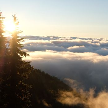


More like Mount Ellinor
Recommended Reviews - Mount Ellinor
Start your review...


Reviews With Photos


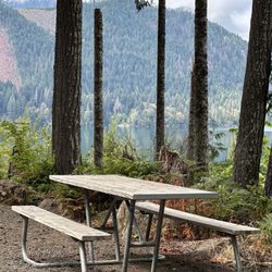
I came here on a Saturday around 9AM, road leading up to it wasn't paved but was pretty smooth. Parking lot was mostly full, we snagged the last spot and there were cars on the street already as well. Lower trailhead also had quite a few cars already parked there when we passed it. The hike was steep and there was a half-marathon going on so runners would go by us every so often. We got up in about an hour and fifteen minutes, short hike but steep. The views were unfortunately obstructed by clouds. Every so often, the clouds would clear a bit and we would be able to see the view, but we mostly saw Lake Cushman, couldn't see anything else around. The hike down was alright, was glad to have hiking poles.


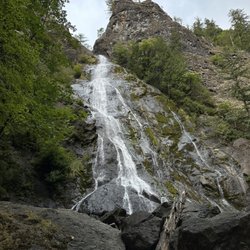
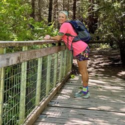
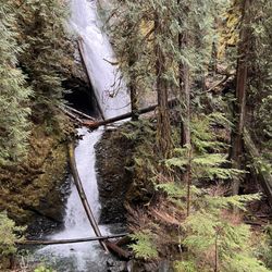
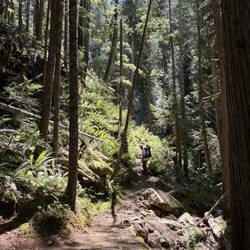
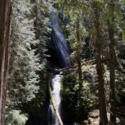
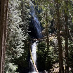
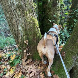
So my friend wanted me to find places closer to Lacey to get in a good hike as opposed to going to Mt Rainier. I saw that Mt Ellinor didn't have any pictures on the Yelp app, which I don't like since I'm a visual person. So I thought I'd check it out. I posted a tip in the app on how to get there as sometimes trailheads are hard to find especially when following national forest (NF) roads which are usually primitive and not marked well. Northwest Forest Pass is needed by the way. I'm still pretty novice as a hiker so I don't over plan and don't have a huge backpack or any of that. I do take water and snacks and a first aid kit and such but nothing too major. There are two trailheads; upper and lower. I took the lower which I think takes longer although there is a secret cut through that you can use to get up to where the lower and upper join quicker. It was perfect weather. Not sunny with mist in the air. Not humid or muggy. Don't forget to register at the registration station before you enter the forest so that if you don't come down or get lost, the rangers or someone will know. I went on a week day around 9 A.M.-ish. There were only 3 people on the trail. Actually there was myself, another hiker with 2 dogs, and a pack of hikers that pretty much did everything they could to disturb the calm & peaceful quietness of the forest. I go hiking to just think and enjoy nature and the silence. I wish some people would respect the fact that other hikers are out there just trying to enjoy nature without a group of silly gooses yapping their mouths really loud and damaging the forest physically as well. Anyway, this trail is perfect for me. It's just arduous and strenuous enough with a decent incline. The switchbacks & steep incline toward the end kind of got me panting a bit ...as well as the fact that the loud mouths were bothering my serenity and I didn't want to be at the top when they got there. So I chose to come down and try again on another day. Otherwise this mount and trail are amazing. There are inclines and it tapers off and then there are switchbacks and declines and just a big variety. The natural surroundings are amazing as well. (see the pictures). I will definitely be going back with my friend and see if it kicks her tail. From the trailhead of the lower trail and back to my car it was almost 8 miles. This is according to my tracking app & I took different combinations of trails within. Many websites say it's two routes. One longer(6.4) and one short(3.2). It depends on what trailhead you start at & what you do once you're on the trails.


One of the best hiking spots I have found since moving out to the PNW from Florida! I am new to the hiking community and found this area perfect for some new challenges! The road leading up the trail is rough (i.e. gravel/dirt, pot holes, narrow) and fairly long (about 4 miles to the lower trailhead and longer to the upper trailhead). I did not experience much traffic - most likely due to visiting during the off-season - but I can imagine it can be a stressful task during the area's busy season. There is a handful of parking spots once you get to the trailhead, but I imagine it get tight during the summer. I worked through the lower trailhead all the way to the stunning view at the top (approximately 3 miles). The first 1/4 mile of the trail is fairly steep (or at least steeper than what I anticipated from a previous review). The trail is well kept and super easy to use, especially for a new hiker such as myself. I would definitely recommend this to any persons traveling out this way! The hike is long enough to get your muscles sore, but won't require an entire day.
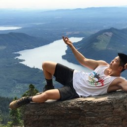

Difficulty: Intermediate Time: 1.5hr - 2hr Gear: Generic hiking boots, NorthFace backpack, and trekking poles Group: 5 Temp: 85(+/-) As the summer is winding down, probably one of the quickest but most intense and popular hikes would be Mount Ellinor. Granted, my friends and I are just casual hikers who are doing it for the instagram pictures and a way to spend some time with one another. We're a car full of grown ass men stuffed in a 4 door honda truck with the driver chatting on snapchat (like who does that...?!) and trying to not let the soccer mom van to our right beat us. The drive up from Seattle is decent but as we got closer to the trailhead the road is rocky and there are pot holes. Please dont be THAT guy with the 2016 mercedes trying to drive up. Shit dude I feel so bad for your car. There are two options for this hike. (1) You could start from the bottom of the trail head with a nice 2.5-3 mile warm up hike (there are spots to park). Its a beautiful scenic view with slight elevation to really warm up your legs for the second half of the hike. Or (2) you could start at the second portion of the hike where you aren't sure if you're already in hell or walking closer to it. I guess that doesn't make sense since you're hiking upwards but just let me have this... The second portion of the hike is around 3.5 miles INCLINE. Trekking poles and good hiking boots is a must in my honest opinion. You start off with an incline and end with an incline. There isn't a point where you're walking at 180 degrees. The trail will be kinda rocky but mostly dirt. Its a very well maintained trail due to its popularity so you can easy navigate through. A lil less than halfway through you'll hit basically 80% rocky terrain and 20% dirt and loose gravel. This is where hiking boots really come in handy (ascending and descending). The ankle support and grip onto the loose dirt and gravel is really nice and gives you a sense of security. The trekking poles prevent the news from saying "man/women falling off a cliff". Trust me, its really nice. Once you're over half way through the view is incredible. And the more you ascend its a surreal experience. The incline is ridiculous but finishing and saying "yeah i did that" is well worth it. Definitely go with a group of friends and BRING ELECTROLYTES.


1 year ago


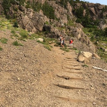
I would totally give this hike 5 stars. I would REALLY like to see some updates on the wta.org website though... I feel like I was NOT ready for what we did! We started at the LPL (lower parking lot) which is not really a parking lot, you just kinda pull off to the side and park or if there is no space just squeeze as far over to the side as you can. We hiked from the LTH (lower trail head) to the UTH (upper trail head... you get the drift here) with really no issues. It was nicely covered in the forest and the breezy/foggy day made it perfect for my not experienced hiking self and my husband not experienced fitness self. I kept comparing it to Si, and how Si was hell on earth, never ending, this was nothing comparative, my auntie could do it, etc. etc. etc..... WHOA SHUT YOUR MOUTH SISTER! When we made it to the UTH, my hubs was winded and sweaty but pumped to keep going (he brought his new Kenetreks and poles to break in before Elk season...) and I was on a roll. We only had 1.9 miles left right... come on.... Those 1.9 miles had to have taken us 1.5 hours.... (don't tell him this but I coulda done it quicker...) It was pretty much straight up through a ton of rocks, loose gravel and insane steps! The trail was fairly well marked, and well maintained (never felt sketched out bc of the trail, more bc of the heights and scrambling on my hands and knees) We made it to the top and chilled out for a bit. Sadly the fog did not clear while we were on the summit, so we did not get to see the incredible views... but hey we did it and that's what counts. I would highly recommend this trail to experienced hikers and plan for a day trip if you are traveling from Tacoma (it takes 2 hours to get there for sure...) Lots of people brought dogs, poles, and packs with water and snacks (this is a must!) TIP: Bring packs with water/snacks, take lots of rest breaks, if you are only interested in summiting start at the UTH, DO NOT CUT OUT AT THE UTHPL and walk down the dirt road to the LPL. We did this, and it adds on .6 miles (we also got count in a down-pour, and at one point thought we would never find our car... mind you at this point it was getting dark). This is NOT a hike for young kids. While we will not be doing Ellinor again (I know I know even though we did not get to see the views...) I suggest doing this and for all my poop talking... sorry Mt. Si has NOTHING on this summit scramble (and yes I'm talking about BIG Si). read more


One of my favorite summer hikes and it you have some ice axe and crampon experience, my favorite winter hike as well. Two places to start, lower requires no National Forest pass, but adds 900 ft in additional hiking. Upper is good too, either way extremely steep. Mt Si is 1000 ft elevation gain per mile, this hike is 1800 ft. You want to be in good shape because the hike down is just as hard as up. Lose rocks, exposed cliffs and mountain goats add to the difficulty of the hike. I saw dogs but recommend against it. The Rock field at the base of the peak is extremely jagged and usually were the goats hang out. Overall, the work put in pays off with amazing 360 alpine views. St Helens, Adams, Rainier and Baker on a clear day are easily seen. As well as Seattle and Tacoma. Be safe, bring the ten essentials and plenty of water and this will be one of your favorite hikes. read more


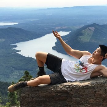
I came here on a Saturday around 9AM, road leading up to it wasn't paved but was pretty smooth. Parking lot was mostly full, we snagged the last spot and there were cars on the street already as well. Lower trailhead also had quite a few cars already parked there when we passed it. The hike was steep and there was a half-marathon going on so runners would go by us every so often. We got up in about an hour and fifteen minutes, short hike but steep. The views were unfortunately obstructed by clouds. Every so often, the clouds would clear a bit and we would be able to see the view, but we mostly saw Lake Cushman, couldn't see anything else around. The hike down was alright, was glad to have hiking poles. read more


3 years ago


So my friend wanted me to find places closer to Lacey to get in a good hike as opposed to going to Mt Rainier. I saw that Mt Ellinor didn't have any pictures on the Yelp app, which I don't like since I'm a visual person. So I thought I'd check it out. I posted a tip in the app on how to get there as sometimes trailheads are hard to find especially when following national forest (NF) roads which are usually primitive and not marked well. Northwest Forest Pass is needed by the way. I'm still pretty novice as a hiker so I don't over plan and don't have a huge backpack or any of that. I do take water and snacks and a first aid kit and such but nothing too major. There are two trailheads; upper and lower. I took the lower which I think takes longer although there is a secret cut through that you can use to get up to where the lower and upper join quicker. It was perfect weather. Not sunny with mist in the air. Not humid or muggy. Don't forget to register at the registration station before you enter the forest so that if you don't come down or get lost, the rangers or someone will know. I went on a week day around 9 A.M.-ish. There were only 3 people on the trail. Actually there was myself, another hiker with 2 dogs, and a pack of hikers that pretty much did everything they could to disturb the calm & peaceful quietness of the forest. I go hiking to just think and enjoy nature and the silence. I wish some people would respect the fact that other hikers are out there just trying to enjoy nature without a group of silly gooses yapping their mouths really loud and damaging the forest physically as well. Anyway, this trail is perfect for me. It's just arduous and strenuous enough with a decent incline. The switchbacks & steep incline toward the end kind of got me panting a bit ...as well as the fact that the loud mouths were bothering my serenity and I didn't want to be at the top when they got there. So I chose to come down and try again on another day. Otherwise this mount and trail are amazing. There are inclines and it tapers off and then there are switchbacks and declines and just a big variety. The natural surroundings are amazing as well. (see the pictures). I will definitely be going back with my friend and see if it kicks her tail. From the trailhead of the lower trail and back to my car it was almost 8 miles. This is according to my tracking app & I took different combinations of trails within. Many websites say it's two routes. One longer(6.4) and one short(3.2). It depends on what trailhead you start at & what you do once you're on the trails. read more


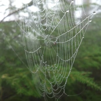


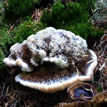


One of the best hiking spots I have found since moving out to the PNW from Florida! I am new to the hiking community and found this area perfect for some new challenges! The road leading up the trail is rough (i.e. gravel/dirt, pot holes, narrow) and fairly long (about 4 miles to the lower trailhead and longer to the upper trailhead). I did not experience much traffic - most likely due to visiting during the off-season - but I can imagine it can be a stressful task during the area's busy season. There is a handful of parking spots once you get to the trailhead, but I imagine it get tight during the summer. I worked through the lower trailhead all the way to the stunning view at the top (approximately 3 miles). The first 1/4 mile of the trail is fairly steep (or at least steeper than what I anticipated from a previous review). The trail is well kept and super easy to use, especially for a new hiker such as myself. I would definitely recommend this to any persons traveling out this way! The hike is long enough to get your muscles sore, but won't require an entire day. read more


9 years ago
Difficulty: Intermediate Time: 1.5hr - 2hr Gear: Generic hiking boots, NorthFace backpack, and trekking poles Group: 5 Temp: 85(+/-) As the summer is winding down, probably one of the quickest but most intense and popular hikes would be Mount Ellinor. Granted, my friends and I are just casual hikers who are doing it for the instagram pictures and a way to spend some time with one another. We're a car full of grown ass men stuffed in a 4 door honda truck with the driver chatting on snapchat (like who does that...?!) and trying to not let the soccer mom van to our right beat us. The drive up from Seattle is decent but as we got closer to the trailhead the road is rocky and there are pot holes. Please dont be THAT guy with the 2016 mercedes trying to drive up. Shit dude I feel so bad for your car. There are two options for this hike. (1) You could start from the bottom of the trail head with a nice 2.5-3 mile warm up hike (there are spots to park). Its a beautiful scenic view with slight elevation to really warm up your legs for the second half of the hike. Or (2) you could start at the second portion of the hike where you aren't sure if you're already in hell or walking closer to it. I guess that doesn't make sense since you're hiking upwards but just let me have this... The second portion of the hike is around 3.5 miles INCLINE. Trekking poles and good hiking boots is a must in my honest opinion. You start off with an incline and end with an incline. There isn't a point where you're walking at 180 degrees. The trail will be kinda rocky but mostly dirt. Its a very well maintained trail due to its popularity so you can easy navigate through. A lil less than halfway through you'll hit basically 80% rocky terrain and 20% dirt and loose gravel. This is where hiking boots really come in handy (ascending and descending). The ankle support and grip onto the loose dirt and gravel is really nice and gives you a sense of security. The trekking poles prevent the news from saying "man/women falling off a cliff". Trust me, its really nice. Once you're over half way through the view is incredible. And the more you ascend its a surreal experience. The incline is ridiculous but finishing and saying "yeah i did that" is well worth it. Definitely go with a group of friends and BRING ELECTROLYTES. read more




7 years ago
9 years ago
Whoa! Awesome hike up this peak with views in every direction. Started on the trail from the lower parking lot in the dark to try to catch sunrise. It was a tough hike, but the trail was pretty clear to follow, and it was absolutely worth the effort. The morning I went (end of August), there were low clouds moving in the valleys, so the scene was constantly changing. Pretty cool to watch. read more


11 years ago
10 years ago
More info about Mount Ellinor
Hoodsport, WA 98548
Directions
Hours
Outdoor Amenities
Ask the Community - Mount Ellinor
Review Highlights - Mount Ellinor













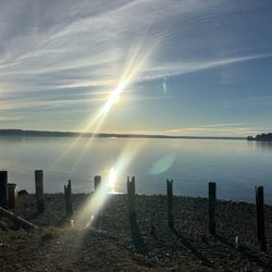


Mount Ellinor - hiking - Updated May 2026
Best of Hoodsport
People found Mount Ellinor by searching for…
Hiking Trails in Hoodsport, WA
Off Road Trails in Hoodsport, WA
Beautiful Views in Hoodsport, WA
Places to Take Pictures in Hoodsport, WA
Dog Friendly Hiking Trails in Hoodsport, WA
Playgrounds for Kids in Hoodsport, WA
Natural Hot Springs in Hoodsport, WA
Waterfall Hike in Hoodsport, WA
Lookout Points in Hoodsport, WA
Walking Trails in Hoodsport, WA
Trending Searches in Hoodsport, WA
Boat Rental near Mount Ellinor
Botanical Gardens near Mount Ellinor
Bounce House Rentals near Mount Ellinor
Campgrounds near Mount Ellinor
Cherry Picking near Mount Ellinor
Cliff Jumping near Mount Ellinor
Dog Friendly Things To Do near Mount Ellinor
Flower Fields near Mount Ellinor
Flower Shop near Mount Ellinor
Garage Sales near Mount Ellinor
Nurseries & Gardening near Mount Ellinor
Outdoor Activities near Mount Ellinor
Outdoor Furniture Stores near Mount Ellinor
Party Equipment Rentals near Mount Ellinor
Pick Your Own Farms near Mount Ellinor
Picnic Areas near Mount Ellinor
Rainy Day Activities near Mount Ellinor
Rock Quarry near Mount Ellinor
Running Trails near Mount Ellinor
Scenic Drive near Mount Ellinor
Secret Spots near Mount Ellinor
State Parks near Mount Ellinor
Strawberry Picking near Mount Ellinor
Sunrise View near Mount Ellinor
Swimming Holes near Mount Ellinor
Browse Articles
Browse Nearby
Browse Brands
Related Searches in Hoodsport, WA
Affordable Jet Ski Rental Options in Hoodsport, Washington
Affordable Kayak Rental Services in Hoodsport, Washington
Best Fishing Locations and Guides in Hoodsport, Washington
Best Fun Things to Do in Hoodsport, Washington
Best Places for Horseback Riding in Hoodsport, Washington
Discover Dog Friendly Beaches Near Hoodsport, Washington
Discover Dog Friendly Trails to Explore in Hoodsport, Washington
Discover Popular Bike Trails in Hoodsport, Washington
Discover Top Boat Tours in Hoodsport, Washington for All Ages
Discover a Hiking Trail in Hoodsport, Washington
Discover the Best Night Hike Trails in Hoodsport, Washington
Dog-Friendly Hikes With Dogs in Hoodsport, Washington
Enjoy Camping Adventures Around Hoodsport, Washington
Enjoy Exciting Mountain Biking Adventures in Hoodsport, Washington
Enjoy Kayaking Adventures in Hoodsport, Washington
Enjoy a Beautiful Waterfall Hike in Hoodsport, Washington
Exciting Cliff Jumping Spots in Hoodsport, Washington
Experience Stunning Sunset Views in Hoodsport, Washington
Experience Thrilling White Water Rafting in Hoodsport, Washington
Explore Beautiful Parks and Green Spaces in Hoodsport, Washington
Explore Bike Rentals Throughout Hoodsport, Washington
Explore Easy Hikes Perfect for All in Hoodsport, Washington
Explore Fun Activities to Do in Hoodsport, Washington
Explore Jet Skis for Sale or Rent in Hoodsport, Washington
Explore Popular Boat Charters Near Hoodsport, Washington
Explore Popular Campgrounds Near Hoodsport, Washington
Explore Popular RV Parks Around Hoodsport, Washington
Explore Popular Scenic Overlook Points in Hoodsport, Washington
Explore Scenic Lakes to Visit in Hoodsport, Washington
Explore Top Dog Parks in Hoodsport, Washington Near You
Explore Whale Watching Tours in Hoodsport, Washington
Explore the Best Boating Spots in Hoodsport, Washington
Family Friendly Hiking With Kids in Hoodsport, Washington
Find Top Dog Friendly Parks to Visit in Hoodsport, Washington
Find the Best Playgrounds to Visit in Hoodsport, Washington
Find the Best Scenic View Locations in Hoodsport, Washington
Find the Best Swimming Pools in Hoodsport, Washington Today
Hiking Trails With Waterfalls in Hoodsport, Washington
Locate a Public Shower Facility in Hoodsport, Washington
Off Leash Dog Hiking Trails in Hoodsport, Washington
Popular Fishing Spots to Explore in Hoodsport, Washington
Popular Kids Activities in Hoodsport, Washington
Popular Things to Do in Hoodsport, Washington
See Top Fireworks Events in Hoodsport, Washington
Top Fishing Charter Experiences in Hoodsport, Washington
Top Paddleboarding Activities in Hoodsport, Washington
Top Running Trails to Explore in Hoodsport, Washington
Top Swimming Lakes to Enjoy in Hoodsport, Washington
People who viewed Mount Ellinor also viewed

Dickerson Creek Waterfall
23 reviews

Rocky Brooks Falls
18 reviews

Newberry Hill Heritage Park
6 reviews

Dosewallips State Park
50 reviews

Rocky Creek Conservation Area
1 review

Staircase Campground
7 reviews

Staircase Area - Olympic National Park
8 reviews

Scenic Beach State Park
36 reviews

Lake Cushman
21 reviews

Skokomish Park
30 reviews