Mount Bailey Photos


You might also consider
More like Mount Bailey
Recommended Reviews - Mount Bailey
Start your review...

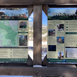
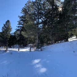
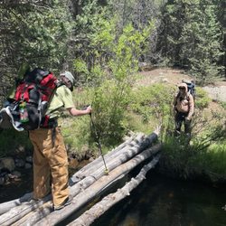
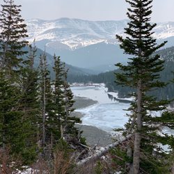
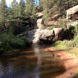
Mt. Bailey is the visually prominent peak you see every time you drive east bound through the town of Bailey on your way to Denver and the Front Range plains. It is a mountain summit in the Front Range of the Rocky Mountains of CO. The 9,089 foot peak is located 1.0 miles northeast of the community of Bailey in Park County, CO. This area is surrounded by private property, and the only known public access is the trail leading to the summit. The cliffs, while appealing for rock climbing, are also private property. You park and start at a children's playground. The trail head is visible and you will begin with a gradual but steady climb. Once at the summit area you will see the communications tower area, complete with barbed wire. Please do NOT disturb the area - disturbing the private property could jeopardize everyone's access to this peak. This trail is not really a good trail for mountain bikes or horses. It is only a half mile each way not worth the effort of bringing a bike here. The trail gets LOTS of use by the locals, one of them introduced me to this trail. I was told when it snows, it gets packed down and turns icy. So bring your microspikes or other traction devices. Tip: This is not a backpacking destination since its too short of a trail. This is more of a day hike when you want your heart to go pitter patter :0 Directions:From Denver, drive on Highway 285 west (signs say south) through Aspen Park. Continue to Annex Lane (about 26 miles west of C-470/285 intersection). Turn south and drive on CO RD 72, turn right (south)on Burland Dr. Drive until you see the parking area and the playgound (about a mile). Yes. You can bring your four legged bff! read more


10 years ago
Short 1/2 mile hike with great views from the top. Please stay to the left as you head up, to the right is private property and we want to be good neighbors. No trash cans here so pack out your picnic lunch. Cliffs at top so monitor your children. Most things done here are by volunteers and you are welcome to help too. If heading to the top is too steep, the 1st half of an easy trails stays in the aspens at the bottom. read more

More info about Mount Bailey
Bailey, CO 80421
Directions
Hours
Outdoor Amenities


Mount Bailey - hiking - Updated June 2026
Best of Bailey
People found Mount Bailey by searching for…
Browse Nearby
BEST of Bailey, Colorado Parks near Mount Bailey
BEST of Bailey, Colorado Restaurants near Mount Bailey
BEST of Bailey, Colorado Lakes near Mount Bailey
BEST of Bailey, Colorado Coffee near Mount Bailey
BEST of Bailey, Colorado Things to Do near Mount Bailey
BEST of Bailey, Colorado Breakfast near Mount Bailey
BEST of Bailey, Colorado Hot Springs near Mount Bailey
Browse Brands
Browse Articles
People who viewed Mount Bailey also viewed
Mount Morrison South Ridge Trail
5 reviews
Hell's Hole Trail
2 reviews
Chavez and Beaver Creek Trail
2 reviews
Snowshoeing
1 review
Mohawk Lakes Trail
18 reviews
Coyote Gulch Park
2 reviews
Chihuahua Lake
2 reviews
Reynolds Park Open Space
6 reviews
Cheesman Canyon Fishing Access Trailhead
2 reviews
Heritage Dells Park
3 reviews