Cancel

    Open app

    Search

    Meyers Ranch Trail

    5.0 (1 review)

    Meyers Ranch Trail Photos

    You might also consider

    Recommended Reviews - Meyers Ranch Trail

    Your trust is our priority, so businesses can't pay to alter or remove their reviews. Learn more about reviews.
    Yelp app icon
    Browse more easily on the app
    Review Feed Illustration
    Photo of Henry L.
    493
    1056
    6383

    4 years ago

    Helpful 5
    Thanks 0
    Love this 4
    Oh no 0

    You might also consider
    Verify this business for free

    People searched for Hiking 7,840 times last month within 15 miles of this business.

    Verify this business

    Alameda Creek Trail

    Alameda Creek Trail

    4.5(89 reviews)
    4.2 km

    I'm trying to check out more paved, longer bike paths managed by East Bay Regional Parks in 2026…read more On a bright, warm, January day, I rode the Alameda Creek trail from the Niles Staging area out to the end of the trail at the bay. There's a large free lot off Old Canyon Road with a not so great porta potty but pretty straightforward access to the trail. It's all paved and fairly wide but has sections that have seem better days with some rough sections, bumps and potholes. Still, it's a mostly pleasant ride as you're riding along the creek the entire way. The first section has some nice views of the winter green hills and even the Niles hillside sign in the distance. For some sections you'll be parallel to a busy road as well as some housing developments but once you get closer to Coyote Hills regional park, the scenery vastly improves. You actually intersect with the Bayview trail at Coyote Hills, so can take a detour around the park if you want more miles. However, I just followed the creek trail until it ends with some picnic benches at the bay. Overall, a fun trail that's mostly flat with a few short inclines each time you go under one of the roadside overpasses. I liked that you didn't have to wait at any busy intersections since the trail is continuous and easy to follow. I got to see some deer, herons, egrets, lots of geese and other shorebirds closer to the bay. The trail wasn't too crowded on a Saturday. Overall, I'm glad I checked it out and may come back again.

    Great bike ride for ebike. Started near Mission / Niles to end of the paved roads near Coyote…read moreCreek. Some parts in Union City needs repairs.

    Photos
    Alameda Creek Trail
    Alameda Creek Trail - Enjoying

    Enjoying

    Alameda Creek Trail

    See all

    Loop along High Ridge Tr., Pioneer Tr., Meyer's Ranch Tr.

    Loop along High Ridge Tr., Pioneer Tr., Meyer's Ranch Tr.

    4.7(3 reviews)
    1.4 km

    This is not a review of Garin Dry Creek Pioneer Regional Park, but instead it is a review of a loop…read moretrail of segments from High Ridge Loop Trail, Pioneer Trail, and Meyers Ranch Trail. These three trails occur in Garin Dry Creek Regional Park. The common trailhead for both Meyers Ranch Trail (takes you north) and High Ridge Loop Trail (takes you south) occurs about 50 feet away from this parking lot. HIGHLIGHTS FROM THE LOOP TRAIL: My photographs show trees shaped like giant mushrooms, where the cap of the giant mushroom-tree is about 30-feet wide. Other photos show rolling hills in the distance, with dense groves of trees situated in the ravines between rolling hills that are far in the distance, and rolling hills closer to the hiker. My photos also show a gnarly tree with trunks looking like octopus arms, with huge 1-foot wide tentacles growing from the tree trunk. Other photographs show a herd of black cows, resting near each other in the grass. Other photos show plush toys (quails, a frog, and a turtle) residing at various places near the loop trail. Another of my photographs shows a triangle-shaped stone, where I used enamels to paint a trail map on the stone. Toy cows sit on the stone. The toy cows know that they should not sit on the enamel-painted trails and, for this reason, these cows are smart and well-behaved BIG LOOP TRAIL CONSISTING OF SEGMENTS OF 3 DIFFERENT TRAILS. I took photos of a group of about 20 black cows, sitting peacefully on the grass in a shaded area next to High Ridge Loop Trail. Continuing in a counterclockwise hiking path, High Ridge Loop Trail includes a hairpin loop and, just beyond this hairpin loop, the trail gets steeper and steeper, and the view gets grander and more beautiful. From the steep part of this trail, one can gaze into the steep ravine by the north edge of the trail, and wonder in amazement at the fact that large trees grow out of the slope above the ravine, despite the fact that the slope is at a 45 degree angle. Looking to the west are more sights that evoke wonder and amazement, and these take the form of rolling hills in the distance, where patches of trees occurring in groves reciding in steep ravines. Some of the hills are entirely covered with trees. FROG AND TURTLE IN THE DRY CREEK BED. Regarding the dry creek running parallel to Meyers Ranch Trail, I went off-trail and hiked along the dry creek bed. I encountered a large puddle, and posed my frog and turtle on top of stones situated in the large puddle. In the dry creek bed, I found a triangle-shaped stone. I painted a trail map on the stone, and then posed some cows on the stone, and took a photograph of the prepared stone. See, attached photo of triangular stone. The cows are from Hobbies Unlimited on Manor Blvd. in San Leandro. On the stone, I used enamel paints, to paint the names of Meyer's Ranch Trail, Pioneer Trail, High Peaks Ridge Trail, May Trail, May Road, and Tamarack Drive. The enamel paint is from Hobbies Unlimited. The frog is from the gift shop at Henry Coe State Park. The turtle was made by Folkmanis Puppets in Emeryville, CA. Several feet away from Meyers Ranch Trail, I inserted a metal rod into the hard earth. This metal rod has a hook on the end of it, and the hook held a sign reading, QUAIL CROSSING. I put two California quails on the ground next to the sign. The QUAIL CROSSING sign is available by mail order from the gift shop at Anza Borrego Desert State Park. The quails are from Wild Republic. See, attached photo of the sign and the quails.

    Great trail for everyone, we had kids on boards, electric…read morebikes, dogs, strollers, seniors, and everything in between sharing the trail with us. It's a great trail, again, can't say it enough..views that are unparalleled...we will be back.

    Photos
    Loop along High Ridge Tr., Pioneer Tr., Meyer's Ranch Tr. - Quail and QUAIL CROSSING sign, posing near Meyer's Ranch Tr.

    Quail and QUAIL CROSSING sign, posing near Meyer's Ranch Tr.

    Loop along High Ridge Tr., Pioneer Tr., Meyer's Ranch Tr. - Get Up, Get Out! Meyer's Ranch - High Ridge Loop Trail 1.22.22

    Get Up, Get Out! Meyer's Ranch - High Ridge Loop Trail 1.22.22

    Loop along High Ridge Tr., Pioneer Tr., Meyer's Ranch Tr.

    See all

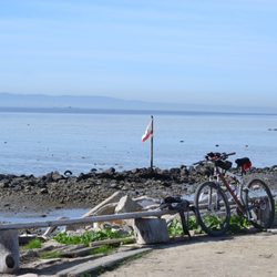
    Shoreline Trail Fremont - Bench and flagpole made up of drift wood. Plus as always my Spark posing

    Shoreline Trail Fremont

    5.0(1 review)
    13.1 km

    The Shoreline Trail Fremont is a just over 4 mile trail that runs North to south along the East Bay…read moreSide of the bay. This trail is part of the larger Bay Trail System and connects to a large county park as well as other trails. Starting on the other side of the Dubmbarton Pier parking lot, the trail travels through a a series of gates underneath the Dumbarton Bridge. Heading North, the trail skits right alongside of the Bay for many miles. As such, the amount of driftwood and other flotsam is impressive. Also, local freelance artists can be endlessly creative with their driftwood art. For those of us longtime Bay Area residents it can often seem like the old driftwood art in Emeryville along Hwy 80 has been resurrected here. Sometimes there is nothing. Such is the nature of driftwood art. Nevertheless its sort of like a fun treasure hunt. The trail itself runs on top of one of the old levee's that used to make up the salt ponds that dotted the bay. They are all undergoing restoration back into marshlands. The levee itself has been beefed up and the trail while dirt is nicely graded. However, there is only one trail spur, The oddly named 'No Name trail" that runs East to West, that will take you directly across the salt pond to the Coyote Hills Regional Park. (located about 2 miles in) The rest of the old levees, have been breached to allow free flowing water, and to provide a sanctuary for all the birds. Speaking of fauna, there are the usual suspects we find in the marshlands, just much less of them. Its possible that this is a newer segment and Nature is taking its time repopulating. The only other thing is that this part of the system does not have as much of the decaying infrastructure that other areas do. Very little rotting piers, or pump houses etc. The trail ends at the Alameda Creek estuary. From there you can pick up the Alameda Creek Trail that heads East. It will also connect you to the Coyote Hills Regional Park and loop back if so inclined. After you leave the parking lot there are no services at all. There is also Zero shade so plan accordingly. Cellphone reception was shockingly okay in most parts, but there is a bit of a dead zone about 1 mile from the Dumbarton Bridge (I'm using Verizon) The first mile of the trail would be cool for kids with all the odd junk, driftwood, and rip rap alongside the levee's but beyond that its not recommended. That is unless you are looking at some sort of Bataan Death March punishment...... Trail: graded dirt Suitable For: Hiking, Mountain Bikes, Hybrid, (use caution with Road Bikes) Services: none Length: 4.2 miles

    Photos
    Shoreline Trail Fremont
    Shoreline Trail Fremont - Looking South. The towers belong to KGO radio

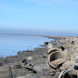
    Looking South. The towers belong to KGO radio

    Shoreline Trail Fremont

    See all

    Dumbarton Bridge Vista Point and Trail - Trail

    Dumbarton Bridge Vista Point and Trail

    5.0(2 reviews)
    15.8 km

    Coming from Palo Alto, this is the last exit before driving onto the Dumbarton Bridge. There's…read moreparking on both sides of the bridge, connected by an underpass. You'll find a bit of seating here along with info boards about the historical baylands, salt pond restoration, and hetch hetchy aqueduct. There's access to a couple different trails, one running parallel to the traffic with the whooshing sounds of vehicles zooming toward the bridge. This pathway more ideal for biking. The other, which I enjoyed much more this past weekend, leads to the Ravenswood Open Space Preserve, with birds galore in and around the ponds and piers extending over the water creating engaging lookout points with info boards about the surrounding wildlife and seating available to relax and appreciate the serene atmosphere. A decent spot to go for a run on a Saturday afternoon with hardly any other visitors in sight.

    The Dumbarton Bridge Vista Point and Trail is a fantastic spot located alongside the western shore…read moreof the Dumbarton Bridge. It is a great spot to view the bridge, bay and both the local preserves and entire Bay Area. This is a remote spot located next to the very busy Hwy 84; however, this spot has great parking and some nice trails. It's just down the road from the Meta (aka "Facebook") campus. It's also a great for anyone biking along the Bay Trail. Despite the noise, the views are fantastic! In addition, it's (apparently) a great spot for fishing. Each and every time we visit, we hear individuals boasting about their catches. If you're looking for a good view of the Bay Area or Dumbarton Bridge or just a nice spot next to the San Francisco Bay Trail, then this is a fantastic find that is ever so slightly off the beaten path!

    Photos
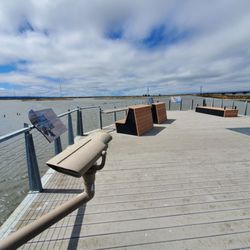
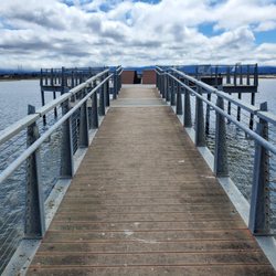
    Dumbarton Bridge Vista Point and Trail - Pier along the trail

    Pier along the trail

    Dumbarton Bridge Vista Point and Trail - Pier along the trail

    Pier along the trail

    Dumbarton Bridge Vista Point and Trail - Views along trail

    See all

    Views along trail

    Bay Area Expeditions - Wild horses on the American Safari

    Bay Area Expeditions

    4.5(27 reviews)
    41.5 kmThe Haight

    If you'd like an intimate trip and to get know others that are nature lovers and adventure lovers,…read moredefinitely check out a trip through BAE! I went on a backpacking trip in Big Sur (Mill Creek trail) and it was great. The price was reasonable considering you get a guide to navigate the 2-2 1/2 mile trek into the woods, it includes dinner and breakfast, and we even got to do archery! An added bonus, in my opinion, because now I'm hooked and going to buy a set for at home! A down side is you need to meet in King City...I had to drive from Monterey in the morning to meet them there (an hour am a half) and then another 1 1/2-2 hours to get to Big Sur. It was a lot of driving for me. Would have preferred to meet at Mill creek trail somehow, but I know being an out of towner, it may have been tricky for me to find. It's a great relaxing night trip...it would be neat if they had two night options...here or elsewhere! I love SF and if I come up again and they have more options, I'd totally be up for going on another excursion with them! Thanks Ting and Mo!

    I felt pretty darned spoiled going on this backpacking trip. The most luxurious backpacking…read moreadventure I've been on yet. What I really liked about this trip, was that the guides and the people in the group were all very friendly, and I learned a lot about wilderness preparedness, some of the local vegetation, and also just made me think of what other supplies I would need to bring, and kept me aware of what is the smart things to do in emergency situations and traveling in general. Some parts of the trail we went on involved a bit of climbing, but wasn't too difficult for the most part and the guides were there every step of the way to offer a helping hand across the stream, or whatever else. What actually enhanced the hike for me was the rain (or heavy mist as guide Chris liked to call it). The hike was so beautiful and green, walking along Mill Creek, and with all the trees, we actually didn't get hit too hard by the rain. The food that guide Dan prepared for us in the evening was also super delicious. The hot meal was much appreciated. And the boxed wine. ;) And of course, plenty of coffee in the morning. There was plenty of space in the teepees that they set up for us, but about half our group slept outside, which I'm sure was absolutely beautiful, but it was a little too chilly for my liking, so I was glad for some shelter. It felt like my group was anti-social (we didn't mean to be) as we pretty much had the teepee to ourselves, until one of the helper guides dove in to stay warm. And I'm actually surprised how much of the supplies the 4 main guides were carrying compared to the rest of the group. We were given some of the bowls, chairs, and the food to carry, but the guides were doing most of the heavy lifting. There was a few things I didn't like about the overall trip, but I understand this is a beginner backpacking tour. For me personally, I'd like to be a little more involved, so I felt pretty helpless, standing around while they set up the teepees and cooked the food. Dan assigned my friends to crush up some croutons. Productivity ftw! And not to stereotype, but it very much felt like a "guys" trip. When we arrived at our meeting spot at Starbucks before caravaning to the park, there were no introductions made, nor was there a sense of the overall itinerary. Basically, we were told just enough to get to the next location. Don't get me wrong, these guys know exactly what they're doing, but I'd appreciate a little more communication/organization. A big thank you to Chris, Dan, Mo, and Steve for providing a fun and informative adventure.

    Photos
    Bay Area Expeditions - Happy Customer in the Black Rock Desert.

    Happy Customer in the Black Rock Desert.

    Bay Area Expeditions - Black Rock Desert private family trip. Photo by Bay Area Expeditions instructor Chris Van Loan

    Black Rock Desert private family trip. Photo by Bay Area Expeditions instructor Chris Van Loan

    Bay Area Expeditions - Big Sur

    See all

    Big Sur

    Meyers Ranch Trail - hiking - Updated May 2026

    Loading...
    Loading...
    Loading...