Cancel

    Open app

    Search

    Memorial Park

    5.0 (1 review)

    Memorial Park Photos

    Recommended Reviews - Memorial Park

    Your trust is our priority, so businesses can't pay to alter or remove their reviews. Learn more about reviews.
    Yelp app icon
    Browse more easily on the app
    Review Feed Illustration
    Photo of Stacy M.
    1044
    190
    1217

    4 years ago

    Helpful 102
    Thanks 3
    Love this 103
    Oh no 1

    Verify this business for free

    People searched for Parks 100 times last month within 15 miles of this business.

    Verify this business

    Hay Creek Day Use Area

    Hay Creek Day Use Area

    4.0(1 review)
    4.7 mi

    Hay Creek Day Use Area is part of the Richard J. Doer State Forest. My daughter and I are in Red…read moreWing, MN for a few days and this place is my favorite. A trout creek (shallow during my visit) meanders for miles, and we just did some tent camping on state forest land (dispersed allowed) and wading, biking and hiking. You'll probably see deer and other gentler wildlife. It's legal to pick blackberries and nuts. :) There are some really nice paved trails for biking, and dirt trails for mountain biking. For hiking you'll find meandering paths through the woods. I read that this is one of the busier places because it's near Minneapolis (and touristy Red Wing and Mississippi River), but I didn't find it too busy, but not overly secluded either. For getting out and getting exercise and fresh air and getting into nature or escaping life for a while without having to use survival skills, this is a great place. You can download maps at the Department of Natural Resources website (do a search for "Hay Creek" - the Hay Creek area is within the Richard J. Doer State Forest area - there's limitations within the Day Use area). The Red Wing Public Library also has flyers at the entrance that has a rough outline of locations. Nearby is the paved Pioneer Goodhue Trail (paved for biking) which I believe turns into the Hay Creek trail. (Red Wing is very bike friendly.) "Hay Trail Road" is the primary point of access and is a gravel road a few miles long. 305th street and 310th street (or Recrecation Road) aren't marked (unless I missed it). Private and Public property does interrupt each other, signage is weak but exists. Fishing is allowed (we didn't fish), and there's snowmobiling paths. I do believe hunting is allowed in some spots (check the map). Someone official with papers did stop to ask if we were fishing, pleasant man, we weren't - but if you fish or hunt I'd make sure you had a license if required. (My daughter is only 13 so license is not required for her. Personally, the water was waaaay too shallow to fish where we were so the question seemed funny unless I was fishing for minnows.) Creek water was very clear. Unfortunately, I don't have a horse or an RV, but there's stables (Hay Creek Stables) that offer trail rides, and there's definitely a presence of horseback riders here. Everyone I've met around the area has been very friendly. Down the road is the Hay Creek Campground for RVs and horse owners. Very horse friendly area. I called the office, and "dispersed camping" (free camping in non-designated spots) is allowed on State Forest land but not in the Day Use Area, but parking is limited and you need a good map to see boundaries, although there are some signs that say "State Forest Land." It's not bear country, but they do list coyotes. If I had any reason to pass through here again, this would be a definitely "always stop here" place on my map. Unfortunately, it's about 900 miles from home. Oh ya, and it's free! No parking fees!! (Don't expect restrooms or porta-johns though.) Highly recommend for outdoor horseback riding, hiking, biking, and drinking coffee at the creek in the morning.

    Luce Line State Trail

    Luce Line State Trail

    4.7(3 reviews)
    55.4 mi

    Calling all bikers! If you have checked out the Gateway…read moreTrail, the Greenway and Cedar Lake Trail and are looking for something a little more quiet and rural feeling, this will be your jam! Leave your road bike at home and take out the cruiser, the cross or the mountain bike because this trail is crushed limestone the entire way. It is flat, shaded in parts, passing by lakes and between farm fields. Most of it you feel like you are out in the middle of beautiful nowhere. There is a parking lot at the trail head. There are porta-potty's strategically spaced along your ride. We came across maps occasionally. What was lacking were the hoards of people! Shhhhhhhhhhhh... maybe we should keep this a secret?! This trail goes 28.5 miles out to Winstead. Then you call a van to come get you? We didn't go that far as we had to make it back to the car at the trailhead. Twenty three miles round trip was plenty far for my burning legs. Whew. That was only half. I can only imagine how wonderful the other half might be. Someday... For those more hardcore, enjoy!!!!

    The Luce Line is an all purpose trail which starts on the Western edge of Plymouth, Mn and extends…read moreWest to Cosmos, Mn. Check the DNR website for entrances with parking lots and which areas are allotted for snowmobiles and horseback riding. The trail from Plymouth is crushed gravel and passes through mostly wetlands, hilly areas and light forests. There are some massive mansions not too far off on either side so you are advised not stray off the trails onto private property. The Long Lake entrance has a rough gravel parking lot and a porta potty!

    Photos
    Luce Line State Trail - The first bridge to cross

    The first bridge to cross

    Luce Line State Trail - Outside trailhead parking lot facing into the wild west...

    Outside trailhead parking lot facing into the wild west...

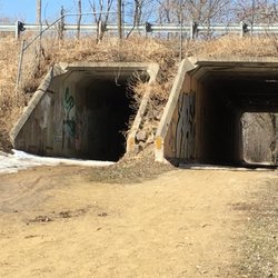
    Luce Line State Trail - Double bridge for snowmobiles on the Long Lake section.

    See all

    Double bridge for snowmobiles on the Long Lake section.

    Welch Village Ski & Snowboard Area - Top of the run

    Welch Village Ski & Snowboard Area

    2.7(43 reviews)
    9.8 mi

    We had four of us there going there today. All four of us are a little bit computer, illiterate and…read moresigning into their website to save the money on the lift ticket. Prices was absolutely the worst thing I've ever done in my life. It was so bad we packed up our year and left Welch Village left missed out on over 500 bucks today lift tickets a couple beers food They have to make the systems easier somehow

    If I could rate it zero stars I would. I took my friend to Welch on 11 January 2026 to teach him…read morehow to ski. We got there at about noon and we had paid for a full day pass (totaling $90 per ticket) and he had also paid for ski rentals to learn (totaling another $45). Everything was going good up until a few hours in my ski lift ticket had fallen off of my jacket due to the flimsy plastic zip ties they give you to put the lift ticket on your jacket. instead of continuing to ski I decided to do "the right thing" and go inside to get a replacement. once inside I dealt with a rude woman at the front desk and had asked her if I could get a replacement ticket because mine fell off. Keep in mind once a ticket is purchased via Welch's website you are given a barcode to get your ticket. I had the barcode pulled up on my phone while I was asking to get a replacement ticket and the woman looked at me like I had 2 heads refusing to scan my barcode.. then asked for my name not 30 seconds later she comes back to me and says I can't get a new one without buying one or I could have my friend (who is learning how to ski) ride the chairlifts to "track it down". I've gone to Welch for over 10 years now and have never had something so ridiculous happen while I was there. Do better Welch...
    Photos
    Welch Village Ski & Snowboard Area - West side panorama

    West side panorama

    Welch Village Ski & Snowboard Area
    Welch Village Ski & Snowboard Area - Sitting outside on the big chair

    See all

    Sitting outside on the big chair

    Memorial Park - parks - Updated August 2026

    Loading...
    Loading...
    Loading...