Gateway State Trail Photos


You might also consider


More like Gateway State Trail
Recommended Reviews - Gateway State Trail
Start your review...



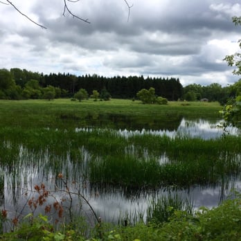
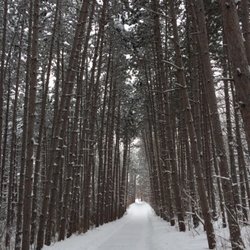
Favorite road bike trail! Long, straight and tree covered, you won't get sunburned or blown away. This feels like a rural trail as you pass ponds, farm fields, cows and horse stables. Love that there are only two major street crossings. Two bridges and two tunnels keep you moving. From the parking lot at 694/36 it is 9 miles to the end if you go straight. (There is a horse trail that is next to the paved trail so keep your eye out. I rode my mountain bike on it for something different once. It was a killer 18 total miles though...Whew!) I love that they added an extension at mile 6 where you can go to the right at the split and bike all the way into Stillwater! There is plenty of bike parking so bring your lock and walk along the river or have lunch before heading back. The 5 mile ride from the split into Stillwater is a fast decline. That being said, you are going to have to work a little harder to get back to your car... It is so worth it! You follow a wooded creek and there are bench stops/ photo op's along the way. (This is 22 miles round trip, just so you know. I need a nap after. lol) read more


4 years ago


The Gateway is an 18.3 mile long flat, paved, rail-to-trail that extends from the heart of St. Paul's North End to it's country terminus at Pine Point County Park in rural Stillwater. From Pine Point you can travel south on country roads another 5 miles and sample all the delights that downtown Stillwater offers and St. Paul's North End does not. Parking is available at either end of the trail, however, you may wish to choose a point someplace in between as there is a fee for parking at Pine Point Park, and the St. Paul end of the trail on Cayuga Street, two blocks east of Jackson Street near Oakland Cemetery is in a very sketchy area. For urban-dwelling St. Paulites with limited access to a car, this trail affords users the opportunity to escape the urban ghetto and take a ramble out in the country. The first several miles starting at the St. Paul end and heading north east will take you past a trout stream, wildlife refuge, over bridges, and with the sight of wildlife interspersed with gang graffiti covered industrial buildings and the I35 just a stone's throw away at times. At mile 3-4 the trail links up with Lakes Keller and Phalen. Here you can take a lovely 3 odd mile detour around the lakes on the paved path, or continue on to Bruce Vento trail junction. Around mile 10 you'll hit the Highway 36 tunnel and pop out the other side to a sight of the North St. Paul giant, creepy snowman. Pause here for a moment to prostrate yourself and beg for mercy. Bring a burnt offering and pour libations. Take heart, for He Who Is Always Frosty often takes pity on two-wheeled travelers to his frightening domain. North St. Paul, and it's conveniently located and charmingly dilapidated downtown is just a few blocks adjacent to the trail, affording weary sojourners their easiest access to food and respite. Should He Who Breathes Ice Into Your Soul choose to spare you, consider pausing here to support the many, many fine business establishments located in this bucolic suburb. North St. Paul is also the jumping off point to the country. From the Highway 36 bridge on, you will be treated to sights of rolling meadows, ponds, quaint trout streams, and small stands of birch, pine, and poplars. Listen for the melodious songs of red wing blackbirds, pileated woodpeckers, the occasional owl, the ennui-filled mooing of area cows....and the conch-shell trumpet blasts of the war lords of He Whose Jolly Round Rolls Crush All...just in case he or his evil ice minions have changed their minds, and decided to reclaim his icy kingdom at the point of frozen javelins from bicycling-riding, holiday-making interlopers. You will also wish to make note of the fact that out here, a dirt equestrian path parallels and sometimes crosses the paved bike trail. Bike riders must announce themselves when horses are sighted using "horse language." "Neigh, neigh. Neigh, neigh, neigh on neigh left," with a courteous whinny is adequate for most situations. The trail also crosses some deceptively deserted-looking country roads and back-woods driveways. Use extra caution here, because drivers drive fast, and they have the last laugh if heedless bikers cross their path. And also, the red-eyed devil ducks of the North St. Paul Snow Demon of Death patrol these areas, especially the middle of driveways and roads. Their pitiless, sarcastic quacks can often be heard for miles as they roam in gangs looking for unwary victims. One bite from them can cause purple polka dot laughing sickness, curable only by a kiss from one of Princess Loosestrife's whimisical faeries...and jeez...you know how THEY are! read more


11 years ago
More info about Gateway State Trail
E Cayuga St
Saint Paul, MN 55117
Payne-Phalen, North End
Directions
(651) 296-5029
Call Now
Hours
Outdoor Amenities
Ask the Community - Gateway State Trail













Why does Yelp recommend reviews?
1 review that is not currently recommended
The reviews below are not factored into the business's overall star rating.

4 years ago



