Mayor's Park Photos


More like Mayor's Park
Recommended Reviews - Mayor's Park
Start your review...

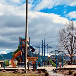
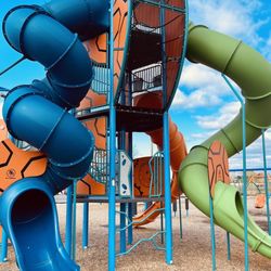
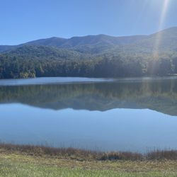
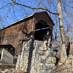
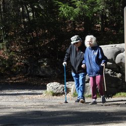
This small park along US-11 has street parking available so that you can enjoy the paved walkways that go through the manicured grass area. There is a nice sized gazebo and several benches throughout the park, some of which are under shade trees. There is a rail track that goes by but no train during my visit. [Review 15114 overall, 616 of 2021, number 1326 in Virginia.] read more


More info about Mayor's Park


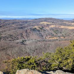


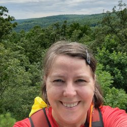

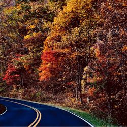


Mayor's Park - parks - Updated July 2026
Best of Mount Jackson
People found Mayor's Park by searching for…
Things to Do in Mount Jackson, Virginia
Playgrounds in Mount Jackson, Virginia
River Swimming in Mount Jackson, Virginia
Secret Spots in Mount Jackson, Virginia
Basketball Courts in Mount Jackson, Virginia
Swimming Holes in Mount Jackson, Virginia
Dog Swimming in Mount Jackson, Virginia
Attractions in Mount Jackson, Virginia
Tourist Attractions in Mount Jackson, Virginia
Public Running Track in Mount Jackson, Virginia
Things to See in Mount Jackson, Virginia
State Parks Camping in Mount Jackson, Virginia
Scenic Drive in Mount Jackson, Virginia
Parks and Recreation in Mount Jackson, Virginia
Photo Spots in Mount Jackson, Virginia
National Parks in Mount Jackson, Virginia
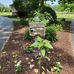
Walking Trails in Mount Jackson, Virginia
Swimming Lakes in Mount Jackson, Virginia
Free Parking in Mount Jackson, Virginia
Secluded Spots in Mount Jackson, Virginia
View Points in Mount Jackson, Virginia
Waterfalls in Mount Jackson, Virginia
Trending Searches in Mount Jackson, VA
Blueberry Picking near Mayor's Park
Cliff Jumping near Mayor's Park
Kayak Rental near Mayor's Park
Kids Activities Outdoor near Mayor's Park
Peach Picking near Mayor's Park
River Swimming near Mayor's Park
River Tubing near Mayor's Park
Strawberry Picking near Mayor's Park
Swimming Holes near Mayor's Park
Swimming Lakes near Mayor's Park
Browse Articles
Browse Nearby
BEST of Mount Jackson, Virginia Playgrounds near Mayor's Park
BEST of Mount Jackson, Virginia Restaurants near Mayor's Park
BEST of Mount Jackson, Virginia Things to Do near Mayor's Park
BEST of Mount Jackson, Virginia Coffee near Mayor's Park
BEST of Mount Jackson, Virginia Picnic Areas near Mayor's Park
BEST of Mount Jackson, Virginia Campgrounds near Mayor's Park
Browse Brands
Related Searches in Mount Jackson, VA
Best Fun Things to Do in Mount Jackson, Virginia
Best Water Parks for Kids in Mount Jackson, Virginia
Check Out Great Playgrounds in Mount Jackson, Virginia
Check Out Off Road Trails in Mount Jackson, Virginia
Discover Baseball Fields Around Mount Jackson, Virginia
Discover Free Parking Options in Mount Jackson, Virginia
Discover Fun Activities to Do in Mount Jackson, Virginia
Discover Lakes & Ponds to Explore in Mount Jackson, Virginia
Discover Popular Photo Spots in Mount Jackson, Virginia
Discover Top Nature Parks to Visit in Mount Jackson, Virginia
Discover Walking Parks in Mount Jackson, Virginia Near You
Discover the Best Beaches in Mount Jackson, Virginia
Enjoy the Best Picnic Spots and Ideas in Mount Jackson, Virginia
Enjoy the Best Walking Trails in Mount Jackson, Virginia
Explore Easy Hikes Perfect for All in Mount Jackson, Virginia
Explore Family-Friendly Zoos and Wildlife in Mount Jackson, Virginia
Explore Free Picnic Areas Around Mount Jackson, Virginia
Explore Fun Activities to Do in Mount Jackson, Virginia
Explore Landmarks & Historical Buildings in Mount Jackson, Virginia
Explore Popular Campgrounds Near Mount Jackson, Virginia
Explore Popular RV Parks Around Mount Jackson, Virginia
Explore Popular Scenic Views Near Mount Jackson, Virginia
Explore Popular View Points Around Mount Jackson, Virginia
Explore Scenic Lakes to Visit in Mount Jackson, Virginia
Explore Top Gyms in Mount Jackson, Virginia Now
Explore Top Water Parks in Mount Jackson, Virginia Today
Explore Volleyball Courts Available in Mount Jackson, Virginia
Explore the Best Swimming Holes Around Mount Jackson, Virginia
Find Picnic Tables for Outdoor Fun in Mount Jackson, Virginia
Find the Best Parks BBQ Grills in Mount Jackson, Virginia
Find the Best Parks for Picnics in Mount Jackson, Virginia
Find the Best Swimming Pools in Mount Jackson, Virginia Today
Fun Things for Kids in Mount Jackson, Virginia
Have Fun at a Splash Pad in Mount Jackson, Virginia
Hiking Trails With Waterfalls in Mount Jackson, Virginia
Locate Tennis Courts Around Mount Jackson, Virginia
Parks With Basketball Courts for Games in Mount Jackson, Virginia
Picnic Areas With BBQ Pits Available in Mount Jackson, Virginia
Plan a Scenic Drive Route Near Mount Jackson, Virginia
Play Pickleball With Locals in Mount Jackson, Virginia
Popular Kids Activities in Mount Jackson, Virginia
Popular Places to Take Pictures in Mount Jackson, Virginia
Popular Things to Do in Mount Jackson, Virginia
Popular Things to See in Mount Jackson, Virginia
Top Hiking Trails to Explore in Mount Jackson, Virginia
Top Running Trails to Explore in Mount Jackson, Virginia
Top Swimming Lakes to Enjoy in Mount Jackson, Virginia
Top Things to Do With Kids in Mount Jackson, Virginia
Top-Rated Basketball Courts to Play at in Mount Jackson, Virginia