Cancel

    Open app

    Search

    Max V Shaul State Park

    4.5 (4 reviews)
    Open 6:00 am - 6:00 pm
    Updated 2 months ago

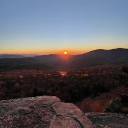
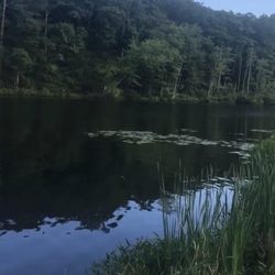
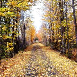
    Max V Shaul State Park Photos

    Recommended Reviews - Max V Shaul State Park

    Your trust is our priority, so businesses can't pay to alter or remove their reviews. Learn more about reviews.
    Yelp app icon
    Browse more easily on the app
    Review Feed Illustration

    5 years ago

    Helpful 0
    Thanks 0
    Love this 0
    Oh no 0

    3 years ago

    Helpful 0
    Thanks 0
    Love this 0
    Oh no 0

    15 years ago

    Helpful 1
    Thanks 0
    Love this 1
    Oh no 0

    12 years ago

    Helpful 0
    Thanks 0
    Love this 0
    Oh no 0

    Ask the Community - Max V Shaul State Park

    Verify this business for free

    Get access to customer & competitor insights.

    Verify this business

    Vroman's Nose Trail

    Vroman's Nose Trail

    4.4(5 reviews)
    4.2 mi

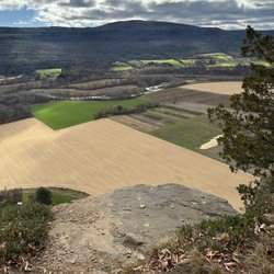
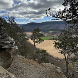
    I was looking forward to hiking this trail for quite some time. There is a decent size parking lot,…read morealthough I could see this might fill up on beautiful days. The trail is quick but with decent incline in many spots. It is well worn and there were muddy spots and leaves to watch for. The views are beautiful with large ledges, but you also want to be careful with younger kids.

    Enjoyed a snowy hike at Vroman's Nose Trail on Friday afternoon. Ended up a bit wetter than…read moreexpected because of the snow, but worth it for the great views at the top. Quality: A nice hike, which is a bit steep on one end of the loop, but pretty moderate on the other. The views going up are fairly boring, but once you reach the peak there is a lot of cliff to explore. Be cautious in the snow, especially when coming down from the top. Quantity: About a mile and a half hike. Value: Free to park and hike. Ambiance: Vroman's Nose Trial is located in the upstate New York town of Middleburgh. It is a tall hill near a lot of farmland, the peak providing lovely views of the countryside. One half of the loop is very steep and the other is a slow climb. We unknowingly did the slow climb up, which made the steep drop back down quite difficult in the snowy terrain. Not a particularly challenging or long hike, but one impacted by the elements. Crowd: Only one other hiker and for good reason, the snow made it difficult. Service: Well marked and easy to follow even with snow on the path. Parking: Tiny lot near the trailhead.

    Photos
    Vroman's Nose Trail - Parking lot

    Parking lot

    Vroman's Nose Trail
    Vroman's Nose Trail

    See all

    Kaaterskill Falls - March 2026

    Kaaterskill Falls

    4.6(166 reviews)
    32.6 mi

    The falls are truly incredible…read more The trail down to the bottom of the falls, is a bit tricky. But so incredibly worth it. I would suggest not to believe the sign saying 189 steps.... it is definitely more! Take drinking water because you'll need that for sure. We went back in August and the heat was definitely there. The parking lot was pretty packed but throughout the trails people were pretty evenly spaced out. Not so much at the base of the falls themselves but there was still plenty of room to move around freely.

    One of the tallest waterfall in NY, similar height to Taughannock Falls. Physical requirement is…read moredifferent tho, Kaaterskill Falls has about 500foot of elevation change and a lot of slippery stone steps at the end, if you come here when the weather is still cold. Parking: most people park at the Laurel-House Road parking area, because it is the closest. Or you can park at Mountain Top Historical Society, the old train station, which an extra mile. Starting from the old railroad station is nice, you can still see some old tracks on the ground. Walk to the overlook is fairly easy, once you get to the start point of Lower falls junction, it is where you need to be prepared. I recommend hiking shoe, especially in colder months where the ground is wet and iced. When you reach to the stone steps, they can get slippery. I am surprised no one fell in late March. Half of the steps were cover in ice and people were wearing regular sneakers. Once you reach the base of the two tier falls, the view is tremendous. If water levels are high, you can feel the energy of the water. There is a lot of spray from the falls when you get close. There is short trail to the middle tier pool. It was iced up during winter, spikes will definitely be useful. The end was amazing too. So close to the lead of the waterfall. You can keep going and follow Escarpment trail and follow the edge of the valley. There is monument for fireman Frank Layman who died during firefighting in 1900, at his monument, you can see route 23A bend around mountain. And if you keep going, there are a couple viewpoint to overlook the valley. Nice break points to enjoy the view and rest your legs.

    Photos
    Kaaterskill Falls - View Of Stream

    View Of Stream

    Kaaterskill Falls
    Kaaterskill Falls

    See all

    Christman Sanctuary

    Christman Sanctuary

    4.9(8 reviews)
    19.6 mi

    The topography of this place is undulating but not too challenging, even for someone like me, a…read morecouch potato. A river runs through it. Along the way, there are some waterfalls of differing levels. Obviously, the volume of water is dependent on recent precipitation. The "mood" of the place depends of that flow. On most occasions, I could hear the rush of water before actually seeing it. It's an added bonus to this place, changing on a daily basis. Like a lot of things upstate, you've got to be informed about a place before you know it exists. If a co-worker hadn't told me about this sanctuary, I doubt I would have found it on my own. There is no fee but the parking lot is small; there's space for about eight vehicles. Check it out. It's a neat place. It'll do some good to get some fresh air.

    Note to self: September may not be the absolute best time to come here because of the very low…read moreflow. Still, there are plenty of things to like about this...once you find it. The falls seem to be commonly known as Bozenkill Falls but the road sign (pictured) says Christman Sanctuary, and the gravel parking lot isn't massive so it may be easy to miss. The first 100+ metres is mostly boardwalks so it's easy enough to navigate. Then comes rocky, uphill trail, but at least markers are readily visible and aplenty. On our first visit I feel like we barely scratched the surface, so will look forward to another visit. Thank you whoever you are, for helping to preserve and maintain this sanctuary!

    Photos
    Christman Sanctuary
    Christman Sanctuary - After a rainfall.

    After a rainfall.

    Christman Sanctuary - Lower falls - Christman Sanctuary

    See all

    Lower falls - Christman Sanctuary

    Overlook Mountain

    Overlook Mountain

    4.5(86 reviews)
    36.1 mi

    Love hiking here! If…read moreyou're in this part of the Catskills, I highly recommend this trail. It's easily accessible and an easier hike to do. The trail is well-groomed and very walkable. There aren't any scrambles or large boulders, which is good.. The view from the top is pretty epic, and the fire tower which has been closed every time I've hiked the mountain has great views too. I would highly recommend this hike.

    This place is absolutely amazing! I've hiked all the Catskills mountains three times over through…read morethe years and I had never been to overlook because there was no reason to but I had heard so much about this location I just had to visit and satisfy my curiosity on why this place is so popular. First off the parking lot is medium sized and parking on the road (even off the road) is risky because certain spots you are not allowed to park so arrive early, get a legit parking spot and save yourself the wasted trip or the hassle of returning to your vehicle to a ticket or it completely gone (towed). The hike up and back for Overlook is approximately 5 miles so everyone is spot on mentioning the distance. It's fairly steep all the way up and while you don't have any views on the way up, you do encounter some old ruins which is a neat break along the way. Once you do make it to the top you are met with a small shed that has some very minor historical information inside and on peak weekends you'll find stewards that can assist with information about the area and hiking tips. The fire tower can't be missed to the left after the small shed and the view is to the right of the shed. I have to say, I've been atop many mountains and it's been a long while since I've had my breath taken away but when I saw the view at Overlook it was breath taking. What made the view so beautiful and different than other mountains I've hiked is that the view is expansive with no mountains obstructing so you can see as far as the eyes can see. It's truly a remarkable view being so high up and seeing so far out. This mountain is known for its rattlesnake population. Sadly I never got to see one because I always hike in the early morning hours and they normally come out at around high noon when the sun is the hottest.

    Photos
    Overlook Mountain
    Overlook Mountain
    Overlook Mountain

    See all

    Devils Path

    Devils Path

    5.0(5 reviews)
    32.7 mi

    Wow, talk about a beautiful drive to get here! Completely isolated with the surrounding town…read morebringing you to the past. The narrow zig-zag roads getting here from the east are a blast to drive on. Taking the devil's path is no joke if you're doing the whole trail. Highly suggest packing light for the hike. Totally regretted my 35lb backpack setup. The elevation spikes and drops will put your knees and ankles to the test. The look out points are gorgeous. Each one deserves to be taken in during a break. The biodiversity is incredible here. You'll notice the nature changes at different points of the hike. Including the areas casted in darkness from the dense trees. The next drinkable source of water from the beginning is a far distance so make sure you pack accordingly. The devils tombstone is the halfway point which is where most people set up camp. Cant harp enough... snacks, snacks, snacks. Stay safe if you choose to part take on this hike! One of the best hikes I've been on.

    The infamous Devils Path! This trail is infamous for being extremely difficult. Is Devils Path…read moredifficult? No and yes! For any experienced hiker doing any of the shorter trails it is fairly straight forward and I'd say fairly easy (for an experienced hiker). What makes DP extremely hard or difficult is when you attempt the entire length in one day. You go up and down five mountains throughout the trip and while any experienced hiker will say going down the mountains can be worst than going up, after you are on your way up the 5th mountain doing DP you will welcome downhill really fast. LOL! I hiked Devils Path with a group of 4 strong experienced hikers for a day trip. We started at Prediger Road, left a car in the middle of our planned route at Stony Clove Notch and finally we left car at our end target Spruceton parking lot. We had lunch at Stony Clove where we refilled our water supplies with the water spout we found there. We assessed our personal abilities and decided we were all in excellent shape and able to keep pressing forward to complete our goal to finish DP in one day. Best advice I can give anyone that is daring to attempt this in a single day is (1) be experience with the distance having done at least 15 miles minimum in the past and (2) bring FOOD, lots of food (leave the diet at home). Also, plan a bail out point in case you realize the distance is too great for you. Devils Path to me isn't so much a hard trail to do but it most certainly is a trail that will test your endurance to the max! My group did car spotting at 4:30am, started our journey about 6:30am and completed the full trail about 6:45pm just before sunset. Would I do this again? Probably not but I am proud to be in the small percentage of people to have completed this in a single day. The sense of accomplishment is resounding. I COMPLETED DEVILS PATH IN ONE DAY!! Woohoo!! :o)

    Photos
    Devils Path
    Devils Path
    Devils Path

    See all

    Giant Ledge - Panther Mountain - Post sunrise golden hour!

    Giant Ledge - Panther Mountain

    5.0(5 reviews)
    32.4 mi

    Really super popular hiking spot! Please don't hang off the edge of the viewpoint for a "cool"…read morepicture because heaven forbid you fall to your death the rangers will take their time for the recover since it's highly unlikely you'd survive the fall. I see way too many tourists comfortably sitting on the view point ledge until they slip and tragedy strikes. Enjoy the photo op responsibly, pretty please with sugar on top! As for the actual hike I agree with the few reviews posted up that this is a fairly easy hike because just about all the elevation happens in the first 3/4 mile up. Once you make it to the halfway point and turn left on the blue trail the rest is fairly flat up till Giant Ledge. If you go further on to Panther Mountain you do take a small dip down into the valley toward Panther and you go back up to the peak of Panther. Honestly, unless you have the desire to hike ALL 33 catskill peaks there is no reason to visit Panther in my opinion. Giant ledge has the better view. WATER, bring plenty of water in the summer because the water source with the big ass sign on the trail about a mile up almost never has water flowing because I have yet to even find the darn source the several times I've been up there so I'd consider that water source unreliable so pack water.

    Absolutely stunning for a sunrise hike. My friends and I have done this for the past two years…read morearound mid October. Get to the trailhead at 5 AM and spend the next hour and a half climbing to the peak to see sunrise. Excellent bang for your buck Hike. I think it's only like a one and a half mile track, but it's the elevation that gives difficulty. Check out my photos and videos. I highly recommend this.

    Photos
    Giant Ledge - Panther Mountain - The gang

    The gang

    Giant Ledge - Panther Mountain - Sunrise starting

    Sunrise starting

    Giant Ledge - Panther Mountain - Start of sunrise

    See all

    Start of sunrise

    Max V Shaul State Park - parks - Updated August 2026
    Loading...
    Loading...
    Loading...