Machicomoco State Park Photos


You might also consider
More like Machicomoco State Park
Recommended Reviews - Machicomoco State Park
Start your review...

Reviews With Photos

Welcome to the latest VA state park adopted by the parks system. Today I explored the interpretive area and got a chance to hike around the waterway. The interpretive area was located in the far lefthand side of the loop of the park. The one thing I enjoyed was how the park had small pocket areas for kayaking/boating, campgrounds, historic appreciation, and hiking. Most of today's adventure landed me in the interpretive area that was so clean and well laid out with amenities such as two spacious picnic shelters, restrooms (family restroom included), and several points of cultural learning. My favorite was the dome longhouse that included a path lined with historical dates and along the walls of the feature were local area history facts. There was a historical home as well that is up for renovation and future use. The paths nearby went by the water which was extremely peaceful and the other route headed into the woods (bring your bug spray). The park staff were very friendly and welcoming. The experience was quite a good escape from the city.

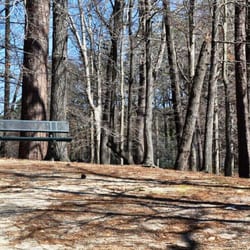
Today was a great day for the outdoors so we visiting another one of the Virginia State Parks. First let me say - I've never had a bad visit at the VASP's Besides the great weather we wanted to visit this newer state park. We enjoy camping in our RV and discovered this park had camping sites. So normally if possible we will check out a park before we drag our big beast RV to a location. I found the camping sites real nice and fairly large. None of the site look difficult to back into. However, they do have several pull through sites. None of the sites seem to have any cover - so you will need to deal with the sun and maybe summertime heat. Just know that. Some sites do have E/W. The dump station appears clean and easy in & out. The bath house was very clean As for the rest of the park. Just wonderful biking/walking path. Not sure but there are a few miles of them and all look flat. As for the trails to the water, they are rocked and again I'm sure a mountain biker can easily handle them. Not 100% sure though if bikes are allowed on them - so check before you do. I even seen an older lady driving her motorized wheelchair on these paths and she didn't seem to have any difficulty. The restroom area and picnic pavilions looked great and were very clean. Of course this facility is newer, so I hope they stay looking as great as they do today. I expect we will be back here with the RV in the Fall or Spring. I say this again due to no real shade in the campground area and no swimming avail. read more


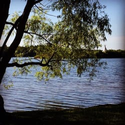
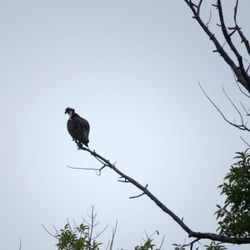
Meaning "A special meeting place", Machicomoco was a lovely place to take a quick walk and only just beating the downpour. The Interpretive Area has gorgeous water views, and short gravel trails. A longer loop trail circled the park, saw a few deer in the fields. There were several marsh birds, including white heron! read more

Quaint State Park just outside Gloucester, Virginia. There's a Small campground with tent, camper, and Yurt camping. A well maintained public restroom, plenty of picnic tables with fire pits. This is a historic site dedicated to Indigenous Tribes of Virginia. A paved sidewalk runs through the entire park, plus there are 6+ miles of trails and gravel walkways to explore. Beautiful area to bike or hike on easy trails. There and several 'cartop' boat launch areas for small hand carried vessels. Plenty of picnic spots. Be sure to explore the Interpretive area of the park for all of the history! Worth noting- ten miles up river is Werowocomoco. It's the Powhatan site where Captain John Smith first met Pocahontas. There's a Virginia State Parks parking pass required. Day rate is $5 paid in cash (no change given) or by check. You must obtain a yellow envelope at the entrance, place your payment in the envelope, deposit in the metal box that's clearly marked, then hang your tag on your windshield. There are simple directions on the envelope to guide you. Pets are permitted, but drones and other aircraft are not! There are trash receptacles provided, but carry in- carry out is always appreciated! Enjoy this peaceful piece of history! And- Leave No Trace! read more
 - Parks Near Me - Hayes, Virginia")


Welcome to the latest VA state park adopted by the parks system. Today I explored the interpretive area and got a chance to hike around the waterway. The interpretive area was located in the far lefthand side of the loop of the park. The one thing I enjoyed was how the park had small pocket areas for kayaking/boating, campgrounds, historic appreciation, and hiking. Most of today's adventure landed me in the interpretive area that was so clean and well laid out with amenities such as two spacious picnic shelters, restrooms (family restroom included), and several points of cultural learning. My favorite was the dome longhouse that included a path lined with historical dates and along the walls of the feature were local area history facts. There was a historical home as well that is up for renovation and future use. The paths nearby went by the water which was extremely peaceful and the other route headed into the woods (bring your bug spray). The park staff were very friendly and welcoming. The experience was quite a good escape from the city. read more


3 years ago
Another great Va State Park! DyK? Machicomoco, in Virginia Algonquian, means Special Meeting Place (per Nps.gov) Also to note, I believe this is Virginia's 40th State Park. - It was more impressive than I anticipated. Beautiful wetlands and overlooks to enjoy the York River, A tributary for the Chesapeake Bay. I drove up unannounced and asked for a camping spot. They let me take my pick! I drove over to the camping area, (RV and tenting + Yurts), and was about ready to unpack, when the skies opened up and Bam! A severe storm blew this place out! I'm so glad I didn't set up yet. I slept in my car. High winds and hail. In a tent? No thanks. - after the big storm it sprinkled all night so I put on my raincoat and floppy hat and headed out for adventure. I hiked a couple trails and hung out on the boat launch (pier) a while. Watched the sunset. After waking up in my car, I simply drove out to my next adventures.(Great dismal Swamp and Kiptopeke State Park) I liked it here at Machicomoco. The Rangers were really nice also, and they had....Flushing Toilets! Go enjoy the outside! read more


More info about Machicomoco State Park
3601 Timberneck Farm Rd
Hayes, VA 23072
Directions
(804) 642-2419
Call Now
Visit Website
https://www.dcr.virginia.gov/state-parks/machicomoco-sp
Hours
Outdoor Amenities
Other Amenities


Why does Yelp recommend reviews?
1 review that is not currently recommended
The reviews below are not factored into the business's overall star rating.
4 years ago
Machicomoco State Park - parks - Updated July 2026
Best of Hayes
People found Machicomoco State Park by searching for…
Things to Do in Hayes, Virginia
Watch Sunset in Hayes, Virginia
Water Parks in Hayes, Virginia
Hiking Trails With Waterfalls in Hayes, Virginia
Places to Take Pictures in Hayes, Virginia
Walking Trails in Hayes, Virginia
Picnic Spots in Hayes, Virginia
River Swimming in Hayes, Virginia
Playgrounds in Hayes, Virginia
Long Term Rv Parking in Hayes, Virginia
State Parks in Hayes, Virginia
Running Trails in Hayes, Virginia
Picnic Areas in Hayes, Virginia
Sunset View in Hayes, Virginia
Fishing Spots in Hayes, Virginia
Camping Sites in Hayes, Virginia
Rv Campgrounds in Hayes, Virginia
Browse Nearby
BEST of Hayes, Virginia Restaurants near Machicomoco State Park
BEST of Hayes, Virginia Things to Do near Machicomoco State Park
BEST of Hayes, Virginia Coffee near Machicomoco State Park
BEST of Hayes, Virginia Breakfast near Machicomoco State Park
BEST of Hayes, Virginia Thrift Stores near Machicomoco State Park
Browse Brands
Related Cost Guides
Browse Articles
People who viewed Machicomoco State Park also viewed
Chickahominy Riverfront Park
16 reviews
Freedom Park
25 reviews
Cumberland Marsh Natural Area Preserve
1 review
Waller Mill Park
34 reviews
Colonial National Historical Park Archeology
4 reviews
Riverview Farm Park
16 reviews
Wahrani Nature Park
2 reviews
Grey's Point Camp
16 reviews
Cross Rip Camp
9 reviews
Anvil Campground
92 reviews