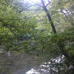
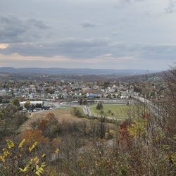
Cancel

    Open app

    Search

    Lower Trail

    5.0 (2 reviews)

    Lower Trail Photos

    Recommended Reviews - Lower Trail

    Your trust is our priority, so businesses can't pay to alter or remove their reviews. Learn more about reviews.
    Yelp app icon
    Browse more easily on the app
    Review Feed Illustration

    3 years ago

    Helpful 0
    Thanks 0
    Love this 0
    Oh no 0
    Photo of Mark W.
    8
    101
    274

    9 years ago

    Helpful 0
    Thanks 0
    Love this 0
    Oh no 0

    Verify this business for free

    People searched for Hiking 203 times last month within 15 miles of this business.

    Verify this business

    Great Allegheny Passage

    Great Allegheny Passage

    4.8(4 reviews)
    115.7 km

    A friend and I rode the Great Allegheny Trail from Myersdale, PA down to Cumberland, MD. It was a…read more33 mile ride overall, but we really enjoyed it. Now, neither of us are Lance Armstrong wanna-bes. We're old farts riding plain bikes. From Myersdale, the first 9 miles is uphill, but since it's an old railroad, it's a very gentle uphill slope. The highlight of this part of the trip was riding across the Keystone Viaduct. On our uphill leg, our average speed was 8.0 mph (from my GPS). At the end of the 9 miles uphill, we arrived at the Eastern Continental Divide. From there, it's ALL downhill all the way to Cumberland. We overheard someone else on the trail say that on the downhill side, "you don't need pedals, all you need are brakes." My GPS said our average speed during the downhill leg was 13 mph. There are a few spots along the way you could get on the trail and just do the downhill portion. We saw some families with kids doing the downhill portion, too. As an alternative, you can ride the Western Maryland Scenic Railroad from Cumberland up to Frostburg, then ride your bikes from Frostburg 16 miles back down the hill to Cumberland. Lesson learned: We had planned to stop and have lunch in Frostburg, MD. When we arrived in Frostburg, we found there was a nice rest area for bicyclists along the side of the trail with maps of the town, park benches, bicycle racks, and port-a-potties. Unfortunately, the path goes by at the BOTTOM of the side of the hill that Frostburg is on. In order to go into town for lunch, we would have had to either bike or hike half a mile UP a steep hill. We decided not to do that. We just ate snacks that we had packed in our backpacks and continued onward to Cumberland. The scenery was beautiful. There were three long tunnels to go through. Each tunnel was either short enough it didn't need to be lit up because you could see light from either side, or had installed lighting (the Big Savage Tunnel was really long but well-lit inside). The trail is well marked with mile markers along the way so you can tell how far you are from Cumberland, MD. The trail ends right in downtown Cumberland next to the Western Maryland Scenic Railroad train station and right where the C&O Canal Towpath begins. We had a great time and I would love to come back here and do the downhill portion with my kids sometime. I think we might try the Western Maryland Scenic Railroad 1-way trip up to Frostburg then ride our bikes down the hill. Side note: Why do I give it 4 stars instead of 5? Only because I try to reserve my 5 star ratings for restaurants that are truly spectacular, and I don't want to inflate my average grade with a rating for a bike trail. :-)

    Where to start? In a word, Awesome. In more than 1 word... This trail has something for everyone…read more(kids included); walking, running, biking, horseback riding (in most sections), to the history of the industrial revolution, trains, coke and steel. The trail is mostly compact gravel with some compact white sand areas around the Pinkerton tunnel. Urban areas are pretty much concrete or macadam. From McKeesport to Pittsburgh, the trail turns into more of an urban recreational trail with uphill and downhill sections much steeper than a normal rail trail. If you have trouble with hills and are travelling the trail from Pittsburgh to Cumberland you may want to consider starting in Boston, PA. Fellow trail users and the locals in town are all friendly. We started the 150 mile journey in beautiful and historic Cumberland, MD. The 15 mile bike ride to Frostburg is on a slight uphill grade. From Frostburg to the Continental divide seems a bit more of an incline but not impossible, even for the recreational rider, and there's enough scenery to stop and see along this 10 mile stretch to give your legs a break. Don't let your dislike of riding up hills discourage you from not riding this section of the trail. Once you pass the divide, the slight downhill goes on well past Confluence. There's multiple small towns along the way, each offering opportunities for a restroom, re-fill your water bottle, get a bite to eat, get a bike repair and stay over-night. The trail is remote in few sections between towns and you will lose cell service often. Reservations in any of bed & breakfasts along the trail is highly recommended. I've biked about a half dozen trails in the past 3 years and this one is, by far, the best one I've biked to-date. I will bike this one again.

    Photos
    Great Allegheny Passage - The GAP begins.... This is right in front of the old train station, below the big C &O Canal sign.

    The GAP begins.... This is right in front of the old train station, below the big C &O Canal sign.

    Great Allegheny Passage
    Great Allegheny Passage

    See all

    David S Ammerman Trail

    David S Ammerman Trail

    4.0(1 review)
    58.3 km

    The David S. Ammerman Trail, formerly known as the Clearfield and Grampian Trail, is another one of…read morePennsylvania's rails-to-trails conversions. It connects Clearfield with Grampian, PA via the roadbed of the Pennsylvania Railroad. The Pennsylvania Railroad's sucsessor, Conrail Railroad, operated the last trains over this route in 1988. In 1992 Clearfield County Rails to Trails obtained ownership, but it would be several years until the trail was completed. In 2011, the name was changed to the David S. Ammerman Trail in memory of the man who championed turning the abandoned rail corridor into a recreational trail. The Ammerman is one of the few rails-to-trails in western PA that my husband Rick and I hadn't yet tried. So with a rare day off together, we decided to trek all the way to Clearfield County to do our first ride of the season. We began our ride in Clearfield at the trailhead, right off of Chester Street, next to the site of an old hardware store. I'm basing the address of the trailhead on Google Maps. Anyway, like www.traillink.com says, there's ample parking here if your'e going to do a ride. The trail surface is all crushed limestone, so a trail, hybrid, or mountain bike is recommended. The ride out of Clearfield is an easy one and you can take it at a leisurely pace. You'll go past some backyards and businesses. Once out of Clearfield, it's a pleasant ride on down to Curwensville . A number of antique stores are along the way. Curwensville is midway between Clearfield and Grampian and the old railroad right-of-way is interrupted in town. The trail makes an odd crossing at Bloomington Avnue and State Street, but it's well marked so you shouldn't get lost. Back on the trail, we made our way west, reaching our endpoint at Grampian, so named by Scottish settlers after the Grampian Mountains of Scotland. The Ammerman isn't the most spectacular rails-to-trails, but it features a few short former railroad bridges, views of forests and farmlands, and it crosses Kratzer Run, Anderson Creek and the Susquehanna River. Although we traveled nearly 200 miles roundtrip in order to enjoy a 20 mile bike ride, we made a whole day of it.

    Mahoning Shadow Trail

    Mahoning Shadow Trail

    4.0(1 review)
    92.5 km

    4.5 stars. The…read moreMahoning Sghadow Trail is a 15 mile rails-to-trails conversion that connects Valier, PA with the tiny hamlet of Winslow via the famous Punxsutawney, PA. It follows the right-of-way of the Pennsylvania and Northwestern Railroad Line, which served the coal industry in southern Jefferson County. The tracks west of Punxsutawney served the Eureka mines of the Berwind-White Coal Company. Along the way the hiker or cyclist will find a lot of hidden remains of the once flourishing coal and coke industries in the area, including several remnants of coke furnaces. A few of them have been restored with signs saying how and when they were used. My husband Rick and I did a full 30 mile round trip on the trail. We began our ride at the western trailhead in Valier, PA. The trailhead is located on County Road 3015, Fordham Road, about 3/10s of a mile in from County Road 3013. Most on line maps will recognize the address I gave you above. Google Maps is best because it shows bike trails. It's best to start at this end of the trail because there is ample parking available. This section of trail follows the beautiful Mahoning Creek. After following the creek for a little bit, we encountered a second trailhead with limited parking along County Highway 3008. We headed NNE then turned south, passing Saints Peter and Paul Cemetery. We curved away from the creek for a bit, going through a wooded area intermixed with some small fields and homes before re-joining it at Gresock Road. Coming in to Punxsutawney, we passed the Punxsutawney Water Treatment Plant and while that might not have been the historical or scenic highpoint, the remnants of 50 beehive coke ovens are located just west of here. We then crossed the creek on an old railroad bridge that has been re-decked for cyclists. Punxsutawney is the only major town on the trail, and as there are no restrooms or even water pumps or fountains along the way, it's an appropriate rest stop. There is a bit of a detour on city streets, however it's well marked. Leaving Punxsutawney we went through some beautiful woodlands along the creek. The eastern section runs along the tranquil Mahoning to the village of Cloe and from there strays from the waterway a bit. We noticed that the trail is interrupted in Cloe for about 1/4 mile or so. We had to use PA 236 tp pick up the trail again, however we noticed it is well marked. And while we thought the western half of the trail is pretty scenic, we really liked the eastern half. This half of the trail has some steep grades, especially for a former railway line. We climbed through the scenic highlands until we reached the small village of Hudson. There are some deep hemlock forests in through here too. We rode all the way to the eastern trailhead which is at County Raod 2001. The trail pretty much ends here with no parking available. Although it appears to cross the highway, it's a private driveway on the other side. So we did a good 30 mile round trip and although the Mahoning Shadow Trail isn't the longest of our rails-to-trails, it's very scenic and it makes for a good morning's or afternoon's cycling. In addition to my usual bike trips, just remember there are no facilities along the trail except in Punxsutawney.

    Lower Trail - hiking - Updated May 2026

    Loading...
    Loading...
    Loading...