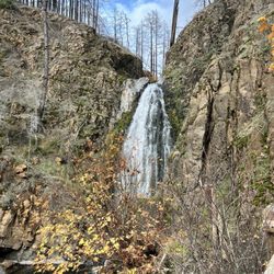
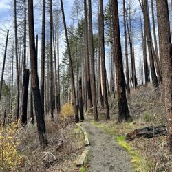
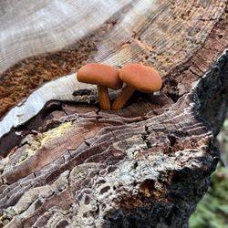
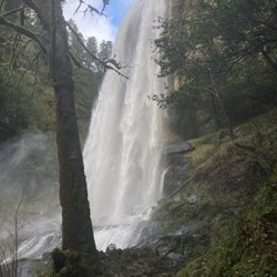
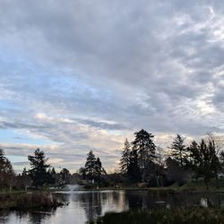
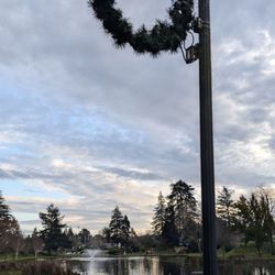
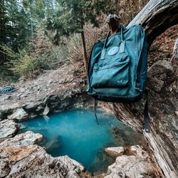
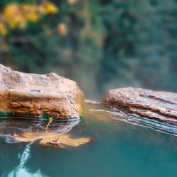
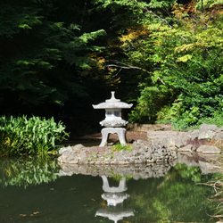
Lone Rock Resources Photos
You might also consider
More like Lone Rock Resources
Recommended Reviews - Lone Rock Resources
Start your review...

13 years ago


More info about Lone Rock Resources


Why does Yelp recommend reviews?
1 review that is not currently recommended
The reviews below are not factored into the business's overall star rating.
10 months ago
Lone Rock Resources - wildlifehunting - Updated May 2026
Best of Roseburg
People found Lone Rock Resources by searching for…
Things to Do in Roseburg, Oregon
Hiking Trails in Roseburg, Oregon
Walking Trails in Roseburg, Oregon
Running Trails in Roseburg, Oregon
Scenic Overlook in Roseburg, Oregon
Beautiful Views in Roseburg, Oregon
Things to See in Roseburg, Oregon
Hiking Trails Kid Friendly in Roseburg, Oregon
Waterfalls in Roseburg, Oregon
Easy Hikes in Roseburg, Oregon
View Points in Roseburg, Oregon
Off Road Trails in Roseburg, Oregon
River Access in Roseburg, Oregon
Places to Visit in Roseburg, Oregon
Scenic Views in Roseburg, Oregon
Fun Things to Do at Night in Roseburg, Oregon
Hiking With Kids in Roseburg, Oregon
Trending Searches in Roseburg, OR
Bounce House Rentals near Lone Rock Resources
Campgrounds near Lone Rock Resources
Dog Friendly Trails near Lone Rock Resources
Floral Designers near Lone Rock Resources
Flower Shop near Lone Rock Resources
Garden Center near Lone Rock Resources
Mexican Catering near Lone Rock Resources
Nurseries & Gardening near Lone Rock Resources
Outdoor Furniture Stores near Lone Rock Resources
Parks near Lone Rock Resources
Party Equipment Rentals near Lone Rock Resources
Pedicure near Lone Rock Resources
Pick Your Own Farms near Lone Rock Resources
Places To Take Pictures near Lone Rock Resources
Plant Nursery near Lone Rock Resources
River Swimming near Lone Rock Resources
Browse Articles
Browse Nearby
BEST of Roseburg, Oregon Restaurants near Lone Rock Resources
BEST of Roseburg, Oregon Things to Do near Lone Rock Resources
BEST of Roseburg, Oregon Coffee near Lone Rock Resources
BEST of Roseburg, Oregon Breakfast near Lone Rock Resources
BEST of Roseburg, Oregon Wineries near Lone Rock Resources
BEST of Roseburg, Oregon Thrift Stores near Lone Rock Resources
Browse Brands
Related Searches in Roseburg, OR
Best Fishing Locations and Guides in Roseburg, Oregon
Best Fun Things to Do in Roseburg, Oregon
Best Off Leash Dog Parks in Roseburg, Oregon
Best Places for Horseback Riding in Roseburg, Oregon
Discover Scenic Waterfall Spots in Roseburg, Oregon
Discover Top Boat Tours in Roseburg, Oregon for All Ages
Discover a Hiking Trail in Roseburg, Oregon
Dog-Friendly Hikes With Dogs in Roseburg, Oregon
Enjoy Camping Adventures Around Roseburg, Oregon
Enjoy Exciting Mountain Biking Adventures in Roseburg, Oregon
Enjoy Kayaking Adventures in Roseburg, Oregon
Enjoy Tent Camping Spots Around Roseburg, Oregon
Enjoy the Best Family Activities in Roseburg, Oregon
Enjoy the Best Walking Trails in Roseburg, Oregon
Explore Beautiful Parks and Green Spaces in Roseburg, Oregon
Explore Bike Rentals Throughout Roseburg, Oregon
Explore Easy Hikes Perfect for All in Roseburg, Oregon
Explore Free Things to Do Around Roseburg, Oregon
Explore Fun Activities to Do in Roseburg, Oregon
Explore Popular Campgrounds Near Roseburg, Oregon
Explore Popular RV Parks Around Roseburg, Oregon
Explore Scenic Lakes to Visit in Roseburg, Oregon
Explore Top Dog Parks in Roseburg, Oregon Near You
Explore Top Water Parks in Roseburg, Oregon Today
Explore the Best Boating Spots in Roseburg, Oregon
Explore the Best Swimming Holes Around Roseburg, Oregon
Family Friendly Hiking With Kids in Roseburg, Oregon
Find Beautiful Views in Roseburg, Oregon
Find Cozy Camping Cabins in Roseburg, Oregon
Find Top Dog Swimming Spots in Roseburg, Oregon
Find Top-Rated Disc Golf in Roseburg, Oregon
Find the Best Playgrounds to Visit in Roseburg, Oregon
Find the Best Swimming Pools in Roseburg, Oregon Today
Hiking Trails With Waterfalls in Roseburg, Oregon
Must-See Tourist Attractions Around Roseburg, Oregon
Off Leash Dog Hiking Trails in Roseburg, Oregon
Perfect Spots to Watch Sunset in Roseburg, Oregon
Popular Kids Activities in Roseburg, Oregon
Popular Picnic Spots to Visit in Roseburg, Oregon
Popular Places to Take Pictures in Roseburg, Oregon
Popular Things to Do in Roseburg, Oregon
Safe River Swimming Areas in Roseburg, Oregon
Safe and Fun Parks for Kids in Roseburg, Oregon
Top Playgrounds for Kids to Enjoy in Roseburg, Oregon
Top Running Trails to Explore in Roseburg, Oregon
Top Swimming Lakes to Enjoy in Roseburg, Oregon
Top Swimming Spots and Pools in Roseburg, Oregon
Top Things to Do With Kids in Roseburg, Oregon