Cancel

    Open app

    Search

    Lake Spaulding

    2.9 (8 reviews)

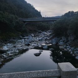
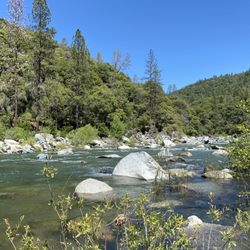
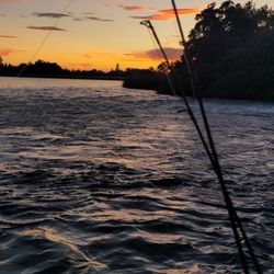
    Lake Spaulding Photos

    You might also consider

    Recommended Reviews - Lake Spaulding

    Your trust is our priority, so businesses can't pay to alter or remove their reviews. Learn more about reviews.
    Yelp app icon
    Browse more easily on the app
    Review Feed Illustration

    2 years ago

    Helpful 0
    Thanks 2
    Love this 0
    Oh no 0

    2 years ago

    Helpful 1
    Thanks 0
    Love this 2
    Oh no 0

    11 years ago

    Helpful 3
    Thanks 0
    Love this 1
    Oh no 0

    11 years ago

    Helpful 3
    Thanks 0
    Love this 1
    Oh no 0
    Photo of AJ S.
    215
    30
    1

    8 years ago

    decent lake but limited camping and hit or miss fishing.. try rollins lake in colfax! closer to stores and much more room for camping

    Helpful 0
    Thanks 0
    Love this 0
    Oh no 1

    10 years ago

    Helpful 0
    Thanks 0
    Love this 0
    Oh no 0

    11 years ago

    Helpful 0
    Thanks 0
    Love this 0
    Oh no 0

    12 years ago

    Helpful 6
    Thanks 0
    Love this 5
    Oh no 0

    Ask the Community - Lake Spaulding

    Verify this business for free

    Get access to customer & competitor insights.

    Verify this business

    Halsey Forebay Picnic Area - Not much action... yet!

    Halsey Forebay Picnic Area

    4.8(5 reviews)
    32.4 mi

    On a recent mild sunny winter weekend afternoon, I visited the Halsey Forebay fishing access area…read more It's a water reservoir that's occasionally stocked with trout and crawfish. It's managed by PG&E. The reservoir is a lake with shallow rocky edges. It's just for casting fishing, no humans or animals should go into the water. The access and parking is FREE. And as always, anglers 16 and older need a CA fishing license to fish. I didn't fish here. I looked about and soaked in the sights though. It was rusticly beautiful. However the perimeter doesn't have any shade trees. But vibes were super quiet, I call it library fishing. Shhhh. As I walked about the perimeter of the lake, I noticed folks were quiet even amongst their own groups. Even the elementary school age children there were super quiet. An incredible feat. QuietPlace. And about the fishing situation, not much luck with the anglers that day. Stock was low. Near the parking lot is a short concrete pier with fishing rod holders. This is closest to the water shed. The picnic area is across the watershed. To get to the area from the parking lot, you will have to walk, on a narrow steel grate walkway, over the watershed. The rushing water provides for a dizzying visual effect. The picnic area is set back enough from the lake so if you bring the kiddos, this is the area where they can go about hooting n hollering. The area has 3-4 concrete picnic tables and a several bbq pits. It's first come, first serve. This area is not paved, dirt packed; shaded with big growth trees. Plus let me tell you I learned the hard way that the walking path doesn't connect fully around the lake. I don't recommend attempting the mythical loop. The path is mostly gravel with the other parts being dirt. Watch where you step; there was a lot of poop along the trail. There is a stretch of the path that ends and funnels you out to the narrow bike lane on Christian Valley Road near Bancroft Road. There is no adjacent room to the side of the bike lane, only a chain link fence. Cars are going 50plus miles a hour inches away from you; and they are on a curve. So wait until traffic clears for a significant distance to hightail yourself across that stretch which runs about 50 feet. Don't try to walk with cars coming at you; don't risk getting impaled by a side view mirror or worse. There is a paved parking lot and a public restrooms with vault toilets. Sorry ladies, I can't provide any additional info about the restrooms. As always, I try my best to avoid public park restrooms. But at least they have a restrooms. And to add the landscape of area doesn't provide for any natural discrete spots to answer the call of nature.

    It's gorgeous out here…read more.. We've been fishing at Halsey Forebay Picnic Area quite a few times now. We've caught trout and crawfish! Along with some gnarly mosquito bites. You can pull in and park in a parking space where it leads right up some picnic benches. Just beyond that, a l is a fence with holders for your pole. About 10-12 of them lined up. If you are fishing here, this is where having a 2nd and 3rd pole comes in handy - just be sure to get your license for that!! The water current starts off strong over here and, depending on what you are using, could float downward towards our into the next person's line, so use wisely! Figure it out! On this cool evening, we were catching them left and right. Everyone fishing here is so friendly. It's fun to meet people and see what they're using. When the sun goes down, and most of the heat goes away, Halsey Forebay becomes a sight for sore eyes... as I said... so gorgeous

    Photos
    Halsey Forebay Picnic Area - This pathway is near the corner of Bancroft and Christian Valley Road.

    This pathway is near the corner of Bancroft and Christian Valley Road.

    Halsey Forebay Picnic Area
    Halsey Forebay Picnic Area

    See all

    Ramshorn Campground - The dogs hanging out at our site.

    Ramshorn Campground

    4.7(3 reviews)
    19.1 mi

    Great campground! There are two loops, the higher numbers being further away from the highway. The…read morescenery is beautiful and the view of the stars at night is breathtaking. The campground itself is kept very clean. There are no showers and the toilets are vault. The toilets are kept exceptionally clean but are still pretty fowl smelling upon entering (just a heads up). There are several swimming holes you can hike down to (directly across the highway from campground). The town of Downieville is also very close and has some fun places to visit. Best camping trip thus far, I will definitely return next summer for more fun!

    This great campground is about 6 miles west of the town of Downieville, tucked among the trees of…read morethe Tahoe National Forest. As the other reviewer notes, there are two loops. The lower loop is almost parallel to Hwy 49, but the upper loop is up a bit further back. Though traffic noises could be heard, they weren't too intrusive. I booked campsite #13, which was in the upper loop. Great site! We didn't have any neighbors immediately next to us, in any direction. Though the campground was almost completely full during my July visit, most people seemed to be out and about exploring the area during the day, and were quiet during the night. This is a tent-only campground, so it was nice not having to hear the hum of RVs all day. The grounds themselves were kept neat and tidy, the vault toilets were some of the cleanest I've seen, and there is potable water available. The campground is really close to some awesome swimming holes on the Yuba River. There is a trailhead directly across Hwy 49 that provides access. My group walked down to the river most days we were there. The traffic on Hwy 49 isn't very heavy so we felt really safe walking across and along the Hwy. The small town of Downieville is a definite must visit while you're in the area. We were camping specifically to attend the Downieville Mountain Brewfest (which was awesome!) but the town itself is charming and full of interesting historical places and things to see. All in all, the Ramshorn Campground provided a great base to explore Downieville, the Yuba River, and Tahoe National Forest. I'll definitely be back to explore more of the area and camp here again.

    Photos
    Ramshorn Campground - View of the river across from the campground.

    View of the river across from the campground.

    Ramshorn Campground - Swimming hole close by.

    See all

    Swimming hole close by.

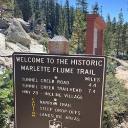
    Marlette lake trail

    Marlette lake trail

    5.0(6 reviews)
    40.8 mi

    We hiked the Marlette Lake Trail from Spooner Lake to Marlette Lake as a backpacking trip for my…read morefriend's bachelorette party! We added some extra distance at the end by hiking to the Marlette Peak Campground to stay for the night. From the parking lot to the campground was about 7 miles each way. The trail itself was well-maintained, moderate difficulty, and had everything you'd want in a good hike! Solid trail conditions. Beautiful mountain and lake views. Some sections of wildflowers. A good amount of sun but also some shaded parts. Gradual incline that never felt super steep, so the elevation gain felt manageable. We saw people hiking as well as mountain biking on this trail. There are several sections of aspen trees along this hike, so it's a great one to come back and do in the fall once the leaves turn yellow. The trailhead area has great facilities, the bathrooms were clean and there is ample parking. The park rangers I spoke to were friendly and helpful. There is a $10/car entry into this area but it's totally worth it, especially when you see how well they take care of it. I loved this hike and will continue to come back to Spooner for hikes in the future!

    There are a few ways to reach Marlette Lake, all of them totally worth it, especially this time of…read moreyear. This trail takes you around Spooner Lake and up to Marlette. It's a 9 mile out and back with fairly gradual elevation gain, up through the trees, until you reach the lake. A great little workout. Marlette sits along the Flume Trail, so you're likely to see a lot of mountain bikers. Fun fact: The Flume Trail got its name because Marlette and the tributaries that feed it were part of a log flume system to carry logs used to build our region all the way down from as far as Virginia City! Marlette has a short fishing season, but people say it's grand if you make the trip. Of course you need to hike in to have that experience. This is definitely a trail worth checking out in our area!

    Photos
    Marlette lake trail
    Marlette lake trail
    Marlette lake trail

    See all

    Lake Spaulding - boating - Updated September 2026

    Loading...
    Loading...
    Loading...