Cancel

Open app

Search

Laguna Mountain Visitor Center

4.5 (2 reviews)

Laguna Mountain Visitor Center Photos

You might also consider

Recommended Reviews - Laguna Mountain Visitor Center

Your trust is our priority, so businesses can't pay to alter or remove their reviews. Learn more about reviews.
Yelp app icon
Browse more easily on the app
Review Feed Illustration

2 months ago

The lady there was very helpful. a weekend volunteer. maps could have been better. info on the area very spotty.

Helpful 0
Thanks 0
Love this 0
Oh no 0
Photo of Nobu S.
40
28
125760

3 years ago

Helpful 0
Thanks 0
Love this 0
Oh no 0

You might also consider

Verify this business for free

People searched for Hiking 207 times last month within 15 miles of this business.

Verify this business

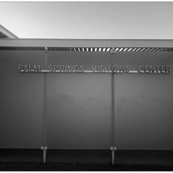
Palm Springs Visitor Center - Free parking MAR2025

Palm Springs Visitor Center

4.1(46 reviews)
68.8 mi

We had just started our trip in Palm Springs and made a stop here. It is very unique building at…read morethe beginning of the road to the aerial Tramway. Tons of parking, and a great view of the mountains from the parking lot. They even have a cool art display on one wall outside by the bathrooms for photo opportunities. The center itself is not large, and is filled with your typical T-shirts, sweatshirts, books, Christmas ornaments, etc. We did pick up a really cool Palm Springs Christmas ornament that was very unique and I didn't see anything like it when shopping downtown. The people at the desk have a large map that they draw on to show you how to get to certain places as they were giving us information which was helpful. I did buy a map that showed homes of past celebrities such as Doris Day, Elvis, etc. We did try to drive around and identify some of these homes, but it's not as easy as you would think. House numbers are not very apparent, and some of these streets are quite narrow, and with traffic behind you, you don't really have the opportunity to go slow and or stop to look. So we eventually gave up and just drove around to observe the unique architecture ourselves. I would say this is definitely worth a quick stop!

Late Nov, 2025. Palm Springs (PS), CA…read more *Location. Conveniently-located at the intersection of N Palm Canyon Dr and the road that goes up to the aerial tramway. *Exterior. Sufficient parking, even on a weekend, with EV charging stations available. Views of the San Jacinto Mountains from the parking area. Outdoor rest rooms available without having to go into the Visitor Center. A few outside photo opps. Architecturally-interesting building. It was apparently a former gas station but, with its update, has the feel of a mid-century modern building. *Interior. (1) There were two manned information desks, with friendly and somewhat helpful staff who offered maps and recommendations of things to see and do in PS. The young man who helped us pulled out a map that had PS proper on one side, and the greater PS (to Coachella) area on the back. He went through a seemingly rehearsed spiel about what we should see/do without first ascertaining what type of activities we were interested in. It was helpful that he informed us that VillageFest, a weekly downtown event with artists, artisans, entertainers, food vendors, and more, would not be held that week because of Thanksgiving. But, we were disappointed that he couldn't answer some of our basic questions about the San Jacinto National Monument area. Also, in asking if the Visitor Center had a map for a self-guided walking tour of attractions, we were directed to a brochure of (paid) walking tours offered by the local historical society. (2) There was a separate desk run by the Agra Caliente Band of Cohuilla Indians, offering tickets that allowed access to hikes in their ancestral lands, including Indian Canyons and/or Tahquitz Canyon. The woman at the desk was very friendly and helpful, and we bought tickets for Indian Garden (valid for one year). Tickets are normally $12 (adults) and $7 (seniors 62+), but a $1/ticket discount is given if purchased at the visitor center. (3) there is a small gift shop with books, maps, and souvenirs. (4) locally-relevant exhibits and brochures to local attractions.

Photos
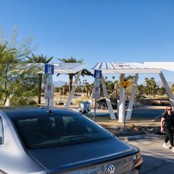
Palm Springs Visitor Center - You have arrived! Bathroom was just behind it on your right side. Lol.

You have arrived! Bathroom was just behind it on your right side. Lol.

Palm Springs Visitor Center

See all

Pacific Crest Trail At Penny Pines - Beauty that you will see on the Indian Creek trail loop in Mt Laguna

Pacific Crest Trail At Penny Pines

4.9(22 reviews)
3.3 mi

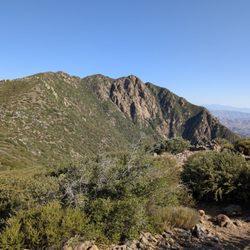
INDIAN CREEK LOOP REVIEW (8.8 miles)…read more Let's begin with 100% of hikes in Mt. Laguna or that includes the PCT will be an ethereal experience. Many say you can create, shape and mold reality. Others will say manifest and it will come. And then there are some that are just bah humbug. I always revel in God's imagination and creativity when he created these mountains. And then gave the gift of ingenuity to humans to work to create pathways and trails for us to enjoy and simply relish in gratitude and awe the entire hike. I'm a real hiker. Real backpacker. Real camper. And real glamping. I hike 2x a week for more than a decade. This is only to give you perspective of this review. This is my first time doing the full loop that included Pacific Crest Trail,Pine Mountain Road,Indian Creek Trail,and Noble Canyon Trail AKA "Indian Creek Loop." And today was wonky. Some parts were hard, some parts were easy, same parts were as if my body never has done hiking before. It was a doozy. I would likely do this hike again within the next couple of weeks. Because in my imagination, I'm an amazing hiker and that did not show today when I was struggling. I love taking photos and there was about an hour where I was trying to manage my breathing and focus and trek poles that I took no photos. Yep, I let the mountain win, smh. On this day, spectacular hike with alternating elevation, endless greenery, and blooming plants. Walking the legendary PCT, passing the "Canada" sign, and glimpsing Anza Borrego's desert floor was unforgettable. From rocky paths to meadows and mountain views, every turn offered something new. No one on the trail until the final half mile where bikers were on trail. I started at Piney Pines. Next time I'll go counterclockwise. GOOD TO KNOW *Att network excellent reception the entire trail *I felt safe as a solo hiker but I still get the quesies. I carry a few safety thins. Shhh. Don't tell *Hike time: 3 hrs, 3 minutes *90% exposed hike. *At the 4 mile marker, shade, benches and toilets. The toilets are unsanitary. I don't want to vomit and make it worse so I do my thing in nature. *When you start there's a point where you just have to finish *You can break this up to build up your mileage over time THIS HIKE IS NOT FOR: *Newbies, there's elevation involved *Whiners, complainers, or scaredy cats *Those who I have only done Cowles Mountain and think this is the next level "Life can be limited and you miss out. But create your own unlimitedness and you must do this hike."

This review is for the Garnet Peak via Pacific Crest Trail which was a 4 mile round trip that took…read moreabout 2 hours to complete. The trail for the most part was easy to follow and completely exposed to the sun. A good portion of the trail was rocky which could make your foot a bit uncomfortable. There were also a few instances where you could go off trail for a bit to check out the desert views! Short video of the hike for those interested: https://www.youtube.com/watch?v=htU3_t3cDMI

Photos
Pacific Crest Trail At Penny Pines - Beauty that you will see on the Indian Creek trail loop in Mt Laguna Garnet Peak

Beauty that you will see on the Indian Creek trail loop in Mt Laguna Garnet Peak

Pacific Crest Trail At Penny Pines

See all

Tijuana Estuary Visitor Center

Tijuana Estuary Visitor Center

4.9(14 reviews)
45.9 mi

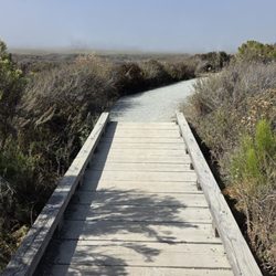
A pretty great afternoon here exploring this ecosystem and getting the opportunity to view some…read moreamazing birds! Estuaries are great places for birders and bird viewing and this place is such a gem! Visitor center has an exhibition to learn about the Estuary, gift shop, ranger on duty, bird books you can borrow, restrooms and water fountain available. Ranger on duty today was super helpful and kind. She shared with me that the Clapper Raill could be seen here and gave me directions to take N McCoy trail and this was where I would most likely see this Rail, which is unique to this Estuary! I was pretty excited about that, however, since I came in the early afternoon. I did not spot one. Oh well, this means I have to come back! After this, I tackled S McCoy trail, which is a longer trail but when you come to the end of it, it where three water ways meet and this was amazing as so many birds were here. I got to see egrets, Willets and also some long billed curlews! Curlews have a very long beak and they are pretty striking birds! Wow! The path is well paved, flat and plenty of benches along the way. Great for a hike, bring your dog, come for a run, come for birding, enjoy a healthy dose of nature! No shade here so make sure to put on sunscreen and bring water. Overall, a lovely place to visit, definitely come check it out if you like nature and birds.

This a cool place. I came heat because I heard from a friend that it was a good place to come for…read morea walk and it was. Parking is mostly street parking and a small parking lot at the Visitor Center. I started at Imperial Beach Blvd. and took the N. McCoy Trail and worked my way down to the end, where the water is between the north & south McCoy Trail. There's a nice look out there and a few benches to relax and bird watch. The trail I took was in good condition and consisted of compact soil and surrounded by the estuary and native brush, plants, and cacti. There were occasional benches along the trail. It was a good walk and I look forward to taking the S. McCoy Trail next time.

Photos
Tijuana Estuary Visitor Center

See all

Stonewall Peak Trail - Some pockets of fall leaves

Stonewall Peak Trail

4.7(100 reviews)
11.2 mi

This is my ideal type of hike. Can be completed in under 4 hours (only took us 1.5 hours including…read morelingering at the top), mostly shaded, lots of uphill, beautiful view up top. Aim to hike in the morning for the most shade. Start at the parking lot across the street and pay $10 to park. There are restrooms on site that are relatively clean. The first quarter mile is a little steep and not shaded, so it seems like you're in for a strenuous hike, but it quickly turns to shade and very gradual incline switchbacks. It's not until you get to the last quarter mile that it gets steep and sunny again. The trail is 2 miles one-way.

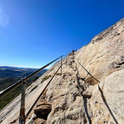
Stonewall Peak is one of the more underrated inland hikes of San Diego County located halfway…read morebetween Julian and Descanso at Cuyamaca Rancho State Park. It's a little over an hour from the I-5/I-8 intersection to reach this trail. We visited during the cooler season when the afternoon temperature was in the low 70s without any clouds to obscure the sun. There was a parking lot across the road from the trailhead for campers and day hikers. The charge for the latter was $10 per vehicle. The trek to the summit was roughly two miles, and we managed to reach it in about 50 minutes. The trail itself had a lot of gentle switchbacks which made the ascent easier and allowed us to keep a good pace. There was also a lot of shade throughout the hike which made it even more pleasant. We saw many parents with young kids along the way. That indicated the difficulty level wasn't too strenuous. Having said that, the final climb did involve scaling across boulders before you reached a set of rock steps with metal handrails on one side leading up to the peak. The views at the top were gorgeous with the backdrop of a clear blue sky and other mountains in the distance. A few signs were mounted facing different directions. They described some of the landmarks that you could see from the respective perch. The only feature missing from this trail was the presence of a nearby body of water (e.g. creek, pond, lake). That would have elevated Stonewall Peak Trail to a full five-star experience.

Photos
Stonewall Peak Trail
Stonewall Peak Trail - Can see the stairs

Can see the stairs

Stonewall Peak Trail - The last stretch

See all

The last stretch

Laguna Mountain Visitor Center - hiking - Updated May 2026

Loading...
Loading...
Loading...