
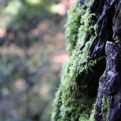
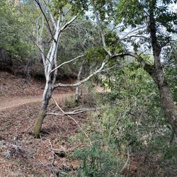
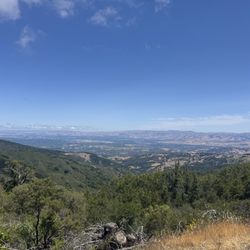
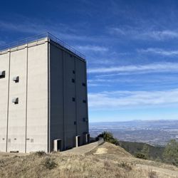
John Nicholas Trail Photos


You might also consider
More like John Nicholas Trail
Recommended Reviews - John Nicholas Trail
Start your review...

7 months ago
Great option for mountain biking, walking, or hiking. The trail starts off easy, but gets steeper as you make your way up. I completed the trail on a mountain bike with minimal stops, and the entire round trip took about three hours. The trail is well maintained, and I did not notice any trash or debris along the way. Hydration is important for this trail, so make sure to hydrate the day before, during, and after your adventure. I brought about 3 liters of water in a camel-bak and was completely out by the time I made it back down. It is also important to be mindful of mountain bikers descending the trail, as some ride fast and may be wearing headphones, making them less aware of those who are ascending. There is no designated parking lot at the main entrance, but there are a few parking spots located along the side of the road. read more

One of my favorite hiking trails in the area! I love that it is very wooded and has a lot of shade and away from the madding crowds. The trail itself is pretty easy and flat. Great walk to take in the nature sights and get amazing views of the mountains. Watch out for the speeding bikers. Parking is very limited along the windy street, so be prepared for that. read more


I have only been here once for MTB. The trails is short 5 miles with the first 2 miles is fire road from the black road. The climb start after you passed the reservoir from the bridge and it is fairly gentle and smooth for 3 miles. I remember that is only1 steep section in the 1/3 part of the trail. My only complain is that other MTB who is coming down has little regards to other park users. They should always slow down and give rights to uphill rider. There are 2 great place to stop and enjoy the view. Once it is a the big boulder and last one is at the benches before the end of the trail. When you hit the intersection with Skyline trail, that is the end of John Nicolas trail and you are almost close to highway 35. Skyline is not as smooth but not technical. Some parts are rocky and get it a little challenging towards castle road. I wanted to give 4 stars due to limited parking but I was told that they are adding more parking in the future. My advice is to come early at 8.00 am on weekend to avoid crowd and get parking. Watch for other hikers and cyclist and share the trail. RIde Safe read more


6 years ago
4 years ago
I have hiked this area for at least 25yrs, i.e. before bicycles were allowed. It used to be sublime, it is now a racetrack for bicycles. The photos show how the once narrow footpath is now the equivalent of a 4 lane freeway for mountain bikes. These clueless bikers cut new and larger swaths, scarring the hills in a manner similar to clear-cutting a forest. An extreme analogy? Perhaps, but give them a couple more decades and it will not be. Bicyclists do not come here for the beauty and serenity, rather they come to destroy it. To be clear, I do not think that is this their conscious intention, which in some ways, makes it worse because they are utterly unconscious of the effect they have on the environment. It's true that many will be superficially courteous and slow down when passing but none will say, "so sorry to disrupt and invade this natural beauty with my noisy toy/machine". Watch them, listen to them, I have never heard one stop and say, "my, how beautiful this land is". They do not see the ever-damaging effect their carelessness has on the countryside. Their "right" to use their toys in nature trumps all. The thoughtful hiker's basic code for travel through nature of, "leave it as you found it", is an idea that is completely foreign to the mountain bikers. read more


5 years ago
8 years ago
10 years ago
More info about John Nicholas Trail
20411-20599 Black Rd
Los Gatos, CA 95033
Directions
Hours
Outdoor Amenities
Ask the Community - John Nicholas Trail
You might also consider


John Nicholas Trail - hiking - Updated July 2026
Best of Los Gatos
People found John Nicholas Trail by searching for…
Hiking Trails in Los Gatos, CA
Redwood Trees in Los Gatos, CA
Redwood Forest in Los Gatos, CA
Dog Friendly Hiking Trails in Los Gatos, CA
Mountain Biking in Los Gatos, CA
Things to Do With Kids in Los Gatos, CA
Great View Points in Los Gatos, CA
Beautiful Views in Los Gatos, CA
Walking Trails in Los Gatos, CA
Hiking With Kids in Los Gatos, CA
Running Trails in Los Gatos, CA
Natural Hot Springs in Los Gatos, CA
Walking Groups in Los Gatos, CA
Lakes & Ponds in Los Gatos, CA
Trending Searches in Los Gatos, CA
Blueberry Picking near John Nicholas Trail
Boat Tours near John Nicholas Trail
Cliff Jumping near John Nicholas Trail
Cruising Spots near John Nicholas Trail
Day Trips near John Nicholas Trail
Dog Friendly Things To Do near John Nicholas Trail
Jet Ski Rental near John Nicholas Trail
Kayak Rental near John Nicholas Trail
Kids Activities Indoor near John Nicholas Trail
Lakes near John Nicholas Trail
Off Road Trails near John Nicholas Trail
Outdoor Activities near John Nicholas Trail
Peach Picking near John Nicholas Trail
Places To Walk Around near John Nicholas Trail
Public Shower near John Nicholas Trail
River Swimming near John Nicholas Trail
Rock Quarry near John Nicholas Trail
Scenic Night View near John Nicholas Trail
Scenic Overlook near John Nicholas Trail
State Parks near John Nicholas Trail
Surf Shop near John Nicholas Trail
Swimming Holes near John Nicholas Trail
Swimming Lakes near John Nicholas Trail
Things To Do On A Rainy Day near John Nicholas Trail
Tubing near John Nicholas Trail
Watch Sunset near John Nicholas Trail
Browse Articles
Browse Nearby
BEST of Los Gatos, California Coffee near John Nicholas Trail
BEST of Los Gatos, California Restaurants near John Nicholas Trail
BEST of Los Gatos, California Things to Do near John Nicholas Trail
BEST of Los Gatos, California Breakfast near John Nicholas Trail
BEST of Los Gatos, California Parks near John Nicholas Trail
BEST of Los Gatos, California Wineries near John Nicholas Trail
BEST of Los Gatos, California Campgrounds near John Nicholas Trail
Browse Brands
Related Searches in Los Gatos, CA
Affordable Kayak Rental Services in Los Gatos, California
Best Dog Hiking Trails Around Los Gatos, California
Best Fishing Locations and Guides in Los Gatos, California
Best Nature Trails for Hiking in Los Gatos, California
Best Places for Horseback Riding in Los Gatos, California
Best Sightseeing Experiences Available in Los Gatos, California
Check Out Off Road Trails in Los Gatos, California
Discover Dog Friendly Trails to Explore in Los Gatos, California
Discover Easy Hiking Trails Near Los Gatos, California
Discover Kid Friendly Hiking Trails in Los Gatos, California
Discover Popular Bike Trails in Los Gatos, California
Discover Walking Parks in Los Gatos, California Near You
Discover a Hiking Trail in Los Gatos, California
Discover the Best Night Hike Trails in Los Gatos, California
Dog-Friendly Hikes With Dogs in Los Gatos, California
Enjoy Camping Adventures Around Los Gatos, California
Enjoy Kayaking Adventures in Los Gatos, California
Enjoy Off Leash Dog Hikes in Los Gatos, California
Enjoy Scenic Places to Walk in Los Gatos, California
Enjoy Tent Camping Spots Around Los Gatos, California
Enjoy a Beautiful Waterfall Hike in Los Gatos, California
Enjoy the Best Walking Path in Los Gatos, California
Enjoy the Best Walking Trails in Los Gatos, California
Explore Beautiful Parks and Green Spaces in Los Gatos, California
Explore Easy Hikes Perfect for All in Los Gatos, California
Explore Fun Activities to Do in Los Gatos, California
Explore Popular Campgrounds Near Los Gatos, California
Explore Popular Dog Walking Trails in Los Gatos, California
Explore Top Dog Parks in Los Gatos, California Near You
Explore the Best Beach Spots in Los Gatos, California
Family Friendly Hiking With Kids in Los Gatos, California
Find Parks and Recreation Activities in Los Gatos, California
Find Top Dog Friendly Parks to Visit in Los Gatos, California
Find Top-Rated Waterfalls in Los Gatos, California Now
Find the Best Parks for Picnics in Los Gatos, California
Hiking Trails With Waterfalls in Los Gatos, California
Off Leash Dog Hiking Trails in Los Gatos, California
Popular Outdoor Activities to Try in Los Gatos, California
Popular Picnic Spots to Visit in Los Gatos, California
Popular Waterfall Hiking Trails in Los Gatos, California
Safe River Swimming Areas in Los Gatos, California
Safe and Fun Parks for Kids in Los Gatos, California
Top Hiking Trails to Explore in Los Gatos, California
Top Playgrounds for Kids to Enjoy in Los Gatos, California
Top Running Trails to Explore in Los Gatos, California
Top Swimming Lakes to Enjoy in Los Gatos, California
Top Swimming Spots and Pools in Los Gatos, California
Top-Rated Camping Sites in Los Gatos, California
People who viewed John Nicholas Trail also viewed
St Joseph's Hill Open Space Preserve
61 reviews
Almaden Quicksilver County Park
296 reviews
Bear Creek Redwoods Preserve
32 reviews
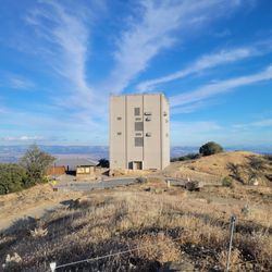
Mount Umunhum
34 reviews
Lexington Reservoir County Park
63 reviews
Novitiate Park
6 reviews
El Sereno Open Space Preserve
5 reviews
Fremont Older Open Space Preserve
186 reviews
Foothill Park
3 reviews
Blossom Valley
Rocky Ridge Trail
3 reviews