Hoodoos Viewpoint Photos


More like Hoodoos Viewpoint
Recommended Reviews - Hoodoos Viewpoint
Start your review...

7 years ago
We came here for an easy rainy day activity. You can hike here from Surprise Corner, but there's also a view point you can drive to. There's several viewpoints where you can see the hoodoos a short walk from the parking lot. The second and third ones have the best views. I thought there would be a bunch of the hoodoos, but there's only one small group of them. If you're in the area, is worth stopping at, but I don't think it's worth going out of your way for. read more


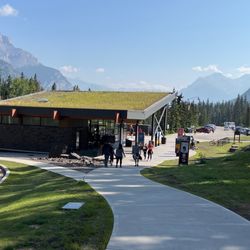
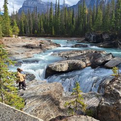
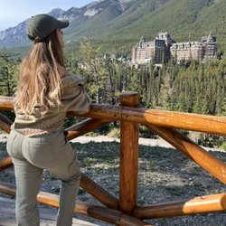
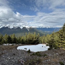
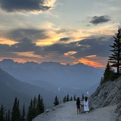
Hoodoo is a column or pinnacle of weathered rock. Tens of thousands of hoodoos in Bryce Canyon versus 6 hoodoos in Banff. You can see the hoodoos from the across the river at the Fairmont Banff Springs hotel, if you know where to look. Face the river and look well to your right up at the top of Tunnel Mountain. For you people who want some exercise, you can walk to the hoodoo viewpoint. Walk or drive to the Banff Surprise Corner at the tip of the peninsula facing the Bow River and Bow Falls. From here it is a 2.7 mile straight up the mountain, on the Hoodoo trail. This will take you over an hour according to google maps, although others who have tried it say it can take much of the day. So bring food and water in a daypack, along with hiking boots. For you lazy slobs like myself and the wife, we took the tour bus up Tunnel Mountain road, or a curvy mountain road called Tunnel Mountain drive to the Hoodoos Viewpoint. The Hoodoos Viewpoint is actually about 100 yards away from the 4 hoodoos closer to the river. The hoodoos are not that spectacular themselves, but the view of the Bow River and Mount Rundle in the background can be spectacular. Unfortunately for us, the smoke from the forest fires made the place look like the LA basin on a smoggy day. There is a paved pathway going in a circuitous route up the mountain, with about 3 different viewpoints. I took so long to get to the top, that they were about to send someone to fetch me -last on the bus again! Signs say no going off the pathway. Canadian park rangers can give citations to trespassers. We saw some people, probably teenagers, trying to get down to the hoodoos to take a selfie, while leaning on the fragile limestone. Too many people do this, and the hoodoo will come tumbling down. Another historical natural monument destroyed by people trying to get a selfie! We watched our step the rest of the day, as hoodoo also means something that brings bad luck! To paraphrase Candice, "Who do? You do!" read more


8 years ago
More info about Hoodoos Viewpoint
Tunnel Mountain Trail
Improvement District No. 9, AB T0L
Canada
Directions
Hours
Outdoor Amenities


Why does Yelp recommend reviews?
1 review that is not currently recommended
The reviews below are not factored into the business's overall star rating.
3 months ago
Hoodoos Viewpoint - landmarks - Updated June 2026
People found Hoodoos Viewpoint by searching for…
Parking in Improvement District No. 9, Alberta
Things to Do in Improvement District No. 9, Alberta
Free Parking in Improvement District No. 9, Alberta
Hiking Trails in Improvement District No. 9, Alberta
Tours in Improvement District No. 9, Alberta
Sunset in Improvement District No. 9, Alberta
Public Parking in Improvement District No. 9, Alberta
Scenic Drive in Improvement District No. 9, Alberta
Boardwalk in Improvement District No. 9, Alberta
Waterfalls in Improvement District No. 9, Alberta
Landmarks in Improvement District No. 9, Alberta
Natural Hot Springs in Improvement District No. 9, Alberta
Must See in Improvement District No. 9, Alberta
To Do in Improvement District No. 9, Alberta
Public Services & Government in Improvement District No. 9, Alberta
Tourist Attractions in Improvement District No. 9, Alberta
What to Do in Improvement District No. 9, Alberta
Sunset Views in Improvement District No. 9, Alberta
Beautiful Views in Improvement District No. 9, Alberta
Trails in Improvement District No. 9, Alberta
Fun Things to Do With Teens in Improvement District No. 9, Alberta
View Points in Improvement District No. 9, Alberta