Herstmonceux Castle Photos


Recommended Reviews - Herstmonceux Castle
Start your review...

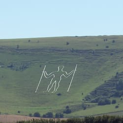
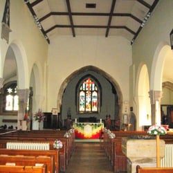
Herstmonceux Castle is an almost fairytale-like castle, situated in rolling countryside in East Sussex, 10 miles from Eastbourne. The castle buildings themselves are now part of a Canadian College and are not open to the public, but the magnificent gardens are open to the public. There's also a tearoom where you can have refreshments afterwards. Begun in 1441, the castle was begun by Sir Roger Fiennes and completed by his son, Lord Dacre. It was the first major building built in brick in southern England since Roman times. After the fortunes of the family declined, the castle was partially dismantled in the late 18th century and stood as a picturesque ruin until the early 20th century when it was restored to its present form. After the Second World War, the estate became home to the Royal Greenwich Observatory, moved from London because of increasing light pollution and excessive ground movement from trains and traffic. (This is now the Observatory Science centre - see separate reviews.) The Observatory closed in the 1980s and in the 1990s became part of Queen's College, Ontario, as Bader College. Access to the grounds is available daily February to November, £8 for adults and £3.50 for 4-17s. Season tickets are available for regular visitors and there are discounts for those living locally. The castle grounds are extensive, and the castle itself sits at one end of a lake with an impressive moat at the front. The gardens include the quadrangle in the middle of the castle, which is followed by a series of walled gardens. These have magnificent herbaceous borders, as well as an Apothecary's garden, Rose Garden, Elizabethan Garden, and walks around the castle moat, and across a wildflower meadow up to a Folly and lake. It's worth a visit of at least a couple of hours. There's a gift shop and cafe - we had a pot of tea for two and really excellent cakes on our visit (a toffee apple muffin and a pumpkin and ginger cake) for under £10. The ticket office entrance is on the east of the estate, accessed through the grounds of the Science Observatory. There is a small car park opposite the main entrance to the front of the castle (parking on gravel / grass). From the village and mediaeval church, access is indirect via public footpaths, but there is no vehicular access this way. read more


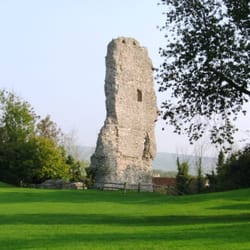
Boasting a fairly colorful history, including standing as an exterior walls-only edifice for well over a century, Herstmonceux Castle's name derived from very early 12th century owners of a manor house that existed on the site, Idonea de Herst who married Ingelram de Monceux, a Norman nobleman. At that time, the manor house was called "Herst of the Monceux." There is evidence that in 1066 some other structure existed before the manor in this location. During most of the 20th century it was vacant, Then, in 1992, it became part of Queen's University at Kingston (Ontario, Canada) and was known as Queen's International Study Centre (ISC), with primarily arts or commerce students. The name later changed, in 2009, to Bader International Study Centre, after Alfred Bader, the Queen's alum who first had the idea to turn this castle into a university study center. Gaining entry may not be possible but the exterior is incredible. Well worth the visit. read more