Cancel

    Open app

    Search

    Hemlock Bluff Nature Preserve

    4.0 (2 reviews)

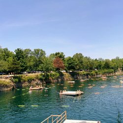
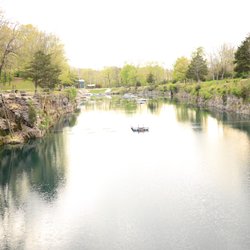
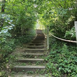
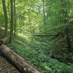
    Hemlock Bluff Nature Preserve Photos

    Recommended Reviews - Hemlock Bluff Nature Preserve

    Your trust is our priority, so businesses can't pay to alter or remove their reviews. Learn more about reviews.
    Yelp app icon
    Browse more easily on the app
    Review Feed Illustration

    3 years ago

    Helpful 0
    Thanks 0
    Love this 0
    Oh no 0
    Photo of Ken N.
    668
    3984
    21554

    8 years ago

    Helpful 2
    Thanks 0
    Love this 2
    Oh no 0

    Verify this business for free

    Get access to customer & competitor insights.

    Verify this business

    Bloomington Rail Trail

    Bloomington Rail Trail

    4.6(7 reviews)
    24.9 mi

    I was looking for something fun to do on a sunny afternoon and came across this nice walking path…read more There is a nice sized parking lot at the trail head. There is a water fountain and a waste can where you first get to the path. One of the main things I loved about this trail is the fact that it is wheelchair friendly. I have a difficult time finding suitable trails to take my daughter on. This trail is not paved but it is very well packed and does have gravel in some spots. I would think that if it was wet from rains it may not be as suitable to walk on. We passed several runners, walkers and bikers. We did not make it the entire length of the trail but the length we did walk was so peaceful. There were no leaves on the trees yet and no green grass but hearing the running water in the creek along part of the trail was very relaxing. I can easily see how this would be a great place to come and get away from city life for a short time! I'll definitely be coming back when I'll be able to walk the entire path. And hopefully see some wildlife and maybe some wild flowers along the way!

    I have been during the day and night. It can be a little dangerous at night. There is a homeless…read morecompound that stays out in the woods, so be sure that you're not alone and that you're prepared for danger. But it is absolutely gorgeous at night. I didnt see anything sketch on my night hike and highly recommend going. Just better safe than sorry. The day time is also really nice. It can get crowded, but thats all parks here in Bloomington. It is usually filled with runners and speed walkers. I dont see many kids. It is a trail, not a full size park. And it doesnt have the art that the B-line has so it may not be well suited for some kids. I would have loved it when I was a kid...but I was a nerdy outdoorsy kid. Definite spot for locals interested in getting off the B-line and out of the hustle and bustle of day-to-day life quickly. I wouldn't really recommend for tourists. We have much better spots for you.

    Photos
    Bloomington Rail Trail
    Bloomington Rail Trail
    Bloomington Rail Trail

    See all

    Dilcher-Turner Canyon Forest - Finally getting some autumn colors

    Dilcher-Turner Canyon Forest

    4.0(1 review)
    29.1 mi

    While exploring Greene County, I saw that there was a moderate 1.6 mile hiking path inside the…read moreDilcher-Turner Canyon Forest. So, I crossed the railroad tracks (heading west) and pulled into the small lot at the south entrance. There is the usual wipe your feet before you enter and the sign in to let someone know the park is getting used. The park is a bit on the primitive side: no restrooms, natural trails, and only a few benches. There aren't actual trail markers, but during the right conditions, it seemed the painting of white patches on trees to help the hiker orient on the paths seemed to work. I could see this being a necessity after the leaves have fallen and covered up the dirt path. Note that there were several dry creeks that I crossed along the way, but because of the 60' elevation change, I could see the need to cross over water or at least muddy ground after a rain storm. The trail does have a short cut for those not wishing to hike the entire distance. After walking up a mild incline for .2 miles, there is a split in the path with a laminated map showing you where you are and the distances around the paths. I recommend snapping a photo of this since there is only one other map posted on the trails. The outer trail to the left (West) is the one with the best views of the canyon. Deep greens and rocky descents are seen and there is a bench to relax and just listen. No immediate access is available here to the canyon floor. However, the trails do gradually reach the lower portion of the canyon to the east, though never quite reaching the bottom, and certainly not near the viewing area on the west end. Along the way, there are a lot more rock outcroppings that have shallow caves. While observing a squirrel who had run into a fallen log, a deer ran by me within 30 yards to the crest of the hill, and then back to where it came from as I followed the path upward. Note: I wouldn't recommend going off trail here unless you have some high tech equipment or are just a bit crazy. The white trail patches are small and are only painted on the side that you can see them from the trail. If you wander off, you will need a lot of luck to find the markers again. If you are unsure, just stop and look to see the next marker before proceeding. They are there....just use patience. Overall, it was an enjoyable hike. I made good time on my trip, including stops to take photos, taking about 45 minutes. Review #1587

    Photos
    Dilcher-Turner Canyon Forest - Small parking area across the train tracks on Edwards Road

    Small parking area across the train tracks on Edwards Road

    Dilcher-Turner Canyon Forest - Dilcher-Turner Canyon

    Dilcher-Turner Canyon

    Dilcher-Turner Canyon Forest - Dilcher-Turner Canyon

    See all

    Dilcher-Turner Canyon

    Tioga Falls Trail - Bottom of falls

    Tioga Falls Trail

    4.5(26 reviews)
    62.7 mi

    This little hike was recommended to me after a snowstorm--which I definitely would not suggest…read more It's mostly uphill, and the wind turned everything into ice, making it really challenging to traverse. Outside of that particular experience (and once I was on the return down-hill), I realized this trail is short, simple, charming , and easy, with a few spots offering really pretty overlook views along the way. About halfway in, a babbling creek starts to follow you, hinting that you're nearing the final destination. Then you can hear the waterfalls before rounding a bend to reveal them. The falls are fantastic with multiple levels and a very peaceful melody. Just a heads-up: the trail begins with a walk down a service road since the original trail is now on private property, roped off as part of a very interesting-looking old house/building. At the end of the service road, there's a short but steep uphill path path to rejoin the trail. After that--smooth sailing.

    Such a beautiful trail. It was easy to get around but luckily I was with someone that knew exactly…read morewhere she was going. The first big bill up the trail was a doozy. I wasn't ready for that, but I made it! We got some beautiful pictures of the waterfall. The waterfall was easy to walk around in and can get wet if you wanted too. Great place to cool down as well. There was also a train track that we walked on and it was right over a creek. Very high up but cool to see. I would definitely go back to visit the trail. I will know more of what I'm getting into next time.

    Photos
    Tioga Falls Trail
    Tioga Falls Trail
    Tioga Falls Trail - Multi-level waterfalls!

    See all

    Multi-level waterfalls!

    Hemlock Bluff Nature Preserve - parks - Updated August 2026

    Loading...
    Loading...
    Loading...