Graveyard Fields Photos


More like Graveyard Fields
Recommended Reviews - Graveyard Fields
Start your review...

Reviews With Photos

This trail is located right off of the Blue Ridge Parkway. We did the loop hike that started at the parking lot, went to second falls (lower falls), then upper falls, and took the loop back. The trail is pretty moderate. It's not very steep overall, just a few minor hills. It was very muddy when we were there. There's one turn off at the end where I think the trail could have been better marked. Luckily another hiker told us the trail on the right was a spur and the falls was to the left. Second falls was really pretty. Upper falls was nice, but kind of hard to get a good view of with the trees around it. You'll get better mountain views on the parkway on your way to and from the hike than on the trail. I think it was supposed to be about a 3 mile round trip hike but we added on a mile or two attempting to find another waterfall unsuccessfully. I think there are better hikes along the parkway, but this one is still worth doing.

A very cool stop along the parkway with a hike down to the river and falls The Blue Ridge Parkway is a 470-mile-long roadway that meanders through the mountains and connects the Shenandoah National Park in Virginia and the Great Smoky Mountains National Park in North Carolina. The parkway boasts about 170 official stops along the path. This site is one of these many stops. The parking lot is not just a pull-off, there are parking spaces, a set of restrooms, and a trail from this stop. There is a large informational display that shows the various sites that can be accessed from this location. There is a set of stairs that leads down to a winding and fairly steep asphalt trail. This trail ends up at the river and a "bridge" that looks questionable but will allow you access to the other side of the river. Hiking up (to the west) will bring you to a set of falls (lower and then upper falls). The trail by the river is not very well marked and is often across rocks in and along the river. Overall, it is a good place to stop, see the river, do some hikes, or just relax. Enjoy.

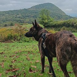
This was a fairly easy hike for my Father in his 60s and I. The drive in is absolutely gorgeous and the parking lot was pretty busy. Once you are on the trail you do not see many people, everyone we saw was friendly. We couldn't figure out where the big falls were but had a great time while looking for them. There are also restrooms in the parking lot and I love that it is dog friendly!

This is a fairly easy hike right off the Blue Ridge parkway. It's a loop trail that goes to two waterfalls -- a smaller lower falls (accessible via a paved path) and a larger upper falls (requires a moderate hike). It can get crowded, so be sure you go early or are ready to wait a bit for a parking spot. I greatly enjoyed this hike and the drive to and from the trailhead on the parkway is beautiful.

Stunning hike. Definitely take a picture of the map before you go. Trail is labeled well enough. Hiked the loop counter clockwise and appeared to be easier. hiked to the lower waterfall had stairs. Beautiful waterfall. Found some blackberries up higher on the trail and found lots of blueberries down below. Delicious hike

" 'Come down now', but we'll stay..." -The Postal Service Let me take you down, cos I'm going to Graveyard Fields. Might sound depressing, but it is the exact opposite. Life and its force are teeming here. On a beautiful day, it will be packed. Parking seems tough, but someone is always leaving as you are arriving. Do not illegally park. You will get ticketed. Grab your jacket and your water and go. The bathrooms are Porta-Potties with sanitizer. It is the only time I have ever used my on-the-go Clorox wipes. On my first reconnoiter, someone opened the door while I was staring at the toilet. I told them it was O.K.; I could not use it. A bit later, I loosened up as my bladder tightened. The point- make sure someone guards your bathroom door, as some locks do not work. There is a map there. Take a photo of it. There are three falls. The Upper Falls are upper; the Lower Falls are lower. The lower ones are also called "Second Falls" on some maps. Yellowstone is dangerous and just for experts. Be careful of exposed metal rods that once held trail boards in place. Do not trip and impale yourself. The Upper Falls trail takes you through all kinds of landscape. I swear, we became primal. We were on a movement quest. It felt right. Archetypical migration memories and fears arose from deep within me. I felt primed. If danger came at me I would quell it. Yet, I was still having a good time. I had found a balance. When we got to a perpendicular creek, I told Ronni, my kid, that I did not want her to decide my fate. The kid's senses were right- cross this creek. You will even see a small plank, I think. Things will get muddy. Keep going. O.K., I am guessing that you kept going. All I can say is that we did. The landscape changed, and you just know that you left a certain zone behind. We had entered Lothlórien. We left my husband, F., behind. We went higher. Some force impelled us to. We wanted to see the falls' birthplace. We went even higher, filled with exhilaration and a manic energy. Then I realized the full impact of the laws of gravity with gravity. Fear of Ronni doing something reckless at the almost-top of a powerful waterfall made me stock-still. Negative scenarios crossed my mind. I had to stop ascending because an eight-year-old made me. I am still bitter about this, because I was bonding with Sophie, age twelve, and could also feel victory close at hand. Close at foot? I did allow them a quick close-up of the water's powerful grace. That's when F. showed up. I was scared, because he is grizzly-sized, and I could not figure out how he got up there. He also dashed my dreams (re: Ronni). Then he and I got more familiar with the laws of gravity. The path that looked hobbity while going up became a mud chute when you had to descend. F. got a back boo-boo, and my arms almost got wrenched from their sockets. The kids were fine. Everyone was muddy. But our souls were cleaner than they had been in the parking lot. Do not forget- no overnight camping due to bears. AT&T goes kaput the farther you go; Verizon doesn't. Oh, and of course, we had our daily portion of weirdness from strangers- yes, even on a hike- an impatient woman asking for directions chided us because we did not notice her child that was only one hundred feet behind everyone. Moral- kids under twelve are a hiking-at-heights hassle. Graveyard Fields forever!

Everybody has to have a favorite place, where they feel completely relaxed and at home. Graveyard fields is that place for me. I've been hiking, camping, and swimming here for over 30 years and have watched its popularity and foot traffic soar every year. The trails are easy and you get to spend more time looking at the scenery than staring at your feet. There are three sets of waterfalls (two of them easy access). There is a great spot to swim in a refreshingly cool pool under lower falls. The trails are lined with blackberries and mountain blueberries so you can snack as you go. There is a bathroom available at the parking lot if needed. The Blue Ridge Parkway is packed full of memorable places, but this is the one I can't wait to get back to.

I gave this 5 stars because if it wasn't raining it would have been. Unfortunately it was rainy and some muddy areas, but beautiful water ways, well marked trails and got to peep some fall foliage. This is a free stop on the Blue Ridge Parkway. They also have restrooms and are pet friendly, which is always a plus in my book. The trails are a little rough with roots and some rocks, also some stairs, which in the higher elevation were kicking my butt, but if you're a regular hiker you'll be all set. read more


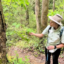
This is probably our favorite place to hike in Asheville...because of its unique adjacent trail, heading toward the waterfalls. I'm actually surprised that there aren't many reviews and pictures of this trail, given its popularity. The reason I couldn't give all 5 stars is because of dirt-poor maintenance! On our recent visit, we noticed so many damaged/broken wooden planks (half a dozen?), with big, gaping holes in them! I was surprised that they didn't close down the trail to fix these hazardous walking areas. I mean, there are a ton of little kids and dogs walking through these dangerous planks! Seriously, these need to be fixed ASAP!! We usually hike down to the waterfalls, and sit on the rocks and just hang out a bit before heading back. Majority of the hike is pretty easy, except for some steep steps. We also walked a bit past the "Bear Country" sign...but I got skittish, so we didn't go far. I am NOT a fan of bears...though my husband swears that the chance of seeing them are miniscule. Still, I saw the sign...and that's enough for me. Maybe next time, I'll get a bit braver...and we'll walk a bit further. read more


7 years ago
This trail is located right off of the Blue Ridge Parkway. We did the loop hike that started at the parking lot, went to second falls (lower falls), then upper falls, and took the loop back. The trail is pretty moderate. It's not very steep overall, just a few minor hills. It was very muddy when we were there. There's one turn off at the end where I think the trail could have been better marked. Luckily another hiker told us the trail on the right was a spur and the falls was to the left. Second falls was really pretty. Upper falls was nice, but kind of hard to get a good view of with the trees around it. You'll get better mountain views on the parkway on your way to and from the hike than on the trail. I think it was supposed to be about a 3 mile round trip hike but we added on a mile or two attempting to find another waterfall unsuccessfully. I think there are better hikes along the parkway, but this one is still worth doing. read more


3 years ago
A very cool stop along the parkway with a hike down to the river and falls The Blue Ridge Parkway is a 470-mile-long roadway that meanders through the mountains and connects the Shenandoah National Park in Virginia and the Great Smoky Mountains National Park in North Carolina. The parkway boasts about 170 official stops along the path. This site is one of these many stops. The parking lot is not just a pull-off, there are parking spaces, a set of restrooms, and a trail from this stop. There is a large informational display that shows the various sites that can be accessed from this location. There is a set of stairs that leads down to a winding and fairly steep asphalt trail. This trail ends up at the river and a "bridge" that looks questionable but will allow you access to the other side of the river. Hiking up (to the west) will bring you to a set of falls (lower and then upper falls). The trail by the river is not very well marked and is often across rocks in and along the river. Overall, it is a good place to stop, see the river, do some hikes, or just relax. Enjoy. read more


6 years ago
This was a fairly easy hike for my Father in his 60s and I. The drive in is absolutely gorgeous and the parking lot was pretty busy. Once you are on the trail you do not see many people, everyone we saw was friendly. We couldn't figure out where the big falls were but had a great time while looking for them. There are also restrooms in the parking lot and I love that it is dog friendly! read more


This is a fairly easy hike right off the Blue Ridge parkway. It's a loop trail that goes to two waterfalls -- a smaller lower falls (accessible via a paved path) and a larger upper falls (requires a moderate hike). It can get crowded, so be sure you go early or are ready to wait a bit for a parking spot. I greatly enjoyed this hike and the drive to and from the trailhead on the parkway is beautiful. read more


7 years ago
Stunning hike. Definitely take a picture of the map before you go. Trail is labeled well enough. Hiked the loop counter clockwise and appeared to be easier. hiked to the lower waterfall had stairs. Beautiful waterfall. Found some blackberries up higher on the trail and found lots of blueberries down below. Delicious hike read more


" 'Come down now', but we'll stay..." -The Postal Service Let me take you down, cos I'm going to Graveyard Fields. Might sound depressing, but it is the exact opposite. Life and its force are teeming here. On a beautiful day, it will be packed. Parking seems tough, but someone is always leaving as you are arriving. Do not illegally park. You will get ticketed. Grab your jacket and your water and go. The bathrooms are Porta-Potties with sanitizer. It is the only time I have ever used my on-the-go Clorox wipes. On my first reconnoiter, someone opened the door while I was staring at the toilet. I told them it was O.K.; I could not use it. A bit later, I loosened up as my bladder tightened. The point- make sure someone guards your bathroom door, as some locks do not work. There is a map there. Take a photo of it. There are three falls. The Upper Falls are upper; the Lower Falls are lower. The lower ones are also called "Second Falls" on some maps. Yellowstone is dangerous and just for experts. Be careful of exposed metal rods that once held trail boards in place. Do not trip and impale yourself. The Upper Falls trail takes you through all kinds of landscape. I swear, we became primal. We were on a movement quest. It felt right. Archetypical migration memories and fears arose from deep within me. I felt primed. If danger came at me I would quell it. Yet, I was still having a good time. I had found a balance. When we got to a perpendicular creek, I told Ronni, my kid, that I did not want her to decide my fate. The kid's senses were right- cross this creek. You will even see a small plank, I think. Things will get muddy. Keep going. O.K., I am guessing that you kept going. All I can say is that we did. The landscape changed, and you just know that you left a certain zone behind. We had entered Lothlórien. We left my husband, F., behind. We went higher. Some force impelled us to. We wanted to see the falls' birthplace. We went even higher, filled with exhilaration and a manic energy. Then I realized the full impact of the laws of gravity with gravity. Fear of Ronni doing something reckless at the almost-top of a powerful waterfall made me stock-still. Negative scenarios crossed my mind. I had to stop ascending because an eight-year-old made me. I am still bitter about this, because I was bonding with Sophie, age twelve, and could also feel victory close at hand. Close at foot? I did allow them a quick close-up of the water's powerful grace. That's when F. showed up. I was scared, because he is grizzly-sized, and I could not figure out how he got up there. He also dashed my dreams (re: Ronni). Then he and I got more familiar with the laws of gravity. The path that looked hobbity while going up became a mud chute when you had to descend. F. got a back boo-boo, and my arms almost got wrenched from their sockets. The kids were fine. Everyone was muddy. But our souls were cleaner than they had been in the parking lot. Do not forget- no overnight camping due to bears. AT&T goes kaput the farther you go; Verizon doesn't. Oh, and of course, we had our daily portion of weirdness from strangers- yes, even on a hike- an impatient woman asking for directions chided us because we did not notice her child that was only one hundred feet behind everyone. Moral- kids under twelve are a hiking-at-heights hassle. Graveyard Fields forever! read more


Everybody has to have a favorite place, where they feel completely relaxed and at home. Graveyard fields is that place for me. I've been hiking, camping, and swimming here for over 30 years and have watched its popularity and foot traffic soar every year. The trails are easy and you get to spend more time looking at the scenery than staring at your feet. There are three sets of waterfalls (two of them easy access). There is a great spot to swim in a refreshingly cool pool under lower falls. The trails are lined with blackberries and mountain blueberries so you can snack as you go. There is a bathroom available at the parking lot if needed. The Blue Ridge Parkway is packed full of memorable places, but this is the one I can't wait to get back to. read more


10 years ago
We did this hike on such a windy, foggy, rainy day .... and it was still great! We went to the upper falls and climbed all the way to the top!! The hike is pretty moderate because of all the rocks, but there were lots of people out and about with their young children or dogs. The "meadow" is recovering and it's definitely not partly a flat hike (what I envisioned). Apparently there are lots of blueberries to pick in July and the early summer must be gorgeous w all of the rhododendrons. read more


10 years ago
More info about Graveyard Fields
Blue Ridge Pkwy
Canton, NC 28716
Directions
Visit Website
http://www.bringfido.com/
Hours
Indoor Amenities
Outdoor Amenities
Ask the Community - Graveyard Fields
Review Highlights - Graveyard Fields


Graveyard Fields - hiking - Updated June 2026
Best of Canton
People found Graveyard Fields by searching for…
Hiking Trails With Waterfalls in Canton, North Carolina
Swimming Holes in Canton, North Carolina
Things to Do in Canton, North Carolina
Parks in Canton, North Carolina
Photo Spots in Canton, North Carolina
Dog Friendly Trails in Canton, North Carolina
Hiking With Kids in Canton, North Carolina
Campgrounds in Canton, North Carolina
Playgrounds in Canton, North Carolina
Sunrise View in Canton, North Carolina
River Swimming in Canton, North Carolina
Caves in Canton, North Carolina
Dog Friendly Parks in Canton, North Carolina
Scenic Overlook in Canton, North Carolina
Scenic Views in Canton, North Carolina
Sunset View in Canton, North Carolina
View Points in Canton, North Carolina
Waterfalls in Canton, North Carolina
Star Gazing in Canton, North Carolina
Secret Spots in Canton, North Carolina
Hikes With Dogs in Canton, North Carolina
Walking Trails in Canton, North Carolina
Trending Searches in Canton, NC
Black Owned Nail Salons near Graveyard Fields
Boat Rental near Graveyard Fields
Cliff Jumping near Graveyard Fields
Day Trips near Graveyard Fields
Fishing Spots near Graveyard Fields
Jet Ski Rental near Graveyard Fields
Kayak Rental near Graveyard Fields
Lakes & Ponds near Graveyard Fields
Off Road Trails near Graveyard Fields
Outdoor Activities near Graveyard Fields
Places To Walk Around near Graveyard Fields
Public Shower near Graveyard Fields
River Swimming near Graveyard Fields
Rock Quarry near Graveyard Fields
Running Trails near Graveyard Fields
Scenic Night View near Graveyard Fields
Scenic Overlook near Graveyard Fields
Secluded Spots near Graveyard Fields
Soccer Store near Graveyard Fields
Splash Pad near Graveyard Fields
Strawberry Picking near Graveyard Fields
Sunrise View near Graveyard Fields
Swimming Holes near Graveyard Fields
Swimming Lakes near Graveyard Fields
U Pick Farms near Graveyard Fields
Watch Sunset near Graveyard Fields
Browse Articles
Browse Nearby
Browse Brands
Related Searches in Canton, NC
Affordable Kayak Rental Services in Canton, North Carolina
Best Fishing Locations and Guides in Canton, North Carolina
Best Places for Horseback Riding in Canton, North Carolina
Check Out Off Road Trails in Canton, North Carolina
Discover Dog Friendly Trails to Explore in Canton, North Carolina
Discover Scenic Mountain Bike Trails Near Canton, North Carolina
Discover Top State Parks to Visit in Canton, North Carolina
Discover a Hiking Trail in Canton, North Carolina
Discover the Best Running Track in Canton, North Carolina
Dog-Friendly Hikes With Dogs in Canton, North Carolina
Enjoy Kayaking Adventures in Canton, North Carolina
Enjoy River Tubing Adventures in Canton, North Carolina
Enjoy Tent Camping Spots Around Canton, North Carolina
Enjoy the Best Picnic Spots and Ideas in Canton, North Carolina
Enjoy the Best Tubing Experiences in Canton, North Carolina
Exciting Cliff Jumping Spots in Canton, North Carolina
Experience Thrilling White Water Rafting in Canton, North Carolina
Explore Beautiful Parks and Green Spaces in Canton, North Carolina
Explore Bike Rentals Throughout Canton, North Carolina
Explore Fun Activities to Do in Canton, North Carolina
Explore Nature Spots Around Canton, North Carolina
Explore Popular Campgrounds Near Canton, North Carolina
Explore Popular Scenic Overlook Points in Canton, North Carolina
Explore Popular View Points Around Canton, North Carolina
Explore Top Dog Parks in Canton, North Carolina Near You
Explore Top Water Parks in Canton, North Carolina Today
Explore the Best Swimming Holes Around Canton, North Carolina
Explore the Best Trail Options in Canton, North Carolina
Family Friendly Hiking With Kids in Canton, North Carolina
Find Beautiful Views in Canton, North Carolina
Find Cozy Camping Cabins in Canton, North Carolina
Find Parks and Recreation Activities in Canton, North Carolina
Find Popular Ziplining Spots Around Canton, North Carolina
Find the Best Parks for Picnics in Canton, North Carolina
Find the Best Playgrounds to Visit in Canton, North Carolina
Find the Best Scenic View Locations in Canton, North Carolina
Great Places to Walk in Canton, North Carolina
Hike the Popular Waterfall Trail in Canton, North Carolina
Hiking Trails With Waterfalls in Canton, North Carolina
Off Leash Dog Hiking Trails in Canton, North Carolina
Plan Nature Center Visits in Canton, North Carolina
Plan a Scenic Drive Route Near Canton, North Carolina
Popular Outdoor Activities to Try in Canton, North Carolina
Popular Picnic Spots to Visit in Canton, North Carolina
Popular Things to Do in Canton, North Carolina
Safe River Swimming Areas in Canton, North Carolina
Top Climbing Spots and Gyms in Canton, North Carolina
Top Playgrounds for Kids to Enjoy in Canton, North Carolina
People who viewed Graveyard Fields also viewed
Black Balsam Knob
3 reviews
Pisgah National Forest
74 reviews
Thompson River Waterfalls
2 reviews
Table Rock State Park
51 reviews
Daniel Ridge Falls
1 review
Ride Kanuga
2 reviews
Oconaluftee Islands Park
15 reviews
Hooker Falls Trailhead - Dupont State Forest
19 reviews
DuPont State Forest
84 reviews
Little Bradley Falls
7 reviews