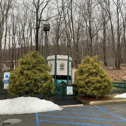
1. friendship park

0

Bloomingdale, NJ

Cancel

Open app

Search

friendship park

4.0 (2 reviews)

friendship park Photos

You might also consider

Recommended Reviews - friendship park

Your trust is our priority, so businesses can't pay to alter or remove their reviews. Learn more about reviews.
Yelp app icon
Browse more easily on the app
Review Feed Illustration

3 years ago

Helpful 0
Thanks 0
Love this 0
Oh no 1
Photo of Mark N.
453
1612
6187

8 years ago

Helpful 6
Thanks 0
Love this 0
Oh no 0

You might also consider

Verify this business for free

People searched for Hiking 1,634 times last month within 15 miles of this business.

Verify this business

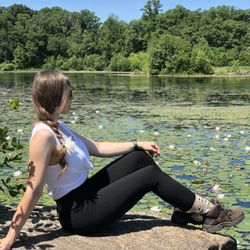
Apshawa Preserve - Water Lilly

Apshawa Preserve

3.6(7 reviews)
2.3 mi

This is our first hike that we took in NJ and although we did not see any bears (thankfully!!) - my…read morehusband did pull out a huge dog tick which was making its way into my skin!! This was absolutely my nightmare come true and I am partially to blame for because I did not spray an insect repellant. I also did not wear clothing that covered my stomach (it was hot!). Anyways, apart from that little scare, it was a beautiful hike. There are a few different trails (based on difficulty) which are detailed on a billboard at the entrance. There are a ton of squirrels and chipmunks running around...like A TON! So don't get scared and think it's a bear. The Butler Reservoir is a beautiful scenery and you can take some awesome pictures! Also, the trail itself is pretty rocky. TIPS: *Wear good hiking shoes, there are some steep/slippery areas and it's rocky most of the way. *Spray insect repellant, inspect your exposed skin for ticks AND take a shower right after you get home. Remove the tick very slowly to prevent the head from breaking off. *If you see a bear - DO NOT RUN! Scream and make yourself appear bigger/more scary by waving hands. *Take a lot of beautiful pictures! *Plan and follow the trail. The trail is available on google maps if you ever get lost and there are color coded markings on the trees throughout the hike. And most importantly - HAVE FUN!

This is one of my favorite local hikes. Its not too far of a drive if you are coming from Bergen…read moreCounty like myself. Upon arrival there is a pretty decent size lot with a good amount of parking. I have never had an issue finding a spot. The hikes are pretty calm with nothing being too strenuous. But you can still get a good hike in. There is a huge lake, a waterfall, some old foundations, a few old tanks, and a dam. So there is a lot to see here. There is even one point where you can see what appears to be an old jeep off one of the trails. This is a good hike if you want to get a good walk in without it being to tough. There is also plenty to see throughout the hikes.

Photos
Apshawa Preserve
Apshawa Preserve - Thinking about my next adventure LOL

Thinking about my next adventure LOL

Apshawa Preserve

See all

Norvin Green State Forest

Norvin Green State Forest

4.4(29 reviews)
4.0 mi

Norvin Green is one of my absolute favorite places in NJ to hike. It has a tremendous variety of…read moretrails with different terrain, difficulty level and unique environments; if the mood strikes you, it's possible to hike up and down a few mountains with gorgeous 360-degree views, or something much easier that involves exploring some of the mines on the eastern side of the forest, closer to the reservoir. There's something for virtually any type of hiker, and because so much of the area is rugged, you're not likely to find too many ignorant young hiking pups wandering aimlessly without water or a map. I usually get out here at least a few times every year, and most recently stopped by with one of my chums two Saturdays ago for an 8.1-mile hike. If you're approaching Norvin Green from 287, I would strongly recommend stopping by the Quick Chek on 511 - the bathroom options are pretty much non-existent in the forest (apart from strategically placed foliage), the employees there are always very pleasant and you have a lot of hiking snack options if you haven't had time to preplan that aspect of the adventure. We did a circuitous route beginning at the Weis parking lot up the green trail, past the natural pool to the kiosk, then up blue to Wyanokie High Point, back down and continuing on the blue trail to Carris Hill, then taking the yellow trail from there down into the wetlands, turning west onto the blue trail, past Chik Falls and over to Otter Hole. At that point, you can either take the green Otter Hole trail back to the kiosk (I think that's about 6 miles), or turn west again in .2 miles onto yellow and up Buck Mountain, meandering along the ridge until you hit the woods road (subjective term) and can follow it back to the green trail/kiosk. Deciding to incorporate Buck Mountain adds about two miles to the trip, so if your haunches aren't up to it, just keep going north on green. You'll still get a workout in, regardless. The climb up to Wyanokie is fairly strenuous. I'm in very good hiking shape and can do it without any breaks if needed, but you're definitely earning the views once you ascend past the main tree line. The view on top has to be one of the top two or three in the state; on a clear day, you can see the NYC skyline (that's true as well for the top of Buck Mountain and several points along the yellow trail before it descends), as well as the mountainous regions to the north and west. It's gorgeous, and the only damper on this particular day was the obvious effects of the seasonal drought - tons of brown foliage and several of the water features were dried up or close to it. Especially down in the wetlands, you're usually hopping over a small stream or two. Not on this day, and Chik Falls was a barely discernable trickle. The Buck Mountain climb is one of the toughest in the area - if you can do it without taking a breather, god bless. It's something like an 800-foot ascent in .1 miles; it doesn't require actual rock scrambling or climbing, but it's probably in the tier right below that. But as with Wyanokie, you're getting amazing views for the sweat expended on the incline, and because it's a nastier section of the forest, there isn't nearly as much foot traffic. It's not unusual to get some solid wildlife sightings up on the ridge. This particular hike certainly had its share of wildlife. We saw either a garter or ribbon snake with Pittsburgh Steelers coloring, a skink, AKA the corgi of lizards, oodles of small frogs (presumably panicking over the lack of water), and met two canine chums, Nala and Argo. A very solid crop, and not out of the ordinary for this area. I couldn't recommend this place more highly. Nearby Wanaque doesn't have a lot of great eating options, so given that you've more than earned your calories from tromping around in the woods, I'd venture a little further south to sup on scrumptiousness.

I love the outdoors , but this hike was not my favorite :( it has an absurd amount of insects…read moreand YES I know it's a forest , but it not even well kept when it comes to markers on the trees for hikers . You can easily get lost because there's barely any markers or directions . The view from the summit is ok but even that doesn't have a sign either . They have bathroom signs to bathrooms that don't exist . Parking to a lot that says private lot .. nature is beautiful . But I wouldn't recommend this place , the pictures posted here are the ONLY thing to see . DO NOT RECOMMEND !!! There are other beautiful hiking places ..

Photos
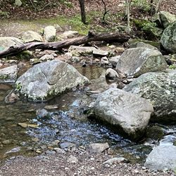
Norvin Green State Forest

See all

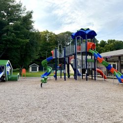
Back Beach Park - New playground

Back Beach Park

4.5(2 reviews)
2.8 mi

I found the "ridge trail" online which starts in this park and goes into the Ramapo Forest. The…read morepark is in a dead end. It's a nice little park that has all the amenities you would like expect; basketball courts, tennis courts, pavilion, jungle gym, bathrooms, and baseball fields. I was very impressed with the cleanliness of the park and the trail. The trail has a few options to walk around a lake, go to "DuPont land" (DuPont used to be in this area, contaminated the land and water years ago), and the top of then mountain. Following the trail to the top of the mountain was easy enough. The view of the reservoir was beautiful! I couldn't help but explore the woods and found some very strange things. I found an abandoned bus, car and a few large appliances. There were a few spots where I could see that people go to drink. I cleaned up their trash. Beer cans are lighter on the way out, I have no respect for anybody who would leave trash in the woods like that. If you are like me and take a hike so you can relax, but then are pissed when you see litter, than this beautiful trail will surely piss you off. Please bring a bag or 2 so you can carry out some of the trash. Thank you.
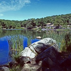
This is a fun place with playing fields. (I go to watch my granddaughter play soccer.) There is a…read moreconcession stand open during games, and a playground. I've lived in the area since the 80's & didn't even know about this little gem.

Photos
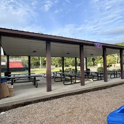
Back Beach Park - Picnic tables

Picnic tables

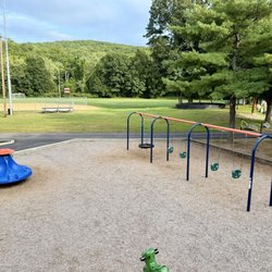
Back Beach Park - Playground and baseball field

Playground and baseball field

Back Beach Park - Slide

See all

Slide

friendship park - hiking - Updated October 2026

Loading...
Loading...
Loading...