Cancel

Open app

Search

Fort Rock State Park Photos

Recommended Reviews - Fort Rock State Park

Your trust is our priority, so businesses can't pay to alter or remove their reviews. Learn more about reviews.
Yelp app icon
Browse more easily on the app
Review Feed Illustration

Reviews With Photos

Rebecca B.

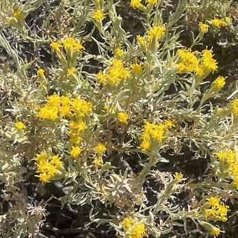
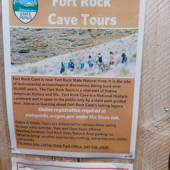
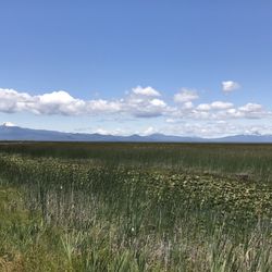
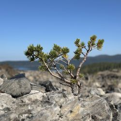
Considering I live three hours away, I sure come back here a lot. I recommend going in the morning, it's hot. Once it stops being cold out there, it's impressively hot. I know that sounds obvious, but it catches me off guard every single time. Take water. Wear a hat. Or go so early it doesn't matter. The parking area is obviously loved and maintained, it's got a great little picnic nook, the bathrooms are clean and the kind you can flush and feel respectable after using. It's a great side trip when you're out that direction. Or, like us, can give you an excuse to drive to the middle of nowhere. Every time we hike around in it, we find new critters, new plants and new places to explore and enjoy the sounds and sights and wind and dirt. It really is a pretty and pristine landmark, and it's not terribly far from other interesting things like Hole in the Ground or Crack in the Ground. Oregon really gets creative out there. There are also cave tours I'm extremely excited to try someday. It's a shame not to see it, so if you happen to be that way and wonder, go take a look!

Andrew H.

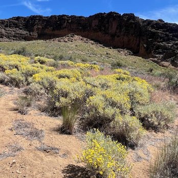
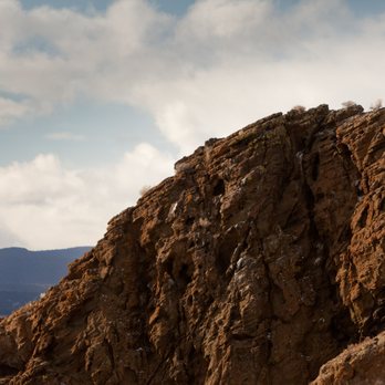
Located in *real* Eastern Oregon. In the *actual* "Oregon Outback". E.g. not what Portlanders call "Eastern Oregon" (Bend). For rock is a very cool ship-like extrusion of rock jutting out of the steppe. Like Smith Rock, there are no similar formations near it. Unlike Smith Rock, climbing up on it is easy and doesn't require any technical rock climbing experience. Great place to get out of the car and dink around on some rocks!
Connie C.

Really worth the drive to come to this out of the way Oregon State Park! Dusty trails to the caldrun and nice viewpoint at the top!

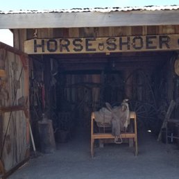
Pavilion
Robin S.

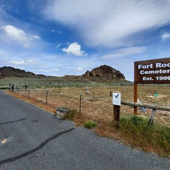
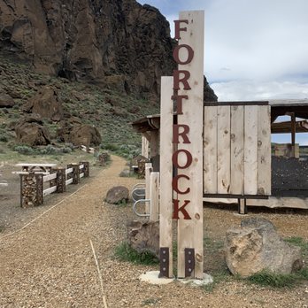
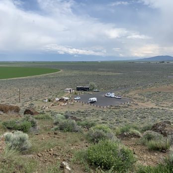
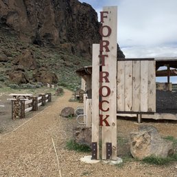
Fort Rock is actually a State Natural Area, not a State Park. None of the typical park info onsite (or on the website). You're on your own! There are trails to and inside the caldera and they're quite visible, but you don't really need trails here. Explore at will. Small entrance area with a good-sized parking lot, restrooms, a picnic pavilion and some unsheltered picnic tables. There is a spot for a camp host but no one was there, or anywhere, when I visited in early February. Geology: http://volcano.oregonstate.edu/fort-rock
See all

11 months ago

Helpful 4
Thanks 3
Love this 3
Oh no 0

4 years ago

Helpful 8
Thanks 0
Love this 5
Oh no 0

3 years ago

Helpful 0
Thanks 0
Love this 0
Oh no 0

3 years ago

Helpful 1
Thanks 1
Love this 0
Oh no 0

8 years ago

Helpful 3
Thanks 0
Love this 2
Oh no 0

6 years ago

Helpful 0
Thanks 0
Love this 0
Oh no 0

8 years ago

Helpful 0
Thanks 0
Love this 1
Oh no 0

6 years ago

Helpful 6
Thanks 0
Love this 7
Oh no 0

6 years ago

Helpful 1
Thanks 0
Love this 1
Oh no 0
Photo of Dana V.
205
21
5

3 years ago

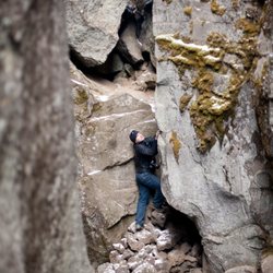
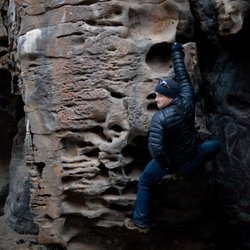
Great short hike with amazing views. Found an area to climb little further up the rocks (safely) to get a better view.

Helpful 0
Thanks 0
Love this 0
Oh no 0

6 years ago

Helpful 0
Thanks 0
Love this 0
Oh no 0

7 years ago

Helpful 0
Thanks 0
Love this 0
Oh no 0

18 years ago

Helpful 3
Thanks 0
Love this 3
Oh no 0
Photo of Sara J.
80
32
9

6 years ago

Helpful 1
Thanks 0
Love this 1
Oh no 0

6 years ago

Helpful 0
Thanks 0
Love this 0
Oh no 0

14 years ago

Helpful 3
Thanks 0
Love this 4
Oh no 0

13 years ago

Helpful 3
Thanks 0
Love this 2
Oh no 0
Photo of R F.
5
189
2

16 years ago

Helpful 0
Thanks 0
Love this 0
Oh no 0
Photo of Pat D.
92
8
5

12 years ago

Helpful 0
Thanks 0
Love this 0
Oh no 0
Photo of james c.
13
793
1

8 years ago

Helpful 0
Thanks 0
Love this 0
Oh no 0

Ask the Community - Fort Rock State Park

Review Highlights - Fort Rock State Park

This ancient site is about 37 miles southeast of La Pine, off National Scenic Highway 31, in the community of Fort Rock, in Lake County.

Mentioned in 3 reviews

Read more highlights

Verify this business for free

Get access to customer & competitor insights.

Verify this business

LaPine State Park - La Pine State Park - campground

LaPine State Park

4.8(39 reviews)
36.2 mi

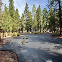
August 26-29, 2025 - La Pine, OR…read more We've stayed at La Pine Campground a few times over the years, and each visit reminds us why we keep coming back. The campground is divided into three loops, each with its own character. The North Loop offers water and electric hookups, with sites that are more widely spaced than the others--something I really appreciate. That extra room makes it feel quieter and more private, and it's probably where we'll book our next stay. The Middle Loop has full hookups, while the South Loop is the busiest, featuring full hookups as well as some cabins. . There are many hiking/cycling trails (dog-friendly), and the Deschutes River runs through the campground. There is a short hike to a waterfall, and a large dog park. Unfortunately, we were a bit restricted in our outdoor activities because of the smoke from the two fires in the area. There was actually ash falling on one of the days. Also, there had been several sightings of a mountain lion in the area, so that added a bit of caution to our activities. Nevertheless, we will definitely come back.

We just stayed one night, right before the campgrounds closed for the year. The grounds were nicely…read moremaintained, and we enjoyed a very peaceful and quiet stay. Some sites are fairly tight, while others had some nice room. The trails here were very enjoyable. Serene surroundings around the river and through the trees. We saw lots of deer, birds, and other critters scrambling about. I'm sure it would've had a slightly different feel during peak season, but we very much enjoyed our night and day of off season.

Photos
LaPine State Park - Kitchen for 3 days

Kitchen for 3 days

LaPine State Park - August 27, 2025 - Large fenced pet area.

August 27, 2025 - Large fenced pet area.

LaPine State Park - South space 25

See all

South space 25

Newberry National Volcanic Monument

Newberry National Volcanic Monument

4.5(51 reviews)
39.6 mi

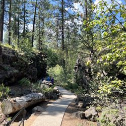
We did the 1.1 mile Trail of the Molten Lands while in the Newberry National Volcanic Monument. The…read moretrail paved and in good condition. It is uphill and some spots are steep. There are informational signs in different sections of the trail. It was incredible to see how far the lava rock stretched. We stopped in the visitor center as well as the lava river caves and lava butte. We werent able to do the Pauline falls or Obsidian parts as the storms came in quick and hard. It is definitely a sight to see though. Its a milder trail than some others we've done this week and is an easier walk for most of the trail. There is also a half way point to loop around and you dont have to do the steep uphill portion to the look out area.

driving access, cost, parking, amenities, shade, trail/mileage/time, difficulty, crowded, route,…read morecell service Newberry is a big park stretching across a large swathe of land south of Bend. Unlike other parks with one visitor center and one central entrance, it has 4 different main attractions you can drive to and visit: 1. Lava Butte - 15 minutes south of Bend. Has the Lava Lands Visitor Center and the shuttle that goes to the rim of Lava Butte during summer months. At the Lava Butte, we took the bus to the top of the cinder cone and hiked the rim, 0.25 miles, took us 15 minutes with a 4 and a 6 year old: https://www.hikingproject.com/trail/7074103/lava-butte-rim-trail Cost: $5 a car for day entry to the park, $3 per person for round trip shuttle ride. The bus driver was very nice and didn't charge us for kids. Shade: Maybe 20-30% shaded, there are some trees on the rim. Difficulty: Easy, and you have nice views. The rim is slanted so there is a little bit of an up and down climb. Crowdedness: Most of the people who take the shuttle up end up hiking around the rim, there isn't much else to do once you've looked at lookout tower. Cell service: We had cell service throughout; it's actually really close to a highway. The visitor's center area right by the main parking lot is also nice, it's a small museum, and they also have a couple talks a day. There are tables in the area, we had a picnic lunch at one of them with the lava butte in the background. 2. Lava River Cave - 15 minutes south of Bend (a few minutes down the road from Lava Butte). I didn't visit, but apparently it's cold there and you need your own flashlights to explore. When we passed by, signs said you need reservations ahead of time to enter. 3. Lava Cast Forest - 40 minutes south of Bend. I did not visit this. 4. Newberry Caldera - 45 minutes south of Bend. Has the Big Obsidian Flow (obsidian fields, as they are often called in other reviews), Paulina Peak, Paulina and East Lakes. At Newberry Caldera, we did this hike, 0.8 miles, in 1 hour 11 minutes with a 4 and a 6 year old: https://www.alltrails.com/trail/us/oregon/big-obsidian-flow Parking: Plenty between 10-11am on a Tuesday in July. It's a huge parking lot. Cost: $5 a car (you can use the same daily pass you got at another part of this park if you went on the same day). Amenities: A non-flush bathroom at the parking lot. I don't remember seeing water. Shade: The first 0.1 miles is shaded, then once you're on the obsidian flow you're completely exposed. Difficulty: Very easy hike, maybe only 100 ft elevation change, just the stairs to get to the edge of the obsidian flow. Crowdedness: There were a decent amount of people on this hike, and with the parking lot mostly empty, I can see this hike being pretty packed on a weekend. Cell service: We had cell service throughout this hike (T-mobile).

Photos
Newberry National Volcanic Monument
Newberry National Volcanic Monument - View from the obsidian flow

View from the obsidian flow

Newberry National Volcanic Monument - Trail

See all

Trail

Crack In the Ground

Crack In the Ground

4.8(13 reviews)
22.4 mi

If you don't have an off road equipped vehicle, don't try it! GPS will do you dirty but you'll just…read moreneed to be ready to fight the backroads required to get here. It's a fantastic adventure for those who like exploring these geographic masterpieces. This is exactly the kind of place that people who love Central Oregon go there for! My dad was excited to finally see this place after years of never getting a chance.

Central Oregon is full of geologic wonders, many of which are unheralded - they're not parks or…read moremonuments, just cool natural features. Crack in the Ground is one. Located on BLM land very near the center of the state*, CitG is a volcanic fissure associated with the Pleistocene eruption of the four cinder cones that created the nearby lava field. The crack formed when the land subsided a bit after/during the eruption, creating a graben and causing the lava to crack along a considerable length. What all that means is we have a super cool hiking spot! You not only can walk above and around the crack, you can walk a fair distance down the middle, too. Although there are a few places where you have to scamper on loose lava blocks, a lot of the trail is easy walking once you're down there. To get to CitG, you can take one of two routes. The easiest, but maybe not the quickest depending on where you start, is to drive to the small town of Christmas Valley and head north on Crack in the Ground Road just east of town center (from Bend, use Hwy 31 east from La Pine, hang a left at the Fort Rock turnoff). The road is gravel and is a bit washboardy but is OK for regular passenger vehicles. Drive straight north until the road gets twisty and then drive another mile or so. You will come across a largish parking area on the west side that sports an outhouse. The path to the crack is to the east about 500 yards. Alternately, drive a bit further north until you see a considerably less substantial dirt road off to the east. It ends in about 100 feet and will put you right near the northern terminus of the crack. All this is clearly visible on Google Maps. The other route is to come from the north via the Green Mountain Campground road, which is an extension of the Crack in the Ground road. Getting to the campground from the north is, however, quite a bit more complicated and I leave that to you to navigate if you choose that route. It is a shorter drive from Bend, depending on how many wrong turns you take. Anyway, once there, you can choose your path in and around the crack. While the walls of the crack are quite steep and high along much of its length, descending to the bottom can be safely achieved in many spots. As with just about all of the hikes in Oregon's lava fields, you'll want shoes with sturdy soles and maybe a pair of leather gloves. So many cool things to see in Oregon. * Not where the Yelp page map marker hilariously shows it in Bend (as of this review). I've tried to correct that but Yelp is often unresponsive to corrections.

Photos
Crack In the Ground
Crack In the Ground
Crack In the Ground

See all

The Paulina Plunge - Great News- the kid from Oklahoma who took the wrong trail and got lost most of the day is now a state champion wrestler.

The Paulina Plunge

4.3(39 reviews)
28.7 mi

This was an ok trip but I had mixed feelings about it…read more Pros: The guide was nice (we had Lane), which made the ride more enjoyable. He knew all of our names before we even left the parking lot. The trail was in good shape from recent rain so a beginner would have no trouble participating. Cons: The email confirmation and website mentioned the bike shortage and that riders had to be a minimum of 4 ft tall with a 24 inch inseam but didn't really explain how to measure that, etc. Sure, I know what an inseam in pants is, but turns out an inseam measurement for bike riding is different. Would have been nice to know without having to look it up the night before and then worry my kid wouldn't be tall enough. Lots of standing around. We were on the 10-4 tour and though we arrived at 9:45 no one directed us to have our kids take the bike test to see if they could go and nobody got fitted for bikes until everyone in the booking had arrived. Then, the large 10 am group was split into two smaller groups and if you were in the second group, you had to stand around for 20 minutes killing time to give the first group a head start. Why not just stagger the starts and have a 10 am and a 10:30? From a customer perspective this sort of sucked. This was billed as a Mountain bike ride with waterfalls and slides, but it was more like, walking/hiking to see 3 waterfalls and then a very mellow 3 mile single track ride to finish. It would have been nice to sort people by skill or interest (shorter vs longer rides) as we definitely had some gung ho dudes in our group and some newbies like me. Two of the waterfalls (at least) were accessible via McKay campground, which was a little disappointing. I thought we would be off the beaten path, checking out a little known spot, etc. Overall, our young kids, 8 and 10 enjoyed it and had fun. It was their first time mountain biking. I'd rate the ride and scenery 4 stars but the administration and organization only 2 stars (I'm a fan of efficiency and customer service) , hence my 3 star rating.

Was excited to go. Day of the trip for our group smoke was heavy. Hazardous in fact. His terms and…read moreconditions explain that you must show up no matter what the conditions. From there the group will vote and you must conform to the group decision. We were the only ones who showed up. The owner, Todd, decided after getting various voice messages the day before and the morning of, but he would cancel the event. Great! No pick up the phone and call your customers to make sure they don't waste their time and come all the way out to the top of a mountain only to find your experience was canceled. He claimed to have sent a text in the early morning hours. But I didn't get it until after the fact. Oh well, not great but not terrible. Did waste a lot of our time driving out there on a horrific weather day for smoke. Talked to Todd personally later, and he said "no problem I'll give your money back." Refund it all of it except our deposit, then wouldn't answer the phone or return multiple calls. In my final message I reminded him of his neglect as a business owner and a conscientious honest human. Told him repeatedly he needed to refund my deposit, as there were no terms or discussion of anything other than a full refund. Really annoying to deal with business owners who aren't conscientious. Really detracts from your credibility. So here's the review I promise to leave you if you went another two weeks without returning my calls again. Gave you four chances Todd.

Photos
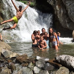
The Paulina Plunge - At the third waterfall.  Such a great time

At the third waterfall. Such a great time

The Paulina Plunge
The Paulina Plunge - A swallowtail resting beside one of the waterfalls

See all

A swallowtail resting beside one of the waterfalls

Fort Rock State Park - landmarks - Updated May 2026
Loading...
Loading...
Loading...