Newberry National Volcanic Monument Photos


More like Newberry National Volcanic Monument
Recommended Reviews - Newberry National Volcanic Monument
Start your review...


Reviews With Photos


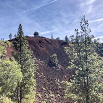
Wow. What a great experience visiting the Newberry National Volcanic Monument, near the towns of Bend, Sunriver, and La Pine, Oregon. Managed by the U.S. Forest Service, this monument provides "a unique opportunity to view the lava lands of central Oregon." The Newberry Volcano is a massive shield volcano. We planned to make only a quick stop at the monument, and then ended up spending a full day there -- and still didn't see everything that interested us! This monument charges a $5/vehicle/day fee for parking; valid Recreation passes are also accepted. BUTTE ZONE area of the monument. *We started at the Lava Lands Visitor Center, where we received helpful information and maps from the park rangers, watched an overview film, and bought some souvenirs from the gift shop. *We next hiked the Trail of the Molten Land, which starts and ends near the Visitors Center. The trail is a paved (partially wheelchair accessible ) one-mile interpretive loop trail with a 150 foot elevation change. We also added a side trail to the Phil Brogen Viewpoint (350 yards each way. Paved. Steep). There is no shade on either trail. Note that there are additional hike/bike trails in this zone, of varying lengths 0.25 -5.5 miles, one way) and elevation changes (0-500'). A few are wheelchair accessible. *We then drove up the narrow and windy 1.75 mile road up to the Lava Butte at 5,020 feet. This butte is a cinder cone that is part of a system of small cinder cones on the northwest flank of the Newberry Volcano. Interestingly, the Lava Butte also houses a Fire Lookout, which is one of the busiest in the Pacific Northwest. During an average year, lookout staff call in more than 125 first reports of fires. Note that the road is open to cars 22' and under, hikers, and bikers. There's also a shuttle bus ($3 round trip through Labor Day) which we would recommend given limited parking. *After driving back down, we took advantage of one of the shaded picnic tables near the Visitors Center to enjoy a picnic lunch. There were additional activities in the Butte Zone that we will need to return to in the future -- exhibits in the Visitors Center, informational Ranger Programs, tour of the Lava River Cave (reservation required), Benham Falls, and more hikes. CALDERA ZONE. Taking 97 south and paved Forest Road 21 (Paulina Lake Road), we then visited the caldera zone. *Paulina Falls Overlook, a short and easy (0.25 miles) walk to see the falls. Zero elevation change. Easy access off Paulina Lake Road. *Drive (3 miles one way) up to the Paulina Peak viewpoint. There are wonderful views at the peak, including of Paulina Lake and East Lake, but it's a challenging drive or hike to get there. The gravel, bumpy road climbs 1,600' in 3 miles, and is sometimes narrow and windy. There were some narrow blind curves that seemingly didn't have enough space for two cars, especially towards the top. There are also steep drop-offs without guard rails. (This wasn't a concern to my husband!) *Big Obsidian Flow trail. This hike starts as a paved trail with a "sparkling" panorama of the rugged landscape of natural glass. We then climbed the 80 steps up to a bench, and my husband scouted a bit higher to the Lower Viewpoint to check out the trail. We decided not to complete the 1.0 mile loop because the trail was rough and we weren't wearing appropriate footwear. There were also many additional things that we didn't do in this zone -- visit to the Paulina Visitor Center or the Paulina Lake Lodge, camping at any of the plentiful campgrounds, water activities on the two lakes, or many additional miles of hiking, biking, and/or horseback riding.

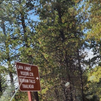
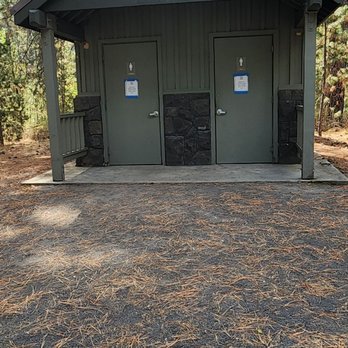
We made it to the visitor center and took a drive through the forest. We stopped to hike down to the waterfall area and noticed there was a nice picnic area and rustic bathrooms. There was also a place to deposit the parking fee. I visited on a weekday, so it was not crowded at all, and we didn't see anyone while on our hike. It was very pretty and the terrain was not bad. There were also no bugs, so that made it better.


We are geological geeks we've been to about a dozen volcanoes active and dormant and this park is the largest we've been too, you couldn't see everything they have in a month. The landscape changes every turn you take. Buttes with old lava trails, lakes with Hotsprings, waterfalls that cascade over lava cooled centuries ago! Campgrounds and resorts can be found nearby so you have many options for exploring. We missed the obsidian field so we will be back soon. Great family destination.


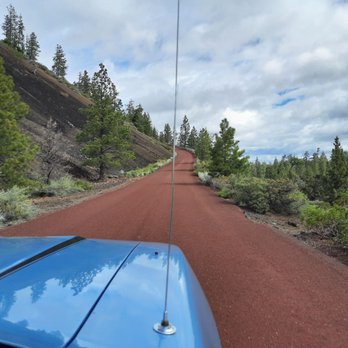
Highly recommend a stop here! There's so much to see and do. We spent an entire day here, from open to close, and still didn't see everything we wanted to. There is a $5 day use fee. You can also buy a 3-day pass for $10, or annual pass for $30. Our first stop was at the Lava Lands visitor center. A lot of good information, including placards, movies, gift shop, restrooms, maps and passport stamps. Once we left there we headed to Lava Butte. At 5020 feet in elevation, there are some picturesque views from the Lookout. We then drove to the other end of the park, near La Pine, to see Paulina Falls and the Big Obsidian Flow Trail. Both were spectacular! We missed a couple other sites we wanted to see (Lava River Cave, Benham Falls Overlook, etc) so we'll definitely be back!


A huge natural area with many wonders to explore. Some of the places include Big Obsidian Flow trail, Lava Butte, Lava River Cave, and many more. There were plenty of trails for hiking and biking. Family favorites were the Big Obsidian Flow trail and Paulina Falls. Hiking sticks were useful on some of the trails.


We will be returning with the expectation of spending the entire day and taking the trip to the top of Lava Butte. We started in the Visitors Center where we spent way too much money on books about the area. My wife realized that she was not prepared to walk the trails. I walked a bit over a half a kilometer up the Trail of the Molten Land. Next time I will walk the full one mile of the trail and enjoy all the vistas. There are several short trails that I want to walk. We drove out the the end of the road to Benham Falls and walked maybe a quarter of the trail to the falls. Next time we will be prepared for the complete hike to the falls. Unfortunately, Lava Rive Cave was closed for the season.


The Lava Land Visitor Center is closed for the season, but you are still able to park in the lot and take in some sites. We arrived just after lunch on Saturday and the lot was pretty full. There was a bit of snow and ice, but we were still able to access Molten Land and Whispering Pines Trails. Even with the amount of traffic in the lot we were able to enjoy the trails and take our time. If you've never had the opportunity to walk in a lava field the experience is pretty awe inspiring. There are multiple interpretive signs along the way explaining how everything came to be. The Molten Land one mile trail is paved and winds all through the lava, tubes, and twisted trees. As an extra little perk, since it was a clear day we were also treated with stunning views of the nearby mountains. We found the experience to be fun and educational. Definitely looking forward to returning in season to take in the rest of Newberry Monument.


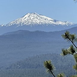

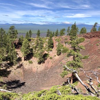
Our newest National Monument from1990, Newberry National Volcanic Monument was created in a National Forest. It's well managed by the U.S. Forest Service. This monument provides a unique view of the Lava Lands of central Oregon. Newberry National Volcanic National Monument includes 54,000+ acres of lakes, lava flows, and spectacular geologic features. The highest point within the Monument is the summit Paulina Peak with views of the Cascades, Newberry Caldera & across the High Desert. Aerial view of Lava Butte, referred to as Newberry Crater, is a caldera formed when the overlying rocks collapse when a magma chamber is emptied. The caldera stretches across 17 square miles in the heart of the volcano. The 1,200 square mile volcano (about the size of Rhode Island) remains very active to this day. Newberry is both seismically and geothermally active. Geologists believe the caldera sits over a shallow magma body only 2 to 5 kilometers deep. We started at the visitor center viewing the lava fields & Cascades from the bottom. Barry Schwartz the Parks Service Volunteer at the top took our pictures & shared info.


Not in one location This monument is not located in one place as I'm used to visiting other monuments. You have many choices of places to visit here and tons of options for anyone's tastes. We started off at the Lava Lands Visitor Center and took the shuttle to access the summit of Lava Butte where we got a spectacular view of 9-sq miles of lava flow . The shuttle departs from the visitor center and runs approximately every 20 minutes. The cost is $2 per person for the round trip and exact change is required. This is separate from the $5 park admission. After Labor Day personal cars can drive up to the summit. There is limited parking up there. We walked around the Lava Butte trail which looped for around 1/4 of a mile. The trail is not paved. Our next stop was the Sun-Lava Path, about 4 miles from the Lava Lands Visitor Center. From here we were able to access Benham Falls by a .5 mile trail one way. Benham Falls are rapids and not waterfall. It was a nice stroll. We then drove to Paulina Falls. There is another $5 fee to enter. There's a lower viewpoint trail about 1/4 mile but by this time we didn't want to do anymore walking and we just went directly to the Falls lookout which was a few feet from the parking lot. The Falls spills over the lowest point of Newberry Caldera. This twin falls drops 80 feet over volcanic cliffs onto a jumble of rocks below. We didn't get a chance to stop at the two lakes, East and Paulina Lakes. Perhaps another time. We tried experiencing the Lava River Caves but this seemed to have the most visitors and finding parking was a real challenge. If this was anything like the Lava Beds National Monument in Tulelake then been there, done that four years ago... yep, flashlights, hard hats and everything. Review #1119
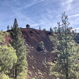

Exit now to ... Newberry National Volcanic Monument ... so we did. Speeding through Deschutes National Forest between Bend and Crater Lake, random curiosity led us to pull over and discover the Lava Lands Visitor Center next to 5.5 miles of paved (yes, fully-paved) paths through the Sun-Lava fields that look like the landscape around Middle-earth Mordor from Lord of the Rings. The sun-baked Trail of the Molten Land is just over a mile long with interpretive signs along the way while the somewhat shaded Whispering Pines Trail goes around parts of the lava. We also lucked into to taking the first shuttle ($2/person) ride at 10:00 a.m. to the summit of Lava Butte which towers above the lava field at 5,020 feet elevation. The bus runs every 20 minutes during the summer. It isn't required to get to the top, but is certainly worth the $2 round-trip fee. At the summit, we did the short 1/4-mile hike around the crater while enjoying the breathtaking views of the black lava, green forest, and snow-capped mountains in the distance. $5/day recreation access fees (or annual passes) are required to enter the monument. The visitor center has a small bookstore and free restrooms. There are also park ranger talks and tours which start at the center. A few miles away (so, different parking) from the Lava Butte is the Lava River Cave Interpretive Site where visitors can go on a self-guided 90-minute 1-mile exploration of a real lava tube. Plan ahead for crowds as well as appropriate clothing, water, and 2 separate light sources (which can be rented) for the cave. Whether it's for a full-day of hiking and education or just a detour to your next destination, I recommend planning (or just exit) to discovery Newberry National Volcanic Monument in the heart of the Deschutes National Forest.
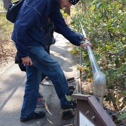

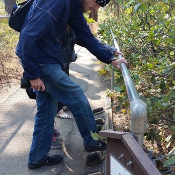
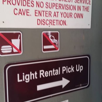
If you are on the way to Crater Lake, don't bypass this place...this is a MUST SEE!!! Especially if you want a change of pace from all the greenness of beautiful lush Oregon. Since the day I was there was also the 101st anniversary of the National Park Service, it seemed to be a fitting place to be. You can hike the lava field trails or you can take a $2 shuttle. We did neither because we were short on time. But I WISH we could have. We only had time to visit the LAVA RIVER CAVE, but the parking lot of full and after circling, we gave up and headed to Maupin, OR for a whitewater rafting trip. BUT I really really really wanted to hike LAVA RIVER CAVE, and thanks to the enthusiasm of a tween and teenager, we returned two days later, with excited kids in tow. Some HINTS to help you have a stellar experience: FIrstly, it's self guided. Secondly, it's a subtle cave, don't expect the WOW of color or cave features like stalagmites and stalactites. But it's super cold, and you can make puffs of breath in the air. And it's super dark. My kind of adventure. HINT: PARKING. When the cave opened at 10 a.m., there were already 14 cars waiting to park in the lot. The entire hike inside the cave is 1.5 hours. So by arriving at about 11 a.m., we were hoping to get a parking spot...oh no...again, no spots. Don't give up though, we went to the lovely LAVA LANDS VISITOR CENTER to buy the young'uns a NATIONAL PARK PASSPORT...and then we returned to find that the strategy worked!!! The early birds were now leaving. HINT: FOOTWEAR AND BAT DISEASE PREVENTION -- Wear good SHOES because the terrain is rocky despite a handrail...also the handrail stops at one point, so you are left to pick your way through the rocks. My friend wore white sandals with a small heel...uh, don't do that. Wear study shoes that have not been in a cave. In fact, don't wear clothes that have been in any other cave. The rangers give a small orientation about contaminating the cave with a disease that harms BATS. Which is why it's good to scrap your shoes at the shoe scraper station just when you start your adventure. HINT: BATHROOM BREAK. AND BRING A SWEATER -- Go to the nearby bathroom first...it's a long underground lava tube...the longest uncollapsed lava tube in Oregon. And there are no facilities within it. ALSO TAKE A LIGHT JACKET and some GLOVES if you are prone to the COLD, it's cold like a meat locker down there...and the kids I was with, they were easily cold and couldn't hold their flashlights. YOU CAN SEE YOUR BREATH, it's that c-c-c-cold! HINT: LET THERE BE LIGHT -- Rent the FLASHLIGHT from the Park Service. I had a headlamp, and it was only good for illuminating your FOOTFALL...the cave can have a high ceiling and if you want to see features, you will need the high-powered trigger flashlight from the park service. For $5 bucks each, it's a smart investment. Also when using it, aim high and steady...so you don't blind others who approach and so you can see the cave features....one NPS flashlight for every two people in your party. I wish I had rented one for myself because the kids held them because they were doing a ballyhoo with the lights so you can't really see anything and it's nausea inducing. HOLD STEADY and AIM UP is key to good seein'. FYI: WHAT YOU DO SEE DOWN THERE -- You aren't going to see huge stalactites or stalagmites. It's kinda monotonous, but that's interesting. You will see some SECONDARY LAVA TUBES inside this main tube, also interesting....the ceiling does drop to THREE FEET towards the end point so you will have to bend down, which is fun...there is a terminus, and then you turn around and head back. It's dark, it can be scary...it's got lots of rocky terrain underfoot...and there is some color, some reddish rocks and soil...but mainly, it's just bigtime FUN and a cool long walk in the cold dark. OVERALL: Amazing experience. Loved it. Shoutout to the rangers and staff at the national park...very professional and friendly. In other words, DO THE CAVE!!!! Worth your time. You'll be glad you experienced LAVA RIVER CAVE.


Newberry is such an amazing place and I don't know why more people know about it. We discovered it while on our Oregon road trip and it was one of the most memorable experiences of the trip. The monument is a large area that has plenty of paved trails, which allows you to walk amongst the volcanic rock while not disturbing any of it, which is wonderful. We loved exploring all of the site and it was just so much fun. We highly, highly recommend this for anyone who loves experiencing different ecosystems and seeing different parts of the world.


We did the 1.1 mile Trail of the Molten Lands while in the Newberry National Volcanic Monument. The trail paved and in good condition. It is uphill and some spots are steep. There are informational signs in different sections of the trail. It was incredible to see how far the lava rock stretched. We stopped in the visitor center as well as the lava river caves and lava butte. We werent able to do the Pauline falls or Obsidian parts as the storms came in quick and hard. It is definitely a sight to see though. Its a milder trail than some others we've done this week and is an easier walk for most of the trail. There is also a half way point to loop around and you dont have to do the steep uphill portion to the look out area. read more

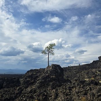


driving access, cost, parking, amenities, shade, trail/mileage/time, difficulty, crowded, route, cell service Newberry is a big park stretching across a large swathe of land south of Bend. Unlike other parks with one visitor center and one central entrance, it has 4 different main attractions you can drive to and visit: 1. Lava Butte - 15 minutes south of Bend. Has the Lava Lands Visitor Center and the shuttle that goes to the rim of Lava Butte during summer months. At the Lava Butte, we took the bus to the top of the cinder cone and hiked the rim, 0.25 miles, took us 15 minutes with a 4 and a 6 year old: https://www.hikingproject.com/trail/7074103/lava-butte-rim-trail Cost: $5 a car for day entry to the park, $3 per person for round trip shuttle ride. The bus driver was very nice and didn't charge us for kids. Shade: Maybe 20-30% shaded, there are some trees on the rim. Difficulty: Easy, and you have nice views. The rim is slanted so there is a little bit of an up and down climb. Crowdedness: Most of the people who take the shuttle up end up hiking around the rim, there isn't much else to do once you've looked at lookout tower. Cell service: We had cell service throughout; it's actually really close to a highway. The visitor's center area right by the main parking lot is also nice, it's a small museum, and they also have a couple talks a day. There are tables in the area, we had a picnic lunch at one of them with the lava butte in the background. 2. Lava River Cave - 15 minutes south of Bend (a few minutes down the road from Lava Butte). I didn't visit, but apparently it's cold there and you need your own flashlights to explore. When we passed by, signs said you need reservations ahead of time to enter. 3. Lava Cast Forest - 40 minutes south of Bend. I did not visit this. 4. Newberry Caldera - 45 minutes south of Bend. Has the Big Obsidian Flow (obsidian fields, as they are often called in other reviews), Paulina Peak, Paulina and East Lakes. At Newberry Caldera, we did this hike, 0.8 miles, in 1 hour 11 minutes with a 4 and a 6 year old: https://www.alltrails.com/trail/us/oregon/big-obsidian-flow Parking: Plenty between 10-11am on a Tuesday in July. It's a huge parking lot. Cost: $5 a car (you can use the same daily pass you got at another part of this park if you went on the same day). Amenities: A non-flush bathroom at the parking lot. I don't remember seeing water. Shade: The first 0.1 miles is shaded, then once you're on the obsidian flow you're completely exposed. Difficulty: Very easy hike, maybe only 100 ft elevation change, just the stairs to get to the edge of the obsidian flow. Crowdedness: There were a decent amount of people on this hike, and with the parking lot mostly empty, I can see this hike being pretty packed on a weekend. Cell service: We had cell service throughout this hike (T-mobile). read more


During the 70's I used to snow shoe into the area, and helped at a funky, ole fun resort. I lived during that time in a super fun tent house, with a brass bed, living area, and cast iron stove for heat. And when I'm not busy with the resort, I'd explore Paulina Lake,walk about the lake, net trout,find arrow heads, listen to the resident story tellers tales, about Chef Paulina. Chief Paulina, a Northern Paiute war leader who violently resisted Euro-American settlement in the Great Basin and for several years orchestrated a successful guerrilla war campaign in the deserts and mountains of eastern Oregon. After attacking Burnt Ranch on the John Day River, a posse of settlers hunted down Paulina and his band and Paulina was shot and killed in a cove near Ashwood, Oregon in 1867. Who exactly killed Paulina remains a mystery to this day... In November of 1990, Newberry National Volcanic Monument was created within the boundaries of Deschutes National Forest. Managed by the U.S. Forest Service, this monument provides a unique opportunity to view the Lava Lands of central Oregon. Newberry National Volcanic National Monument includes 54,000+ acres of lakes, lava flows, and spectacular geologic features in central Oregon. The highest point within the Monument is the summit Paulina Peak (7,985 ft.), showcasing views of the Cascades, Newberry Caldera and across the High Desert. Although commonly referred to as Newberry Crater, the "crater" is in fact a caldera formed when the overlying rocks collapse when a magma chamber is emptied. The caldera stretches across 17 square miles in the heart of the volcano. The 1,200 square mile volcano (about the size of Rhode Island) remains very active to this day. Newberry is both seismically and geothermally active. Geologists believe the caldera sits over a shallow magma body only 2 to 5 kilometers deep. Visitors see numerous cinder cones and vents (over 400 throughout the area), miles of basalt flows, as well as rhyolite flows of obsidian. read more


Wow. What a great experience visiting the Newberry National Volcanic Monument, near the towns of Bend, Sunriver, and La Pine, Oregon. Managed by the U.S. Forest Service, this monument provides "a unique opportunity to view the lava lands of central Oregon." The Newberry Volcano is a massive shield volcano. We planned to make only a quick stop at the monument, and then ended up spending a full day there -- and still didn't see everything that interested us! This monument charges a $5/vehicle/day fee for parking; valid Recreation passes are also accepted. BUTTE ZONE area of the monument. *We started at the Lava Lands Visitor Center, where we received helpful information and maps from the park rangers, watched an overview film, and bought some souvenirs from the gift shop. *We next hiked the Trail of the Molten Land, which starts and ends near the Visitors Center. The trail is a paved (partially wheelchair accessible ) one-mile interpretive loop trail with a 150 foot elevation change. We also added a side trail to the Phil Brogen Viewpoint (350 yards each way. Paved. Steep). There is no shade on either trail. Note that there are additional hike/bike trails in this zone, of varying lengths 0.25 -5.5 miles, one way) and elevation changes (0-500'). A few are wheelchair accessible. *We then drove up the narrow and windy 1.75 mile road up to the Lava Butte at 5,020 feet. This butte is a cinder cone that is part of a system of small cinder cones on the northwest flank of the Newberry Volcano. Interestingly, the Lava Butte also houses a Fire Lookout, which is one of the busiest in the Pacific Northwest. During an average year, lookout staff call in more than 125 first reports of fires. Note that the road is open to cars 22' and under, hikers, and bikers. There's also a shuttle bus ($3 round trip through Labor Day) which we would recommend given limited parking. *After driving back down, we took advantage of one of the shaded picnic tables near the Visitors Center to enjoy a picnic lunch. There were additional activities in the Butte Zone that we will need to return to in the future -- exhibits in the Visitors Center, informational Ranger Programs, tour of the Lava River Cave (reservation required), Benham Falls, and more hikes. CALDERA ZONE. Taking 97 south and paved Forest Road 21 (Paulina Lake Road), we then visited the caldera zone. *Paulina Falls Overlook, a short and easy (0.25 miles) walk to see the falls. Zero elevation change. Easy access off Paulina Lake Road. *Drive (3 miles one way) up to the Paulina Peak viewpoint. There are wonderful views at the peak, including of Paulina Lake and East Lake, but it's a challenging drive or hike to get there. The gravel, bumpy road climbs 1,600' in 3 miles, and is sometimes narrow and windy. There were some narrow blind curves that seemingly didn't have enough space for two cars, especially towards the top. There are also steep drop-offs without guard rails. (This wasn't a concern to my husband!) *Big Obsidian Flow trail. This hike starts as a paved trail with a "sparkling" panorama of the rugged landscape of natural glass. We then climbed the 80 steps up to a bench, and my husband scouted a bit higher to the Lower Viewpoint to check out the trail. We decided not to complete the 1.0 mile loop because the trail was rough and we weren't wearing appropriate footwear. There were also many additional things that we didn't do in this zone -- visit to the Paulina Visitor Center or the Paulina Lake Lodge, camping at any of the plentiful campgrounds, water activities on the two lakes, or many additional miles of hiking, biking, and/or horseback riding. read more





2 years ago
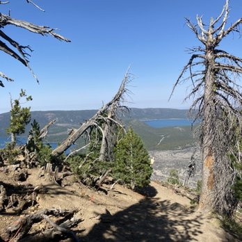
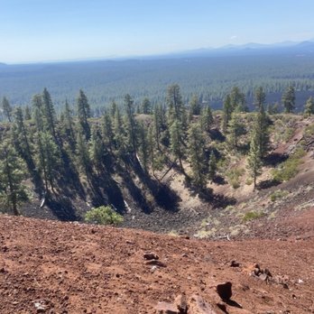
We made it to the visitor center and took a drive through the forest. We stopped to hike down to the waterfall area and noticed there was a nice picnic area and rustic bathrooms. There was also a place to deposit the parking fee. I visited on a weekday, so it was not crowded at all, and we didn't see anyone while on our hike. It was very pretty and the terrain was not bad. There were also no bugs, so that made it better. read more





2 years ago
We are geological geeks we've been to about a dozen volcanoes active and dormant and this park is the largest we've been too, you couldn't see everything they have in a month. The landscape changes every turn you take. Buttes with old lava trails, lakes with Hotsprings, waterfalls that cascade over lava cooled centuries ago! Campgrounds and resorts can be found nearby so you have many options for exploring. We missed the obsidian field so we will be back soon. Great family destination. read more


8 months ago

10 months ago

Highly recommend a stop here! There's so much to see and do. We spent an entire day here, from open to close, and still didn't see everything we wanted to. There is a $5 day use fee. You can also buy a 3-day pass for $10, or annual pass for $30. Our first stop was at the Lava Lands visitor center. A lot of good information, including placards, movies, gift shop, restrooms, maps and passport stamps. Once we left there we headed to Lava Butte. At 5020 feet in elevation, there are some picturesque views from the Lookout. We then drove to the other end of the park, near La Pine, to see Paulina Falls and the Big Obsidian Flow Trail. Both were spectacular! We missed a couple other sites we wanted to see (Lava River Cave, Benham Falls Overlook, etc) so we'll definitely be back! read more





2 years ago
A huge natural area with many wonders to explore. Some of the places include Big Obsidian Flow trail, Lava Butte, Lava River Cave, and many more. There were plenty of trails for hiking and biking. Family favorites were the Big Obsidian Flow trail and Paulina Falls. Hiking sticks were useful on some of the trails. read more


4 years ago
We will be returning with the expectation of spending the entire day and taking the trip to the top of Lava Butte. We started in the Visitors Center where we spent way too much money on books about the area. My wife realized that she was not prepared to walk the trails. I walked a bit over a half a kilometer up the Trail of the Molten Land. Next time I will walk the full one mile of the trail and enjoy all the vistas. There are several short trails that I want to walk. We drove out the the end of the road to Benham Falls and walked maybe a quarter of the trail to the falls. Next time we will be prepared for the complete hike to the falls. Unfortunately, Lava Rive Cave was closed for the season. read more


The Lava Land Visitor Center is closed for the season, but you are still able to park in the lot and take in some sites. We arrived just after lunch on Saturday and the lot was pretty full. There was a bit of snow and ice, but we were still able to access Molten Land and Whispering Pines Trails. Even with the amount of traffic in the lot we were able to enjoy the trails and take our time. If you've never had the opportunity to walk in a lava field the experience is pretty awe inspiring. There are multiple interpretive signs along the way explaining how everything came to be. The Molten Land one mile trail is paved and winds all through the lava, tubes, and twisted trees. As an extra little perk, since it was a clear day we were also treated with stunning views of the nearby mountains. We found the experience to be fun and educational. Definitely looking forward to returning in season to take in the rest of Newberry Monument. read more


4 years ago
Recommend visiting this national monument if you're in the Bend area! Very cool area to explore. I recommend driving up to the Lava Butte and walking around the Obsidian Flow. I also recommend having the National Park Annual pass - it covers this place as well. read more


Our newest National Monument from1990, Newberry National Volcanic Monument was created in a National Forest. It's well managed by the U.S. Forest Service. This monument provides a unique view of the Lava Lands of central Oregon. Newberry National Volcanic National Monument includes 54,000+ acres of lakes, lava flows, and spectacular geologic features. The highest point within the Monument is the summit Paulina Peak with views of the Cascades, Newberry Caldera & across the High Desert. Aerial view of Lava Butte, referred to as Newberry Crater, is a caldera formed when the overlying rocks collapse when a magma chamber is emptied. The caldera stretches across 17 square miles in the heart of the volcano. The 1,200 square mile volcano (about the size of Rhode Island) remains very active to this day. Newberry is both seismically and geothermally active. Geologists believe the caldera sits over a shallow magma body only 2 to 5 kilometers deep. We started at the visitor center viewing the lava fields & Cascades from the bottom. Barry Schwartz the Parks Service Volunteer at the top took our pictures & shared info. read more
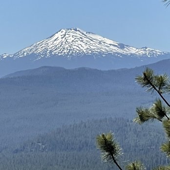


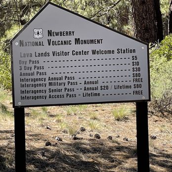
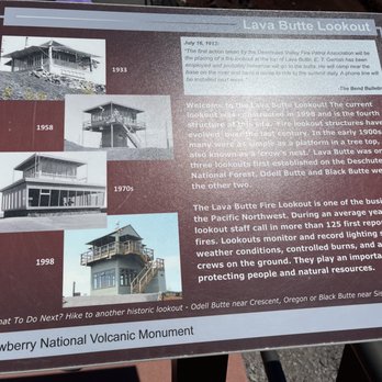


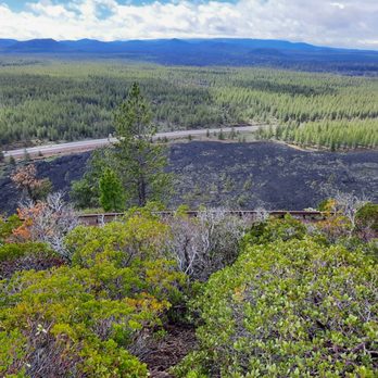
Not in one location This monument is not located in one place as I'm used to visiting other monuments. You have many choices of places to visit here and tons of options for anyone's tastes. We started off at the Lava Lands Visitor Center and took the shuttle to access the summit of Lava Butte where we got a spectacular view of 9-sq miles of lava flow . The shuttle departs from the visitor center and runs approximately every 20 minutes. The cost is $2 per person for the round trip and exact change is required. This is separate from the $5 park admission. After Labor Day personal cars can drive up to the summit. There is limited parking up there. We walked around the Lava Butte trail which looped for around 1/4 of a mile. The trail is not paved. Our next stop was the Sun-Lava Path, about 4 miles from the Lava Lands Visitor Center. From here we were able to access Benham Falls by a .5 mile trail one way. Benham Falls are rapids and not waterfall. It was a nice stroll. We then drove to Paulina Falls. There is another $5 fee to enter. There's a lower viewpoint trail about 1/4 mile but by this time we didn't want to do anymore walking and we just went directly to the Falls lookout which was a few feet from the parking lot. The Falls spills over the lowest point of Newberry Caldera. This twin falls drops 80 feet over volcanic cliffs onto a jumble of rocks below. We didn't get a chance to stop at the two lakes, East and Paulina Lakes. Perhaps another time. We tried experiencing the Lava River Caves but this seemed to have the most visitors and finding parking was a real challenge. If this was anything like the Lava Beds National Monument in Tulelake then been there, done that four years ago... yep, flashlights, hard hats and everything. Review #1119 read more


7 years ago
Exit now to ... Newberry National Volcanic Monument ... so we did. Speeding through Deschutes National Forest between Bend and Crater Lake, random curiosity led us to pull over and discover the Lava Lands Visitor Center next to 5.5 miles of paved (yes, fully-paved) paths through the Sun-Lava fields that look like the landscape around Middle-earth Mordor from Lord of the Rings. The sun-baked Trail of the Molten Land is just over a mile long with interpretive signs along the way while the somewhat shaded Whispering Pines Trail goes around parts of the lava. We also lucked into to taking the first shuttle ($2/person) ride at 10:00 a.m. to the summit of Lava Butte which towers above the lava field at 5,020 feet elevation. The bus runs every 20 minutes during the summer. It isn't required to get to the top, but is certainly worth the $2 round-trip fee. At the summit, we did the short 1/4-mile hike around the crater while enjoying the breathtaking views of the black lava, green forest, and snow-capped mountains in the distance. $5/day recreation access fees (or annual passes) are required to enter the monument. The visitor center has a small bookstore and free restrooms. There are also park ranger talks and tours which start at the center. A few miles away (so, different parking) from the Lava Butte is the Lava River Cave Interpretive Site where visitors can go on a self-guided 90-minute 1-mile exploration of a real lava tube. Plan ahead for crowds as well as appropriate clothing, water, and 2 separate light sources (which can be rented) for the cave. Whether it's for a full-day of hiking and education or just a detour to your next destination, I recommend planning (or just exit) to discovery Newberry National Volcanic Monument in the heart of the Deschutes National Forest. read more




9 years ago
If you are on the way to Crater Lake, don't bypass this place...this is a MUST SEE!!! Especially if you want a change of pace from all the greenness of beautiful lush Oregon. Since the day I was there was also the 101st anniversary of the National Park Service, it seemed to be a fitting place to be. You can hike the lava field trails or you can take a $2 shuttle. We did neither because we were short on time. But I WISH we could have. We only had time to visit the LAVA RIVER CAVE, but the parking lot of full and after circling, we gave up and headed to Maupin, OR for a whitewater rafting trip. BUT I really really really wanted to hike LAVA RIVER CAVE, and thanks to the enthusiasm of a tween and teenager, we returned two days later, with excited kids in tow. Some HINTS to help you have a stellar experience: FIrstly, it's self guided. Secondly, it's a subtle cave, don't expect the WOW of color or cave features like stalagmites and stalactites. But it's super cold, and you can make puffs of breath in the air. And it's super dark. My kind of adventure. HINT: PARKING. When the cave opened at 10 a.m., there were already 14 cars waiting to park in the lot. The entire hike inside the cave is 1.5 hours. So by arriving at about 11 a.m., we were hoping to get a parking spot...oh no...again, no spots. Don't give up though, we went to the lovely LAVA LANDS VISITOR CENTER to buy the young'uns a NATIONAL PARK PASSPORT...and then we returned to find that the strategy worked!!! The early birds were now leaving. HINT: FOOTWEAR AND BAT DISEASE PREVENTION -- Wear good SHOES because the terrain is rocky despite a handrail...also the handrail stops at one point, so you are left to pick your way through the rocks. My friend wore white sandals with a small heel...uh, don't do that. Wear study shoes that have not been in a cave. In fact, don't wear clothes that have been in any other cave. The rangers give a small orientation about contaminating the cave with a disease that harms BATS. Which is why it's good to scrap your shoes at the shoe scraper station just when you start your adventure. HINT: BATHROOM BREAK. AND BRING A SWEATER -- Go to the nearby bathroom first...it's a long underground lava tube...the longest uncollapsed lava tube in Oregon. And there are no facilities within it. ALSO TAKE A LIGHT JACKET and some GLOVES if you are prone to the COLD, it's cold like a meat locker down there...and the kids I was with, they were easily cold and couldn't hold their flashlights. YOU CAN SEE YOUR BREATH, it's that c-c-c-cold! HINT: LET THERE BE LIGHT -- Rent the FLASHLIGHT from the Park Service. I had a headlamp, and it was only good for illuminating your FOOTFALL...the cave can have a high ceiling and if you want to see features, you will need the high-powered trigger flashlight from the park service. For $5 bucks each, it's a smart investment. Also when using it, aim high and steady...so you don't blind others who approach and so you can see the cave features....one NPS flashlight for every two people in your party. I wish I had rented one for myself because the kids held them because they were doing a ballyhoo with the lights so you can't really see anything and it's nausea inducing. HOLD STEADY and AIM UP is key to good seein'. FYI: WHAT YOU DO SEE DOWN THERE -- You aren't going to see huge stalactites or stalagmites. It's kinda monotonous, but that's interesting. You will see some SECONDARY LAVA TUBES inside this main tube, also interesting....the ceiling does drop to THREE FEET towards the end point so you will have to bend down, which is fun...there is a terminus, and then you turn around and head back. It's dark, it can be scary...it's got lots of rocky terrain underfoot...and there is some color, some reddish rocks and soil...but mainly, it's just bigtime FUN and a cool long walk in the cold dark. OVERALL: Amazing experience. Loved it. Shoutout to the rangers and staff at the national park...very professional and friendly. In other words, DO THE CAVE!!!! Worth your time. You'll be glad you experienced LAVA RIVER CAVE. read more



Newberry is such an amazing place and I don't know why more people know about it. We discovered it while on our Oregon road trip and it was one of the most memorable experiences of the trip. The monument is a large area that has plenty of paved trails, which allows you to walk amongst the volcanic rock while not disturbing any of it, which is wonderful. We loved exploring all of the site and it was just so much fun. We highly, highly recommend this for anyone who loves experiencing different ecosystems and seeing different parts of the world. read more


Newberry National Volcanic Monument was one of the sights that Steve and I went to while visiting Bend, OR on Memorial Day weekend. The monument is not far out of Bend and makes the drive short and manageable. We did some hiking along the Deschutes river, visited the lava fields, went up the lava butte on a shuttle and was charmed by the wildlife. We saw chimpmunks, squirrels and lizards. The squirrels liked showing off which added humor to our visit here. We didn't even hit the tip of the iceberg on hiking and if you have a mountain bike there are a ton of great trails to go on! The visitor center is very informative and I enjoyed the gift shop where I got a piece of a thunder egg which apparently is very common in Oregon. This was a great stop and I would certainly do it again! Very tranquil with great views of mountain peaks! read more


Both the lava butte and the caldera sections are great - they're accessed by different roads off Hwy 97. Two fine caldera lakes, an awesome obsidian flow and tons of great campground spots. The visitor center at the Butte is pretty good with informative and well-presented volcanic geology displays. read more


We decided to hike up the volcano, which actually was a lot of fun. Was it hot? Yes. But the views were great and the top especially was breathtaking. Ours kids thought we were walking on the moon. We'd come back again. read more


6 years ago
Newberry National Volcanic Monument is SUCH a hidden gem! While on our road trip, we decided to make a stop here after we had just left Crater Lake NP. PSA: if you have an America the Beautiful pass, you can get in here for free! Our first stop was the Big Obsidian Flow Trailhead. It was so incredible to see the youngest lava flow in OR! There were mountains of obsidian rocks and it felt like we were walking on another planet. One thing to keep in mind is that the obsidian rocks are very sharp. My friend learned the hard way when he picked up a rock and got cut! We spent most of our day hiking the Cinder Hill trailhead which was mostly shaded and offered a gorgeous view of the caldera at the top. We caught the sunset at Paulina Peak and we even caught the NEOWISE comet at the overlook! Paulina Peak offers an obstructed panoramic view of the entire area and is absolutely stunning during day and night. The night skies at Paulina Peak are particularly magical as there aren't any city lights nearby & you're at the highest elevation(7,984 ft) in the park. Although we originally planned to be at Newberry for a quick day trip, we were so impressed by it that we ended up staying there overnight to catch the sunrise at the overlook as well. This park is a MUST see! read more


8 years ago
Mixed bag of options. Many choices at this Monument. Here are my thoughts: 1.. Paulina Falls (5 stars - go early and enjoy solitude - great place to stroll). 2. Paulina Peak - drive up in 15 min or hike up in 100 min. (4 stars - go early for solitude). 3. Big Obsidian Trail (3 stars - you will have some unstable footing on the trail loop and odds are you will have some single mom and her screaming ADHD kid(s) somewhere in the vicinity. 4. Lava Cast Forest (4 stars - 30 min rough road to arrive keeps most folks away - an interesting and pleasant 30 minute stroll along a paved path awaits). 5. Lava River Cave (2 stars - a loud, crowded, dirty, dusty place which is a magnet for large young families - good for the little ones - but not so much for childless adults - our least favorite activity). 6. Lava Butte Lookout (3 stars - gives you a sense of scale of the lava flow - but not much to it). read more


We visited sections of this 54,000 acre monument over the course of 2 days. On the first day we started off at the visitor center which has many informational displays that provided a good overview. We also caught the shuttle to Lava Butte, a cinder cone capped by a crater, which runs every 20 minutes. The fire tower was in use so we were unable to view the monument from there, but we took the short rim path that circles the crater. Unfortunately, wildfires in the area obscured to a degree the view of the north Cascades. On the following day, we drove to Paulina Lake with the first stop at the lodge though it was closed. We then took the long, windy drive via a gravel road to Paulina Peak which provided a spectacular, though smoky, view of Paulina and East Lakes as well as the Newberry Caldera and the Obsidian Flow. I can only imagine what it would be like on a crystal clear day. We then made the short drive to view the Big Obsidian (black glass) Flow. There is a 1-mile interpretive trail we planned to take, but there were too many stairs to reach the top so I decided to give my achy knees a break. Note: the $2 fee to ride the shuttle from the visitors center to lava butte requires exact change. read more


11 years ago
If you're in Bend, this is one of the "must do" places to go. Newberry is a huge place, and it can be hard to know what to do and what to skip, especially if you have limited time. But after 3 visits, here is what I recommend... Start at the "Big Obsidian Flow" (about 15 miles off US-97). This is a short, 1 mile hike that will take you through a martian wasteland of obsidian and pumice. Make sure to wear closed-toe shoes! And, if it's hot and/or sunny, bring water, as you will be climbing up through the flow itself. On the same road is Paulina Lake; although most of the guidebooks recommend it, we didn't find it particularly amazing. So, if you're short on time, skip the lake and head for Paulina Falls (also on the same road). The upper viewpoint is a simple walk from the parking lot. The lower viewpoint involves hiking down almost to the base of the falls, and then back up again, but the trail is wide and easy, and the view is even better. If you have more time, head back to US-97, and hit the Deschutes River Trail at Benham Falls. I just can't get enough of this trail--it features a wild river, gorgeous trees, and (if you come at the right time) great fall color or wildflowers. The Lava River Cave is totally worth doing if you have time, and haven't happened to explore a huge cave before. As for the Lava Cast Forest, opinions in my family are somewhat divided. My hubby loves it. On the other hand, I was a little disappointed by the "forest" itself--and by how much time it took us to crawl over the miles of gravel roads to get there in our non-4-wheel-drive vehicle. So, as you can see, there's a lot to do. Enjoy! read more


7 years ago
What a beautiful park. We went to the visitor center and then took the short paved walk through the lava fields. Beautiful views and good informational signs along the way. Bring water if it's a hot day. Also took the shuttle to the top of the cinder cone and walked around the rim. All the park employees were very helpful, knowledgeable, and friendly. There is another part to the park where you can drive and see water filled calderas, but we didn't have time for that today. read more


The cave is boring. Skip it unless you have tons of time to kill or are weirdly enthusiastic about lava tubes. It's the same thing all the way through, shaped like a subway station, with gray walls and floor and nothing different to see. Though I didn't see much of the rest of the park or do any tours, it seemed kind of nice. Definitely more worthwhile than the cave. The museum section was boring but outside, the scenery was pretty and it was pleasant to walk the trails or sit and watch the dozens of chipmunks and lizards. Would have been a nice place for a picnic. Overall, if I hadn't gotten to see this park, I wouldn't be too torn up about it. But it wasn't a terrible use of a couple hours. read more


8 years ago

9 years ago
What a wonderful day! First off, you need to realize that Newberry National Volcanic Monument actually consists of several locations to include: Lava Butte, Lava River Cave, Lava Cast Forest, and Newberry Caldera. These are all within a short drive from each other. I had read that the Cave is very cool and requires that you have a flash light to visit, so we did not go. What we did was the Lava Butte and it took us a few hours to hike the trails and take the tram to the top. You can literally see where the lava starts and stops here and clearly see the cinder cone. There are great park volunteers that will teach you everything you need to know about the different types of lava rock. We had a great time, definitely worth a visit and worth the few bucks it costs to get through the gates. read more


9 years ago


8 years ago

9 years ago

11 years ago


9 years ago
Going to the lava tubes? Dress for winter and being flashlights and headlamps. Fascinating adventures through the caves and helpful information from great Parks Rangers. A must if you're visiting Bend. read more


7 years ago
Page 1 of 2
More info about Newberry National Volcanic Monument
Ask the Community - Newberry National Volcanic Monument
Review Highlights - Newberry National Volcanic Monument


















Why does Yelp recommend reviews?

Newberry National Volcanic Monument - landmarks - Updated May 2026
Best of Bend
People found Newberry National Volcanic Monument by searching for…
Trending Searches in Bend, OR
Boat Rental near Newberry National Volcanic Monument
Bounce House Rentals near Newberry National Volcanic Monument
Campgrounds near Newberry National Volcanic Monument
Caves near Newberry National Volcanic Monument
Cliff Jumping near Newberry National Volcanic Monument
Flower Fields near Newberry National Volcanic Monument
Flower Shop near Newberry National Volcanic Monument
Garage Sales near Newberry National Volcanic Monument
Garden Center near Newberry National Volcanic Monument
Gold Panning near Newberry National Volcanic Monument
Hair near Newberry National Volcanic Monument
Hidden Gems near Newberry National Volcanic Monument
Landmarks & Historical Buildings near Newberry National Volcanic Monument
Movie Theatre near Newberry National Volcanic Monument
Nurseries & Gardening near Newberry National Volcanic Monument
Outdoor Furniture Stores near Newberry National Volcanic Monument
Party Equipment Rentals near Newberry National Volcanic Monument
Pedicure near Newberry National Volcanic Monument
Pick Your Own Farms near Newberry National Volcanic Monument
Public Services & Government near Newberry National Volcanic Monument
Secluded Spots near Newberry National Volcanic Monument
Table And Chair Rentals near Newberry National Volcanic Monument
Things To Do On A Rainy Day near Newberry National Volcanic Monument
Browse Articles
Browse Nearby
Browse Brands
Related Searches in Bend, OR
Best Fun Things to Do in Bend, Oregon
Best Places for Stunning Views in Bend, Oregon
Best Waterfalls and Swimming Holes in Bend, Oregon
Book Engaging Historical Tours in Bend, Oregon
Discover Famous Monuments in Bend, Oregon
Discover Historic Sites and Places in Bend, Oregon
Discover Popular Landmarks in Bend, Oregon
Discover Popular Photo Spots in Bend, Oregon
Discover the Best Caves to Explore in Bend, Oregon
Enjoy Arts & Entertainment in Bend, Oregon
Enjoy a Beautiful Waterfall Hike in Bend, Oregon
Enjoy the Best Walking Trails in Bend, Oregon
Essential Tips for Every Tourist in Bend, Oregon
Experience Stunning Sunset Views in Bend, Oregon
Explore Beautiful Castles and Landmarks in Bend, Oregon
Explore Beautiful Parks and Green Spaces in Bend, Oregon
Explore Easy Hikes Perfect for All in Bend, Oregon
Explore Free Things to Do Around Bend, Oregon
Explore Fun Activities to Do in Bend, Oregon
Explore Fun Field Trips in Bend, Oregon
Explore Popular Scenic Overlook Points in Bend, Oregon
Explore Popular View Points Around Bend, Oregon
Explore Secret Spots Worth Visiting in Bend, Oregon
Explore Top Art Galleries Located in Bend, Oregon
Explore Venues & Event Spaces in Bend, Oregon
Find Beautiful Views in Bend, Oregon
Find Exciting Tours to Take in Bend, Oregon
Find Fun Things to Do With Kids in Bend, Oregon
Find Top Art Museums in Bend, Oregon
Find Top Libraries to Visit in Bend, Oregon
Find Top-Rated Waterfalls in Bend, Oregon Now
Find Visitor Centers to Explore in Bend, Oregon
Find a Public Library Near You in Bend, Oregon
Find the Best Bridge Spots in Bend, Oregon
Find the Best Playgrounds to Visit in Bend, Oregon
Hiking Trails With Waterfalls in Bend, Oregon
Must-See Tourist Attractions Around Bend, Oregon
Popular Outdoor Activities to Try in Bend, Oregon
Popular Picnic Spots to Visit in Bend, Oregon
Popular Places to Take Pictures in Bend, Oregon
Popular Things to Do in Bend, Oregon
Popular Things to See in Bend, Oregon
Public Services & Government Offices in Bend, Oregon
Top Entertainment Options in Bend, Oregon
Top Hiking Trails to Explore in Bend, Oregon
Top Museums for Kids to Visit in Bend, Oregon
Top Places to Visit in Bend, Oregon for Sightseeing
Top Things to Do With Kids in Bend, Oregon


