Cancel

Open app

Search

Echo Cliff at Panther Mountain

5.0 (1 review)

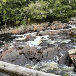
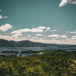
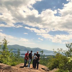
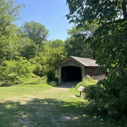
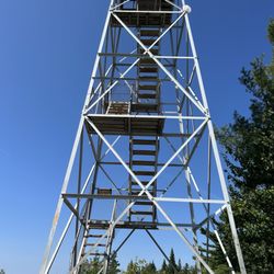
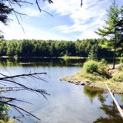
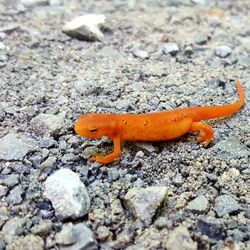
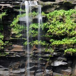
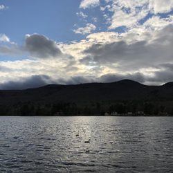
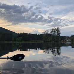
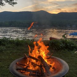
Echo Cliff at Panther Mountain Photos

More like Echo Cliff at Panther Mountain

Recommended Reviews - Echo Cliff at Panther Mountain

Your trust is our priority, so businesses can't pay to alter or remove their reviews. Learn more about reviews.
Yelp app icon
Browse more easily on the app
Review Feed Illustration

4 years ago

Helpful 4
Thanks 0
Love this 4
Oh no 0

Verify this business for free

Get access to customer & competitor insights.

Verify this business

Prospect Mountain

Prospect Mountain

4.2(58 reviews)
64.3 km

Super cool and beautiful place to hike there are an abundance of trails a few picnic areas and for…read morethose of you who don't wanna hike you can drive up to the top! Currently it's free to drive up as when I passed the toll booth it stated so! This one will be short and sweet as it's just beautiful here in the trees overlooking the lake! Overall this was an awesome find and the view the breeze blowing through my hair was satisfying beyond any means as this chill relaxing spot was much needed!

This is an excellent autumn hike with amazing views. Although short at only two miles from…read moretrailhead to summit, you'll need proper shoes for this hike and you will warm up due to the steep grade and moderate rock scrambling. We took the red trail all the way to the top and we took the blue trail on the way down (it merges with the red trail). I'm giving four stars because the trail marking are really good, except where they aren't and just disappear for a while or entirely. The red trail is mostly well marked, though there were still times when we just had to keep heading up the mountain because we couldn't find the next marker. On our way down, the blue trail was really, really well marked until it just stopped and we could not find another marker. I'm not a fan of going off trail because I know it can be dangerous and it can be damaging to local ecosystems, but without a clear trail to follow and nearly a mile into the woods, we did the best we could (kept heading downhill and to the right hoping to find the red trail, but eventually finding the road anyway). If you start at the trailhead, you will walk up metal stairs and onto a walkway over the highway. From there, you'll follow the trail about a mile up where you will find a road. Beware of traffic, cross the road, and you'll have another mile to go to reach the summit (you can take red or blue trail) where there is a parking lot and great viewing.

Photos
Prospect Mountain - Lake George

Lake George

Prospect Mountain
Prospect Mountain - Lake George

See all

Lake George

Glimmerglass State Park - Hyde Hall covered bridge

Glimmerglass State Park

4.7(26 reviews)
77.7 km

This is a gorgeous state park on the northeast edge of Otsego Lake. My wife, two teenage sons (15…read moreyrs, 13 yrs), and I came here with our miniature poodle for a quick visit during a 4-night stay in Sharon Springs, NY. We came here every day to enjoy the lovely view of the lake, take a leisurely stroll with the dog, and spend an afternoon fishing (for my 15 year old son). It's about a 15-20 minute drive from Cooperstown along the east shore. At the main entrance, you'll pay a $7 admission fee per vehiecle, or you can just show your NY State Parks Empire Pass card. This is a gem of a park that is well worth the price of admission. First, it feels open and spacious with nice hiking trails. Second, the view of Lake Otsego is lovely. You may see a few kayakers or windsurfers on the lake depending on weather conditions. If you have young children, this is a must-visit place as there are kid-friendly playgrounds. Third, the lake is shallow and calm by the beach, but the water temperature can feel a bit chilly. In the summer, they have lifeguards available starting at 11:00am. Finally, the park has a concession stand which sells basic snacks, hot dogs, and drinks. It's also worth it to take a short walk up the hill to see Hyde Hall and the view of the lake from there!

Very friendly staff at front gate beautiful lake to swim in and camping available as well.read more

Photos
Glimmerglass State Park - Oldest covered bridge in America

Oldest covered bridge in America

Glimmerglass State Park - Lake and Beach at Glimmer Glass

Lake and Beach at Glimmer Glass

Glimmerglass State Park

See all

Bald Mountain

Bald Mountain

4.6(16 reviews)
46.2 km

Bald Mountain is rated an easy trail to do with families around Old Forge. My family with teens…read moredecided to hike this trail and said it was super fun. They liked the climbing the boulders, ledges and roots. It does take some balance and finesse to navigate the trail. Some difficult areas have herd trails next to it to help with the steep portions if you're unable to climb. It would be difficult for anyone with mobility issues or balance issues. 3 areas with breath taking views. The full trip is 1.8 miles with a steep incline a few steps in and then some ups and down in the trail. It took our family 28 minutes to hike up. This was with stops to take pictures and 34 minutes to hike down. Descending is more of a challenge. Registration book and pencil at the beginning of the trail to sign in. I would use caution during a wet season or early morning dew.

REALLY enjoyed my hike the other weekend!!…read more I didn't know what to expect because of the number of people this mountain attracts but I was really happy during the hike because it wasn't as crowded as I thought. It was like the perfect amount of hike! The views were gorg and amazing!! We had to wait in line for like 20 minutes to climb up the lookout, but it was totally worth it for the pic and the view! Really beautiful, will be back for sure! Also - be careful parking on the side of the road, the cops wait to give out tickets after people park..

Photos
Bald Mountain
Bald Mountain
Bald Mountain - Randaxe Fire tower

See all

Randaxe Fire tower

Cold Brook Preserve - Ribbon Cutting Ceremony on Earth Day April 22nd 2013

Cold Brook Preserve

4.5(2 reviews)
78.1 km

A new nature preserve owned by Saratoga PLAN that features miles of marked hiking trails. The…read moretrail starts out on Homestead Rd but can also be accessed from the nearby Wilton Wildlife Preserve trails off of Preserve Way and also from the Nature Conservancy trails off of Ruggles Rd. The three trail systems connect unofficially for now but work is being done to make the connecting trails official and have them marked and maintained. Care of the Coldbrook Preserve is done by several volunteer stewards and additional help is always desired. Contact Saratoga PLAN if interested in helping out here or contact me as I'm one of the Stewards of this preserve. The trails are all what I would classify as easy terrain and family friendly. Most of the trails are flat and with a few hills and minor stream crossings. Walk way bridges are planned to span the water but for now are crossible with the primitive structures already in place. An endangered species of turtle inhabits some of the wetlands the trails go through and there are benches along the trails to allow visitors places to rest and quietly observe the wildlife we share this area with. Please carry out all trash you bring in here. There are also several geocaches placed throughout the preserve and adjacent preserves so there is always more fun for all to enjoy this gift of nature.

Totally beautiful and not crowded which is perfect for social distancing. Pine needle covered…read moretrails, a few hills but great for all. Can be a little muddy so don't dress up!!

Photos
Cold Brook Preserve - Trail Head Sign on Homestead Rd

Trail Head Sign on Homestead Rd

Cold Brook Preserve - Trailhead entrance sign

Trailhead entrance sign

Cold Brook Preserve - View of the wetlands from one of the benches along the trail

See all

View of the wetlands from one of the benches along the trail

Sleeping Beauty Mountain - Mid October, Sleeping Beauty Summit.

Sleeping Beauty Mountain

4.8(5 reviews)
78.4 km

A great hike of moderate difficulty. The summit is lovely, with beautiful views of Lake George and…read morethe surrounding mountains. Some areas of the trail are fairly eroded, but there were crews there working to protect the trail and divert water. Even with a full parking lot, the hike was long enough that we didn't see people very often along the way. We saw some families with little ones, but none near the top, so I'm not sure how far they made it. This wouldn't be an easy hike carrying kids, and I don't think most kids under 10 would stick it through to the end. A few portions are pretty steep, so it'd be tough on little legs. The one downside is that apparently Dacy Clearing Road isn't always fully open to vehicles, so rather than parking closer to the trailhead, you may have a few extra miles to walk on a gravel road. This takes your roundtrip from approximately 5 miles to roughly 8.

One of the most beautiful places I've hiked in. The view from the summit is spectacular on a sunny…read moresummer day, and probably even better in the fall. The hike to the top can be long or short, depending on your skill level, and how you want it to be. If you choose to do a longer hike, you can park at the Hogtown parking lot at the bottom. If you choose the shorter path ( 1.8 mi) to the summit, you must drive further down a dirt path (if the gate to go further is open) for another mile or so and park at the Dacy clearing. The hike itself is not bad. It can be a little rocky and steep, but if you're in average shape, you should be okay. It is for the average to moderate hikers. There were a lot of families with smaller children and dogs when I went. It's definitely something a family can enjoy. If you go on a nice day, I would recommend bringing lunch or snacks with you. It was really nice to eat with a view of the Adirondacks, and Lake George.

Photos
Sleeping Beauty Mountain - Fire on the Mountain.....not really a fire but nature's autumn magic.

Fire on the Mountain.....not really a fire but nature's autumn magic.

Sleeping Beauty Mountain - Bumps Pond

Bumps Pond

Sleeping Beauty Mountain

See all

Christman Sanctuary

Christman Sanctuary

4.9(8 reviews)
83.8 km

The topography of this place is undulating but not too challenging, even for someone like me, a…read morecouch potato. A river runs through it. Along the way, there are some waterfalls of differing levels. Obviously, the volume of water is dependent on recent precipitation. The "mood" of the place depends of that flow. On most occasions, I could hear the rush of water before actually seeing it. It's an added bonus to this place, changing on a daily basis. Like a lot of things upstate, you've got to be informed about a place before you know it exists. If a co-worker hadn't told me about this sanctuary, I doubt I would have found it on my own. There is no fee but the parking lot is small; there's space for about eight vehicles. Check it out. It's a neat place. It'll do some good to get some fresh air.

Note to self: September may not be the absolute best time to come here because of the very low…read moreflow. Still, there are plenty of things to like about this...once you find it. The falls seem to be commonly known as Bozenkill Falls but the road sign (pictured) says Christman Sanctuary, and the gravel parking lot isn't massive so it may be easy to miss. The first 100+ metres is mostly boardwalks so it's easy enough to navigate. Then comes rocky, uphill trail, but at least markers are readily visible and aplenty. On our first visit I feel like we barely scratched the surface, so will look forward to another visit. Thank you whoever you are, for helping to preserve and maintain this sanctuary!

Photos
Christman Sanctuary
Christman Sanctuary - After a rainfall.

After a rainfall.

Christman Sanctuary - Lower falls - Christman Sanctuary

See all

Lower falls - Christman Sanctuary

Lake Algonquin - Sunsets over it.

Lake Algonquin

5.0(1 review)
18.9 km

Have you guys heard of this coronavirus thing?…read more Anyway, it's this worldwide pandemic thingy that confined everyone to their homes for basically the last five months. Seeing as how my home is a tiny apartment in Brooklyn, this left my wife and I both working full-time from home, with a toddler, and nowhere to go. We're extremely lucky in our family, and had a small (but far bigger than our apartment), old, house we could shelter in next to this beautiful lake in the Adirondack Park. And this lake has been a lifesaver. In cold weather, it provided me with a shoreline overrun by nature that I could take out my excess energy on to fix up. In hot weather, swimming keeps me from flying into murderous rages (no air conditioning in this old house). When calm, we can kayak, and paddleboard, and just float when we feel lazy. At dusk, we can fish, and skim rocks, and point out frogs to our daughter. With its mountain backdrop, Lake Algonquin is gorgeous in all seasons. The sun glitters like diamonds in the summer. The colors of the autumn leaves are brief but spectacular. It freezes so solid in the winter that they have car races on it, and the snow remains pristine and perfect, unlike the sludge of NYC that appears after an hour or two. And when everything wakes up and starts blooming in spring, it's incredible and alive and downright magical. My father-in-law disparages it as merely a dammed river (perhaps he means 'damned'), but I love this lake, and I feel so fortunate to spend time next to it. Worldwide pandemics aren't my favorite, but Lake Algonquin has been a silver lining for sure.

Photos
Lake Algonquin
Lake Algonquin - Kayak on it.

Kayak on it.

Lake Algonquin - Build a fire next to it.

See all

Build a fire next to it.

Echo Cliff at Panther Mountain - hiking - Updated May 2026

Loading...
Loading...
Loading...