1. East Sooke Regional Park

0

Sooke, BC

Cancel

Open app

Search

East Sooke Regional Park

4.2 (6 reviews)

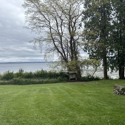
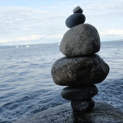
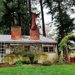
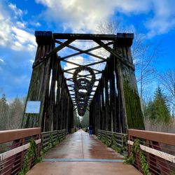
East Sooke Regional Park Photos

You might also consider

More like East Sooke Regional Park

Recommended Reviews - East Sooke Regional Park

Your trust is our priority, so businesses can't pay to alter or remove their reviews. Learn more about reviews.
Yelp app icon
Browse more easily on the app
Review Feed Illustration
Photo of Sheri H.
367
3110
4169

2 years ago

Helpful 0
Thanks 0
Love this 0
Oh no 0
Photo of A M.
84
34
5

12 years ago

Helpful 1
Thanks 0
Love this 0
Oh no 0

10 years ago

Helpful 0
Thanks 0
Love this 0
Oh no 0

10 years ago

Helpful 1
Thanks 0
Love this 0
Oh no 0

10 years ago

Helpful 0
Thanks 0
Love this 0
Oh no 0

16 years ago

Helpful 1
Thanks 0
Love this 0
Oh no 0

Verify this business for free

People searched for Parks 114 times last month within 15 miles of this business.

Verify this business

Sooke Potholes Provincial Park - Map from P2.

Sooke Potholes Provincial Park

4.6(9 reviews)
10.5 km

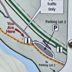
This place is nothing short of breath-taking. Why? So scenic, and you don't have to break the…read morebody to get to it. What I mean by that is this. I fully expected to hike a fair distance to see the best of the best. But a good Samaritan took pity on me whilst looking at the map in the parking lot and gave me some valuable advice. He was there with his wife about to embark on some serious hiking from what I could see. Why was it valuable advice? Because the map was like trying to decipher a rubics cube. This man took all the guesswork away and cut to the chase to what I'm calling the Sweet Spot for viewing. Start at P lot 3, go to the end of the p lot to find the entrance of a trail. Go to the right to get on the trail, and veer for routes to the left, which are closest to the water. You will come to spectacular views of the potholes; high above, so be careful. There are no fences or ropes, so I can not stress more. Be uber careful. But so beautiful. And so much joy for so little work. Meaning I didn't have to walk far to be so richly rewarded. These pics are what I took, but do not do the experience justice. They don't show depth. You just gotta go and experience it for yourself. If I ever see that man again, I'd buy him a bottle of wine. He was a Godsend. I guess the best I can do now not knowing who he was, is a big fat thank you here. And hope he's a Yelper.

This place is super confusing!! I wish this park was labeled a bit more cause it was hard to find…read morepotholes that you can actually swim in! First off, please park on lot #2 for best route to the potholes. When you're there, head to Peddle Beach for a small peddle beach. You see a pothole that folks can lay around and swim in. You will see another trail that leads to the potholes. It's about a two minute walk to the what you'll see in my pictures. To the potholes, there are one or two other potholes too you can swim in. In my pictures, that's the place you want to go to. In there, there are rocks for to camp up at and you can swim In the shallow ends or in the deep ends. There are multiple holes that are available for you to pick from. The hard part is walking on the rock formulation cause it can hurt a bit and can be slippery cause of the water. And the water is COLD! But of course, when you're in, you'll be fine. You can walk around the trail, I don't remember the name, I think it was Water Trail? But it's just a trail for hikers. There is a PotHoles View Point and it is just to view these rapid potholes. There were some teenagers that said that you can hope the fence to go down. It look super sketchy, so we didn't go down with them. You can't really float down there given how rapid the water was going. When you first get into the park, there is an initial parking lot that doesn't require you to pay. You can swim and lay around there too. We noticed that it's mainly for kids so it can get crowded. Parking was pretty crowded when we leave, so get there early to avoid walking too far. Parking lot is $2.25 until sunset. It was a great park but so confusing!! Most of the people that we talked about the way were just as confused.

Photos
Sooke Potholes Provincial Park - Map at P3

Map at P3

Sooke Potholes Provincial Park

See all

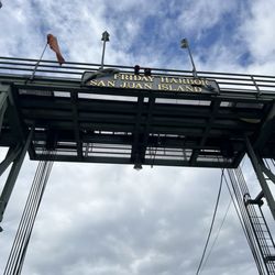
San Juan Island National Historic Park - Friday Harbor entrance

San Juan Island National Historic Park

4.7(19 reviews)
52.3 km

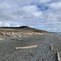
I only got to visit the American Camp side of this park, but it was wonderful!…read more Driving along Cattle Point Road you'll see signs to enter multiple different sites at the park. I mainly stopped at three locations: Cattle Point Interpretive Area: You can either take the steps down to the pebbly beach to feel more connected to the water, or go up the mossy mound to get a high ground view of... well, everything. I saw water, cliffs, islands, ducks, eagles, seals... unfortunately, no whales, though, prob because this is not the time of year they are around much. Cattle Point Lighthouse: Walked on a cute trail to the lighthouse, where I saw a humongous red fox on a hill, looking like it was digging or pouncing on something! On the other side of the lighthouse are views of miles of open sky and water. South Beach: On the road leading to the beach, we actually saw a black fox just chilling, lying on the road. It moved to the fenced area as we approached, and my gosh it was beautiful. I didn't even know black foxes existed! The beach itself is wide and has views of endless water, with some driftwood hanging out near you. I know there's so much more to the park that we didn't see, but I was quite happy with the wildlife and incredible scenery. Especially the foxes... I've only seen like one other (that I can remember), so seeing the ones here were such a bonus. The trails and sites that we missed are even more reason to return to San Juan Island National Historical Park. I just hope I'm able to come out to this island again someday.

Awesome ferry ride over to the islands. With Beautiful views. Entering was easy and quick.read more

Photos
San Juan Island National Historic Park - South Beach

South Beach

San Juan Island National Historic Park - Cattle Point Interpretive Area, down at the pebble beach

Cattle Point Interpretive Area, down at the pebble beach

San Juan Island National Historic Park - View from top at Cattle Point Interpretive Area

See all

View from top at Cattle Point Interpretive Area

Olympic Hot Springs - Log bridge over a creek.

Olympic Hot Springs

3.6(28 reviews)
35.8 km

AMAZING!! I was bummed out that I couldn't get reservations to Goldmyer hotsprings (only 20 people…read moreallowed a day) and found directions to these online. Totally blew my expectations out of the water! We went on a slightly rainy Sunday in July. We got pools to ourselves and only shared when a group of people around our age politely asked to join. There are 7 pools and the best one is the last, you hike up a hill to it. The nudeness is strange but a good experience for all. Yes the water is slightly sulfur-y, and probably not very clean but it has flow in and out, and is not stagnant and gross. I recommend going to Olympic Rafting & Kayaking (very close) to use their showers afterwards. We got there after hours around 8pm and the bathrooms and showers were still open. If the hot springs aren't good enough, the hike there tops it all off. My girlfriend and I are athletic but do not enjoy exercise, this ~2 mile hike each way is very slightly uphill, and the forest is so diverse and beautiful surrounding that it doesn't even seem like a hike. More of a nature walk lol. Took us about 3 hours to get there from North Seattle, using the Kingston Ferry. Great drive, camping recommended unless you head out early. It's amazing that more people don't know about this truly amazing place, get there now!

Firstly, several of these reviews are for the wrong hot springs. If a review mentions a restaurant,…read moreor a resort, or a time slot, they are referring to the SOL DUC hot springs, not these ones. Also, the reviews that mention that the hike is easy are all outdated! It's a slog to get there! The Olympic hot springs are a 12 mile hike mostly uphill. It used to be a much shorter hike but about five years ago the road washed out and you now have to hike an extra 8 miles... 12 miles total... one way. It's a slog! The springs themselves, while pretty, are shallow, muddy, slimy, and overall pretty gross. The signs warn of fecal bacteria. If you're hoping to hike 12 miles to soak in pristine pools, think again. Nudity is common. If anyone is actually using the hot springs, they will likely be nude. Get over it!! Let the nudists have their place... and 12 miles deep in the woods is a nice place to be nude. You might also see nudists hiking or biking on the trail to the hot springs. It's not common but does happen occasionally. Just smile and say hi! The hike starts off easy on a paved road for about 3/4 of a mile. Then you have to use a single-track dirt bypass trail that is steep and rooty. If you're using a bike you'll be pushing and carrying it over things. Then you're put back on an old paved road again. It's another 2 miles to the Glines Canyon overlook which is fun to see. Then it's another 5 miles on the same road, but now 100% uphill and sometimes steep, just to reach the trailhead. Once at the trailhead, you're already over 8 miles into it and you have another 2.5 or so to hike... bikes not allowed. You have to park at the Madison Falls parking lot. You're supposed to have a National Park pass.

Photos
Olympic Hot Springs - Mileage once at the trailhead. This is AFTER already hiking over 8 miles uphill.

Mileage once at the trailhead. This is AFTER already hiking over 8 miles uphill.

Olympic Hot Springs - Hot Spring

Hot Spring

Olympic Hot Springs - Bear warning!

See all

Bear warning!

Lime Kiln Point State Park - Lighthouse

Lime Kiln Point State Park

4.9(40 reviews)
43.1 km

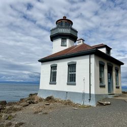
I hadn't planned to visit Lime Kiln Point State Park while staying on San Juan Island, but our BnB…read morehost INSISTED we include a visit to the park in our itinerary. Lesson learned; always trust the guidance of locals when visiting a new place. This park is a gem! Visitors will find this gorgeous park located on the west side of the Island, perfectly situated to offer stunning views of the Salish Sea. The park is named for its historic lime kiln used by settlers in the late 1800s and early 1900s. An interpretive center has displays and activities about orcas and the area's lime kiln industry once important to the region. The coastline is incomparable! A five to ten minute downhill walk from the parking lot reveals remarkable views of the Olympic Mountains and an expansive view of sparkling water stretching far into the distance. It's said this site is one of the best whale watching locations in the islands, where visitors will most likely be able to see orcas! We weren't fortunate enough to find any during our visit, but the scenery was rewarding enough. The trail continues along the rocky shoreline, passing several pristine coves and thickets of madrones with twisted, curling red bark. The trail soon reveals a beautiful lighthouse on a rocky bluff, and the lime kilns in the distance. There is a well-curated gift shop back at the parking lot, as well as picnic tables, information kiosks, and public restrooms. There's a whole lot of beauty packed into this 42 acre park... something you won't want to miss!

Truly a picturesque park with beautiful coastal hikes. We certainly enjoyed walking along the…read morecoastline while taking in the scenery. Walking to the lighthouse was a perfect adventure and not strenuous if you are looking for a pretty easy hike. Stop and look out for whales (we didn't see any) and also check out the tide pools!

Photos
Lime Kiln Point State Park

See all

Dungeness National Wildlife Refuge - Dungeness National Wildlife Refuge.

Dungeness National Wildlife Refuge

4.6(65 reviews)
42.1 km

This is a pretty unique place as the spit is the longest natural sand spit in the United States,…read moremeasuring at about 5 miles long. Why isn't there an exact length? Well, it's because the spit is growing about 15 feet a year through the deposition of sediment by the motion of the tidal currents. If you have time, you can hike the entire length of the spit to reach the New Dungeness Lighthouse. There are daily tours available, or even better, you can opt to reserve to live in the lighthouse keeper's house! Don't worry about carrying all of your luggage on the hike - they will drive you in a four-wheel drive transfer vehicle. I've also heard of people boating to the lighthouse instead of land-based transportation. Anyway, this area is very gorgeous and amazing for getting outside. It feels like the sky and the ocean swallow you up in all of the shades of blue.

Had such a relaxing visit to Dungeness National Wildlife Refuge! The scenery is gorgeous and super…read morecalm. Couldn't hike all the way to the lighthouse this time around, but it's on my list for next time for sure. A couple of quick heads-ups for fellow visitors: * ​If you don't have a State Park Pass, the entrance fee is $3. Make sure to bring cash, as the card machine was down during our visit. * Free parking is available, and there's a campground right nearby. * Definitely bring a hat, sunglasses, plenty of water, and solid walking shoes. It's a lovely place to unwind!

Photos
Dungeness National Wildlife Refuge - Dungeness National Wildlife Refuge

Dungeness National Wildlife Refuge

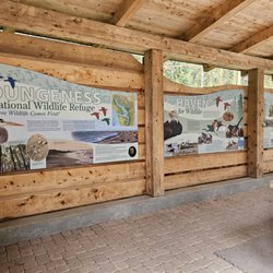
Dungeness National Wildlife Refuge - Information panels

Information panels

Dungeness National Wildlife Refuge - Entrance

See all

Entrance

East Sooke Regional Park - parks - Updated October 2026

Loading...
Loading...
Loading...