Donell Vista Photos


You might also consider
More like Donell Vista
Recommended Reviews - Donell Vista
Start your review...

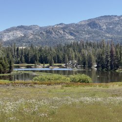
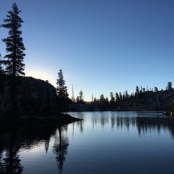
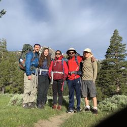
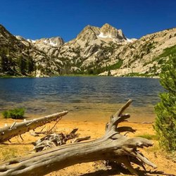
Wow such a little gem off of Hwy 108 as you are climbing over the Sierras. It was quite early but I decided to pull over to grab a drink from the cooler and decided this was the spot. It a a small area with parking and has restrooms. The are was pretty clean and its a short loop type setup. However once you park the views are stunning. it also appears to be the gateway for multiple trails. There are not a ton of parking spots so I can imagine it can fill up but if you looking for a spot to pull over and stretch your legs this is excellent read more


More info about Donell Vista


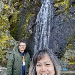
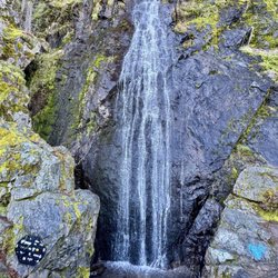


Donell Vista - localflavor - Updated May 2026
Best of Tuolumne County
People found Donell Vista by searching for…
Things to Do in Tuolumne County, CA
Fireworks in Tuolumne County, CA
Lookout Points in Tuolumne County, CA
Hiking Trails in Tuolumne County, CA
Redwood Trees in Tuolumne County, CA
Off Leash Dog Hikes in Tuolumne County, CA
Waterfall Hike in Tuolumne County, CA
Waterfall in Tuolumne County, CA
Bike Path in Tuolumne County, CA
River Access in Tuolumne County, CA
Dog Friendly Hiking Trails in Tuolumne County, CA
Secret Spots in Tuolumne County, CA
Fireworks Shows in Tuolumne County, CA
Off Road Trails in Tuolumne County, CA
Easy Hikes in Tuolumne County, CA
Scenic View in Tuolumne County, CA
Fun Things to Do at Night in Tuolumne County, CA
Places to Take Pictures in Tuolumne County, CA