Cascade Falls Photos


You might also consider


More like Cascade Falls
Recommended Reviews - Cascade Falls
Start your review...






5 months ago
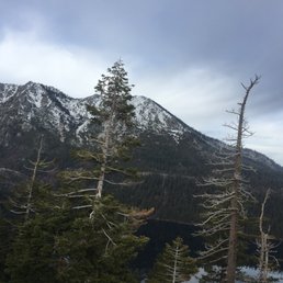
This ended up being one of my favorite hikes in Lake Tahoe. It's definitely more enjoyable in the spring or fall, when there's less fog and you can fully take in the surrounding scenery, but even so, I was happy with the experience. Reaching the waterfalls was especially rewarding and made the hike well worth it. read more



11 months ago
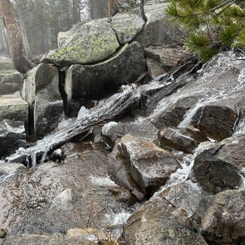
Hike was about 2 hours total-- one hour there, one hour back. It was such a fun hike! Maybe not so much for my mom because she was lowkey struggling since it started to become a rocky trail, the closer you get to the waterfall. It's not a smooth, walk-in-the-park trail, since it's rocky, so just be prepared! I've seen lots of people use hiking sticks or trekking poles-- they were definitely prepared. The view at the end is definitely worth it! read more



9 months ago
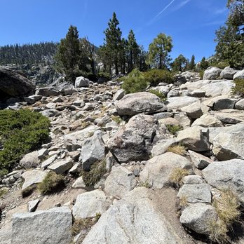
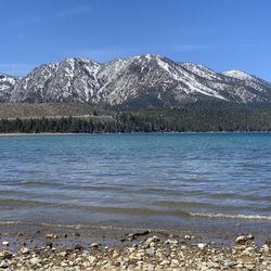
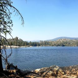
Cascade Falls is a really nice short hike in South Lake Tahoe. The trail isn't very long, but it gives you some great views along the way. You get to walk through tall pines, open granite, and then see both Cascade Lake and Lake Tahoe in the distance, which is worth the effort. When I went, the waterfall itself wasn't at full flow, but it was still beautiful to see. I can only imagine how much more impressive it looks in the spring when the snow is melting. Even without that, the whole area has a peaceful feel and plenty of spots to stop and take in the views. I'd definitely recommend this hike if you're in the Tahoe area. It's short, scenic, and not too difficult, which makes it a good option for most people. Whether you want a quick outing or just a place to enjoy Tahoe's beauty, Cascade Falls is a great choice. read more


An early break in Mid May weather made this hike a 5 star experience. The trail is easy to moderate level. Just about a 1 mile from the Inspiration Point parking ($10) to the cascade falls. Epic views of Lake Tahoe and Cascade Lake throughout the hike. We hiked a total of about 2.5 miles which includes a 1/2 mile of exploration of the creek that feeds the falls. The falls are dangerously accessible so stay alert in and around the creek and while on the trail. Parking is a nightmare, but the hike is worth it. read more

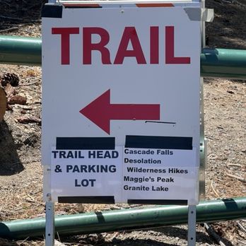


No no no. This is all wrong. A hike CANNOT be this scenic. One of my favorite memories of hiking in Tahoe was sitting in the middle of the stream behind Cascade Falls, watching the water flow over the edge and down towards the lake below. I sat there for a while with nobody else around. Just me, basking in nature's beauty and serenity, cares momentarily forgotten. Cascade Lake is not directly reachable unless you're one of the few wealthy enough to own property on the lake's north shore. The rest of us are consigned to hiking to Cascade Falls above and behind the lake, where there's a perfect vantage point of trees and water for miles. Yeah, I'll take that. The falls are reachable via a less than 1-mile (but rugged) hike along the Cascade Falls Trail. The trail begins at the Bayview Campground where there's a small amount of parking. More parking is available along Emerald Bay Rd (State Route 89) outside the campground. As you head away from the campground, the trail narrows and gets more rugged with rocks to climb over, and gets more scenic with a sweeping view of Cascade Lake and Lake Tahoe behind it. The end of the trail sort of disappears out into a wide, slanted rocky area on the face of the mountain near the falls. There's at least one spot where you can climb down a steep narrow opening between the rocks to get closer to the edge of the falls. This is not your typical well-defined trail that you might find at a county park. I visited in the late afternoon in June of 2021, and I didn't run into more than a handful of people here. There was a moderate amount of water at the falls but not a ton of it, so I was able to sit on a large dry rock in the middle of the stream there. The number of people probably depends on the time of day and the season, but should you visit, I hope you find the same serenity and inspiration that I did. read more

I call this my Lake Tahoe warmup hike when you can get here early on a weekday. Get here before 8am, and I would head up north farther to The Eagle Falls parking lot, next to Vikingsholm, the most difficult place to park. But getting here around 845am on a weekday, and you have a decent chance to find a spot in the paved parking lot. Hardest part of this hike is like going to Costco on a weekend: getting parking. Woke up the wife and deprived her of her beauty rest. Drove north on highway 89 to Inspiration Point, making a left into the Cascade Lake Campground, and to the back for public parking. Pit toilets at the parking lot. No restrooms and no water on the trail. The trail starts off easy enough, broad level terrain on a dirt trail through the forests. About 10 minutes in, the trail hits the a rocky pathway, with the forests opening up, with a grand view of Cascade Lake 100 feet below. Next 40 minutes of hiking are brutal. No cover, temperatures in the 80s thanks to global warming, hiking on a boulder strewn pathway up and down over rocks up to the size of beach balls. Hat, hiking boots and long pants mandatory, unless you want blackened toe nails and scraped thighs. Bring hiking poles if you have them. You hike along the side of Cascade Lake, well above the Lake, with a beautiful view of the deep blue lake, and surrounding green forests. You pass the far end of the lake, with a view of both Cascade and Lake Tahoe in the background. Giant flat formation of granite rock appears, wiping out the trail. On the other side, we finally hear falls. We are at the falls, with Cascade creek, running into the falls down below. Rock formation on the other side of the creek above the falls is as crowded as Times Square, with people camping down to eat lunch. Crossing the creek can be iffy in early June, as it can be swift and rugged. Some folks in their swimming suits wading in the shallow pools of water alongside the creek. Getting back is just as brutal as it is mostly uphill climbing through the rocky trail, up and over boulders everywhere on the trail. 40 minutes later back in the full parking lot. Feet beat up from climbing up and down all those rocks, banging the front of the boots on boulders left and right. Wore my $10 Big 5 sporting goods clearance sale new high top boots, and even with a thick padded insole, felt every bump on the trail, through the bottom of the soles of the boots. You get what you pay for! read more

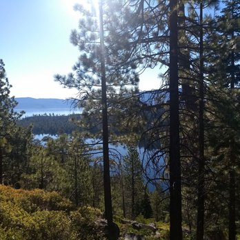


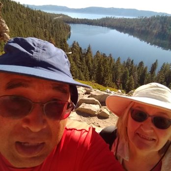

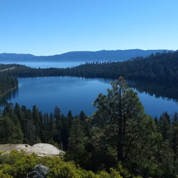


After researching hiking places we hadn't done before I chose this spot because it said it was easy. Hmm, it was not especially difficult but, it was not flat and if you have footing or balance challenges I wouldn't recommend it. If you drive to the end of the campgrounds there is limited parking. We went on a Monday morning and got the last available parking. Otherwise you can park on Hwy 89 and walk in. Parking is free if you are going to cascade falls. Have to pay $10. If you are going to desolation wilderness. I enjoyed this hike. The elevation was not bad but, you are taking small and long steps to get up and down rocks, pebbles and dirt trail. The views are awesome. We saw 2 waterfalls that you can hear from far away. Pine trees, waterfalls, lakes, beautiful outdoors, what's not to like? read more


7 years ago
One of the nicest hikes I've ever been on. Unbelievable views and variety in terrain. Starts out kind of woody at the Bayview Trailhead, then gets rockier as you go up. There are many trees, one was fallen that we had to traverse on the way. The apex of hike takes you to the waterfall which is truly spectacular overlooking Cascade Lake and Lake Tahoe in the background. I could've sat there all day and admired the view. I drank right out of the stream, some of the cleanest water you'll find in the country. I would describe the hike as fairly easy, about two miles there and back. There are some steep points that require careful footing and strength. Truly a gem, I recommend it highly. We need to preserve places like this. I live in LA and it made me want to move to Tahoe. Nature at its finest. read more
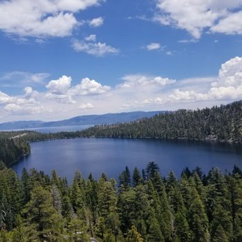
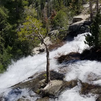

I was quite disappointed from my experience hiking Cascade Falls. I'm pretty shocked so many Yelpers gave it wonderful reviews. I had researched that this was a highly worthwhile hike in Lake Tahoe, yet.....I mean....I couldn't even find Cascade Falls when I arrived! I was expecting some magnificent waterfall, yet when the trail came to it's climax....I was left underwhelmed. Let me just give some background info and details from my explorations here..... Cascade Falls is located in the South Lake Tahoe section. More precisely, the trailhead starts inside of the Bayview Campground near the heart of a lot of the Tahoe action including Eagle Falls, Inspiration Point and Emerald Bay State Park. Coming upon the Bayview Campground, there were clear signs for Cascade Falls that couldn't be missed. I found parking along the main road, though this was early around 8am during the summer time. When I completed my hiking a couple of hours later, as you can imagine....parking had filled up completely! (Funny....for my first time visiting Lake Tahoe.....I was surprised by the amount of congestion throughout. I was expecting a quiet and soothing getaway...imo) The hike to "Cascade Falls" was not difficult. It was only roughly 1.5 miles roundtrip. Though, as I trekked further along the trail, the path did veer off and became very fuzzy in terms of following in the correct direction. Continuing....I did climb along rocks though none of this section was extraneous. Ultimately.....I arrived at what looked like the end of the pathway and climb. But....I was quite confused. I didn't know where to turn to or in which direction to look to find this amazing "Cascade Falls"!!!?? At this "pinnacle" there was a steep ledge and overlook where maybe the falls could have led down to. BE CAREFUL here. I noticed other visitors traversing down rocks and unless you have sturdy shoes, trying to find "Cascade Falls" may be slippery and not worth it. I could have navigated higher into the more mountainous section of this trail....yet there wasn't a clearly marked continued pathway or sign indicator helping to lead me in the right way. So yes....this apex at Cascade Falls left me wanting more. Though..... I must give credit where credit is due. The best part about hiking Cascade Falls was the picturesque scenery all around me. I did stop for some scenic photos of the landscape and looking out onto tranquil Cascade Lake with Lake Tahoe situated in the distance. For those who appreciate nature....the hiking was pleasant. All I'm saying is don't expect to arrive at a majestic waterfall in the end. Another note....when I visited over the summer time back in July, it was early morning and my views gazing out onto the waters and the surrounding backdrop had me looking directly into the sun. So for anyone who has read my prior reviews....yes, this blocked my quality photo taking. I would suggest coming over here in the afternoon where you'd have the sun at your back....and then I believe pictures would be much better served. Just a recommendation for those who care about that stuff, lol. Finally, although most folks have raved about Cascade Falls....it wasn't impressive for me. The hike along the trail is worthwhile, but in the end....I was left wondering "is this it"? "Have I made it to the best part(s)"? "What was all the great talk about"? I'm just trying to temper everyone's expectations....this hike is not all that. read more


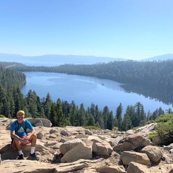

2 years ago

3 years ago
Beautiful views, easy trails lots of rocks to traverse,good for adults and kiddos. Highly recommend read more

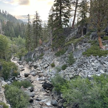
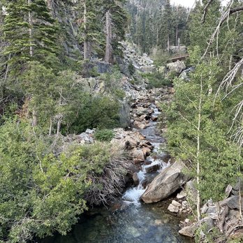


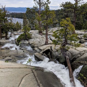


4 years ago
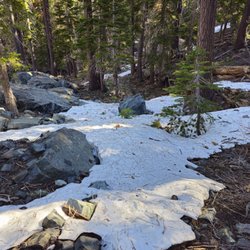
Great hike! Definitely moderate level. I (27) had a great time and found it very enjoyable but my mum (66) had a hard time and needed frequent stops on the way back. Somewhat tricky with the snow so be sure to have good hiking boots. Great spots at the falls to sit and have a little picnic. Excellent views throughout and very friendly people along the way. If you're not used to hiking in higher altitudes be prepared for a more difficult trek. read more


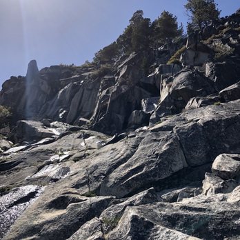


9 years ago
If you're looking for a short hike that packs in a lot of scenery and diversity, Cascade Falls is perfect. There are two lots you can park at-either the Bayview Campground day use area or across the street at the Inspiration Point lot. I would imagine those fill up on weekends or at peak times, but we arrived at 6:30 on a Wednesday summer evening and easily found a spot in the Inspiration Point lot. To get to the trailhead, walk through the campground and find the signs for the Bayview trail. If you go left you will follow the 1 mile trail to the falls. There is also access to Desolation Wilderness from this area but you don't need to fill out a permit if you're just going to the falls. The trail starts out with an easy grade through the pine forest and then eventually you'll wind your way up some granite rocks along the mountainside. To your left you can see Cascade Lake and further out, views of Tahoe. You can start to see the falls around the bend as you approach them and then eventually hear the rushing water. The trail sort of ends as you approach the falls and then you scramble over towards them. Make note of where you exited the trail-it's not clearly marked and if you're exploring the falls and scrambling around the rocks, it might get disorienting to make your way back to the trailhead. The views from the top are spectacular-we were there before sunset after a bit of rain, the clearing skies were amazing. The round trip took us about an hour and 15 minutes but we hurried on the way down to make it back before sundown. Slippery rocks so wear sneakers with good traction-be safe and enjoy! read more


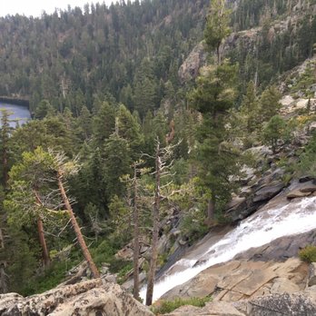
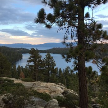


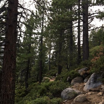


Thanks fellow Yelpers for this hike! We would have driven right by, if we hadn't seen the yelp. Great hike! Scenic! First half of the hike is easy through the forest, then comes the climbing and rocks. We were able to hike as much as we wanted! read more
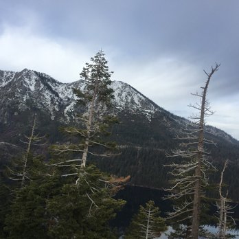


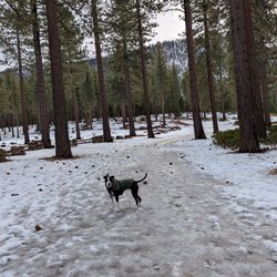
Took my dog here on a hike, and she loved it! The trail is fairly easy, but proper shoes is a must since you will be stepping off of giant rocks along the trail. This is a very scenic hike with plenty of opportunities to take pictures. We also didn't really worry about bugs or mosquitos.. yay! I knocked down one star because sometimes we couldn't tell which direction we needed to go. At one point, we reached a wide open area, and didn't really know where to go... but I guess it doesn't matter since its all open to nature. read more


10 years ago
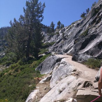
Nice easy hike that's only about 2 miles round trip. Took my friends & I only about an hour long to do this whole hike (not including taking the time to enjoy the view of the lake at the top). This is a great workout to work out your legs. There are some stairs and lots of rocks to get through but nothing too hard. I also saw dogs and kids doing this hike. We came on a Thursday, August 18 and it wasn't crowded at all. There also wasn't much of a waterfall at this time. It was more of a stream of water going thru the rocks. This made it able to walk through the rocks and get a better shot of the lake. One thing that could've been better is to have signs throughout the hike because you can easily get off trail which is what we did. But we were able to get to and back with no problems. read more

7 years ago
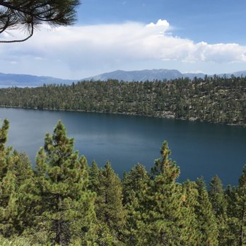
This is a beautiful hike that starts at the back of the Bayview Trailhead Campground. You may park at the back of the campground and start you hike from there or you may park on the highway or across the campground. Parking was free, but can be limited. I arrived at 8 am and there was plenty of parking and left at eleven. I noticed parking was busy at that time. The views were amazing. The hike itself was easy with a rocky path that was well maintained for dogs adults and kids. I would say the path is best for kids above four. The view was of the waterfall. read more
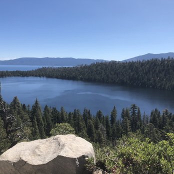


8 years ago

Hiked this trail yesterday, we were told to bring snow shoes but never needed them. Parking is on the street around inspiration point on the way to emerald bay. Hike through the campsite and then you will see the trail head. The hike is moderate with a huge payoff as you make it to the falls! You litterally can put your hands in the water. It will take 1-2 hours round trip at a leisure pace. read more


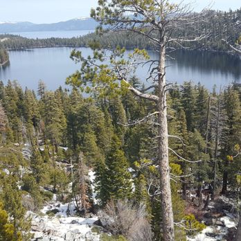

4 years ago

8 years ago
Beautiful view, would've wished the waterfall was full on but overall great. Easy hike, lots of rocks-wear shoes that grip or you could lose your balance on the gravel. read more


8 years ago
Awesome Hike! The directions for this site on yelp is misleading so I use the directions to inspiration point. The parking lot is accross the street from the campground. However I didn't realize it until I got there that there is also parking (limited) if you drive through the campground just before the trail signs. The hike was easy on a good day. I'm sure if it was blazing hot..there be much sweat. Lots of shade along the way and great views. The stream was nice, cold, and refreshing to relax by. I would definitely come here again for a quick need of adventure. read more


6 years ago
Nice moderate hike to see a great view of the tahoe mountains and lake! Approximatey 2 miles round trip. Parking can be hard to find as we parked on the side of the road and walked about a quarter mile up to the bayview campground. That's where the trail is! Must try! read more


10 years ago
Moderate hike. Trail is well maintained and the view of Fallen Leaf Lake is spectacular. You do work up a sweat. Wear good shoes as there are spots where the sand and granite rock are slippery. Lots of people on the trail. But all had trail courtesy. We liked it. read more


9 years ago
This was a fantastic hike unfortunately we started late in the day thinking it would not take much time to get to the falls. The hike to the falls took us only about 45 minutes. There is so much to see and it was such a broad expanse for the falls that soon we got lost and could not find the trail back. Make sure that you know where you're at and how you got there. It is easy to get lost in finding the trail back. We started back about 30 minutes before sunset but we were not able to find the trail back. We got so lost that we were praying for guidance as it got to dark to see. We felt foolish for letting this happen. Our prayers were answered when a volunteer rescue team came along looking for another couple who were lost! They pointed us in the right direction as they went on to find the other couple. So we were not the only fools! Thank you Jesus for those wonderful v volunteer rescue squad. It is well worth the trip and allow plenty of time to explore the Falls area and make sure you know how to get back to the trail at all times. The landscape is awesome and very large area. It is easy to get turned around and not find your path that brought you in. If you are going late in the afternoon make sure you bring flashlights just in case this happens to you. In the dark it is a treacherous trail back. Not difficult but many rocks or toe grabbers along the way. This is definitely a hike you need to take when you're in the lake Tahoe area. read more


8 years ago

8 years ago

9 years ago
9 years ago

10 years ago

9 years ago
5 years ago

9 years ago

9 years ago
10 years ago
9 years ago
More info about Cascade Falls
South Lake Tahoe, CA 96150
Directions
Visit Website
http://www.tahoeadventuresports.com/hikeindex/west/cascade.htm
Hours
Indoor Amenities
Outdoor Amenities
Ask the Community - Cascade Falls
Review Highlights - Cascade Falls
You might also consider





















Why does Yelp recommend reviews?
1 review that is not currently recommended
The reviews below are not factored into the business's overall star rating.

6 years ago
Cascade Falls - hiking - Updated May 2026
Best of South Lake Tahoe
People found Cascade Falls by searching for…
Things to Do in South Lake Tahoe, California
Hiking Trails in South Lake Tahoe, California
Free Snow Play in South Lake Tahoe, California
Beaches in South Lake Tahoe, California
Scenic View in South Lake Tahoe, California
Watch Sunset in South Lake Tahoe, California
Campgrounds in South Lake Tahoe, California
Things to Do at Night in South Lake Tahoe, California
Parks in South Lake Tahoe, California
Free Parking in South Lake Tahoe, California
Places to Take Pictures in South Lake Tahoe, California
Waterfall Hike in South Lake Tahoe, California
Sunrise View in South Lake Tahoe, California
Dog Friendly Beaches in South Lake Tahoe, California
Playgrounds in South Lake Tahoe, California
Walking Trails in South Lake Tahoe, California
Dog Friendly Trails in South Lake Tahoe, California
Tourist Attractions in South Lake Tahoe, California
Easy Hikes in South Lake Tahoe, California
Hiking Trails Kid Friendly in South Lake Tahoe, California
Landmarks in South Lake Tahoe, California
Running Routes in South Lake Tahoe, California
Trending Searches in South Lake Tahoe, CA
Boat Rental near Cascade Falls
Botanical Gardens near Cascade Falls
Bounce House Rentals near Cascade Falls
Campgrounds near Cascade Falls
Cherry Picking near Cascade Falls
Cliff Jumping near Cascade Falls
Dog Friendly Things To Do near Cascade Falls
Flower Shop near Cascade Falls
Garage Sales near Cascade Falls
Lookout Points near Cascade Falls
Nurseries & Gardening near Cascade Falls
Outdoor Activities near Cascade Falls
Outdoor Furniture Stores near Cascade Falls
Party Equipment Rentals near Cascade Falls
Pick Your Own Farms near Cascade Falls
Picnic Areas near Cascade Falls
Rainy Day Activities near Cascade Falls
Rock Quarry near Cascade Falls
Running Trails near Cascade Falls
Scenic Drive near Cascade Falls
Secret Spots near Cascade Falls
State Parks near Cascade Falls
Sunrise View near Cascade Falls
Swimming Holes near Cascade Falls
Table And Chair Rentals near Cascade Falls
Browse Articles
Browse Nearby
BEST of South Lake Tahoe, California Coffee near Cascade Falls
BEST of South Lake Tahoe, California Things to Do near Cascade Falls
BEST of South Lake Tahoe, California Restaurants near Cascade Falls
BEST of South Lake Tahoe, California Breakfast near Cascade Falls
BEST of South Lake Tahoe, California Walking Trails near Cascade Falls
BEST of South Lake Tahoe, California Parks near Cascade Falls
BEST of South Lake Tahoe, California Campgrounds near Cascade Falls
BEST of South Lake Tahoe, California Sightseeing near Cascade Falls
BEST of South Lake Tahoe, California Visitor Centers near Cascade Falls
Browse Brands
Related Searches in South Lake Tahoe, CA
Affordable Kayak Rental Services in South Lake Tahoe, California
Best Fishing Locations and Guides in South Lake Tahoe, California
Best Places for Horseback Riding in South Lake Tahoe, California
Best Sledding Spots and Fun in South Lake Tahoe, California
Best Waterfalls and Swimming Holes in South Lake Tahoe, California
Check Out Off Road Trails in South Lake Tahoe, California
Discover Dog Friendly Trails to Explore in South Lake Tahoe, California
Discover Kid Friendly Hiking Trails in South Lake Tahoe, California
Discover Scenic Waterfall Spots in South Lake Tahoe, California
Discover a Hiking Trail in South Lake Tahoe, California
Discover the Best Night Hike Trails in South Lake Tahoe, California
Dog-Friendly Hikes With Dogs in South Lake Tahoe, California
Enjoy Camping Adventures Around South Lake Tahoe, California
Enjoy Exciting Mountain Biking Adventures in South Lake Tahoe, California
Enjoy Kayaking Adventures in South Lake Tahoe, California
Enjoy Tent Camping Spots Around South Lake Tahoe, California
Enjoy a Beautiful Waterfall Hike in South Lake Tahoe, California
Enjoy the Best Picnic Spots and Ideas in South Lake Tahoe, California
Enjoy the Best Tubing Experiences in South Lake Tahoe, California
Enjoy the Best Walking Path in South Lake Tahoe, California
Enjoy the Best Walking Trails in South Lake Tahoe, California
Experience Thrilling White Water Rafting in South Lake Tahoe, California
Explore Beautiful Parks and Green Spaces in South Lake Tahoe, California
Explore Easy Hikes Perfect for All in South Lake Tahoe, California
Explore Fun Activities to Do in South Lake Tahoe, California
Explore Nature Spots Around South Lake Tahoe, California
Explore Popular Campgrounds Near South Lake Tahoe, California
Explore the Best Beach Spots in South Lake Tahoe, California
Explore the Best Boating Spots in South Lake Tahoe, California
Explore the Best Swimming Holes Around South Lake Tahoe, California
Explore the Best Trail Options in South Lake Tahoe, California
Family Friendly Hiking With Kids in South Lake Tahoe, California
Find Beautiful Views in South Lake Tahoe, California
Find Fun Kids Activities Outdoor in South Lake Tahoe, California
Find Popular Ziplining Spots Around South Lake Tahoe, California
Find the Best Scenic View Locations in South Lake Tahoe, California
Hike the Popular Waterfall Trail in South Lake Tahoe, California
Hiking Trails With Waterfalls in South Lake Tahoe, California
Off Leash Dog Hiking Trails in South Lake Tahoe, California
Plan a Scenic Drive Route Near South Lake Tahoe, California
Popular Outdoor Activities to Try in South Lake Tahoe, California
Popular Picnic Spots to Visit in South Lake Tahoe, California
Safe River Swimming Areas in South Lake Tahoe, California
Safe and Fun Parks for Kids in South Lake Tahoe, California
Top Running Trails to Explore in South Lake Tahoe, California
Top Swimming Lakes to Enjoy in South Lake Tahoe, California
Top Swimming Spots and Pools in South Lake Tahoe, California
Top Things to Do With Kids in South Lake Tahoe, California
Walk Dog Friendly Hiking Trails in South Lake Tahoe, California
Walk the Best Paved Walking Trails in South Lake Tahoe, California
People who viewed Cascade Falls also viewed

Rubicon Trail
58 reviews

Mount Tallac Trail
91 reviews

Lam Watah Trail to NV Beach
20 reviews

Desolation Wilderness
34 reviews

Emerald Bay State Park
302 reviews

Glen Alpine Trailhead
7 reviews

Lower Glen Alpine Falls
47 reviews

Inspiration Point
33 reviews

Spooner Summit
17 reviews

Bayview Trailhead-Bayview Campground
21 reviews