1. Crooked River Ranch Cabins

0

Terrebonne, OR

Cancel

Open app

Search

Crooked River Ranch Cabins

3.5 (14 reviews)
Closed • 9:00 am - 10:00 pm

Crooked River Ranch Cabins Photos

You might also consider

More like Crooked River Ranch Cabins

Recommended Reviews - Crooked River Ranch Cabins

Your trust is our priority, so businesses can't pay to alter or remove their reviews. Learn more about reviews.
Yelp app icon
Browse more easily on the app
Review Feed Illustration

5 months ago

Helpful 0
Thanks 0
Love this 0
Oh no 0
Photo of Amanda C.
16
83
60

1 year ago

Helpful 0
Thanks 1
Love this 0
Oh no 0

2 years ago

Helpful 0
Thanks 0
Love this 0
Oh no 0
Photo of Ami N.
0
63
36

7 years ago

Helpful 1
Thanks 0
Love this 0
Oh no 0

6 years ago

Helpful 2
Thanks 0
Love this 0
Oh no 0

9 years ago

Helpful 0
Thanks 0
Love this 0
Oh no 0

9 years ago

Helpful 0
Thanks 0
Love this 0
Oh no 0

8 years ago

Helpful 0
Thanks 0
Love this 0
Oh no 0

6 years ago

Helpful 0
Thanks 0
Love this 0
Oh no 0
Photo of gwen a.
32
20
20

12 years ago

Business owner information

Photo of Sean R.

Sean R.

Helpful 0
Thanks 0
Love this 1
Oh no 0

13 years ago

Business owner information

Photo of Sean R.

Sean R.

Helpful 0
Thanks 0
Love this 1
Oh no 0

11 years ago

Helpful 1
Thanks 0
Love this 0
Oh no 0

9 years ago

Smelly disgusting sheets on futon in Cabin 3. Worst experience ever. Will not stay here again. Owners denied all responsibility.

Business owner information

Photo of Sean R.

Sean R.

Helpful 0
Thanks 0
Love this 0
Oh no 0
Photo of M L.
0
6
0

11 years ago

Helpful 0
Thanks 0
Love this 0
Oh no 0

Ask the Community - Crooked River Ranch Cabins

Broken Top Mountain

Broken Top Mountain

4.5(2 reviews)
32.9 mi

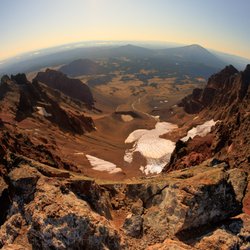
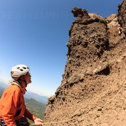
Depending on your experience level and head-space, this is either an extremely heady "hike" or an…read moreeasy climb. This is 99% a hike, but once you near the summit, you will definitely have to do some rock climbing moves. They are easy moves, easier than anything you'd find in a rock gym, but the rock is a little loose. This is the Oregon Cascades after all, where the mountains feel like they are made out of epoxy and kitty litter! The summit views are tremendous though. Almost all the Oregon Cascades are visible (from N-to-S): Hood, Jefferson, The Three Sisters (this is an excellent place to photograph South Sister), Bachelor, etc. The best views though, are peering right down into the massive summit crater of Broken Top. Bring a wide-angle lens! Expect this to take a full day. I recommend starting EARLY. (before sunrise)

This is one of my favorite mountains to climb, but also one of the more dangerous hikes I have been…read moreon. This mountain looks as if it has blown its top, but according to a couple of geology classes I have taken, the cone at the top has been eroded by glaciers. Which is almost as cool. Another noticeable feature to this mountain is its location compared to the other mountains in the Cascade Range in this area. The Three Sisters, Mount Bachelor, Mount Jefferson, and Mount Thielson are all in the same linear path. But Broken Top is west of this path. What is important about that is that when you get to the top of Broken Top you are actually given a different perspective of the other mountains. You are looking at the Cascade Moutain Range as if you are flying above them. Now if you combine this with the fact that you can drive pretty close to the base of this mountain. You have a pretty awesome combination. There are a couple ridges that you can take to get to the top of Broken Top. I have only been on the southern ridges. From what I am told, this is not the safest path to take. I don't recommend it unless you are an experienced climber. My friends and I took this path because it is the shortest. The downside is that it is fairly steep and does not lead you to officially summit the top. We both had some close calls on this ridge. The terrain is so steep that once you misstep and start sliding you have a really hard time stopping. I had started to slide on this ridge a couple of times and was very lucky to have caught my arm on some rocks before sliding off of a cliff. Next time we will be sure to take the ridge to the north. From what I am told, it is longer but much safer and takes you to the official summit. The hike itself is very beautiful. You start above the treeline somewhat and follow the trailhead. You will find an old canal and some melting glaciers in the summertime. Once you enter the valley you will see that you are inside the bowl of Broken Top. Everyone I have talked to seems to all agree that this reminds you of the video game Halo. As the bowl looks like the giant halo around the planet that you see. From here you will want to pick the ridge you plan on climbing up. I recommend passing on the south ridge and walk around to the north ridge. This trail is located in the three sisters wilderness and it important to remember that help is not close. So you will want to be extra careful. As you may not even have cell coverage. The terrain and the ecology around here are fragile, so you will want to be respectful and travel along durable paths and not leave any trash on the ground. Obey the rules and make safe decisions and you will have a five-star experience. Here is a link to the land management agency that manages this land https://www.fs.usda.gov/recarea/deschutes/recarea/?recid=38808 Here is a lin to a map and elevation gain and loss to the different routes https://www.alltrails.com/trail/us/oregon/broken-top-trail Here are some more summit tips on this mountain http://www.summitpost.org/broken-top/150574

Photos
Broken Top Mountain
Broken Top Mountain
Broken Top Mountain

See all

Three Fingered Jack - Lunch break view

Three Fingered Jack

3.0(2 reviews)
29.7 mi

One summer weekend, in 2018, the forecast called for west south west winds which blew the forest…read morefire smoke away from Sisters, so I decided to do a hike at Three Finger Jack. It's about a 13 to 14 mile round trip. The first three miles the dirt in several spots is very soft, like sand. For me that was the bummer part of this hike. Especially if your pack is 30 lbs, plus your body weight. Your striding along all of a sudden the soft dirt breaks your stride. :-| I was hoping to pick fresh wild berries. Unfortunately, other hikers beat me to them. I was lucky to find two berries; which I took a photo of before I picked them. This berry is part of the blueberry family (see photo). I took a break and found a great spot with a fantastic view. This area would be an awesome future camping spot. I setup my hammock and had a late lunch. A mild wind kept this area cool, and I felt so comfortable I took a short nap. When I awoke the view hadn't changed. As one of my friends would say, "it's a million dollar view!" I continued on the trail and finally came to view Three Finger Jack. I sat down looking at the details of Three Finger Jack. My objective was to view Three Finger Jack and plan another time to camp and conquer Jack. I'm hoping to find a hiking buddy to join me. Jack's a brittle kind of a guy. One false move, you'll have a quick way down. :-0 While hiking back down, I again came across the view of Black Butte. To the left, wild fire smoke was returning (see the before and after photos). As I arrive back to the trail head I saw a cool scene of a deer looking for dinner.

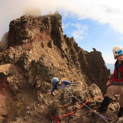
See that craggy, busted, pinnacle of friable rock on your right as you're driving into Bend from…read morePortland? The one just north of that nipple-looking one*? That's Three Fingered Jack. If you happen to live in Oregon and also happen to want to do some *alpine* rock climbing in Oregon, this is one of your only choices. (that nipple I describe above is your other) The rock quality on both is horrendous. If this rock were in Washington or California, no one would climb it. It breaks, it sheds, it's hard to protect. It reminds me of the Chugach up here in Alaska. At least the approach is short. Take the PCT north for about 3-4 miles. Eventually, you'll see TFJ (if you want to be seen as kewl by other peak baggers, this is how you should represent this mountain in text). You really, truly, cannot miss it. Once you see it, pick the least horrible way to hoof it up the loose dirt/gravel/scree/choss and up onto the higher parts of the peak. Eventually, you'll come to an awkward traverse. This is "The Crawl**". Some folks protect TC, some folks don't. I climbed it protected because I was new to all things alpine and someone else rigged up all the ropes for me. I didn't find it to be that bad. Would I climb it unprotected? Maybe. Should you? I don't know dude, risk management is a personal thing. Maybe you should think about it for a while. After negotiating TC, you'll reach the summit block. This pillar of petrified poo is rated at 5.0-5.2 depending on which crusty, old-timey mountaineer you ask. The climbing is easy, but it doesn't protect all that well. People usually plug some small cams. I'm very comfortable taking a fall on small cams when compared to my peer-group. I don't think the placements here are very good. Remember rule 000001 of climbing: don't fall. If you're just a hiker, I would NOT recommend YOLO-ing up this fucker in your Keens! This is easy rock climbing, but it is absolutely rock climbing. This ain't no scramble, go back to Chow if you're looking for one of those! There's usually a whole mess of tat on the summit, so you can rappel back down the small face of portable-chickenhead-hand-holds. Despite the abysmal rock quality, TFJ is still worth tagging. Once. Why? The approach is short and the views of Mt Jefferson are stunning. (FYI cool kid: if you want to sound hip when talking about Mt Jefferson, call it "Jeffy". Also: talk constantly about how the only route worth doing is Jeff Park Glacier. But *never* call it that, just shorten it to "Jeff Park") If you're feeling really freaky, you can also easily attempt TFJ in the winter. The road is plowed. The summit block? It's often coated in beautiful-but-impossible-to-protect rhyme ice. Good luck, friend. *The nipple is Mt Washington. **When I lived in Oregon, I found that TC was a good benchmark for gauging the mental toughness of prospective climbing partners. If you want to do this too, it could go like this: "Hey, you ever climb TFJ?" "Yeah bro." "So...whudja think of 'The Crawl'?" "Fawk brah, that shit was easy! I could've sprinted through it in my Crocs!" That guy could be someone you want to climb with. He could be a confident, sure-footed climber and a natural leader. Or he could just be a loose-cannon with a deathwish. Use your own judgment. Pay attention to body language.

Photos
Three Fingered Jack - Such a young punk!

Such a young punk!

Three Fingered Jack - The Crawl

The Crawl

Three Fingered Jack - Summit block

See all

Summit block

Timberline Mountain Guides - Sunrise

Timberline Mountain Guides

4.7(14 reviews)
26.1 mi

I just completed TMG's Mount Hood Silcox Hut Summit program (6/15-16)…read more The staff at TMG were great making sure we had all the necessary equipment for every condition you might encounter on the mountain, including rental gear that was in great condition. They also make sure you have the necessary skills to safely climb the mountain and provide the instruction in an easy to understand and comfortable way. The Silcox Hut is an amazing surprise to this program by providing comfortable and surprisingly luxurious accommodations for being situated halfway up a mountain! The "hut keeper" Steve was not only welcoming and an amazing host but an incredible cook providing delicious and varied dishes. Our guide, Max, was a knowledgeable, helpful and very patient person. His professionalism and experience were evident throughout the trip and made sure we made it safely to the summit and back down. I would specifically ask for him when you book your trip!

My climbing partner and I had a glorious, exhilarating climb up North Sister. We always climb with…read moreTMG with wonderful experiences in the past, and this time was no exception. It was a very challenging climb, but we always had perfect confidence in our guide, Geoff Lodge. We learned new climbing techniques and exceeded what we previously thought were our capabilities. We are two women (of a certain age but fit), and Geoff, and all of our other guides from TMG, have had tremendous confidence in us and gave us the tools and security to succeed.

Photos
Timberline Mountain Guides - Route to the summit

Route to the summit

Timberline Mountain Guides - Summit of Mt. Hood

Summit of Mt. Hood

Timberline Mountain Guides - Silcox Hut

See all

Silcox Hut

Mt Jefferson

Mt Jefferson

5.0(1 review)
32.0 mi

Ah, Mt Jefferson…read more "Jeffy". A true mountain-man's mountain. How do I mean? Well, how many people do you think can name the 2nd-tallest mountain in Oregon? Probably not many. I know very few (non-climber) Oregonians that even know this factoid. It doesn't have a ski resort on it. It's not clearly visible from any major metro. It's hard to climb in the winter. A rope is must for most people. Jeffy is quite a bit harder to summit than Wy'east (Hood) to the north. The first time I attempted Jeffy, I failed. We tried to climb it via the Whitewater Glacier route (not recommended, what a slog) and some folks got gun-shy about 700 vertical feet from the summit. The call was made to turn everyone around. I came back a year later with a much stronger team and climbed the excellent Jeff Park Glacier route. It's got a little bit of everything: backpackin', glacier sloggin', ice climbin', rock climbin', and hours and hours of crampon scrapin' (seriously, on summit day we had our crampons on for like 20 hrs...closest I've gotten to what I imagine it's like to wear high heels all day) Our biggest mistake was the descent. We rappelled the East Face. Look at me: DO NOT do that. It seems like it would save time but the rap-stations are never-ending and the rock fall is horrendous. One of our ropes nearly split in two from a rock impact. The best descent route for Jeff Park is the crappy Whitewater Glacier route I ridiculed above. I know, I know. Sorry, being safe isn't always the same as being fun.

Photos
Mt Jefferson
Mt Jefferson
Mt Jefferson - Our route

See all

Our route

Crooked River Ranch Golf Club - The famous #5 Canyon Hole in the foreground.

Crooked River Ranch Golf Club

3.5(12 reviews)
0.6 mi

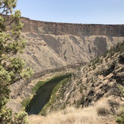
Solid, par 71 course located along the spectacular Crooked River canyon. It's fairly easy, rated…read moreonly 66.5/113 from the longest tees, the blues (the 'short' blues - they can set up longer blue tees on four holes which ups the rating to 67.4/116). - Prices are in line with other Central Oregon courses. I found a coupon in the Smart Saver which saved me a bit of cash. Senior rates available for those over 60. - The course is not on the GolfNow app. You'll need to go through their own website or call to get a tee time. - The facility has a moderate-sized driving range and two practice greens. No short game area (practice bunker). - Free range balls with a tee time. Just fill up a basket at the ball dispenser and have at it. I have never seen this at other than top end courses. - Smallish but well-stocked pro shop. - Carts are electric, no frills such as GPS. You can drive them to the parking to load/unload your clubs. Access to the parking lot is via a narrow corridor between buildings on your left as you exit the pro shop from the rear. - Crooked River is quite walk-able. Its short and has little elevation change. - They have a beverage cart but it only came around once on a round when the temperature was low 90's. Beverage cart does not stock a sugar-free sports drink! Boo! - Parking is inadequate. It's shared with the other Crooked River Ranch facilities. I was lucky to snag the last spot on a weekday round. I suppose they have an overflow lot somewhere. The course itself: - Greens are close to immaculate and I played my first round during the heat of summer. Balls roll true. Which is especially important because some of the greens are diabolical with slopes and tiers. Perhaps the most challenging aspect to the course. - Fairways are wide and forgiving. If you can drive even close to straight, you'll be fine. There are a couple of doglegs that require clubbing down. I never had a bad lie in the fairway. - Rough is playable until you get into the 'second cut', if you will. Then you may be in a typical Central Oregon lava field. - Not many water hazards. Your approach shot on #8 is over water and if you hook it off #5 or slice off #13, you're in the canyon. - Bunkers seem to be in good shape. I managed to avoid them all. - On the tee at #13, if you can, take the short walk down to the canyon edge (random dirt paths) to check out the views. Awesome. - The course has colored rocks indicating distance to the green, as is typical of most courses. But the distances on some holes seemed to differ quite a bit from what my GPS golf app had. All in all, a fine course and one I'll put on my rotation. It's a bit of a drive from Bend but worth it.

The skinny guy with mustache working the pro shop was incredibly rude to me. The views are nice…read morecourse not in great shape. Save your money and time avoid this place.

Photos
Crooked River Ranch Golf Club - Free range balls with a tee time

Free range balls with a tee time

Crooked River Ranch Golf Club - #10 tee

#10 tee

Crooked River Ranch Golf Club - #13 view

See all

#13 view

Crooked River Ranch Cabins - climbing - Updated November 2026

Loading...
Loading...
Loading...