Cosmic Ashtray Photos


You might also consider
More like Cosmic Ashtray
Recommended Reviews - Cosmic Ashtray
Start your review...

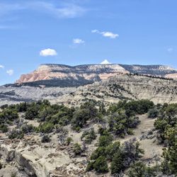
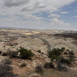
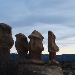
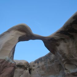
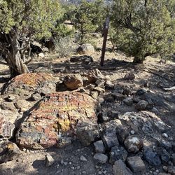
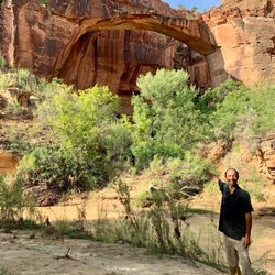
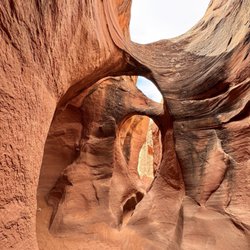
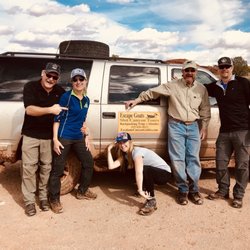
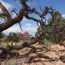
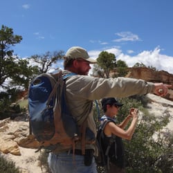
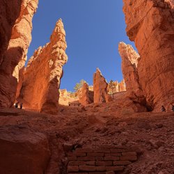
Cosmic Ashtray is a really unique place within Grand Staircase Escalante National Monument. Relatively unknown place and hidden, but it is a monument you won't see anywhere else. More detail in my blog https://himebackpacker.blogspot.com/2025/01/cosmic-ashtray-grand-staircase.html read more


More info about Cosmic Ashtray
Escalante, UT 84726
Directions
Hours
Outdoor Amenities


Cosmic Ashtray - hiking - Updated June 2026
Best of Escalante
People found Cosmic Ashtray by searching for…
Things to Do in Escalante, Utah
Hiking Trails in Escalante, Utah
Walking Trails in Escalante, Utah
Watch Sunset in Escalante, Utah
Running Trails in Escalante, Utah
Secret Spots in Escalante, Utah
Places to Run in Escalante, Utah
Star Gazing in Escalante, Utah
Dog Friendly Parks in Escalante, Utah
Secluded Spots in Escalante, Utah
Trending Searches in Escalante, UT
Browse Articles
Browse Nearby
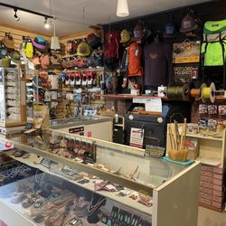
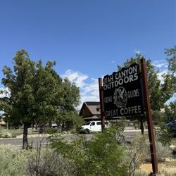
BEST of Escalante, Utah Coffee near Cosmic Ashtray
BEST of Escalante, Utah Restaurants near Cosmic Ashtray
BEST of Escalante, Utah Parks near Cosmic Ashtray
BEST of Escalante, Utah Swimming Holes near Cosmic Ashtray
BEST of Escalante, Utah Breakfast near Cosmic Ashtray
BEST of Escalante, Utah Things to Do near Cosmic Ashtray
BEST of Escalante, Utah Campgrounds near Cosmic Ashtray
Browse Brands
Related Searches in Escalante, UT
Best Fishing Locations and Guides in Escalante, Utah
Best Lookout Points to Visit in Escalante, Utah
Best Nature Trails for Hiking in Escalante, Utah
Best Places for Horseback Riding in Escalante, Utah
Best Spots for Star Gazing in Escalante, Utah
Check Out Off Road Trails in Escalante, Utah
Discover Dog Friendly Trails to Explore in Escalante, Utah
Discover Popular Bike Trails in Escalante, Utah
Discover Top Nature Parks to Visit in Escalante, Utah
Discover a Hiking Trail in Escalante, Utah
Enjoy Camping Adventures Around Escalante, Utah
Enjoy Exciting Mountain Biking Adventures in Escalante, Utah
Enjoy Scenic Night View Experiences in Escalante, Utah
Enjoy Tent Camping Spots Around Escalante, Utah
Enjoy the Best Picnic Spots and Ideas in Escalante, Utah
Enjoy the Best Walking Trails in Escalante, Utah
Exciting Cliff Jumping Spots in Escalante, Utah
Experience Stunning Sunset Views in Escalante, Utah
Explore Beautiful Parks and Green Spaces in Escalante, Utah
Explore Easy Hikes Perfect for All in Escalante, Utah
Explore Nature Spots Around Escalante, Utah
Explore Popular Campgrounds Near Escalante, Utah
Explore Popular RV Parks Around Escalante, Utah
Explore Popular Scenic Overlook Points in Escalante, Utah
Explore Popular View Points Around Escalante, Utah
Explore Scenic Lakes to Visit in Escalante, Utah
Explore the Best Trail Options in Escalante, Utah
Family Friendly Hiking With Kids in Escalante, Utah
Find Beautiful Views in Escalante, Utah
Find Fun Kids Activities Outdoor in Escalante, Utah
Find Top Dog Friendly Parks to Visit in Escalante, Utah
Find the Best Parks for Picnics in Escalante, Utah
Find the Best Playgrounds to Visit in Escalante, Utah
Find the Best Scenic View Locations in Escalante, Utah
Hiking Trails With Waterfalls in Escalante, Utah
Must-See Tourist Attractions Around Escalante, Utah
Off Leash Dog Hiking Trails in Escalante, Utah
Perfect Spots to Watch Sunset in Escalante, Utah
Picnic Areas With BBQ Pits Available in Escalante, Utah
Plan Nature Center Visits in Escalante, Utah
Popular Fishing Spots to Explore in Escalante, Utah
Popular Picnic Spots to Visit in Escalante, Utah
Popular Things to Do in Escalante, Utah
Relax at Natural Hot Springs Near Escalante, Utah
Safe River Swimming Areas in Escalante, Utah
Safe and Fun Parks for Kids in Escalante, Utah
Top Playgrounds for Kids to Enjoy in Escalante, Utah
Top Running Trails to Explore in Escalante, Utah
People who viewed Cosmic Ashtray also viewed
Escalante Natural Bridge
2 reviews
Grand Staircase Escalante National Monument
11 reviews
Zebra Slot
5 reviews
Peekaboo Loop Trail
3 reviews
Tropic Trail
1 review
Grand Staircase ATV Tours
2 reviews
Figure 8 Combination
3 reviews
Full Moon Hike
1 review
Bryce Canyon Off Road Rentals
1 review
Bryce-Zion Trail Rides
1 review