1. Tunnel Slot
,
Cancel
Open app
Search
Sign Up
Log In
Nearby
Bookmarks
Start a Project
Add a Business on Yelp
Add Review
Directions
Add Photo
More like Tunnel Slot
Swimming Holes
Canyoneering
Trail
Hiking Trails
Start your review...
Get app
1 year ago
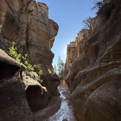
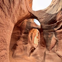
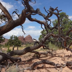
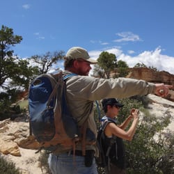
What a beautiful hike and the Tunnel Slot Canyon did not disappoint. There was no water when we went (we were kind of disappointed) but had a great day hiking there and back. A must see if you're in the area. read more
Tunnel Slot - Tunnel Slot Canyon - Hiking Near Me
Escalante, UT 84726
Hours
What time does Tunnel Slot open?
What time does Tunnel Slot close?
Does Tunnel Slot have parking?
Yes, Tunnel Slot has parking options.
Get access to customer & competitor insights.
Amazingly huge and remote place to explore! We only tackled one trail for the first visit, Lower…read moreCalf Creek Falls. It's an easy, 6-mile hike with minimal elevation change, and a stunning waterfall at the end! Definitely bring plenty of water and sun protection- small sections of shade but plenty of non-shaded areas. A fantastic introduction to this area- plenty of red rocks too. Either display your America the Beautiful parks pass on your dashboard, or pay for a day pass and display in your car (this almost certainly varies in different parts of the park- but signage was pretty good in this trail area).
Wow what breathtaking views! We enjoyed our time exploring the area. Parts of the roads were…read morenarrow but still enjoyed it.
View from Powell Point Vista in Grand Staircase-Escalante National Monument
Overlook at Upper Valley Granaries in Grand Staircase - Escalante National Monument
See all
The Devils Garden turn off is on the way to Hole in the Wall. Dirt Road…read more At parking , there is a rest room , no trash. The Actual Garden is a 4 mile unmarked trail trek These photos are within 1000 yards of parking. Great 2 Hours.
We had an amazing time at Devils Garden. Be aware the end of the road is dirt so it can get sketchy…read moreif there's been rain recently. We made it through some mud and were treated to some great closeup views of hoodoos there. On the way back we were treated to a close up view of a cattle drive that passed our stopped car. We loved the whole experience!
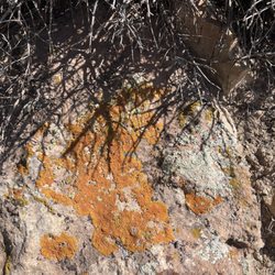
We did the one mile walk and it was super. We saw lots of…read more50 million year old petrified wood as it was created when this area was a sea bed. It wasn't everywhere , but pieces were well marked in the map given at the gate. Colors you have never seen. 600 year old trees still living. Types of cactus i ve never seen And if you know about Lichen, there were many many growths in multiple types and colors. Lichen is alive in full sun and partial shade. There are over 16,000 types in the world. You are highly discouraged to not keep anything you discover. I obey. I went to a rock shop to buy what i saw today. Great Day!
As part of our family trip to Utah's National Parks, we stayed at Utah State Parks since they had…read moreopenings. It was a good choice. This is a nice state park with friendly staff and clean facilities. You get access to clean restrooms with showers and even a dishwashing area. These are excellent amenities and exactly what you need after a long day of hiking the nearby national parks. In addition, the park itself has some hiking and recreational activities available and is located on a scenic reservoir. Very good state park.
Orange lichen
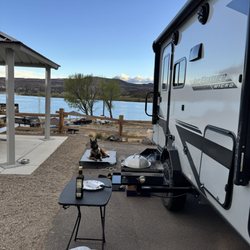
Site 49
Nice little visitor center in Big Water, on the south side of the Monument. Very good scientific…read morereview of the Staircase.
This is Escalante Natural Bridge within the heart of Grand Staircase Escalante National Monument…read more It stands at 130 feet high and is located along a 2-mile trail each way just off Highway 12 in Escalante, Utah. To be more precise, the parking lot and trailhead sit 14 miles outside the small town of Escalante. I wasn't so impressed with this Escalante Natural Bridge. If you look up at it...it sort of blends in with the rest of the backdrop. It doesn't really stand out shining by itself high above the canyon floor. My best interpretation of how I witnessed it was like trying to find a hidden object within a colorful collage. And I don't mean to be so specific...but all I'm saying is that overall, the view didn't really "wow" me. I guess I had high expectations since everything in Utah seems to be wondrous...just after trekking all the way to arrive at it, the appearance fell flat. Let me explain the 4-mile roundtrip hike along this Escalante Natural Bridge Trail.... It was difficult. And I don't mean in terms of strenuous...the trail is all along flat ground. I'm talking about having to cross 4 different rivers/streams just to make it here! Yes, be prepared to either take your shoes off and walk barefoot (which I did) or come with water shoes or flip flops! And the water in the rivers (for me being 5 foot 10 inches) actually got up to my knees. I was a little scared traversing these sections. Biggest point of all is that I highly advise you to be mindful about the path of the trail. There are no signs, and you just have to follow footprints embedded in the sand. At times, trust the most logical pathway of the trail. I can't recall the number of moments I had to pause from hiking and backtrack because I took a wrong turn! The 2 miles each way were tough and I had to take my time going slowly. It felt as if the journey lasted 10 miles to get to this Escalante Natural Bridge! In total, I at least used half the day grinding the 4 total miles...grrr! This Escalante Natural Bridge is one of the big highlights for exploring Escalante NM and, there is a 5th stream you can cross to try and capture better/more accessible views looking up at the bridge. Overall, the appearance wasn't so rewarding in my opinion. I tried finding better vantage points but wasn't successful. Though...when I looked at pictures on the internet, I did find more scenic photos than the area I was standing in front of. For those adventurous ones out there hoping to discover better spots for what makes this Escalante Natural Bridge so special...then maybe you can go ahead at your leisure and climb more rocks or even continue further along the trail. I decided to call it quits and return to the trailhead. I accepted my journey's fate and was okay with leaving with the pictures I had taken. Oh well. Not everything can be perfect. I would like to quickly recommend another hike right nearby that was the ultimate best memory from my time in Grand Staircase Escalante. It's called Lower Calf Creek Falls. This was a 6-mile roundtrip trail that took me to Lower Calf Creek Waterfall...simply a stunning waterfall that is an absolute MUST DO! So majestic! I'd say Lower Calf Falls is maybe 3 miles down the road from here on UT - Highway 12. So, although this Escalante Natural Bridge was okay...it's worthwhile in that it can be paired together with Lower Calf Creek Falls. You might as well hike both of them since they're so close to each other. And then for those spontaneous travelers out there...you can actually camp out for the evening in Lower Calf Creek Campground...a terrific setting in nature. Just some final details about Escalante Natural Bridge.... I visited on a Saturday in late July of 2021, and I was virtually the only person hiking on this trail. It's pretty remote and quiet. You can use Google Maps to find the trailhead for not just here at Escalante Bridge, but for Lower Calf Creek Falls as well. In general, Grand Staircase Escalante NM is mostly navigated along dirt roads. It'd be very helpful if you had a 4x4 vehicle to drive to some of the hard-to-reach landmarks. For myself I only had a compact car, so I was limited in the amount of exploring I was able to do. Before coming here and to Lower Calf Creek...you can first stop in at the Escalante Interagency Visitor Center. Park rangers provide maps, and they'll offer any advice and itineraries for helping you plan out your days. Alright. This is Escalante Natural Bridge along a 2-mile pathway here in Grand Staircase Escalante National Monument.
Crossing another river to get to the bridge. Don't be frustrated. Try to embrace it, lol.
Standing under a tree looking up at the bridge. It wasn't so scenic because the bridge blended in with the background.
This is Escalante Natural Bridge.
The Toadstool Hoodoos are cool rock formations formed by differential erosion. They look like…read moremushrooms, as the harder rock caps and protects the softer rock underneath. The hike is an easy 1.5 miles. The views at the end are worth it, and you can get close to the rock formations as you like (although don't topple the rocks!). It's suitable for families with small children. If you don't mind driving on an unpaved road (I did it in a 2WD sedan), check out House Rock Valley Road for unparalleled views of the landscape with swirling sandstone, painted hills, and other cool rock formations. Check out the Wire Pass Trail for amazing slot canyons, although check the weather. If there's any chance for rain, do not enter the slot canyons since the formations channel water and form deadly floods in the canyon. The visitor center in Kanab is huge, with lots of good pamphlets and displays about the geology and archaeology of the area.
This feels like a review in progress because the area is so large - but was pleasantly surprised by…read morehow much more I want to explore this region. We did Willis Creek Narrows and Lower Calf Creek Falls - both incredible. Now adding to the wish list for return trips. The drive along US 12 is just spectacular. Definitely recommend a high clearance vehicle with 4WD to access some of the more remote locations. Be prepared to adventure and bring what you need as this is not a manicured national park, but more a haven for those looking for an off-grid escape.
Visitor center
Peek-a-boo is tight, fun and fairly easy with amazing colors and really interesting rock…read moreformations. Spooky is a lot harder. We had a guide, Gary, from Roam outdoor adventures and glad we did. His help in navigating how to get down from spots through the rocks/boulders that can be rather daunting and dangerous. Though the slots aren't really long, navigating through them is not a quick pass through. They take time. The site could use some signs to get people to start at the right side. Some start at the wrong end and there is no place in these slots for anyone to pass by you. It can get really hot in the summer so 2 liters of water is recommended along with snacks. The ruts in the road can be passed by in a regular car but you will wind up with loose bolts. The road is partially paved there and dirt the rest of the way. Very dusty. Excellent experience. No fee required but donations at the parking lot and restrooms appreciated. Please pack out what you packed in and leave no trace. Some have started writing on the walls of these areas and it's not only awful to have to see but ruins these old sights for everyone. Very disappointing.
Let me set the record straight, slot canyons are my jam! I will go anywhere there is an opportunity…read moreto walk, shimmy, or rappel into a slot canyon. I just think they are the most interesting Mother Nature created places to explore. We came here on a July 4th holiday with some friends of my husbands. The road out here can be rough in spots and does require a 4X4 to get out here, but we made it safely to the canyon. These slot canyons are located within the Grand Staircase-Escalante National Monument in the beautiful state of Utah. This land is run by the BLM. Talk about beautiful! The canyon walls with their orange/red colored Navajo sandstone just envelopes you as you walk through this slot canyons. So many twists and turns with lots of crevices to peer or climb into. Be sure to pack plenty of water, sunscreen, good trail shoes (not Skechers HA! HA!), a hat and a small pack so you can move through the slot canyons comfortably. Both of these canyons are so worth the drive and the time. Most of all remember to Leave No Trace. Happy Adventuring!
Peek-a-boo
Spooky slot canyon
Ancient Moqui Steps in the sandstone
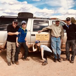
A couple of people in town recommended we contact Shawn at Escape Goats for a private day tour of…read morethe area. We wanted to go to slot canyons and see the area, but unfortunately I had knee surgery a couple of months ago, and after some hiking the day before, my knees just weren't up to the challenge. Nevertheless, Shawn created a unique and custom tour just for us, and showed us some out of the way spots that were breathtaking, a slot that was easier to get to, some pictographs, caves and canyons, a view top with hoodoos, an arch and some moqi balls. All along the way Shawn gave us a rundown of the history of the area, and we learned about the landscape and the plant and animal life. We didn't see anyone else, even though it is high season, because he took us off the beaten track, to places only an expert in the area would know about. Shawn is passionate about the environment and the great outdoors, and he clearly enjoys his work! Shawn and the tour were a highlight in our trip to Escalante and Utah! I highly recommend Shawn and Escape Goats!
Sean was an excellent guide to a slot canyon for my husband and me. He's so knowledgeable about the…read morearea- very interesting information along our hike. He was very patient while hiking too. We highly recommend this company!!
View
Shawn our guide
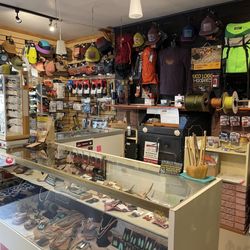
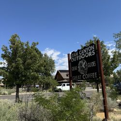
Great coffee, gear, and the friendliest folks! Greeted us with a smile this morning! Love this…read moretown, the residents and business owners.
The chai was delicious and the gear shop has some great stuff! The staff was amazing and helpful…read moreand knows their products well! Cute little shop full of quality outdoor gear and friendly people and great coffee! It's a must stop anytime I come back.
So true!!
Awesome trail to take the family. It is kid friendly. Make sure you bring water and a camera…read more Plenty of photo opportunities!
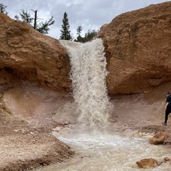
Mossy Cave Trail is outside the fee area for Bryce Canyon Canyon National Park, and I'm not sure if…read morethe rangers check if you've paid. Anyways, I have an annual pass so I didn't worry about it. This is one of the lowest elevation hikes in the park as well as one of the only hikes that begins with a climb and ends with a descent, so if you're not sure about your endurance and want an easy, safe hike where you won't get stuck, this hike is for you! You can see hoodoos, and also Tropic Ditch Falls. It's not a waterfall in the usual sense, as it's a result of a man-made canal that diverted water from East Fork of the Sevier River to Bryce Canyon. I would say that the view was....ok. The trail also leads you to Mossy Cave, which isn't a cave but a sheltered overhang. I was in the season where there wasn't any moss, nor any icicles. It was pretty cold temperature-wise in the grotto. This is a low-effort, low reward type of hike, which is ok. In comparison to the beautiful views that you can get in the scenic drive inside the park, I would say skip this trail if you're short on time and wanting views.
There it is!
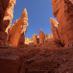
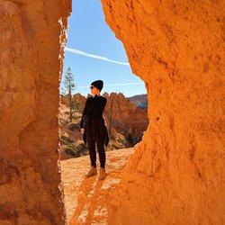
Highly recommend!! I…read moredid the the Figure-8 Combination hike, which combines three amphitheater hikes, Queen's Garden, Navajo Loop, and the Peekaboo Loop. The NPS recommends to do the hike in a clockwise direction due to the elevation slope at the end of the hike, but I wanted to be contrarian haha. It wasn't bad! I liked how there were some tunnels going through some of the hoodoos, and there were various parts of the trail in the shade and in the sun just by going around the rock formations. It was absolutely beautiful when I went, with great cottony white clouds against an azure sky. Do note that there's no water on the trail, and seasonal pit toilets on Peekaboo Loop, but otherwise no restrooms on this portion of the trail. I spent the morning hiking, and then went back to town for a buffet. I couldn't image hiking on a stuffed stomach.
This hike is iconic, probably the most famous in the park. The rec is to do this hike as a loop…read morecoupled with queen's garden for a 4-5 mile round trip trek. You get up close to the hoodoos and see lots of beautiful vantage points in the park. It was closed for a while in early 2026 because of a mud slide but reopened in March and as far as I know has remained open since I was there in April 2026. You can do this hike either clockwise (starting near sunrise viewpoint) or counterclockwise (starting near sunset viewpoint). I was recommended to do it clockwise. There was plenty of parking near sunrise view point, I had no trouble on a Sunday in early April. Took me a couple hours to do the whole thing from start to finish. Overall if you have time for only one hike in Bryce, this is the one I'd rec! You'll see so many iconic and beautiful spots here.
BEST of Escalante, Utah Restaurants near Tunnel Slot
Canyoneering in Escalante, UT
Things to Do in Escalante, UT
Swimming Holes in Escalante, UT
Running Trails in Escalante, UT
Things to Do on a Rainy Day in Escalante, UT
Watch Sunset in Escalante, UT
Trail in Escalante, UT
Hiking Trails in Escalante, UT
Walking Trails in Escalante, UT
Bike Paths in Escalante, UT
Public Shower in Escalante, UT
Attraction in Escalante, UT
Picnic Spots in Escalante, UT
Places to Run in Escalante, UT
Two Step Lessons in Escalante, UT
Kids Playground in Escalante, UT
Easy Hikes in Escalante, UT
Waterfalls in Escalante, UT
Active Life
Atv Rentals/Tours
Best Dog Hiking Trails Around Escalante, Utah
Best Fishing Locations and Guides in Escalante, Utah
Best Places for Horseback Riding in Escalante, Utah
Best Spots for Star Gazing in Escalante, Utah
Check Out Off Road Trails in Escalante, Utah
Discover Dog Friendly Trails to Explore in Escalante, Utah
Discover Popular Bike Trails in Escalante, Utah
Discover a Hiking Trail in Escalante, Utah
Discover the Best Night Hike Trails in Escalante, Utah
Dog-Friendly Hikes With Dogs in Escalante, Utah
Effective Stairs Workout Spots in Escalante, Utah
Enjoy Exciting Mountain Biking Adventures in Escalante, Utah
Enjoy Off Leash Dog Hikes in Escalante, Utah
Enjoy Tent Camping Spots Around Escalante, Utah
Explore Beautiful Parks and Green Spaces in Escalante, Utah
Explore Bike Rentals Throughout Escalante, Utah
Explore Landmarks & Historical Buildings in Escalante, Utah
Explore Popular Campgrounds Near Escalante, Utah
Explore Popular RV Parks Around Escalante, Utah
Explore Scenic Lakes to Visit in Escalante, Utah
Family Friendly Hiking With Kids in Escalante, Utah
Find Exciting Tours to Take in Escalante, Utah
Find Parks and Recreation Activities in Escalante, Utah
Find Top Dog Friendly Parks to Visit in Escalante, Utah
Find the Best Parks for Picnics in Escalante, Utah
Hiking Trails With Waterfalls in Escalante, Utah
Hot Springs
Off Leash Dog Hiking Trails in Escalante, Utah
Picnic Areas With BBQ Pits Available in Escalante, Utah
Popular Places to Take Pictures in Escalante, Utah
Rafting/Kayaking
Relax at Natural Hot Springs Near Escalante, Utah
Safe River Swimming Areas in Escalante, Utah
Safe and Fun Parks for Kids in Escalante, Utah
Top Dog Friendly Things to Do in Escalante, Utah
Top RV Campgrounds to Visit in Escalante, Utah
Top-Rated Camping Sites in Escalante, Utah
Uncover the Best Secluded Spots Around Escalante, Utah
Visit Popular Museums in Escalante, Utah Now
Walk Dog Friendly Hiking Trails in Escalante, Utah
Cinema near Tunnel Slot
Cliff Jumping near Tunnel Slot
Things to do in Escalante
Brands by name
Articles by date
Great pace in the Neon Canyon. This is one of the places I really wanted to see in person. Golden…read moreCathedral is one of the iconic pictures in Grand Staircase of Escalante. I had seen the pictures many times, but seeing in person is totally different. I was in awe. I did this as a day hike from Egypt trailhead. 5 times crossing Escalante river (out and back meaning 10 total) in December is tough, however it is definitely worth it. Doing in December means nobody there! So the Golden Cathedral was all ours that day! Only our car at the trailhead. What a gorgeous hike.
Cosmic Ashtray is a really unique place within Grand Staircase Escalante National Monument…read more Relatively unknown place and hidden, but it is a monument you won't see anywhere else. More detail in my blog https://himebackpacker.blogspot.com/2025/01/cosmic-ashtray-grand-staircase.html
What a wonderful area. We did 2 nights/3 day backpacking from Hurricane Wash…read more Day1, Hurricane wash--Jacob Hamblin Arch, Coyote Natural Bridge, then Cliff Arch. Camped at the saddle. Day2, campsite to Crack-in-the-Wall, and back to campsite, then traced back to Jacob Humblin Arch and camp, Day3 hike out. 3 amazing arches including Stevens Arch, 1 natural bridge, and dramatic view at Crack-in-the-Wall. Only saw 2 dayhikers on day1, 1 dayhiker on day3. Other than that nobody else. Real solitude with gorgeous view.