Bryce Canyon City Park Photos

More like Bryce Canyon City Park
Recommended Reviews - Bryce Canyon City Park
Start your review...

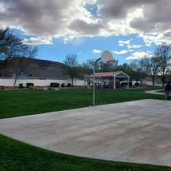
Fun little park outside of "the" park. We got into Bryce in the late afternoon so wanted to stretch our legs before getting some dinner. This park was perfect for our little boy. There are basketball courts (when we went there were even balls out that we could play with). The playground is big and has some good slides and swings. The park is fenced on the east side so you don't need to worry about kids running out into the road. Check it out, you won't regret it! read more
More info about Bryce Canyon City Park
Bryce, UT 84764
Directions
Hours
Outdoor Amenities


Bryce Canyon City Park - parks - Updated July 2026
Best of Bryce
People found Bryce Canyon City Park by searching for…
Browse Nearby
BEST of Bryce, Utah Restaurants near Bryce Canyon City Park
BEST of Bryce, Utah Picnic Areas near Bryce Canyon City Park
BEST of Bryce, Utah Coffee near Bryce Canyon City Park
BEST of Bryce, Utah Things to Do near Bryce Canyon City Park
BEST of Bryce, Utah Playgrounds near Bryce Canyon City Park
BEST of Bryce, Utah Breakfast near Bryce Canyon City Park
BEST of Bryce, Utah Natural Hot Springs near Bryce Canyon City Park