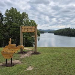
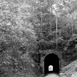
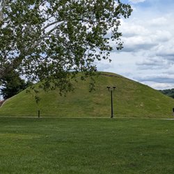
Chief Logan State Park Photos


More like Chief Logan State Park
Recommended Reviews - Chief Logan State Park
Start your review...

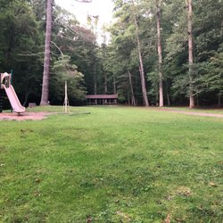
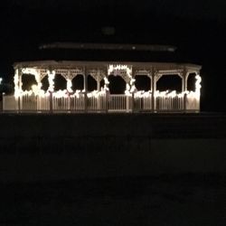
I had an amazing visit to Chief Logan!! I stayed in the lodge in room 305, which had a lovely balcony with Adirondack chairs to sit in overlooking the trees and the playground/ fire pit area. It was not busy at all, not noisy, and had plenty to do just at the lodge! There's a full service restaurant, drinks, and a gazebo as well as an exhibit on WV in the hallways by the conference rooms. The trails were marked well enough, though some were closed, but even the green space was nice to walk around in. My favorite thing though, was the animal exhibit. Mandy the bear, who's an impressive 28 year old black bear, is adorable, and loves peanuts. Barry was awesome and had great information on not just Mandy, but all the residents at the wildlife center, including bobcats, a Barred Owl, and a sweetheart of an Eurasian Boar named Mo. Warning!! The Tomblin Pass between the two park areas is a whopping 16% grade, so if you are going to the campground with a trailer, don't come in exit 30 for the lodge way but the park entrance near town. It's gorgeous up on the pass, but steeeep and windy. The road is in excellent shape though, if you take it slow and easy, you should be fine without hauling too much behind you. read more


 - Parks Near Me - Logan, West Virginia")


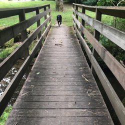
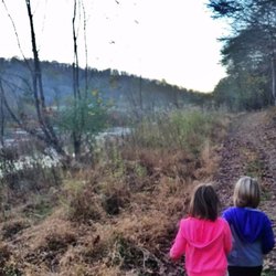
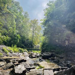
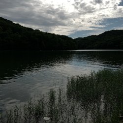
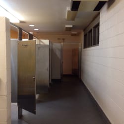
Lovely little park I wish I could if explored more. Plenty of areas to walk around as it winds around and around. I loved the old cabin on site. One issue I've had with most of the stops in WV is the lack of information. I would of loved to of known where the cabin was from, what year it was from, the general history. Alas, there was no plaques to be read. It was locked due to vagrants. Supposedly they will open it up during reenactment days. It's peaceful and beautiful in the fall. It never seemed too busy the two times I drove through. There are restrooms, but I didn't partake. There are also picnic tables available. A man made pond for fishing was being actively used. I am not sure what fish are stocked in it. I did get to see a deer and apparently they're fed or not people shy as it was in the parking lot close to people nearby. Hopefully this doesn't become a problem, particularly during rut. We walked a small trail just to get out and enjoy the rare 81 degrees in November. It was peaceful. I could see myself spending a lot of time here. Volunteers were busy setting up holiday displays of different characters. They do a Christmas drive thru light show, but I will sadly be missing it. read more


We've loved exploring West Virgina State Parks, ever since COVID-19 hit. Our fourth visit was to Chief Logan State Park! Lots of great hikes and views! Wonderful conference center and hotel with views! Plus 20% off! Great deals!!! read more


3 years ago
4 years ago
7 years ago
11 years ago
The facilities are new, attractive and make for an enjoyable stay. The staff is polite and helpful. The food is excellent and for a good price. The rooms are comfortable, clean and very modern. The real problem with the facility is the wifi is awful. I could not get good connection any place in the entire facility. I had to sit close to my door in the room to get coverage. If I moved to any other location the wifi dropped. Overall a fantastic facility. read more


8 years ago
More info about Chief Logan State Park
Ask the Community - Chief Logan State Park


Chief Logan State Park - parks - Updated June 2026
Best of Logan
People found Chief Logan State Park by searching for…
Things to Do in Logan, West Virginia
Fishing in Logan, West Virginia
Attractions in Logan, West Virginia
Hiking in Logan, West Virginia
Beautiful Views in Logan, West Virginia
Hiking Trails in Logan, West Virginia
Scenic Views in Logan, West Virginia
Playgrounds in Logan, West Virginia
Places to Swim in Logan, West Virginia
Places to Take Pictures in Logan, West Virginia
Fishing Spots in Logan, West Virginia
Picnic Areas in Logan, West Virginia
Fun Things to Do at Night in Logan, West Virginia
Parks for Kids in Logan, West Virginia
River Swimming in Logan, West Virginia
Fishing Ponds in Logan, West Virginia
Off Road Trails in Logan, West Virginia
Walking Trails in Logan, West Virginia
Watch Sunset in Logan, West Virginia
Swimming Lakes in Logan, West Virginia
Secret Spots in Logan, West Virginia
Sunset View in Logan, West Virginia
Trending Searches in Logan, WV
Browse Articles
Browse Nearby
Browse Brands
Related Searches in Logan, WV
Best Fishing Locations and Guides in Logan, West Virginia
Best Nature Trails for Hiking in Logan, West Virginia
Best Places for Horseback Riding in Logan, West Virginia
Best Places for Stunning Views in Logan, West Virginia
Best Water Parks for Kids in Logan, West Virginia
Check Out Great Playgrounds in Logan, West Virginia
Check Out Off Road Trails in Logan, West Virginia
Discover Baseball Fields Around Logan, West Virginia
Discover Popular Bike Trails in Logan, West Virginia
Discover Top Nature Parks to Visit in Logan, West Virginia
Discover the Best Fishing Lake in Logan, West Virginia
Discover the Best Night Hike Trails in Logan, West Virginia
Enjoy Scenic Night View Experiences in Logan, West Virginia
Enjoy the Best Night View Spots in Logan, West Virginia
Enjoy the Best Picnic Spots and Ideas in Logan, West Virginia
Enjoy the Best Walking Trails in Logan, West Virginia
Explore Free Picnic Areas Around Logan, West Virginia
Explore Landmarks & Historical Buildings in Logan, West Virginia
Explore Popular Campgrounds Near Logan, West Virginia
Explore Popular Picnic Areas Around Logan, West Virginia
Explore Popular RV Parks Around Logan, West Virginia
Explore Popular View Points Around Logan, West Virginia
Explore Scenic Lakes to Visit in Logan, West Virginia
Explore Top Gyms in Logan, West Virginia Now
Explore the Best Swimming Holes Around Logan, West Virginia
Explore the Best Trail Options in Logan, West Virginia
Family Friendly Hiking With Kids in Logan, West Virginia
Find Beautiful Views in Logan, West Virginia
Find Fun Kids Activities Outdoor in Logan, West Virginia
Find Parks and Recreation Activities in Logan, West Virginia
Find Picnic Tables for Outdoor Fun in Logan, West Virginia
Find Top-Rated Waterfalls in Logan, West Virginia Now
Find the Best Parks for Picnics in Logan, West Virginia
Great Places to Swim in Logan, West Virginia
Parks With Basketball Courts for Games in Logan, West Virginia
Perfect Spots to Watch Sunset in Logan, West Virginia
Picnic Areas With BBQ Pits Available in Logan, West Virginia
Plan a Scenic Drive Route Near Logan, West Virginia
Popular Fishing Spots to Explore in Logan, West Virginia
Popular Kids Activities in Logan, West Virginia
Popular Places to Take Pictures in Logan, West Virginia
Popular Things to Do in Logan, West Virginia
Relax at Natural Hot Springs Near Logan, West Virginia
Safe River Swimming Areas in Logan, West Virginia
Top Hiking Trails to Explore in Logan, West Virginia
Top Swimming Lakes to Enjoy in Logan, West Virginia
Top-Rated Basketball Courts to Play at in Logan, West Virginia
Top-Rated Hikes in Logan, West Virginia to Explore
People who viewed Chief Logan State Park also viewed
Hatfield McCoy Trails
6 reviews
Cabwaylingo State Forest
3 reviews
Devil Anse ATV Resort
1 review
Twin Hollow Campground and Cabins
13 reviews
Mountaintop Adventures
12 reviews
Legendary Tours
1 review
Bac Country ATV Rentals
2 reviews
Samson Oceanfront Park
1 review
Hatfield-McCoy Marathon
4 reviews
Black Gold 24Hr and 12Hr Endurance Challenge
1 review