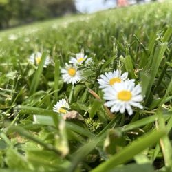
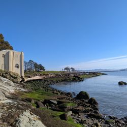
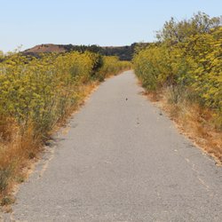
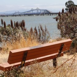
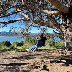
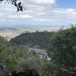
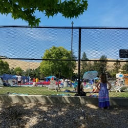
Chicken Ranch Beach Photos


You might also consider
More like Chicken Ranch Beach
Recommended Reviews - Chicken Ranch Beach
Start your review...

Small with portable potty. I'd heard about this spot for years and when I finally went, I hate to admit I was truly underwhelmed. There are so many fantastic places to go to revel in nature and this isn't in my top 10. It was small, kinda dull, and flat with no amenities. Next time I'm out this way I'll go to Limantour. read more


Interesting little beach. Not the type of beach to play in or picnic in, basically just for taking a walk or sticking a kayak in the water. The sand is full of rocks, grasses, and sticky mud from the tide going in and out. Nice place to view the water. No sidewalk or wheelchair access. The bathroom situation is a port-a-potty. Park on the side of the road and hoof it down the hill. read more


3 years ago
If youre hoping to find a chicken ranch at this beach, you'll be disappointed. I was a little disappointed. But only because we didn't have any beachwear with us. We did stroll along to a bridge and along the water a little ways. Lots of kayakers were gathered on the shore - saw lots of kayaks for rent at the resort a ways down the beach. Coincidence? The water was cool, but not freezing cold. It was an overcast day but really pleasant by the water. This would have been a great place to throw down our blanket and spend a few hours if we didn't have other plans ahead of us. read more


9 years ago
15 years ago
16 years ago
11 years ago
12 years ago
10 years ago
17 years ago
More info about Chicken Ranch Beach
Ask the Community - Chicken Ranch Beach
Review Highlights - Chicken Ranch Beach
You might also consider


Chicken Ranch Beach - beaches - Updated July 2026
Best of San Rafael
People found Chicken Ranch Beach by searching for…
Swimming Holes in San Rafael, California
Fishing Spots in San Rafael, California
Parks in San Rafael, California
Dog Swimming in San Rafael, California
Secret Spots in San Rafael, California
Things to Do in San Rafael, California
Kids Friendly Beaches in San Rafael, California
Photo Spots in San Rafael, California
Picnic Spots in San Rafael, California
Closest Beach in San Rafael, California
Sea Shell Beaches in San Rafael, California
Fun Things to Do With Kids in San Rafael, California
Off Leash Dog Beaches in San Rafael, California
Picnic Areas in San Rafael, California
Secluded Beaches in San Rafael, California
Parks for Kids in San Rafael, California
Romantic Spots in San Rafael, California
Sunrise View in San Rafael, California
Beach Chair Rentals in San Rafael, California
Swimming in San Rafael, California
Open Water Swimming in San Rafael, California
Kayak in San Rafael, California
Trending Searches in San Rafael, CA
Beach Chair Rentals near Chicken Ranch Beach
Black Owned Nail Salons near Chicken Ranch Beach
Boardwalk near Chicken Ranch Beach
Boat Rental near Chicken Ranch Beach
Cliff Jumping near Chicken Ranch Beach
Crabbing Location near Chicken Ranch Beach
Day Trips near Chicken Ranch Beach
Dog Friendly Beaches near Chicken Ranch Beach
Dog Swimming near Chicken Ranch Beach
Fishing Spots near Chicken Ranch Beach
Jet Ski Rental near Chicken Ranch Beach
Kayak Rental near Chicken Ranch Beach
Mudslide near Chicken Ranch Beach
Pool Day Pass near Chicken Ranch Beach
Public Beaches near Chicken Ranch Beach
Public Pools near Chicken Ranch Beach
River Swimming near Chicken Ranch Beach
River View Restaurant near Chicken Ranch Beach
Salt Water Pool near Chicken Ranch Beach
Snorkeling near Chicken Ranch Beach
Soccer Store near Chicken Ranch Beach
Splash Pad near Chicken Ranch Beach
State Parks near Chicken Ranch Beach
Strawberry Picking near Chicken Ranch Beach
Swimming Holes near Chicken Ranch Beach
Swimming Lakes near Chicken Ranch Beach
Volleyball Courts near Chicken Ranch Beach
Browse Articles
Browse Nearby
BEST of San Rafael, California Restaurants near Chicken Ranch Beach
BEST of San Rafael, California Things to Do near Chicken Ranch Beach
BEST of San Rafael, California Coffee near Chicken Ranch Beach
BEST of San Rafael, California Parks near Chicken Ranch Beach
BEST of San Rafael, California Breakfast near Chicken Ranch Beach
BEST of San Rafael, California Vacation Rentals near Chicken Ranch Beach
BEST of San Rafael, California Picnic Areas near Chicken Ranch Beach
BEST of San Rafael, California Resorts near Chicken Ranch Beach
BEST of San Rafael, California Campgrounds near Chicken Ranch Beach
Browse Brands
Related Searches in San Rafael, CA
Affordable Paddle Board Rental in San Rafael, California
Best Swimming Beach in San Rafael, California
Book a Snorkeling Tour in San Rafael, California
Browse Top Hotels in San Rafael, California for Your Stay
Discover Dog Friendly Beaches Near San Rafael, California
Discover Public Beaches to Visit in San Rafael, California
Discover Public Pools Open in San Rafael, California
Discover Scenic Beach Camping Sites in San Rafael, California
Discover Sea Shell Beaches Near San Rafael, California
Discover Top Nature Parks to Visit in San Rafael, California
Discover the Best Tide Pools in San Rafael, California
Enjoy Surfing Adventures in San Rafael, California
Enjoy Water Activities and Fun in San Rafael, California
Enjoy a Dog Beach Day in San Rafael, California
Enjoy the Best Walking Trails in San Rafael, California
Experience Stunning Sunset Views in San Rafael, California
Experience Thrilling Parasailing Adventures in San Rafael, California
Explore Beautiful Parks and Green Spaces in San Rafael, California
Explore Easy Hikes Perfect for All in San Rafael, California
Explore Off Leash Dog Beaches in San Rafael, California
Explore Popular Campgrounds Near San Rafael, California
Explore Popular Scenic Views Near San Rafael, California
Explore Scenic Lakes to Visit in San Rafael, California
Explore Secluded Beaches to Relax in San Rafael, California
Explore Secret Spots Worth Visiting in San Rafael, California
Explore Top Dog Parks in San Rafael, California Near You
Explore Top Marinas Near San Rafael, California
Explore Top Water Parks in San Rafael, California Today
Explore the Best Swimming Holes Around San Rafael, California
Find Beautiful Views in San Rafael, California
Find Free Beach Parking Options in San Rafael, California
Find Reliable Beach Chair Rentals in San Rafael, California
Find Surf Lessons Near You in San Rafael, California
Find Top-Rated Waterfalls in San Rafael, California Now
Find the Best Parks for Picnics in San Rafael, California
Find the Best Playgrounds to Visit in San Rafael, California
Find the Best Swimming Pools in San Rafael, California Today
Great Places to Swim in San Rafael, California
Popular Fishing Spots to Explore in San Rafael, California
Popular Picnic Spots to Visit in San Rafael, California
Relax at Popular Beach Parks in San Rafael, California
Safe Beaches for Kids in San Rafael, California
Safe and Fun Parks for Kids in San Rafael, California
Top Hiking Trails to Explore in San Rafael, California
Top Paddleboarding Activities in San Rafael, California
Top Places for Snorkeling in San Rafael, California
Top Playgrounds for Kids to Enjoy in San Rafael, California
Top Swimming Lakes to Enjoy in San Rafael, California