Cancel

    Open app

    Search

    Cedar Creek Campground

    3.0 (3 reviews)

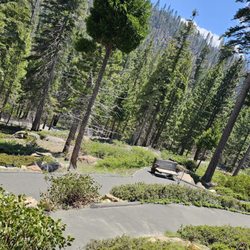
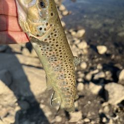
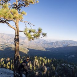
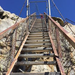
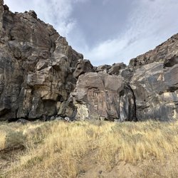
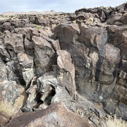
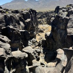
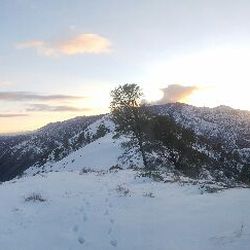
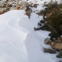
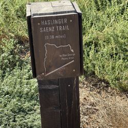
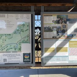
    Cedar Creek Campground Photos

    You might also consider

    More like Cedar Creek Campground

    Recommended Reviews - Cedar Creek Campground

    Your trust is our priority, so businesses can't pay to alter or remove their reviews. Learn more about reviews.
    Yelp app icon
    Browse more easily on the app
    Review Feed Illustration

    5 years ago

    Helpful 0
    Thanks 1
    Love this 0
    Oh no 0

    9 years ago

    Helpful 0
    Thanks 0
    Love this 0
    Oh no 1

    10 years ago

    Helpful 0
    Thanks 0
    Love this 0
    Oh no 0

    Verify this business for free

    People searched for Hiking 156 times last month within 15 miles of this business.

    Verify this business

    Packsaddle Trail - Cave is located and top of mountain

    Packsaddle Trail

    4.7(3 reviews)
    17.4 mi

    Packsaddle hiking trail is located about 14 miles north of Kernville, located in Tulare county…read more Parking lot for Packsaddle trail is located about 500 feet past McNally's Fairview Lodge if your heading north. Trail head starts right across the street from parking lot. Make sure you stretch and be ready to start off with a steep climb for about a mile and a half befor you get a break. When you start hiking the trail, you will come to a fork on the trail about 200 feet from the start, stay to the RIGHT. You will cross the creek about 3 times back and fourth. Be careful after stepping on water or moist soil and then stepping on rocks. Yours boots, shoes might be very slippery after stepping on water, so don't slip and fall. Trail is about 5 miles total round trip. The only part that confuses everybody is where the trail splits off again, one towards the cave and the other towards I think it's called Rincon trail. (Look at my Packsaddle pics) the trail is pretty awesome, I have NEVER seen any Mtn lions, bears, bats or Bigfoot inside the cave. I have only seen small birds flying in and out. The cave is a little dusty, so take a mask if you don't deal to well with dust and don't forget to take a flashlight. I normally explore first and then eat my snacks after. Make sure you pack back in what ever you pack out. Normally after a good hike I love to stop into Kern River brewery for some delicious beers and a delicious burger. Happy hiking.....

    This hike was pretty long. We briefly skimmed the information on this hike before starting and we…read morecould not find the cave on our own. In total, we walked 6 miles (3 miles in and 3 miles out). I definitely suggest bringing lots of water because the hike is draining as a majority of the way in is a steady uphill. There isn't much to see until you get to the "end" of the trail when you reach the small river, but the trek is worth it. We saw a small waterfall and plenty of wildlife. My group stayed at the Fairview Campsite that's right across the street to the trailhead and cooled down by the river afterward. Overall, I would suggest this hike to anyone looking for a challenge, but be prepared before you start!

    Photos
    Packsaddle Trail
    Packsaddle Trail - Make sure you turn left when you get to the big rock to head towards the cave.

    Make sure you turn left when you get to the big rock to head towards the cave.

    Packsaddle Trail - Real or fake? I'm going to guess fake cave painting.

    See all

    Real or fake? I'm going to guess fake cave painting.

    Remmington Trail - sunset in the horizon

    Remmington Trail

    4.0(2 reviews)
    12.4 mi

    This trail is somewhat short. On the day I went, the place was crowded (day party?) so I went…read morethrough the trail and watch the rapid water goes through. Afterwards, I feel like I had to claim my hot pool area because other people have taken over the larger pool areas as well the one secluded midway through the trail. The point is, come early and just leave because it gets crowded fast

    Remmington Trail is a mountain biking trail that accesses Lightner Peak. The trailhead is located…read moreat (35.573915, -118.550334). From CA-178 East, exit at Borel Rd three miles before the town of Lake Isabella. Note your odometer and go as follows: - Turn east on Borel Rd - At 0.3 mile, there's a fork. Go right. - At 1.1 miles, Swamp Flats Campground. Continue straight. - At 2.0 miles, Hobo Campground. Continue straight. - At 3.6 miles, large parking area on the right with tree in the center. Park. From the parking area (2480'), cross the road and hike up the signed Remington Ridge Trail about 4 miles to where the trail passes east of peak 6252' and drops about 100' into a final saddle. After crossing the saddle leave the trail on the right where convenient and hike west up the slope gaining 250' to the summit. (http://angeles.sierraclub.org/hps/guides/02a.htm) The hike is about 10-12 miles roundtrip with an elevation gain of 4500'. This hike is awesome in the early spring or late winter. The trail may be snowy, but it provides great views of the snow-capped Sierras. The first time I hiked it, we missed the summit and ended up doing about 18 mi of hiking. (See map here: http://goo.gl/maps/H1HbH). To avoid this, bring a GPS.

    Photos
    Remmington Trail - Hot pool!

    Hot pool!

    Remmington Trail - Beautiful mountain sunset

    Beautiful mountain sunset

    Remmington Trail - Fresh snow peaks

    See all

    Fresh snow peaks

    Cedar Creek Campground - hiking - Updated July 2026

    Loading...
    Loading...
    Loading...