Cancel

    Open app

    Search

    Carters Lake Guide Service

    5.0 (1 review)

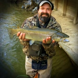
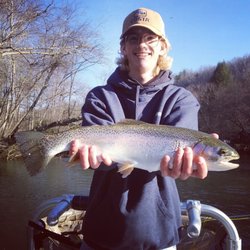
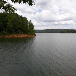
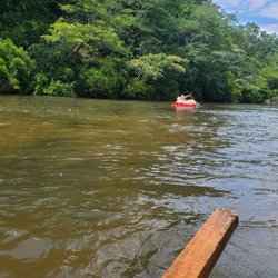
    Carters Lake Guide Service Photos

    More like Carters Lake Guide Service

    Recommended Reviews - Carters Lake Guide Service

    Your trust is our priority, so businesses can't pay to alter or remove their reviews. Learn more about reviews.
    Yelp app icon
    Browse more easily on the app
    Review Feed Illustration

    13 years ago

    Helpful 0
    Thanks 0
    Love this 1
    Oh no 0

    Verify this business for free

    Get access to customer & competitor insights.

    Verify this business

    Edge of the World

    Edge of the World

    4.6(14 reviews)
    63.6 km

    Edge of the World is a great nearby walking trail that winds along Amicalola Creek. The trail is…read moremostly easy, with a mix of wooden walkways (watch out for a few holes) and dirt paths. There are also a few side trails that climb up the mountain if you're looking for a bit more of a challenge (including dodging Joro spiders!). The small waterfalls are beautiful, and the cool creek water is perfect for dipping your feet in on a warm day.

    Loved the Edge of the World! All I could think in my head was the song, it's the end of the world…read moreas we know it, & I feel fine. The Edge of the World is a landscape we never see. It was semi difficult hike just because we live in Florida and use to live in Illinois (AKA Flatland), but we did it. The easiest way to this is from the parking lot, walk to the left and walk down the stairs. Keep walking on the boardwalk and watch for holes in the boardwalk. When the boardwalk is done, keep walking and then you will come to trees, the trees have steps made from the trees, & carefully watch your step and go down. I actually scooted my butt down and then climbed the tree steps. It was not bad, just something I'm not accustomed to. You will see the water and rocks moving and it is just so beautiful. People walk through and sit in the water and take pics. Be careful when you walk through it can be slippery. We had water shoes. Water is so refreshing. We actually walked the long way, which is walking to the right of the parking lot to the start of the boardwalk. We didn't want to walk down the stairs bc they looked pretty steep. It really is amazing. I'd say you will be here about an hour or two. Parking is free and there are a bunch of signs you need a fishing license. Which we don't have. We just parked And walked!

    Photos
    Edge of the World
    Edge of the World
    Edge of the World

    See all

    Fort Mountain State Park

    Fort Mountain State Park

    4.6(53 reviews)
    6.0 km

    This is a beautiful, incredible state park that is so worth the trek (driving and walking wise)…read more There are a couple different lookout spots you'll want to check out, and at the security hut they give you a map so you know where to go. All of the workers were so friendly and helpful here. The hike at the very top was perfect- about a mile or so, the scenic lookout is about halfway through so you can take a break if you need. There's a good amount of elevation to get your heartbeat going but then it calms down after awhile. At the outlook, it would be easy to sit and enjoy the few for a long time. It's stunning. You can also take a fork in the path to visit the Fort that's here (thus named Fort Mountain). There are some info signs explaining the mysterious origins of the fort and it's pretty interesting.

    Fort Mountain State Park is one of few favorites places to visit, especially in the spring or in…read morethe fall. The scenery is simply picturesque. Despite the harsh cold winds of winter, we had the sun which made it bearable and our hike was splendid on the day we visited. Our first stop had to be the visitor center to get a new annual pass & patches. The attendants helped us secure the pass that best matched our needs. The visitor center has restrooms and a gift store. For my girlfriend, it's always difficult to resist the items --- t-shirts, stuffed animals, historical books, camping supplies, snacks --- they sell there. If I am not mistaken, I believe they also sell firewood and ice for those looking to camp. If you need a map of the park, it can be found here as well. We then headed to the lake to hike the trail that circles it. It's an easy trail, so it makes for a nice walk for chatting and stopping to admire the views of the lake and mountainside. The beach at the lake is relatively small, but the facilities there are nice, with boat rentals, playground, picnic tables, and putt-putt golf. Im assuming a lot of these services are seasonal because we saw no one using them. I did like that there was a ramp that led from the parking lot to the beach for visitors that may have mobility issues. We hiked several different trails, and all were well blazed. The trails that led to fire tower and the stone wall had informational signs. Unfortunately the fire tower can only be viewed from the outside. I would love to see the view from the top! But if it's views you are interested in, checkout the overlook trail! The view is A-M-A-Z-I-N-G!!! We also did the Big Rock Nature Trail (trailhead is near the lake dam). The 3/4-mile trail led to a beautiful waterfall. We didn't touch the Gahuti Trail this time, but we plan to do it next time we come back; it's challenging but very beautiful from what I have read about the trail. I would recommend it if you have a day for a hiking adventure. Snacks and water are required. The cabins and cottages all look well maintained from the outside and are located in beautiful areas of the park. We didn't check out the campground, but it's near the lake, but Fort Mountain State Park seems to have something for everyone!

    Photos
    Fort Mountain State Park
    Fort Mountain State Park
    Fort Mountain State Park

    See all

    Rich Mountain Wildlife Management Area

    Rich Mountain Wildlife Management Area

    5.0(1 review)
    35.1 km

    December 13, 2020…read more Approximately 8 miles north of Elijah, GA on highway 76 shortly before entering the town of Cherry Log, you'll turn right onto Rock Creek Connector which takes you to a regular looking two lane road called Rock Creek Rd. Almost immediately upon making the right hand turn on Rock Creek road is the sign "Rich Mountain Wildlife Management Area" and my cell reception (meteo PCS) dropped again. Following Rock Creek Road eventually turns into a crushed gravel road with a stream running next to it and past several farms including a small horse farm. This was my third time to this area in the past month, and thankfully my final time. My goal was to summit Tickanately Bald, a peak that was nearly 4000 ft tall and nestled 0.7 miles south of Rich Mountain. This time I went up FS295 to the end and hiked the rest of the way. The 4000 ft challenge led by the Appalachian Trail Club has less than 10 members who have ever climbed all 32 peaks. And there is a good reason why. You might think...hey, these peaks aren't Mt Everest. What's the big deal? You wouldn't be wrong, however, plan accordingly, if you want to attempt it. Be warned: this activity is not without risk. Climbing walls of vegetation only to encounter brambles that want to cut you, is definitely not everyone's cup of tea. In many cases, there is no good footing. Especially after a rain. Stream crossings or hopping is a skill and balancing yourself across rocks to ford a small spring also is an art form, especially if your heart is pounding out of your chest from climbing 1000 ft. And finally, it's very easy to get yourself turned around. If your phone dies, runs out of battery, or you simply smash it while slipping on a patch of leaves covering a slick rock, well you are SOL, especially without cell phone service to call for help. And better have a back up plan. Don't go out there without a secondary GPS device. Pack water, pack a snack. Put something on your windshield in writing notifying people you are out for a walk and expect to be back. Give someone a clue where you are going too. Weather can change quickly, and the terrain difficult to navigate. While these mountains aren't huge, they are still fairly remote compared to the usual urban park you may have encountered. Plan ahead an be safe! Suffice it to say, I had fantastic weather. (Winter is the best season to get out and conquer your Georgia 4K peaks! And Limited Vegetation). I brought my phone and my GPS watch and a bottle of water and although the distance to the peak was 2.5 miles I gave myself 6-7 miles and plenty of daylight to climb this peak by leaving at noon. FS295 is approximately 4 miles from the beginning of Rock Creek Road and begins steadily up for 2 miles right at the Hunter Checkin Station. It's fairly navigable and I managed it in my Prius at 4-6 mph! There are a couple of nice choice camping spots along the way. At the top, I parked and ran 1.2 miles down to Little Rock Creek. From there I picked a line and started hiking up, and pretty much kept this up for 1300 ft or 1.5 miles till I reached the top of Rich Mt where there is an old chimney from an old house that once was. There is no benchmark (the geodesic marker often installed by the US Forest Service to denote the high point) to be found anywhere on Rich Mountain, unfortunately. There is an old unmaintained trail to the West (facing south) which leads you directly to Tickanately. Unfortunately, I went down the wrong side of Rich Mountain and had to adjust. Translation...climb back up to the top of Tickanately, then stumbled upon the path which I took back to Rich, before descending the same 1300 ft I had climbed----this time it was weeeeehaww and nimbly bounding down hill till I got back to Little Rock Creek. The total elevation gain was 2400 ft in 2.5 hours and my glutes got worked big time. The feeling of accomplishment was overwhelming. Seven 4K peaks done and 25 to go!

    Photos
    Rich Mountain Wildlife Management Area
    Rich Mountain Wildlife Management Area
    Rich Mountain Wildlife Management Area

    See all

    Cartecay River Experience

    Cartecay River Experience

    3.7(67 reviews)
    30.1 km

    Cartecay River Experience has a really good tubing experience because they have several options for…read moreyou when you go to the first location for the business. You can sign up there (where the pizza shop is) to go on the regular lazy river or you can sign up to go on the "Extreme" river. If it's a weekend, you're definitely looking at a line, so plan ahead. They allow you to bring your own tubes and just pay the shuttle fee. That's fantastic! The extreme river experience is several miles up the road, which makes it a longer trip, but also puts you above a bunch of rapids. DO NOT TIE YOUR TUBES TOGETHER IF YOU ARE IN BIG GROUPS!!!! Two is OK, but more than that runs the risk of one of your tubes going the wrong direction and then tearing holes in your tube. There is NO ONE COMING. Your best bet, if your tube pops/rips/deflates is to just keep going down the river the best you can. We made the mistake of tying the 4 of us together....my mom and sister went down one side of the rapids while her boyfriend and I went down the other. There wasn't any choice in this- it was just where the current led our tubes. Since we were connected, the rope stopped us from passing through the rapids easily. We got stuck! My sister managed to get untied and floated on down. My mom had to get out of her tube. I got out of mine and had to help my mom and her boyfriend, and by the time I got to him, his tube was shredded open. I ended up giving him my tube and I just rolled across all the rocks on my way down the rest (more than half) of the river. It kinda sucked for me. I don't know if it's allowed or if it costs more, but you should ask for an extra tube if you're going thru any rapid sections. It may sound like my experience was terrible, but it was fun for everyone else. We brought our own tubes too- so we saved some money on rentals! If you're going on the "extreme" run, and you're renting tubes, you'll need to wait for the shuttle- which could take up to an hour and a half- depending on the lines. Bring water- stay hydrated. If you bring your own tubes, the only shuttle you'll be using is the one at the bottom of the run to bring you back to your car(s). If you plan on going tubing regularly- I highly recommend getting your own tubes. We were able to park, fill up our tubes, and get in the water in like 30min. Same thing for the return trip in the shuttle and packing up. The people are very nice and everything seems sets up with ease. I DO have to take a star away for the changing rooms. They only have 2 and they are AWFUL. I must recommend that you bring a changing pop-up tent with you. It'd be a much more hygienic option. Would I go back! Absolutely! It was fun! We learned a few things and our next trip on the Cartecay will be perfect! I guarantee that if you follow our tips, things will go swimmingly.

    Very unorganized. There are no people guiding you where to go and no one telling you how long the…read morewait time will be. There are actually two locations. The pizza place and the actual place that you get to get on a tube. Do not go to the pizza place as you will wait two hours in the bearing heat, I'm talking the devil's ass crack hot because there is no shade whatsoever. There is overpriced snow cones but other than that just heat. You wait here and sign in only to get on a bus that will take you to the actually place where the tubes are. You tell them your name and the amount of people you have. I had an issue with this as well because there was no cap that means that they were allowing larger groups of people to sign up to get tubes. I'm talking groups of 16 plus and you have to wait until they get done. People at this location were nicer and they offered free bottles of water and beer for waiting. When we finally got to get on the river is actually nice... the first hour. This is a three hour long River. After a while of floating in the heat I was starting to get a headache and I kept running into branches on the side and getting stuck under the rocks. I recommended some kind of device that will help you navigate the water. I fell in once, lost my tube and someone was nice enough to get it for me. For that I was grateful as I would have wadding another hour. The best part of the trip was the whirlpool and the slide. If you can brave it that long it is a small pay out. Don't see myself returning but it was experience.

    Photos
    Cartecay River Experience
    Cartecay River Experience
    Cartecay River Experience

    See all

    Carters Lake Guide Service - fishing - Updated May 2026

    Loading...
    Loading...
    Loading...