Cancel

    Open app

    Search

    Carter Lake Trail

    3.0 (1 review)

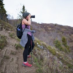
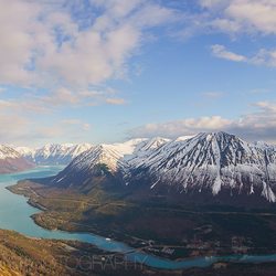
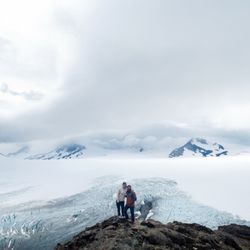
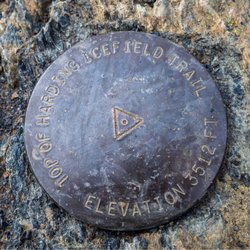
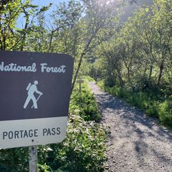
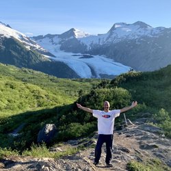
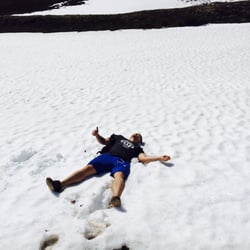
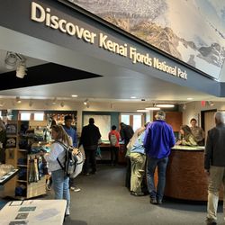
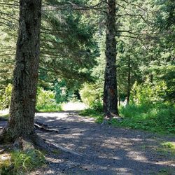
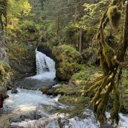
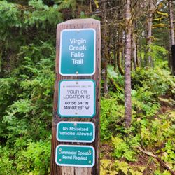
    Carter Lake Trail Photos

    You might also consider

    Recommended Reviews - Carter Lake Trail

    Your trust is our priority, so businesses can't pay to alter or remove their reviews. Learn more about reviews.
    Yelp app icon
    Browse more easily on the app
    Review Feed Illustration
    Photo of Joy L.
    170
    1650
    9602

    4 years ago

    Helpful 2
    Thanks 0
    Love this 1
    Oh no 0

    Verify this business for free

    Get access to customer & competitor insights.

    Verify this business

    Slaughter Gulch Hike - views from up high

    Slaughter Gulch Hike

    5.0(1 review)
    12.4 mi

    The first time I drove through Cooper Landing, I had a thought that went something like "Wow, this…read morearea is beautiful, look at that water! I wish I could see a better view of it though..." Since then, Cooper Landing has been a place that I have thoughts like this about: "Beautiful place, some good places to eat on the way to Homer, not much to do if you're not into fishing though..." Well, I discovered this terrific trail (along with half of the Anchorage metro last weekend), and I'm happy to report I was wrong! The trail is short (in mileage, a little over 2 miles) and steep (in elevation gain, about 2,600 ft). Going down will be 2 to 4 times as fast as going up. It took us about 2 hrs to get to the top, hiking at a steady clip with no breaks. We started late because, what the hell is the point of waking up early to hike when it's light out past 11pm? And we ended up having the summit to ourselves! Keep going towards the end, there are multiple "false summits" near the top where it feels like you're about to top-out, but you ain't. Here's a tip, try to impress/annoy your (masked, distanced) friends by yelling out "SORRY, FALSE SUMMIT!" as you hit each one! At the summit, amazing panoramic views of the turquoise waters of Cooper Landing abound! Great for testing out that panoramic functionality on that new phone you bought during quarantine! You also should've brought a beer, sorry I didn't tell you earlier in the review :( The trailhead is at the end of the short road called "Stetson Cir", navigate to it from the Yelp page and it should take you directly there. It's not formally marked with a sign or anything (nor are there any restroom facilities), but the start of the trail is very well-worn and hard to miss, it seems like locals use it to gather firewood.

    Photos
    Slaughter Gulch Hike - When you first exit the trees

    When you first exit the trees

    Slaughter Gulch Hike - Great spot for a pano!

    Great spot for a pano!

    Slaughter Gulch Hike - Pano

    See all

    Pano

    Exit Glacier and Harding Icefield Trail

    Exit Glacier and Harding Icefield Trail

    4.8(79 reviews)
    24.0 mi

    Let me start by saying that I had set some pretty high expectations of the Harding Icefield Trail…read moreand was worried they wouldn't meet them ... But they actually ended up far surpassing them. This trail was, by far, our favorite hike we did in Alaska, and one of our top hikes in general. This is a strenuous hike that you need to come prepared for. It's about 8.2 miles roundtrip with over 3000 feet of elevation gain with some rocky areas. We wore hiking shoes and rented some poles, and it went great. We did the hike in September, and there was still snow toward the end of the hike - so these poles definitely came in handy once we hit that. This hike was absolutely beautiful. You'll start out with gorgeous views of the trees, rivers, and wildlife. The higher up to go, you'll start to get a sneak peek of the glaciers, and let me tell you - pictures don't do it justice and won't prepare you for what you're going to see. The Harding Icefield is absolutely breathtaking - just pure white as far as you can see. It's such a peaceful experience that we could've just sat there for hours and taken it all in. The hike up was rough, but it's 100% worth it when you reach the end. Pack lots of water and snacks. It was rainy the day we went, so our rain jackets were lifesavers. But there is a lot of open hiking, so definitely back sunscreen if it's a sunny day. And don't forget your bear spray. Absolutely incredible hike. 100% recommend it.

    We checked in at the visitor center before the hike, where they loaned us trekking poles and let us…read moreknow the trail was open all the way to Top of the Cliffs--it had only just opened past Marmot Meadows. The hike itself is tough, especially with the snow patches you have to cross to reach the top, which was also still snow-covered. Coming down was actually kind of fun--you could slide if you didn't mind a wet bum. The views made it all worth it. The Harding Icefield is just massive and awe-inspiring. We also saw the glacier below, along with people mountaineering through the crevasses and hiking out on the ice. We saw a few hikers pushing past the recommended stopping point, but we turned around at the top. Not interested in testing our luck with a rockslide or avalanche. There were plenty of people on the trail, so we never felt concerned about wildlife, and we ran into a couple of interpretive rangers along the way who were friendly and happy to chat.

    Photos
    Exit Glacier and Harding Icefield Trail
    Exit Glacier and Harding Icefield Trail
    Exit Glacier and Harding Icefield Trail

    See all

    Portage Pass Trail - The trailhead for Portage Pass, located right near the Whittier Tunnel.

    Portage Pass Trail

    5.0(9 reviews)
    30.4 mi

    Portage Pass Trail is a fantastic hike in Whittier, Alaska!…read more I didn't even know this trail existed until the Ship Captain on my 26 Glacier Tour Cruise mentioned it was his favorite activity. So...being only about 6pm in the summertime and still looking for more worthwhile areas of Whittier to explore...I thought...why not come over here to Portage Pass to hike for a few hours! From the parking lot where I had left my car for the cruise, the trailhead was only 1-mile away near the tunnel area getting in and out of Whittier. When turning onto the road leading towards the trailhead, be careful of all the potholes along the way. I parked on the side of the road. Portage Pass Trail is a 4-mile roundtrip hike. Well...let me just back up a little... It's a 1-mile hike to Portage Pass which overlooks Portage Lake and Glacier in the background. Then, it is 1 more mile to trek from Portage Pass down to the shores of Portage Lake. Then...obviously, it is a 2-mile hike back to the trailhead. The 1st mile hiking to Portage Pass was virtually all uphill. I gained 800 feet in elevation. This part was moderately strenuous. I believe, since you work hard to make it to Portage Pass, you might as well go all the way to Portage Lake/Glacier. The 2nd half of the hike from Portage Pass was mostly downhill where I winded my way through bushy areas but all on a defined, dirt trail. And it was sort of fun to maneuver on down to the shore. And just to back up one moment, at Portage Pass in late afternoon, the sun was shining brightly onto Portage Glacier and the surrounding landscape offering beautiful views worthy of pausing for photos. Finally, at "The Toe" of Portage Lake and Glacier...the setting was calm and quiet. There weren't many hikers around with me at 7pm. I took some time to admire Portage Glacier but found that my pictures weren't nearly as colorful being at eye-level with a fading sun in comparison to the perspectives looking down on the landscape while hiking lower from Portage Pass. For me being a picky photo person, the dwindling sun started facing me which created shadows rather where I would have preferred the sun positioned at my back. So...to give a suggestion...I believe visiting Portage Lake and Glacier; you'd be better served coming in the morning time. I also noticed that you could hike around the lake to possibly even step on Portage Glacier! That was intriguing to me, but I knew I still had the return hike to complete along with taking the tunnel to depart Whittier. Those factors were on my mind. And...I didn't have any micro spikes or crampons with me so the best I could do was maybe just stand in front of the glacier. But I feel that would maybe lose the photogenic aspect whereas being at the shoreline, I could capture the glacier in its entirety. This just me being particular...lol, that's all. I spent 25 minutes wandering along the shore, even to just breathe in the fresh air. Had I known about Portage Pass Trail ahead of time, I certainly would have afforded myself an extended stay to marvel at how cool untouched glaciers can appear in the distance. The hike back to Portage Pass was uphill, but not nearly as difficult as the initial trek from the trailhead. Then, of course, once back at Portage Pass, it's downhill back to the dirt road where I parked. I'd say the 4 total miles hiked plus time at the lake took me 3.5 hours...just enough time to complete my 26 Glacier Cruise Tour plus this afternoon hiking adventure making for an absolutely wonderful summer day experience here in Whittier, Alaska.

    Wanting to see a glacier but with our previous honeymoon glacier adventure being canceled due to…read moreinclement weather, we had to get creative. My husband and I found the trail head for Portage Pass and decided to give it a shot! The trail head is located down a gravel road, on your right hand side immediately after you exit the Whittier tunnel. There is no parking lot. The trail was extremely easy to follow and as most reviews state, the 1st mile is all incline until you reach the peak. Once you reach the summit, the wind picks up but then it is all downhill until you reach the glacier. During our adventure, the trail was quite slippery and frozen over with ice but we managed to find a few foot holds. Seeing a glacier up close and personal is absolutely breathtaking and a once in a lifetime experience. We had the entire trail to ourselves since it was the off-season and not too many people wanted to brave the whipping windchill. Definitely worth the short drive from Anchorage if you want to see this glacier before it is gone!

    Photos
    Portage Pass Trail - From the trailhead, it's 1-mile to Portage Pass and 2-miles to Portage Lake.

    From the trailhead, it's 1-mile to Portage Pass and 2-miles to Portage Lake.

    Portage Pass Trail - Appreciating the moment at Portage Pass.

    Appreciating the moment at Portage Pass.

    Portage Pass Trail - At the shores of Portage Lake.

    See all

    At the shores of Portage Lake.

    Falls Creek Trail

    Falls Creek Trail

    5.0(6 reviews)
    33.4 mi

    Man, how am I just now getting around to hiking this?!…read more Falls Creek is located at ~Mile Post 105.6 on the Seward Highway. In relation to other trails: To the West: Rainbow Trailhead (https://www.yelp.com/biz/rainbow-trailhead-anchorage) To the East: Indian Valley Trailhead (https://www.yelp.com/biz/indian-valley-trail-anchorage) Stats: Mileage: 2.7 (one-way) Gain: 2,900 ft About a 1,000 ft/mile, steep but not *too* steep. The trail starts out...next to a falls! It closely follows Falls Creek for the first half of its length. As the water is loud and the brush is thick, I'd highly recommend doing some trail karaoke with your friends to make sure you alert any bears in the area that you're coming. Eventually, you get out of the brush and the valley expands. It's gorgeous. It's wide and it's bright-freakin'-green (my favorite shade of that color), or at least it was in mid-June. This is going to sound odd but, it actually reminded me of some of the valleys I hiked in Hawaii! It made me a little butthurt that I am only just-now getting around to hiking the trail. The trail ends at a lake. I'm not sure what the name of it is, so I'll just call it "Falls Lake". The lake frequently has snow on/in/around it, up until July. But, there is an ample amount of vegetated, snow-free flat area around the lake, this would be a perfect "Baby's First Backpacking" trip. (no permits required, just load yourself down and hike up) You can continue up past the lake, onto the ridge between South Suicide Peak and Indianhouse Mountain. The path will quickly change from "hiking" to "scrambling" though. I'd only recommend going up South Suicide if you are confident on your feet, and I'd only recommend going up Indianhouse if you have a rope and a partner! If you're quick enough, this can be done as an after-work hike. If you're slow or looking for a casual stroll, you can easily make a day of this hike.

    I'm still sore. Dragged my spouse and our neurodivergent son with me to do this hike on a sunny…read moreSeptember Saturday. We parked at 1pm (parking lot was packed). Got back to the parking lot after 5pm. You'll need most of your day to do this hike if you're not a professional. This hike is beautiful but it is challenging for sure. You are going uphill the entire time. On the way down it's so steep you're jamming your toes trying not to fall. We did the bulk of this hike with nothing but backpacks full of snacks hahaha. Everyone that passed us up or down had poles, guns, bear spray, bells, dogs, the whole enchilada. I don't recommend hiking this area the way we did, we just got lucky :) It was a beautiful day and we were never alone for longer than 15-20min at a time. Weather was perfect, it was sunny and warm but the breeze was breezin'. The falls are a sight to see and made this strenuous hike completely worth it for my water-loving son. I can't wait to return soon and make it further.

    Photos
    Falls Creek Trail
    Falls Creek Trail - Falls Creek 11/16/19

    Falls Creek 11/16/19

    Falls Creek Trail - Nice spot at the end to cool off.

    See all

    Nice spot at the end to cool off.

    Byron Glacier Trailhead - Avalanche debris (not the Byron Glacier, contrary to popular belief, which is much further up-valley)

    Byron Glacier Trailhead

    4.6(18 reviews)
    27.4 mi

    This is the perfect trail for a family! People of all ages can come. It's super short with an easy,…read moreflat dirt path. We saw senior citizens, kids, dogs, etc. all comfortably share this path. I took my husband and parents who are in their 60s to this trail. My parents aren't too fond of when I take them on what they call "too crazy of an adventure," but this trail they handled just fine. It only took 55 minutes to drive from Anchorage to the trail head. And you get to drive the beautiful scenic Seward Highway. That itself already made the trip worth it. The trail is only 1.4 miles one way. There are no river crossings or switch backs. It's just out and back. It's a pretty sunny walk, so bring a hat/sunscreen. At the endpoint, you get a nice view of the Byron Glacier. Apparently you can even sometimes visit ice tunnels. Those weren't available when we went because an avalanche reportedly happened the week prior. But it was still definitely worth the trip. If you take your time to enjoy the walk and glacier, the "hike" takes about 3-4 hours.

    Absolutely stunning trail! Very friendly to all ages and all levels of athleticism. I've hiked out…read morethere with people as young as 3 and as old as 70-something! It takes about 10 or 15 minutes to walk out there if you're going at a relaxed/moderate pace. PLEASE be careful around the snow and be VERY aware that the ice above the river is often very thin! You'll see other footprints over it, but you are NOT supposed to walk on it, especially on the parts above the river! The water is eroding it from the inside out and one wrong footstep could send you falling 20ft into an ice cavern :( You can have just as much fun here without risking your life!! I always wear bug spray here, but I've seen only a few bugs. Don't drink the water unless you have a filter with you. If you're driving in from Anchorage, the Alaska Wildfire Conservation Center is directly on the route and definitely worth stopping at!

    Photos
    Byron Glacier Trailhead - Avalanche debris (not the Byron Glacier, contrary to popular belief, which is much further up-valley)

    Avalanche debris (not the Byron Glacier, contrary to popular belief, which is much further up-valley)

    Byron Glacier Trailhead - Avalanche debris (not the Byron Glacier, contrary to popular belief, which is much further up-valley)

    Avalanche debris (not the Byron Glacier, contrary to popular belief, which is much further up-valley)

    Byron Glacier Trailhead - Avalanche debris (not the Byron Glacier, contrary to popular belief, which is much further up-valley)

    See all

    Avalanche debris (not the Byron Glacier, contrary to popular belief, which is much further up-valley)

    Kenai Fjords National Park

    Kenai Fjords National Park

    4.8(62 reviews)
    26.9 mi

    "Where Mountains, Ice, and Ocean Meet"…read more Exploring this National Park was a nice addition to my trip to Alaska. I came here to do volunteer work. In the evenings, we mostly fished in the Kenai River. After finishing up our work, my group planned two fun days at the end of the week. One day we chartered a boat in Homer to Halibut fish and the other we visited Seward and got to see the Exit Glacier in Kenai Fjords National Park. Kenai Fjords National Park is massive. It is the fifth most-visited park in Alaska and is the closest national park to Anchorage. The park was established in 1980 and encompasses over 600,000 acres outside of the town of Seward. Snow and ice cover 50 percent of the park with the Harding Icefield stretching over 700 square miles. The park's headquarters and visitor center is located in Seward. The nice thing about Kenai Fjords National Park is that it provides both leisurely and adventurous activities for visitors. Activities include kayaking, boat tours, camping, fishing, biking, hiking, cross-country skiing, dog sledding and mountaineering. Various companies offer tours that are guided by National Park Rangers. In addition to seeing the beautiful scenery up close, you can also see both land and marine wildlife. Seward is also a destination for cruise ships and provides passengers from the ships with tours of the park. Kenai Fjords National Park lies on the southeastern side of the Kenai Peninsula and can be reached from Seward. The most significant fjords include Aialik Bay, Harris Bay, McCarty Fjord and Nuka Bay. Most of the interior of the park is covered by the Harding Icefield. A cool thing for me was that I was doing work at an airport when I was here in Alaska. Because my work was volunteer, one of the pilots offered to take some of us up in a plane to see Alaska from above as an appreciation for the work that we were doing. We flew over the Harding Icefield and got to see how massive is it. It was such an awesome experience. Another way to see the Icefield up close is to hike on the Harding Icefield Trail. Kenai Fjords National Park is made up of three main areas - the Exit Glacier, Harding Icefield and the coastline. The Exit Glacier is the easiest section of the park to reach. I stopped by the visitor center in Seward first before seeing the glacier. It is a nice place to visit and to learn about the park. There are park rangers on hand to answer questions and a gift shop. We then headed over to the Exit Glacier. It is the only destination in Kenai Fjords National Park that is accessible by land. They have a small nature center that you can visit before heading out on the trail to the glacier. The Exit Glacier hike is the best way to see this this glacier up close. Sadly, it has shrunk considerably due to climate change. They have signs showing where the glacier once stood by year. Park scientists continue to monitor and record the glacier's accelerating recession. At some point, you won't be able to see the glacier anymore from the overlook trail. I really enjoyed my time visiting this park. Getting a chance to fly over the Harding Icefield was an amazing experience for me. Then checking out the Exit Glacier later in the week really made me appreciate how beautiful this park is. I hope someday I can return here and hike on Harding Icefield Trail to get up and close to it.

    One of the best parts of our June Alaska cruise occurred on the last day in Seward. We viewed…read moreparts of Kenai Fjords National Park from the water on a Major Marine boat trip. We saw the Holgate and Aialik glaciers, tons of wildlife (Orcas, sea otters, Stellar sea lions, harbor seals, puffins, and more). The finale was seeing the amazing rock formations in Porcupine Bay. Afterwards, we stopped by the Kenai Fjords National Park visitor center to learn more about the park. Wish we had more time for further exploration!

    Photos
    Kenai Fjords National Park
    Kenai Fjords National Park - Red Elderberry

    Red Elderberry

    Kenai Fjords National Park - Porcupine Bay

    See all

    Porcupine Bay

    Trail of Blue Ice

    Trail of Blue Ice

    4.2(6 reviews)
    27.4 mi

    Where is all the blue ice? I don't see no trail! Well... I did see a couple of glaciers up top…read moreunder white snow, so I saw sprinkling of blue ice. This is the Tony Knowles Coastal trail of Portage. You start at Moose Flats, or Visitor's center, and walk/jog/bike/skate/meander 5 miles to the opposite end. I started at Moose Flats and it was a good time viewing natural and unnatural areas of interest. Scouted out camp spots, watched kayakers in a lake, and enjoyed walking over bridges during the jaunt. It was good, not great. So much so, that instead of walking all the way back I hitched to get the car and pick up walking companion. Then we jetted over to Byron's Glacier for a proper, albeit shorter, hike. Would come again if camping in area, but would pass for future hiking funsies due to lack of interest.

    This is a flat 5-mile trail that links together the many sights and sounds of one of my favorite…read moreareas in Alaska: Portage. Despite being located a little over an hour from Anchorage, this area gets obscene amounts of snow and rain. As a consequence of all that H2O falling from the sky, the mountains in here are heavily glaciated, even though they are not very tall by Alaska standards. (tallest in the area is around 6,000 ft, with many in the 3,000-4,000 ft range) Because this trail is so flat, it's very commonly cycled. Bring your bike and make a half-day of it, or bring only your boots for a much fuller day. There are places to view Salmon here, but I can never seem get the timing right. Stuff to see in this area from/next to the trail: Explorer Peak (and Explorer Glacier): https://www.yelp.com/biz/explorer-peak-portage Byron Glacier Trail: https://www.yelp.com/biz/byron-glacier-trailhead-anchorage Portage Glacier visitor center: https://www.yelp.com/biz/portage-glacier-and-begich-bloggs-visitor-center-girdwood

    Photos
    Trail of Blue Ice
    Trail of Blue Ice
    Trail of Blue Ice

    See all

    Carter Lake Trail - hiking - Updated May 2026

    Loading...
    Loading...
    Loading...