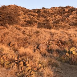
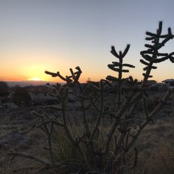
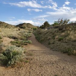
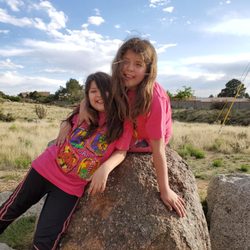
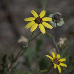
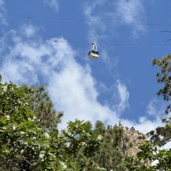
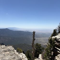
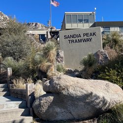
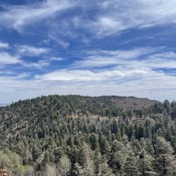
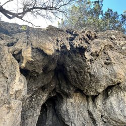
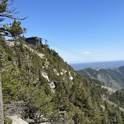
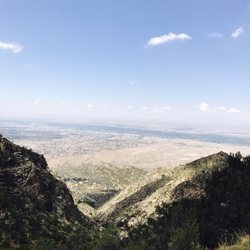
Carnuel Hiking Photos
You might also consider
More like Carnuel Hiking
Recommended Reviews - Carnuel Hiking


More info about Carnuel Hiking
Carnuel Valley
Carnuel, NM 87123
Directions
Visit Website
http://www.city-data.com
Hours
Outdoor Amenities


Carnuel Hiking - hiking - Updated June 2026
Best of Carnuel
People found Carnuel Hiking by searching for…
Sunset View in Carnuel, New Mexico
Hiking Trails With Waterfalls in Carnuel, New Mexico
Secret Spots in Carnuel, New Mexico
Fun Things to Do at Night in Carnuel, New Mexico
Lakes & Ponds in Carnuel, New Mexico
Sunrise Hike in Carnuel, New Mexico
Dinosaur Park in Carnuel, New Mexico
Free Campgrounds in Carnuel, New Mexico
Sand Dunes in Carnuel, New Mexico
Easy Hiking Trails in Carnuel, New Mexico
Rock Quarry in Carnuel, New Mexico
Night Hike in Carnuel, New Mexico
Things to Do in Carnuel, New Mexico
Camping With Showers in Carnuel, New Mexico
Swimming Lakes in Carnuel, New Mexico
Walking Trails in Carnuel, New Mexico
Canyoneering in Carnuel, New Mexico
Tent Camping in Carnuel, New Mexico
Fishing Spots in Carnuel, New Mexico
Trending Searches in Carnuel, NM
Browse Articles
Browse Nearby
Browse Brands
Related Searches in Carnuel, NM
Best Nature Trails for Hiking in Carnuel, New Mexico
Best Places for Horseback Riding in Carnuel, New Mexico
Best Waterfalls and Swimming Holes in Carnuel, New Mexico
Check Out Off Road Trails in Carnuel, New Mexico
Discover Dog Friendly Trails to Explore in Carnuel, New Mexico
Discover Lakes & Ponds to Explore in Carnuel, New Mexico
Discover Popular Bike Trails in Carnuel, New Mexico
Discover Popular Photo Spots in Carnuel, New Mexico
Discover Scenic Mountain Bike Trails Near Carnuel, New Mexico
Discover Top Nature Parks to Visit in Carnuel, New Mexico
Discover a Hiking Trail in Carnuel, New Mexico
Discover the Best Running Track in Carnuel, New Mexico
Dog-Friendly Hikes With Dogs in Carnuel, New Mexico
Enjoy Camping Adventures Around Carnuel, New Mexico
Enjoy Exciting Mountain Biking Adventures in Carnuel, New Mexico
Enjoy Scenic Night View Experiences in Carnuel, New Mexico
Enjoy Tent Camping Spots Around Carnuel, New Mexico
Enjoy Water Activities and Fun in Carnuel, New Mexico
Enjoy the Best Picnic Spots and Ideas in Carnuel, New Mexico
Enjoy the Best Tubing Experiences in Carnuel, New Mexico
Enjoy the Best Walking Trails in Carnuel, New Mexico
Experience Stunning Sunset Views in Carnuel, New Mexico
Experience Thrilling White Water Rafting in Carnuel, New Mexico
Explore Easy Hikes Perfect for All in Carnuel, New Mexico
Explore Free Things to Do Around Carnuel, New Mexico
Explore Popular Campgrounds Near Carnuel, New Mexico
Explore Popular Scenic Overlook Points in Carnuel, New Mexico
Explore Scenic Lakes to Visit in Carnuel, New Mexico
Explore Secret Spots Worth Visiting in Carnuel, New Mexico
Explore the Best Boating Spots in Carnuel, New Mexico
Explore the Best Trail Options in Carnuel, New Mexico
Family Friendly Hiking With Kids in Carnuel, New Mexico
Find Beautiful Views in Carnuel, New Mexico
Find Cozy Camping Cabins in Carnuel, New Mexico
Find Parks and Recreation Activities in Carnuel, New Mexico
Find the Best Parks for Picnics in Carnuel, New Mexico
Find the Best Scenic View Locations in Carnuel, New Mexico
Find the Best Swimming Pools in Carnuel, New Mexico Today
Hiking Trails With Waterfalls in Carnuel, New Mexico
Perfect Spots to Watch Sunset in Carnuel, New Mexico
Plan Nature Center Visits in Carnuel, New Mexico
Plan a Scenic Drive Route Near Carnuel, New Mexico
Popular Fishing Spots to Explore in Carnuel, New Mexico
Popular Kids Activities in Carnuel, New Mexico
Popular Places to Take Pictures in Carnuel, New Mexico
Popular Things to Do in Carnuel, New Mexico
Top Paddleboarding Activities in Carnuel, New Mexico
Top Running Trails to Explore in Carnuel, New Mexico
People who viewed Carnuel Hiking also viewed
Embudo Canyon Trailhead
11 reviews
La Luz Trail
31 reviews
Eastside
Piedras Marcadas Canyon
24 reviews
Westside
Tramway Trail
4 reviews
Eastside
Sulphur Canyon Trail
2 reviews
Travertine Falls
1 review
Ojito de San Antonio Open Space
1 review
Bear Canyon Open Space
1 review
Eastside
Juan Tabo Cabin
1 review
Sandia Crest
2 reviews
North Valley/Los Ranchos