Paseo del Bosque Trail Photos


You might also consider

More like Paseo del Bosque Trail
Recommended Reviews - Paseo del Bosque Trail
Start your review...


Reviews With Photos


Albuquerque has over 400 miles of trails and this section has been part of my bicycling route everyday while I'm in town. These trails are such a lush experience. I feel spoiled. There is not a dull moment on any of them as they twist and turn through various neighborhoods. If you ride enough of them -- and I devoured what I could -- you will realize that these are a central component of this community. I came here to ride these trails and it was worth seeing this city in a way I never have in all the years that I've visited. Bring a bike and go exploring.


Absolutely gaw-geous! The Bosque Trail is close-ish to where my parents live, so on several visits to ABQ I have taken it upon myself to walk/run along some legs of it. The trail is paved and is accessible, with several options of locations to park at and begin and end at. It runs close to the Rio Grande and part goes through the Rio Grande Valley State Park. It is beautiful. There isn't a lot of shade (hello, desert!) so wear sunscreen AND reapply. That may mostly be a belated note to myself....but anyway... The views along the trail of the river and the mountains are gorgeous. The people are considerate when passing, and seem to give plenty of warning giving you time to move aside for those faster than you or on a bike. I think it is a great option for open outdoor space to enjoy nature and get some activity in. It is worth a visit, if not visits on a regular basis if you are able.


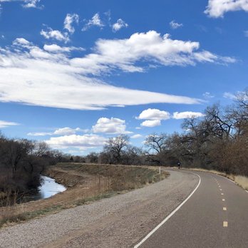
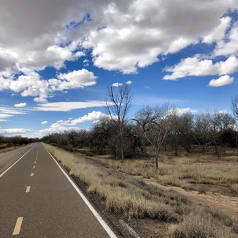
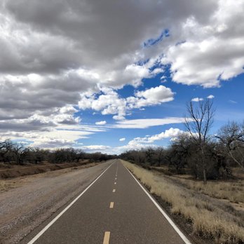
Sure, "distancing" doesn't sound like a particularly appealing lifestyle model, but there are definitely opportunities to celebrate solitude and silence, Exhibit A: Paseo del Bosque trail. The last decade plus, I've lived near the river, and this multi-use path has been my exercise bestie, taking me from Alameda to Rio Bravo, preparing for a half marathon, pulling my kiddo's bike trailer to the zoo, and creating lifelong memories: that day I saved a wood duck, the porcupine sleeping in the cottonwood, the six foot long bull snake, the preggo snapping turtle. I could go on and on, but there's no time like the present to talk about the present... If you're taking advantage of the only upside to this Cabrona nightmare -- getting outside for some vitamin D on the daily -- this trail is the city's best natural resource. In particular, I encourage you to tour the west side of the river -- technically not this trail, but a series of dirt paths running along the shore and west, from Montano to Paseo del Norte and beyond. I'm posting photos from our walk today, wherein we found a great little bottle fortress. Apparently people drop small notes in the bottles which list new year wishes or positive prayers for the planet. We could all use some of those, right about now. Want to scavenge? Find this fort.


Paseo del Bosque Trail is a great place to go bike riding; we did a 17-mile, round-trip ride here the first time we visited. It's an easy-to-navigate, well-maintained trail that facilitates riding along at a good pace. That said, the scenery you'll find along the trail is more than a bit repetitive, so much so that if you're going for a relatively long ride (like we did) you'll find it fairly monotonous. Just how monotonous is the scenery? Even though the trail is very close to the Rio Grande, and runs totally parallel to it, you'll only actually see the river briefly at the beginning of the trail... Another minus - there isn't a whole lot of shade here, despite the fact that there are a fair number of trees near the trail. Given this, you should plan appropriately and bring along lots of water.


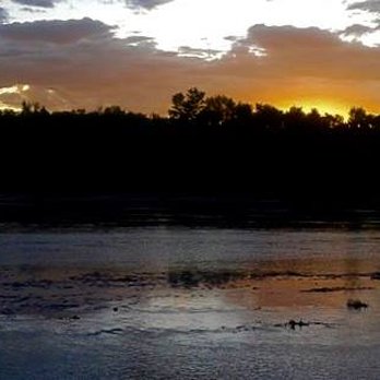
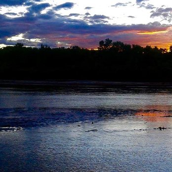
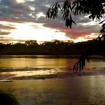
Bicycle/pedestrian super-highway between downtown ABQ and Corrales. No cars whatsoever for 16 miles. In addition to encounters with indigenous animals, sometimes it is possible to hear lions/exotic animal sounds coming from the zoo. Run into llamas/camels somewhere between the Montaño bridge and Corrales. During the summer, the trail is a great place to train for a triathlon. Stop at Tingley Beach to use the outdoor exercise equipment. Hit the Rio Grande Pool at around 3:00 pm, try to get a lane, do some laps. Otherwise, throw a towel under a tree or not if you need some vitamin D or are wearing SPF 500 sunscreen if you need it. On a budget of $2.50, it is the closest feeling to laying on an actual beach in Albuquerque. Off the path, there are dirt trails leading to river banks and places to chill where the constant sound of police sirens are substantially diminished. Hang out there until it is almost dark --especially during the fall--it can be highly photogenic at the golden hour. At sunset, the typically muddy brown river can change colors several times according to what is going on in the sky. I imagine it is the same at sunrise, but I don't get up that early. Wouldn't recommend hanging out in the bosque after dark. I think being a state park it is probably closed anyways. In general, be careful when venturing off the paved portion of the trial. Hate to say this--especially if you are a lady ---bring a friend or two or mace, a pit bull, and martial arts skills if you got 'em.
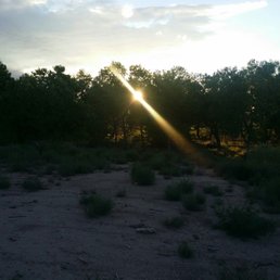

Absolutely love this trail! It doesn't matter if your biking, running or walking its always an adventure. I've come here often with my bestie to hike through the bosque or in the paved trail and with my honey on bike rides and some hikes. Never fails to awe me. Its amazing how close to nature you can be seemingly in the middle if the city. There's not much I can say that hasn't been said so I'll give some helpful tips from someone who is sometimes a bit over prepared. Always have enough water and snacks. Sometimes you don't realize the energy you can burn having fun. So make sure you have something to nibble on to keep your energy up. Make sure you have sprayed yourself with sunscreen. I know some people don't have this problem but I'm part Irish and unfortunately I burn easily. So protect your skin. During the mosquito time make sure you have bug spray. I don't know how tasty you are to them but apparently I'm pretty tasty. Also have your helmet and sunglasses because the sun can be bright and well you never know if you may take a spill. I also take a backpack that has antisceptic spray, hand sanitizer and a first aid kit. Like I said you may not need them and I hope you don't but its always good to have. One thing I always take with me no matter who I am with is pepper spray. Its a safety precautions that I take for peace of mind because you always good nothing goes wrong. I also carry a small knife in case if an emergency good or bad. All in all the trail is a safe and fun place to ride and walk or jog. Its a good way to clear your head and get away from the hustle and bustle of everyday life. HAVE FUN AND BE SAFE!!


Excellent. I prefer the South Valley area: less crowded; less developed. A great place for photography. &, on occasion, you'll see some very interesting characters out there. I mean they're WAY OUT there. Ha.


10 months ago
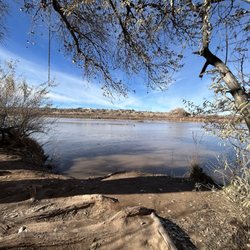
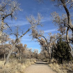
I took my wife and our dog for a walk along the Paseo del Bosque Trail, and it was exactly the reset we needed. We went in late November, when the cottonwoods are still glowing gold, and the whole riverside felt like it was an autumn paradise. The trail is flat and easy, with long stretches that let you really settle into the scenery-Rio Grande on one side, trees and little side ponds on the other. Our dog loved it. There's plenty of room to keep a dog on leash without feeling crowded, and enough side paths and textures (sand, dirt, leaves) to keep him interested. We saw ducks and geese cruising on the water, along with a woodpecker working a cottonwood trunk. It also turned into a really sweet date. There are quiet spots to stop, sit by the water, and just watch the birds and the current go by. It never felt unsafe or overly busy, just a steady trickle of walkers, cyclists, and other people out enjoying the trail. If you're visiting Albuquerque-or you just moved here and want to fall in love with the area a little bit-Paseo del Bosque is an easy yes. read more


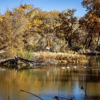

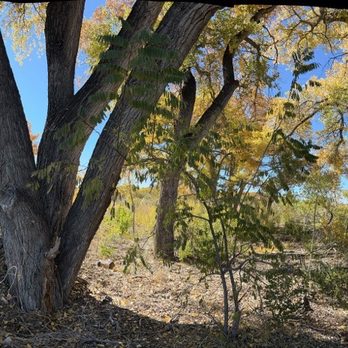
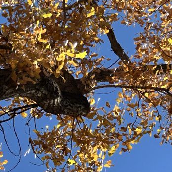

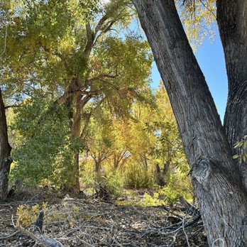


Albuquerque has over 400 miles of trails and this section has been part of my bicycling route everyday while I'm in town. These trails are such a lush experience. I feel spoiled. There is not a dull moment on any of them as they twist and turn through various neighborhoods. If you ride enough of them -- and I devoured what I could -- you will realize that these are a central component of this community. I came here to ride these trails and it was worth seeing this city in a way I never have in all the years that I've visited. Bring a bike and go exploring. read more


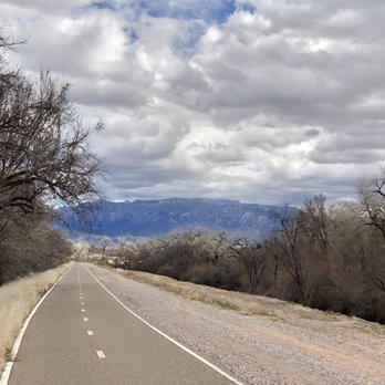
Absolutely gaw-geous! The Bosque Trail is close-ish to where my parents live, so on several visits to ABQ I have taken it upon myself to walk/run along some legs of it. The trail is paved and is accessible, with several options of locations to park at and begin and end at. It runs close to the Rio Grande and part goes through the Rio Grande Valley State Park. It is beautiful. There isn't a lot of shade (hello, desert!) so wear sunscreen AND reapply. That may mostly be a belated note to myself....but anyway... The views along the trail of the river and the mountains are gorgeous. The people are considerate when passing, and seem to give plenty of warning giving you time to move aside for those faster than you or on a bike. I think it is a great option for open outdoor space to enjoy nature and get some activity in. It is worth a visit, if not visits on a regular basis if you are able. read more

1 year ago

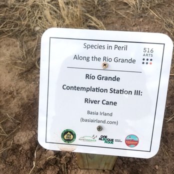
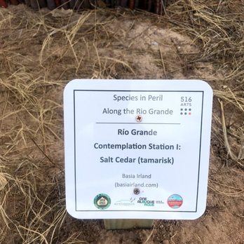
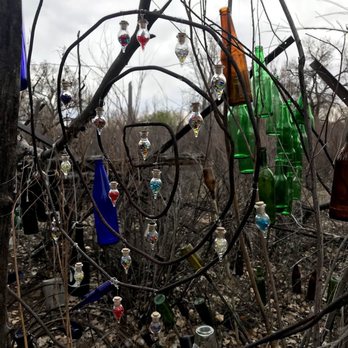
Sure, "distancing" doesn't sound like a particularly appealing lifestyle model, but there are definitely opportunities to celebrate solitude and silence, Exhibit A: Paseo del Bosque trail. The last decade plus, I've lived near the river, and this multi-use path has been my exercise bestie, taking me from Alameda to Rio Bravo, preparing for a half marathon, pulling my kiddo's bike trailer to the zoo, and creating lifelong memories: that day I saved a wood duck, the porcupine sleeping in the cottonwood, the six foot long bull snake, the preggo snapping turtle. I could go on and on, but there's no time like the present to talk about the present... If you're taking advantage of the only upside to this Cabrona nightmare -- getting outside for some vitamin D on the daily -- this trail is the city's best natural resource. In particular, I encourage you to tour the west side of the river -- technically not this trail, but a series of dirt paths running along the shore and west, from Montano to Paseo del Norte and beyond. I'm posting photos from our walk today, wherein we found a great little bottle fortress. Apparently people drop small notes in the bottles which list new year wishes or positive prayers for the planet. We could all use some of those, right about now. Want to scavenge? Find this fort. read more




6 years ago
Paseo del Bosque Trail is a great place to go bike riding; we did a 17-mile, round-trip ride here the first time we visited. It's an easy-to-navigate, well-maintained trail that facilitates riding along at a good pace. That said, the scenery you'll find along the trail is more than a bit repetitive, so much so that if you're going for a relatively long ride (like we did) you'll find it fairly monotonous. Just how monotonous is the scenery? Even though the trail is very close to the Rio Grande, and runs totally parallel to it, you'll only actually see the river briefly at the beginning of the trail... Another minus - there isn't a whole lot of shade here, despite the fact that there are a fair number of trees near the trail. Given this, you should plan appropriately and bring along lots of water. read more


10 years ago
Bicycle/pedestrian super-highway between downtown ABQ and Corrales. No cars whatsoever for 16 miles. In addition to encounters with indigenous animals, sometimes it is possible to hear lions/exotic animal sounds coming from the zoo. Run into llamas/camels somewhere between the Montaño bridge and Corrales. During the summer, the trail is a great place to train for a triathlon. Stop at Tingley Beach to use the outdoor exercise equipment. Hit the Rio Grande Pool at around 3:00 pm, try to get a lane, do some laps. Otherwise, throw a towel under a tree or not if you need some vitamin D or are wearing SPF 500 sunscreen if you need it. On a budget of $2.50, it is the closest feeling to laying on an actual beach in Albuquerque. Off the path, there are dirt trails leading to river banks and places to chill where the constant sound of police sirens are substantially diminished. Hang out there until it is almost dark --especially during the fall--it can be highly photogenic at the golden hour. At sunset, the typically muddy brown river can change colors several times according to what is going on in the sky. I imagine it is the same at sunrise, but I don't get up that early. Wouldn't recommend hanging out in the bosque after dark. I think being a state park it is probably closed anyways. In general, be careful when venturing off the paved portion of the trial. Hate to say this--especially if you are a lady ---bring a friend or two or mace, a pit bull, and martial arts skills if you got 'em. read more



3 years ago

9 years ago

10 years ago
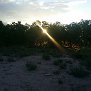
Absolutely love this trail! It doesn't matter if your biking, running or walking its always an adventure. I've come here often with my bestie to hike through the bosque or in the paved trail and with my honey on bike rides and some hikes. Never fails to awe me. Its amazing how close to nature you can be seemingly in the middle if the city. There's not much I can say that hasn't been said so I'll give some helpful tips from someone who is sometimes a bit over prepared. Always have enough water and snacks. Sometimes you don't realize the energy you can burn having fun. So make sure you have something to nibble on to keep your energy up. Make sure you have sprayed yourself with sunscreen. I know some people don't have this problem but I'm part Irish and unfortunately I burn easily. So protect your skin. During the mosquito time make sure you have bug spray. I don't know how tasty you are to them but apparently I'm pretty tasty. Also have your helmet and sunglasses because the sun can be bright and well you never know if you may take a spill. I also take a backpack that has antisceptic spray, hand sanitizer and a first aid kit. Like I said you may not need them and I hope you don't but its always good to have. One thing I always take with me no matter who I am with is pepper spray. Its a safety precautions that I take for peace of mind because you always good nothing goes wrong. I also carry a small knife in case if an emergency good or bad. All in all the trail is a safe and fun place to ride and walk or jog. Its a good way to clear your head and get away from the hustle and bustle of everyday life. HAVE FUN AND BE SAFE!! read more

9 years ago
Excellent. I prefer the South Valley area: less crowded; less developed. A great place for photography. &, on occasion, you'll see some very interesting characters out there. I mean they're WAY OUT there. Ha. read more

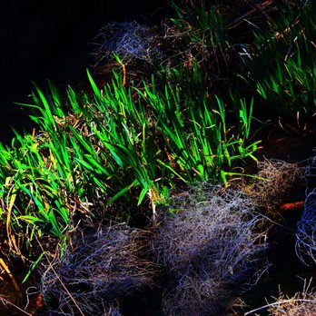


The Bosque Trail is absolutely outstanding I can come out here every day or every weekend to ride my bike to play along the creek with the family or for running it is absolutely great whatever you want to do come out here enjoy it alone or with the family. read more

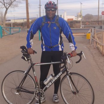


11 years ago


11 years ago

10 years ago

11 years ago
11 years ago
More info about Paseo del Bosque Trail
Along The Rio Grande
Albuquerque, NM 87102
Barelas/South Valley
Directions
Visit Website
http://www.cabq.gov
Hours
Indoor Amenities
Outdoor Amenities
Ask the Community - Paseo del Bosque Trail
Where would it be a good place to park and start my jog? How late is it too late to start my run?
Hi Ray, try the National Hispanic Cultural Center, Tingley Beach, the end of Mountain Road (just drive all the way west), or the parking lot just north of I40 (map it for directions). North of I40 is a little harder - try the Rio Grande Nature…
Review Highlights - Paseo del Bosque Trail











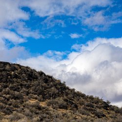

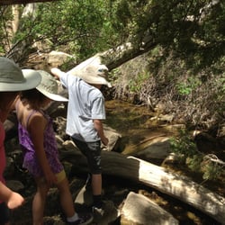



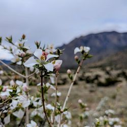
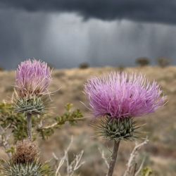
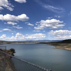

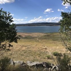
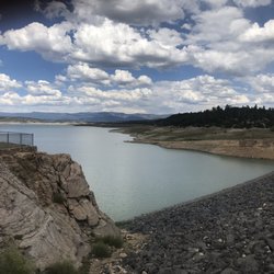
Paseo del Bosque Trail - hiking - Updated September 2026
Best of Albuquerque
People found Paseo del Bosque Trail by searching for…
Photo Spots in Albuquerque, NM
Things to Do in Albuquerque, NM
Horseback Riding in Albuquerque, NM
Attractions in Albuquerque, NM
Scenic View in Albuquerque, NM
Sunset View in Albuquerque, NM
Swimming Lakes in Albuquerque, NM
Hiking Trails With Waterfalls in Albuquerque, NM
Picnic Areas in Albuquerque, NM
Walking Trails in Albuquerque, NM
Running Trails in Albuquerque, NM
Off Road Trails in Albuquerque, NM
Dog Friendly Trails in Albuquerque, NM
Stroller Walk in Albuquerque, NM
Dog Friendly Beaches in Albuquerque, NM
Nature Walks in Albuquerque, NM
Parks and Recreation in Albuquerque, NM
Trending Searches in Albuquerque, NM
Apple Picking near Paseo del Bosque Trail
Archery near Paseo del Bosque Trail
Barbershop near Paseo del Bosque Trail
Beautiful Views near Paseo del Bosque Trail
Blow Dry Bar near Paseo del Bosque Trail
Caves near Paseo del Bosque Trail
Cliff Jumping near Paseo del Bosque Trail
Consignment Shops near Paseo del Bosque Trail
Corn Maze near Paseo del Bosque Trail
Dog Friendly Things To Do near Paseo del Bosque Trail
Dog Friendly Trails near Paseo del Bosque Trail
Dog Swimming near Paseo del Bosque Trail
Eyebrow Threading near Paseo del Bosque Trail
Eyelash Extensions near Paseo del Bosque Trail
Formal Wear near Paseo del Bosque Trail
Hiking near Paseo del Bosque Trail
Kids Birthday Party near Paseo del Bosque Trail
Makeup Artists near Paseo del Bosque Trail
Mens Suits near Paseo del Bosque Trail
Night Hike near Paseo del Bosque Trail
Off Road Trails near Paseo del Bosque Trail
Outdoor Activities near Paseo del Bosque Trail
Parks near Paseo del Bosque Trail
Photo Spots near Paseo del Bosque Trail
Picnic Areas near Paseo del Bosque Trail
Picnic Spots near Paseo del Bosque Trail
Places To Take Pictures near Paseo del Bosque Trail
Private Schools near Paseo del Bosque Trail
Public Shower near Paseo del Bosque Trail
River Swimming near Paseo del Bosque Trail
Rock Quarry near Paseo del Bosque Trail
Scenic Night View near Paseo del Bosque Trail
Scenic Overlook near Paseo del Bosque Trail
Sunrise View near Paseo del Bosque Trail
Browse Nearby
BEST of Albuquerque, New Mexico Coffee near Paseo del Bosque Trail
BEST of Albuquerque, New Mexico Restaurants near Paseo del Bosque Trail
BEST of Albuquerque, New Mexico Things to Do near Paseo del Bosque Trail
BEST of Albuquerque, New Mexico Breakfast near Paseo del Bosque Trail
BEST of Albuquerque, New Mexico Walking Trails near Paseo del Bosque Trail
BEST of Albuquerque, New Mexico Parks near Paseo del Bosque Trail
BEST of Albuquerque, New Mexico Airport near Paseo del Bosque Trail
BEST of Albuquerque, New Mexico Campgrounds near Paseo del Bosque Trail
BEST of Albuquerque, New Mexico Sightseeing near Paseo del Bosque Trail
Browse Brands
Related Searches in Albuquerque, NM
Affordable Bike Repair Services in Albuquerque, New Mexico
Affordable Bike Tune Up Services in Albuquerque, New Mexico
Affordable Cheap Bike Tune Up Services in Albuquerque, New Mexico
Affordable Kayak Rental Services in Albuquerque, New Mexico
Affordable Mobile Bike Repair in Albuquerque, New Mexico
Best Dirt Bike Riding Spots in Albuquerque, New Mexico
Best Dog Hiking Trails Around Albuquerque, New Mexico
Best Electric Bike Rental Services in Albuquerque, New Mexico
Best Fishing Locations and Guides in Albuquerque, New Mexico
Best Places for Horseback Riding in Albuquerque, New Mexico
Best Sightseeing Experiences Available in Albuquerque, New Mexico
Best Sledding Spots and Fun in Albuquerque, New Mexico
Check Out Off Road Trails in Albuquerque, New Mexico
Convenient Bike Sharing Programs in Albuquerque, New Mexico
Discover Dog Friendly Trails to Explore in Albuquerque, New Mexico
Discover Easy Hiking Trails Near Albuquerque, New Mexico
Discover Popular Bike Tours in Albuquerque, New Mexico
Discover Popular Bike Trails in Albuquerque, New Mexico
Discover Scenic Bike Paths in Albuquerque, New Mexico
Discover Scenic Mountain Bike Trails Near Albuquerque, New Mexico
Discover a Hiking Trail in Albuquerque, New Mexico
Discover the Best Night Hike Trails in Albuquerque, New Mexico
Dog-Friendly Hikes With Dogs in Albuquerque, New Mexico
Enjoy Camping Adventures Around Albuquerque, New Mexico
Enjoy Hiking Adventures in Albuquerque, New Mexico
Enjoy Kayaking Adventures in Albuquerque, New Mexico
Enjoy Off Leash Dog Hikes in Albuquerque, New Mexico
Enjoy Scenic Places to Walk in Albuquerque, New Mexico
Enjoy Tent Camping Spots Around Albuquerque, New Mexico
Enjoy the Best Tubing Experiences in Albuquerque, New Mexico
Enjoy the Best Walking Trails in Albuquerque, New Mexico
Experience Stunning Sunset Views in Albuquerque, New Mexico
Explore BMX Bike Shops Near Albuquerque, New Mexico
Explore Beautiful Parks and Green Spaces in Albuquerque, New Mexico
Explore Bike Rentals Throughout Albuquerque, New Mexico
Explore Easy Hikes Perfect for All in Albuquerque, New Mexico
Explore Electric Bikes Available in Albuquerque, New Mexico
Explore Fun Activities to Do in Albuquerque, New Mexico
Explore Popular Campgrounds Near Albuquerque, New Mexico
Explore Popular Scenic Overlook Points in Albuquerque, New Mexico
Explore Scenic Lakes to Visit in Albuquerque, New Mexico
Explore Top Dog Parks in Albuquerque, New Mexico Near You
Explore the Best Rock Climbing Areas in Albuquerque, New Mexico
Family Friendly Hiking With Kids in Albuquerque, New Mexico
Find Beautiful Views in Albuquerque, New Mexico
Find Cheap Bike Rentals Around Albuquerque, New Mexico
Find Cozy Camping Cabins in Albuquerque, New Mexico
Find Parks and Recreation Activities in Albuquerque, New Mexico


