Boca Negra Canyon Photos


You might also consider

More like Boca Negra Canyon
Recommended Reviews - Boca Negra Canyon
Start your review...


Reviews With Photos
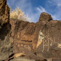

Mouth Park Boca Negra Canyon is one of five (including the Visitors Center) disparate locations around Albuquerque encompassing Petroglyph National Monument. The Good: *This might be the smallest of the sites, but maybe the most fun if you're a fan of climbing. *Not as many Petroglyphs (100 vs 400) as Piedras Mercadas Canyon, but because the hikes/climbs are so short, it makes one feel like they've seen a lot. *Restrooms *Drinking fountains *Spectacular views of Albuquerque and the surrounding area once you get to the top. The Meh: *No dogs allowed *Minimal $2/weekend & $1/weekday entrance fee, but free with National Park pass, of course. The Ugly: *If you have bad knees, then this ain't for you. Steep steps and fairly hearty--but short--inclines to get one to the top. TLDR: Not the most Petroglyphs, but maybe the most fun, if you're a fan of climbing, that is.


Boca Negra Canyon is within the Petroglyph National Monument. There are three hiking trails inside the canyon - Macaw, Mesa Point, and Cliff Base; all told you can see somewhere in the neighborhood of a hundred petroglyphs. The three trails here vary in difficulty - Cliff Base and Macaw are moderate; Mesa Point is an ass kicker ;-) Recently, I hiked Mesa Point with a friend visiting from out-of-town. The rocks (mostly volcanic in origin) have many different drawings, which including animals, humans, and symbols (both ceremonial and religious). The combination of the easy access, the difficult terrain, the natural beauty and the historical significance made our visit to this trail both extremely fun and memorable. Tip: Boca Negra Canyon is open daily from 8:30am to 4:30pm; last entry at 4:00pm is strictly enforced.


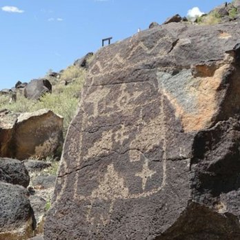
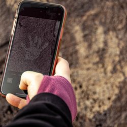
Beautiful trails are located in Boca Negra Canyon to view hundreds of ancient petroglyph images, including people, animals and ceremonial figures. The Mesa Point and Cliff Base Trails are easily explored paved pathways that climb up the side of the canyon for a closer look at the carvings and stunning scenic views. The canyon was formed by six volcanic eruptions that occured about 200,000 years ago. The liquid lava formed peninsulas around the existing hills, that subsequently eroded leaving canyons in a process called reverse topography. Over time, huge boulders broke away and tumbled down creating the canvas for ancient people to chip and peck away to create the numerous petroglyphs over hundreds, or thousands, of years. Amazing to visit this ancient sacred ground that is located literally right next door to a very urban Albuquerque.


We loved Boca Negra. It's easy to park and walk to the petroglyphs. It's a little steep on the climb but very doable if you have average mobility. There is also a flatter section where you can see quitea bit without the climb.


Great views of the city and petroglyphs for only $1 to park. You get a good, short hike I and get to see a ton of drawings on the rocks. The trail is sometimes hard to follow, but not bad amd is right off the parking lot.
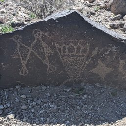

Boca Negra Canyon is a great place to file for history and hiking. I really like the location and being able to park close to the trails and get right into it. The petroglyphs are really cool and unique. Well worth a visit to check out and experience
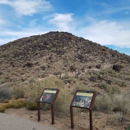

This is the park for viewing the petroglyphs. Located just a few miles north of the Petroglyph National Park visitor center. The Mesa Point Trail is a short but steep walk up the mountain that gives you the best views of the petroglyphs and of the surrounding city. Note- it's not the best for those with mobility issues but it should be okay for kids 5 and older. Admission is $2 per car weekends, $1 weekdays. If you have the fourth grader pass it's free...


Really enjoyable hike after we landed and needed to stretch our legs a bit. Lots of nice petroglyphs that were easy to spit and beautiful views of the city as well. Amazing that it is as close to town as it is. No facilities out in this area other than some shaded picnic areas so if you are going for an extended hike make sure to bring some water.
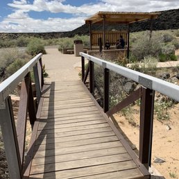

Aaah, New Mexico?! Where do I start!? So much mysteries and almost sure history. I wish I have all the time in the world to see parts of this state that holds a lot of stories. This place here is also enchanting. A little bit of hike (a smooth one...) takes you all the way to the top and see the magnificent 360 views. This you do a self guided tour which, I did with my family. It is short and sweet and you will run into postings that says a little or a lot about this canyon. I recommend this to all who visit one day or some day. I'm sure we can google this as well. What a lovely experience I had. I love and cherish good memories.


1 year ago
Came here during a trip to ABQ. Boca Negra is managed by ABQ city vs federal gov so it does remain open during the federal shutdown (please continue to follow safety guidelines and follow regulations regarding park behavior). This canyon has 3 separate trails for viewing petroglyphs; a 5 min, a 15 min, and a 1 hr. Maps for these are available at the Petroglyph National Monument (managed by federal gov and may be shut down due to the federal shutdown). I did the 15 min and the 5 min trails, these are not accessible trails for strollers or wheelchairs as they include stairs and walking through semi paved and unpaved rocky walkways. There are small signs throughout the trails including education information as well as briefs about some of the petroglyphs. Please do not go when it is raining or recently rained; the trails are sandy and become very slippery + the rocks become darker and it is incredibly hard to spot and distinguish petroglyphs. read more


Mouth Park Boca Negra Canyon is one of five (including the Visitors Center) disparate locations around Albuquerque encompassing Petroglyph National Monument. The Good: *This might be the smallest of the sites, but maybe the most fun if you're a fan of climbing. *Not as many Petroglyphs (100 vs 400) as Piedras Mercadas Canyon, but because the hikes/climbs are so short, it makes one feel like they've seen a lot. *Restrooms *Drinking fountains *Spectacular views of Albuquerque and the surrounding area once you get to the top. The Meh: *No dogs allowed *Minimal $2/weekend & $1/weekday entrance fee, but free with National Park pass, of course. The Ugly: *If you have bad knees, then this ain't for you. Steep steps and fairly hearty--but short--inclines to get one to the top. TLDR: Not the most Petroglyphs, but maybe the most fun, if you're a fan of climbing, that is. read more


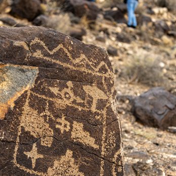


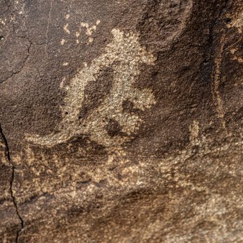


Boca Negra Canyon is within the Petroglyph National Monument. There are three hiking trails inside the canyon - Macaw, Mesa Point, and Cliff Base; all told you can see somewhere in the neighborhood of a hundred petroglyphs. The three trails here vary in difficulty - Cliff Base and Macaw are moderate; Mesa Point is an ass kicker ;-) Recently, I hiked Mesa Point with a friend visiting from out-of-town. The rocks (mostly volcanic in origin) have many different drawings, which including animals, humans, and symbols (both ceremonial and religious). The combination of the easy access, the difficult terrain, the natural beauty and the historical significance made our visit to this trail both extremely fun and memorable. Tip: Boca Negra Canyon is open daily from 8:30am to 4:30pm; last entry at 4:00pm is strictly enforced. read more




3 years ago

Beautiful trails are located in Boca Negra Canyon to view hundreds of ancient petroglyph images, including people, animals and ceremonial figures. The Mesa Point and Cliff Base Trails are easily explored paved pathways that climb up the side of the canyon for a closer look at the carvings and stunning scenic views. The canyon was formed by six volcanic eruptions that occured about 200,000 years ago. The liquid lava formed peninsulas around the existing hills, that subsequently eroded leaving canyons in a process called reverse topography. Over time, huge boulders broke away and tumbled down creating the canvas for ancient people to chip and peck away to create the numerous petroglyphs over hundreds, or thousands, of years. Amazing to visit this ancient sacred ground that is located literally right next door to a very urban Albuquerque. read more


We loved Boca Negra. It's easy to park and walk to the petroglyphs. It's a little steep on the climb but very doable if you have average mobility. There is also a flatter section where you can see quitea bit without the climb. read more
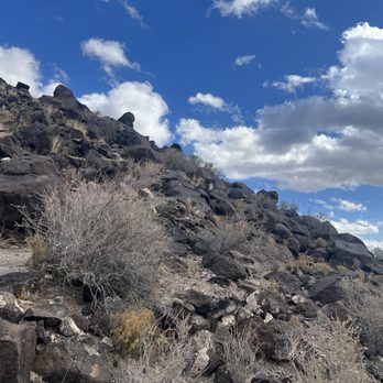

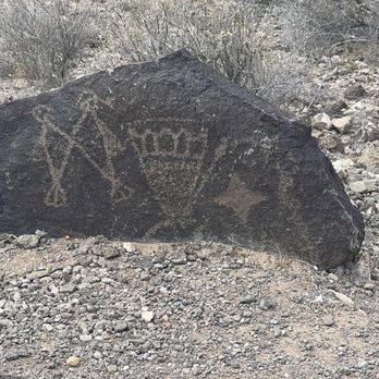


Great views of the city and petroglyphs for only $1 to park. You get a good, short hike I and get to see a ton of drawings on the rocks. The trail is sometimes hard to follow, but not bad amd is right off the parking lot. read more


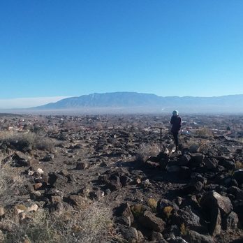

3 years ago
Boca Negra Canyon is a great place to file for history and hiking. I really like the location and being able to park close to the trails and get right into it. The petroglyphs are really cool and unique. Well worth a visit to check out and experience read more

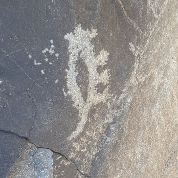

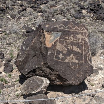


This is the park for viewing the petroglyphs. Located just a few miles north of the Petroglyph National Park visitor center. The Mesa Point Trail is a short but steep walk up the mountain that gives you the best views of the petroglyphs and of the surrounding city. Note- it's not the best for those with mobility issues but it should be okay for kids 5 and older. Admission is $2 per car weekends, $1 weekdays. If you have the fourth grader pass it's free... read more


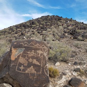


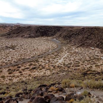
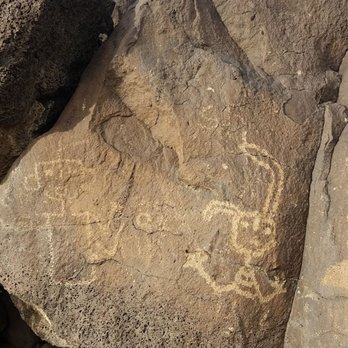
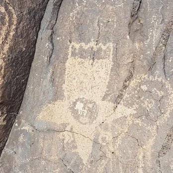


Really enjoyable hike after we landed and needed to stretch our legs a bit. Lots of nice petroglyphs that were easy to spit and beautiful views of the city as well. Amazing that it is as close to town as it is. No facilities out in this area other than some shaded picnic areas so if you are going for an extended hike make sure to bring some water. read more


7 years ago
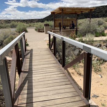
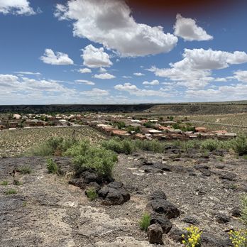
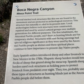
Aaah, New Mexico?! Where do I start!? So much mysteries and almost sure history. I wish I have all the time in the world to see parts of this state that holds a lot of stories. This place here is also enchanting. A little bit of hike (a smooth one...) takes you all the way to the top and see the magnificent 360 views. This you do a self guided tour which, I did with my family. It is short and sweet and you will run into postings that says a little or a lot about this canyon. I recommend this to all who visit one day or some day. I'm sure we can google this as well. What a lovely experience I had. I love and cherish good memories. read more




9 years ago
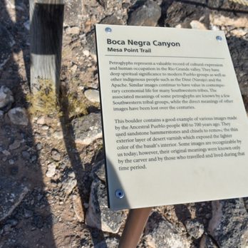
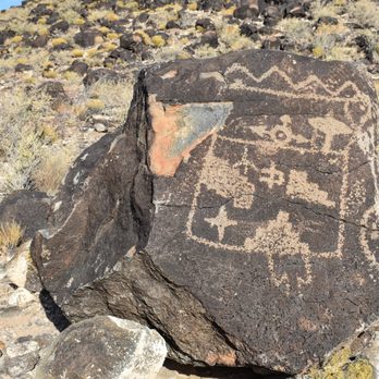
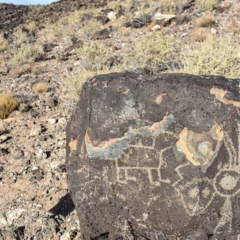
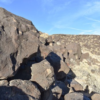
Boca Negra Canyon is within the Petroglyph National Monument. While visiting Boca Negra Canyon there are a multitude of symbols carved onto the archeological sites. The volcanic rocks had many drawings including figures of people, animals, and ceremonial and religious symbols carvings. The landscape here is considered holy ground to Native American tribes. While climbing up Boca Negra there are many petroglyphs leading all the way up to the top of the canyon. The views of all of the petroglyphs while hiking and climbing rocks to the top were really remarkable read more




8 years ago
More info about Boca Negra Canyon
Unser Blvd
Albuquerque, NM 87121
Westside
Directions
Hours
Indoor Amenities
Outdoor Amenities
Ask the Community - Boca Negra Canyon
Review Highlights - Boca Negra Canyon

















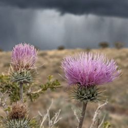
Boca Negra Canyon - hiking - Updated October 2026
Best of Albuquerque
People found Boca Negra Canyon by searching for…
Scenic View in Albuquerque, NM
Sunset View in Albuquerque, NM
Things to Do in Albuquerque, NM
Hiking Trails in Albuquerque, NM
Scenic Drive in Albuquerque, NM
Walking Trails in Albuquerque, NM
Running Trails in Albuquerque, NM
Natural Hot Springs in Albuquerque, NM
Picnic Areas in Albuquerque, NM
Places to Take Pictures in Albuquerque, NM
Picnic Areas BBQ Pits in Albuquerque, NM
Field Trips in Albuquerque, NM
National Parks in Albuquerque, NM
Beautiful Views in Albuquerque, NM
Attractions in Albuquerque, NM
View Points in Albuquerque, NM
Dog Friendly Parks in Albuquerque, NM
Trending Searches in Albuquerque, NM
Apple Picking near Boca Negra Canyon
Archery near Boca Negra Canyon
Barbershop near Boca Negra Canyon
Beautiful Views near Boca Negra Canyon
Blow Dry Bar near Boca Negra Canyon
Corn Maze near Boca Negra Canyon
Dog Friendly Trails near Boca Negra Canyon
Eyelash Extensions near Boca Negra Canyon
Formal Dresses near Boca Negra Canyon
Formal Wear near Boca Negra Canyon
Halloween Events near Boca Negra Canyon
Hidden Gems near Boca Negra Canyon
Hiking Trails near Boca Negra Canyon
Historical Sites near Boca Negra Canyon
Kids Birthday Party near Boca Negra Canyon
Landmarks & Historical Buildings near Boca Negra Canyon
Makeup Artists near Boca Negra Canyon
Off Road Trails near Boca Negra Canyon
Photo Spots near Boca Negra Canyon
Places To Take Pictures near Boca Negra Canyon
Places To Walk near Boca Negra Canyon
Places To Walk Around near Boca Negra Canyon
Private Schools near Boca Negra Canyon
Public Art near Boca Negra Canyon
Public Shower near Boca Negra Canyon
Pumpkin Patches near Boca Negra Canyon
Rock Quarry near Boca Negra Canyon
Scenic Night View near Boca Negra Canyon
Scenic Overlook near Boca Negra Canyon
Small Venues & Event Spaces near Boca Negra Canyon
State Parks near Boca Negra Canyon
Browse Nearby
BEST of Albuquerque, New Mexico Parks near Boca Negra Canyon
BEST of Albuquerque, New Mexico Restaurants near Boca Negra Canyon
BEST of Albuquerque, New Mexico Coffee near Boca Negra Canyon
BEST of Albuquerque, New Mexico Things to Do near Boca Negra Canyon
BEST of Albuquerque, New Mexico Breakfast near Boca Negra Canyon
BEST of Albuquerque, New Mexico Shopping near Boca Negra Canyon
Browse Brands
Related Searches in Albuquerque, NM
Affordable Kayak Rental Services in Albuquerque, New Mexico
Best Dog Hiking Trails Around Albuquerque, New Mexico
Best Fishing Locations and Guides in Albuquerque, New Mexico
Best Fun Things to Do in Albuquerque, New Mexico
Best Places for Horseback Riding in Albuquerque, New Mexico
Best Sightseeing Experiences Available in Albuquerque, New Mexico
Book Engaging Historical Tours in Albuquerque, New Mexico
Check Out Off Road Trails in Albuquerque, New Mexico
Discover Charming Historic Homes in Albuquerque, New Mexico
Discover Dog Friendly Trails to Explore in Albuquerque, New Mexico
Discover Easy Hiking Trails Near Albuquerque, New Mexico
Discover Famous Monuments in Albuquerque, New Mexico
Discover Historic Sites and Places in Albuquerque, New Mexico
Discover Lakes & Ponds to Explore in Albuquerque, New Mexico
Discover Popular Bike Trails in Albuquerque, New Mexico
Discover Popular Landmarks in Albuquerque, New Mexico
Discover Popular Photo Spots in Albuquerque, New Mexico
Discover Top Points of Interest in Albuquerque, New Mexico
Discover Top Scenic Spots to Visit in Albuquerque, New Mexico
Discover a Hiking Trail in Albuquerque, New Mexico
Discover the Best Caves to Explore in Albuquerque, New Mexico
Discover the Best Night Hike Trails in Albuquerque, New Mexico
Dog-Friendly Hikes With Dogs in Albuquerque, New Mexico
Enjoy Camping Adventures Around Albuquerque, New Mexico
Enjoy Kayaking Adventures in Albuquerque, New Mexico
Enjoy Off Leash Dog Hikes in Albuquerque, New Mexico
Enjoy Scenic Places to Walk in Albuquerque, New Mexico
Enjoy Tent Camping Spots Around Albuquerque, New Mexico
Enjoy the Best Walking Trails in Albuquerque, New Mexico
Experience Stunning Sunset Views in Albuquerque, New Mexico
Explore Beautiful Botanical Gardens in Albuquerque, New Mexico
Explore Beautiful Castles and Landmarks in Albuquerque, New Mexico
Explore Beautiful Parks and Green Spaces in Albuquerque, New Mexico
Explore Children's Museums Near Albuquerque, New Mexico
Explore Easy Hikes Perfect for All in Albuquerque, New Mexico
Explore Free Things to Do Around Albuquerque, New Mexico
Explore Fun Activities to Do in Albuquerque, New Mexico
Explore Fun Field Trips in Albuquerque, New Mexico
Explore Popular Campgrounds Near Albuquerque, New Mexico
Explore Popular Scenic Overlook Points in Albuquerque, New Mexico
Explore Scenic Lakes to Visit in Albuquerque, New Mexico
Explore Secret Spots Worth Visiting in Albuquerque, New Mexico
Explore Top Dog Parks in Albuquerque, New Mexico Near You
Explore Venues & Event Spaces in Albuquerque, New Mexico
Explore the Top Car Museum in Albuquerque, New Mexico
Family Friendly Hiking With Kids in Albuquerque, New Mexico
Find Beautiful Views in Albuquerque, New Mexico
Find Cozy Camping Cabins in Albuquerque, New Mexico
Find Parks and Recreation Activities in Albuquerque, New Mexico


