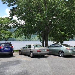
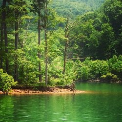
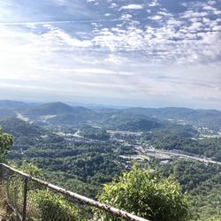
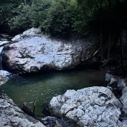
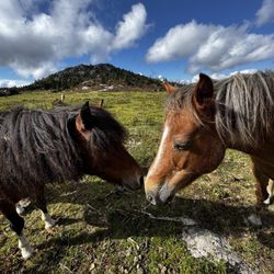
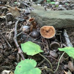
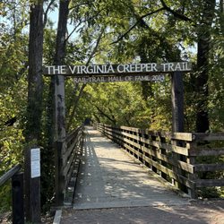
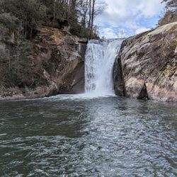
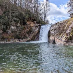
Cancel

    Open app

    Search

    Callalantee

    4.3 (3 reviews)

    Callalantee Photos

    Recommended Reviews - Callalantee

    Your trust is our priority, so businesses can't pay to alter or remove their reviews. Learn more about reviews.
    Yelp app icon
    Browse more easily on the app
    Review Feed Illustration

    16 years ago

    Helpful 1
    Thanks 0
    Love this 0
    Oh no 0

    15 years ago

    Helpful 1
    Thanks 0
    Love this 0
    Oh no 0

    16 years ago

    Helpful 0
    Thanks 0
    Love this 0
    Oh no 0

    Verify this business for free

    Get access to customer & competitor insights.

    Verify this business

    Grayson Highlands State Park - Friendly horse coming in for a sniff

    Grayson Highlands State Park

    4.7(38 reviews)
    17.5 mi

    We needed some time in the mountains. I had visited here before but mostly for shorter trails. This…read moretime we needed some Appalachian Trail in our lives. We did a couple of short trails but the monster was the Appalachian Trail to Mount Rogers Loop. It's logged at 14.3 miles but we ended up logging around 15.2 miles with various trips off trail to check out. The first part of this trail is fine. You walk through areas where some of the wild ponies hangout. Sometimes you can catch wild cattle too(which we did, but not until we were on our way out). The off trail to Mount Rogers is also fairly easy. If you're coming down from Mount Rogers and taking the loop around the mountain, make sure you have plenty of water and maybe some kind of snack for energy. There is a little section from mile 8-12 that almost put me down. It reminded me of a dehydration episode I had in Montana a few years ago. This time I had all the water I needed, but I'm so glad I had food for energy. There's a little section where you gain so much elevation in such a short amount of time... those types of sections always make my legs want to give up. I powered through with some breaks, but it'd help if that section were at the beginning instead of near the end. If I ever do that loop again, I'll take it counter-clockwise. Grayson Highlands is an amazing place that stands on its own in the area. The AT runs through it, but the ponies and cattle and any other animal you might run into make the place magical. Being at the top is also nice. You can see mountains and landscape for miles. It's also a decent place to camp in my opinion since it's so wide open. It can be a bit windy at the top, though. On our trail, there was a fair bit of downed trees, so be aware that you might have to climb, walk around, or whack your way through portions if any storms have rolled through. Watch the weather because it can change fast, but honestly, just prepare for it. You're going to have a unique experience, whether you have to battle fog early in the morning or once the sun comes out. We also hit a patch of drizzly rain, but it didn't last long. We were able to see it coming and adjust our speed to let it pass. Grayson is a state park, so it doesn't have all the amenities that a national park has, but it does connect to some national forests/parks, and it's a beautiful/well-maintained place. Good job Virginia for keeping this place pristine. I realize that not everyone seeks out the long trails. The good thing about Grayson is that there are various trails. You can find 2-5 mile trails, 5-9 mile trails, 10-15 mile trails, and I think there are 1 or 2 that are even longer! There's something for everyone here.

    What an incredible experience! I won't even comment on the pics because they speak for themselves!…read moreThis park has several hiking trails, some more challenging than others, mainly due to all the loose rock and gravel, but it made for a great workout on a gorgeous day! They also host overnight camping and are part of the Appalachian Trail as well. $10 to park isn't bad, but there wasn't an attendant when we first got there. I doubled back after we did the first trail so I wouldn't get fined or anything. We heard parking fills up fast so we got there early, but there were actually still plenty of spots by the time we were ready to leave in the early afternoon (we arrived at like 8am).

    Photos
    Grayson Highlands State Park - 2 horses kissing

    2 horses kissing

    Grayson Highlands State Park - Flowers!

    Flowers!

    Grayson Highlands State Park

    See all

    Elk Knob State Park - Hiking trail

    Elk Knob State Park

    4.4(11 reviews)
    12.4 mi

    DO NOT VISIT THIS PARK IN A RV or LARGE VEHICLE! We came from Boone which from our Google map said…read more23 minutes or 5 miles. The road to park is very steep in sections and has two (2) hairpin turns not designed for large heavy vehicles. When we got to the state park, at what felt like the top of the mountain, the only thing we saw were a dozen or so new picnic tables surrounded by a field of leafless trees ~ mid April. Very disappointed to say the least. IMPORTANT: On the way back down to Boone our brakes started to fail at about an .08 of the way down and we had the pull over and let them cool down for 45 minutes to let them stop smoking. This was a very scary experience and a poor decision to visit. Absolutely would not recommend this experience in any car or in an RV!!! Hope this helps someone.

    Well marked trails in a beautiful clean natural environment. Easy to find state park just 11 miles…read morenorth of Boone. There is no park entry fee. Signage and way finding are very good. There are 5.5 miles of trails. To the summit seems a straight uphill climb. You need to have good shoes on and be somewhat in shape. The view is supposedly spectacular. Our party didn't make it, we took a flatter trail. There is a Junior Ranger Program and an interesting hiking guide to search for fungi. Picnic areas are available. There is a fee to camp. Dogs on leashes are welcome to outside areas, but not inside buildings.

    Photos
    Elk Knob State Park - Outdoor art

    Outdoor art

    Elk Knob State Park
    Elk Knob State Park

    See all

    Virginia Creeper Trail

    Virginia Creeper Trail

    4.8(45 reviews)
    18.1 mi

    April, 2025. We visited Abington, Virginia quite a few years ago. After discovering the Virginia…read moreCreeper Trail at that time, we promised that we'd return "someday" to bike at least part of the trail. This trail is a nationally-acclaimed Rails-to-Trails that extends for 34 miles and over 47 trestle bridges. While best known as a biking trail, it's actually a multi-use trail with bikers, walkers, stroller pushers, runners, equestrians, and more, especially near the access points. In the past, the trail started near Whitetop, went about 18 miles to the center point near Damascus, and ended in the charming town of Abingdon (or vice versa). Unfortunately, Damascus was hard hit by Hurricane Helene, and 18 trestle bridges were destroyed as well as many portions of the trail so the Whitetop to Damascus portion of the trail is currently closed. The 18-mile stretch from Damascus to Abington IS open. While there are bike rental companies, as well as shuttle services to take you to the trail's start, we brought our own bikes. We decided to ride the 8.5 mile segment from Abingdon (elevation: 2,020' to Alvarado Station (the old train stop at 1,750') and back. This "lower" section is considered a relatively easy to moderate stretch through rolling farmland and forests and over beautiful trestle bridges. As mentioned, our turning point was Alvarado Station, where we enjoyed our picnic lunch on a bench river-side. The stop also had drinks and snacks available for sale, a water refill station, restrooms, and a big, friendly dog eyeing our lunches! The trail is wide in most areas, and is very well-maintained. There are multiple access points with parking lots, information kiosks, regular mileage markers, benches, photo ops, and some restrooms. In a relatively recent development, e-bikes are now allowed on the trail. With its restaurants, breweries, shops, local theater, and more, make some extra time to visit Abingdon!

    Love riding the Virginia Creeper Trail. Most people ride it from Whitetop Mountain down to…read moreDamascus, but it's just as enjoyable riding the section from Abingdon to Damascus, and back. Both routes offer beautiful scenery and make for a great ride. ‍

    Photos
    Virginia Creeper Trail - The Spouse...at the start.

    The Spouse...at the start.

    Virginia Creeper Trail - Wildflowers

    Wildflowers

    Virginia Creeper Trail

    See all

    Hungry Mother State Park - Inside my Yurt!

    Hungry Mother State Park

    4.8(27 reviews)
    29.7 mi

    Hungry Mother State Park is more than a 5 star review for me. It's beautiful. It's also my 30th VA…read moreState Park Visit! Hidden away in the mountains of southern VA, is a great lake with water that looked crystal clear! You can paddleboat, kayak, canoe and swim! The swim spot is more than twice the size of Lake Anna State Park. And surrounded by the beautiful mountains. I hiked the 6 miles around the lake with the stop off ay Molly's Knob. It's gorgeous! I had preplanned this trip to see these parks down here many months ago. While, I camped in a tent at Claytor Lake, I rented a Yurt for two nights here at Hungary Mother. I've never stayed in a Yurt before and I loved it! It was hot though, don't get me wrong. That Yurt was like a volcano tube all day and 1/2 the night. Luckily I was gone during the daytime and due to location, around 3am to 6am it wasn't very hot at all. LoL. Mountains make the difference! The Yurt was spacious and lovely. I'll rent again in the future. Employees were nice. Gift shop was amazing. Unlike most other state parks, this one had long trails. Like I said, one was 6 miles..usually, at other parks, they have .5 and .9 mile trails that you peice together to make a 6 mile trail. Those who've been, know what I mean. My favorite VA State Park is Sky Meadows. Perfect for me and only 25 min from my house. Hungry Mother is second place winner for me!! Love it!

    April, 2024. We were traveling between Roanoke, VA and the Cumberland Gap National Historical Park…read morewhen we saw a sign for Hungry Mother State Park in Marion, VA. It was close to lunch time, so we decided to go to check it out and have a picnic lunch there, lake-side. Road signage to the main part of the park wasn't great, and our GPS took us to the campground which was a few miles from the Visitor's Center. A camper sent us in the right direction. We stopped at the Visitor's Center, paid the $7 parking fee, spoke with staff, and picked up a map. We learned from staff that Hungry Mother was one of VA's original six state parks. It's known for its woodlands and placid 108 acre lake. It offers miles of hiking and biking trails, fishing, boating (including rentals), a beach (with concessions in-season), camping and cabin rentals, and special events and programs. Our goal though was to take a short walk and to find a place to eat our picnic lunch! We found the Lake Trail loop, which is a 5.7 mile hiking and biking trail. The first mile parallels Park Blvd, and was gently rolling and relatively flat. Plus, it had picnic tables lake-side! Hungry Mother State Park was a pleasant place to stop during our travels. We hope to return in the future to explore it further. Slight mark-down in rating due to insufficient signage and for charging $7 for parking for a short visit and even when most amenities were still closed off-season. This is state of VA policy, not specific to Hungry Mother.

    Photos
    Hungry Mother State Park - Cabin 14

    Cabin 14

    Hungry Mother State Park - Cabin 14

    Cabin 14

    Hungry Mother State Park - Cabin 14

    See all

    Cabin 14

    Callalantee - parks - Updated May 2026

    Loading...
    Loading...
    Loading...