Cancel

    Open app

    Search

    Buntzen Lake

    5.0 (1 review)

    Buntzen Lake Photos

    Buntzen Lake Reviews in Other Languages

    Verify this business for free

    People searched for Lakes 1,143 times last month within 15 miles of this business.

    Verify this business

    Garibaldi Provincial Park

    Garibaldi Provincial Park

    4.8(35 reviews)
    42.4 km

    The hike to Garibaldi Lake! This was a difficult one for me, maybe one of the tougher ones I've…read moreaccomplished and I'm saying that because I'm not the most patient of hikers. I'm more of a speed hiker that likes to get in and get out! But to access Garibaldi Lake, (the obvious main event to the park), you must take the Rubble Creek Trail. It's an 18 kilometer out and back hike (or as us Americans would say - "roundtrip")...that is a length of 11.5 miles long. And with that 11.5 miles, the path is all uphill! Everything about it is uphill until you eventually arrive at...Garibaldi Lake! So...for the folks out there who maybe don't hike often, I'd just suggest preparing for the long haul. The hike will be strenuous, but pace yourself, take breaks when necessary and before long...the reward will be worth the grind! And then, you'll be coming back for more! Another thing, I'm always motivated to capture undisturbed pictures in nature. And it's this inspiration that I use to discover what's out there. I want to reflect back on the experience and know I afforded myself ample time during the day to accomplish the sights and sceneries that make for memorable stories. Lol, it's this type of internal mentality that pushes me to strive for greater heights, so to speak, hehehe. Okay so this Rubble Creek Trail to Garibaldi Lake! You must make a reservation 2 days in advance prior to visiting. Just go to bcparks.ca and sign up for a pass. I also used this website for accessing Joffre Lakes Provincial Park situated in Mount Currie, BC. And btw, this Garibaldi Lake is located just north of Whistler, BC. One side note...the parks, lakes and hikes here in Lower British Columbia are simply fantastic! There's a laundry list of things to do. And especially when you speak to locals and they recommend hidden, under the radar places that the public eye doesn't know much about. I thought the Canadian Rockies in Alberta were stunning, but British Columbia nature is really, really scenic! Before arriving at Garibaldi Lake, I suggest taking a short side trek to Barrier Viewpoint for some quick panoramic looks. Also, along the trail you'll pass over a short bridge looking up at a waterfall. It's worthy of a photo. Finally arriving at Garibaldi Lake, at first it may not be so picturesque (even when the sun is out!) but give it a chance. Walk around and explore and you'll find colorful instances where you'll connect with those green and turquoise blue waters. Especially when you're looking back towards the entrance area of the lake, the return hike back down had some of my most fulfilling pictures of the day. It's weird, it's like the angle of the sun can play tricks on you. Be patient and hopefully magical moments will evolve! I tried to walk around the perimeter of Garibaldi Lake, but that wasn't possible. So...I had to relax a little and take my foot off the gas pedal, lol. In fact, some of my best views were simply looking out at the snowcapped mountain peaks. There's a glacier set in the distance as well. A lot of visitors brought their bathing suits with them. And although the lake is glacially fed and freezing, people were still swimming! I even joined in on the fun and took my clothes down to my underwear and hopped in the waters, lol. Granted, it was only briefly, but still, I wanted to leave no stone unturned while here! I'd also point out that since the lake is not navigable 360 degrees around, it sort of took the pressure off me to find the best picture angles. Instead, I really tried to embrace the setting and live in the moment! There's camping allowed here, but again you must make reservations for it. Btw, it's free to book your entry pass to the lake. Parking is free too. One last thing, remember...when you head back towards the entrance of Garibaldi Lake, you'll be pleasantly surprised with the lake colors illuminating from the tree line pathway. I left the lake around 3pm and suddenly, light greens and blues were evident! There are vault toilets at the lake. Interestingly, they ask you to bring your own toilet paper. Never seen that before. Overall, Garibaldi Lake was a wonderful way to enjoy a summer day in the great outdoors. I can't believe I hiked 18 kilometers. And the path through the forest makes for a quiet atmosphere in the woods. I would still rank Joffre Lakes as my favorite BC landmark, but this Garibaldi Lake has its value and major popularity among hikers. Thank you for taking time to read this.

    All I have to say is be prepared.. As this is about an 18km hike, I recommend leaving early in the…read moremorning and staying over night in Whistler so you don't feel rushed. This time around when we went, due to the pandemic, we had to book a time slot the day of as they were limiting the amount of hikers. Driving there isn't the problem nor is the parking, it's the length of time but the reward at the end is worth it. I recommend bringing a small bag for liquids, snacks, bug spray, hat and towel as you could swim there but keep in mind you can't throw away your garbage at the site due to bears even though there's a camp site there. The hike isn't super steep and you won't have to climb anything (at least I didn't), you just have to be ready to walk a lot. The path is well marked so you can't get lost. I would say the average round trip if you aren't including staying at the destination to eat and take photos is roughly 4-5 hours round trip at a steady pace. Hike's are always calming and it helps clear your mind from stress and clutter. This is probably one of the best local hikes I've done so far and I would definitely recommend it to anything looking for a challenge and beautiful view. And if you want to be more adventurous, you can also extend your trip to panoramic ridge and black tusk!

    Photos
    Garibaldi Provincial Park
    Garibaldi Provincial Park - View from Garibaldi Lake campground

    View from Garibaldi Lake campground

    Garibaldi Provincial Park - Some stunning Garibaldi Lake colors!

    See all

    Some stunning Garibaldi Lake colors!

    Cat Lake - one of the cat lake docks

    Cat Lake

    3.0(13 reviews)
    53.1 km

    Love, love, love Cat Lake!…read more It's $15/site each night. If there isn't a fire ban then you can buy wood from the Rangers by the arm-load ($8) or wheelbarrow ($25). There's a 2km logging road off of the highway to get to the parking lot. The road is kind of rough, so it's a good idea to take it slow. The road is best suited to trucks/Jeeps/SUV type vehicles but can be driven up in a car if you take it easy. The parking lot often fills up fast, but there is an overflow lot as well as parking along the road. You can't drive in to the sites, so be prepared to carry in your gear. There are sites 5min from the parking lot, but they get claimed quickly and you could find yourself walking most of the way around the lake. The camp provides a few wheelbarrows to help with packing in/out, but you can't count on getting one if it's busy. If you camp at Cat Lake you need to be Bear-Aware. There are bears in the area, and they have had serious problems with campers and bears in the past. All food items, cooking supplies, toiletries, clothes worn while cooking should be kept either in your car or in one of the many bear caches provided. Garbage and recycling should be disposed of in their respective bins and not stored in the caches. It takes a little bit of extra time to keep your site bear safe; however, when a bear's life (and your safety) depend on it, then it's not a big thing to take time out of your routine to do. The lake is fantastic for swimming May-September. There are a few docks and a rope swing. Cat Lake has a reputation for being a party site. Rangers are trying to change that, and in the 10+ years I've been going there I've noticed that it has gradually become much more family oriented. I'm not sure if that's due to the effort of the Rangers, the fact that the partiers of the past are coming with their young families now, or some combination of the two. Bring toilet paper! The outhouses are almost always out of toilet paper. Most campers at Cat Lake are friendly and the overall feel is very fun and relaxed.

    Look, I'm not really a camper. I went on this trip because my girlfriend loves it and was dying to…read morego, so I was happy to make the best of it. We brought a few of our best friends, and the group vibes were high the whole weekend. What was also high was the slant the campsite was on. The hike in is a horrendous trek that feels like it lasts several business days, and to get to Site 8 you have to navigate down a steep, treacherous hill that I'm shocked didn't claim my life. The entire campsite is on such a severe slant that flat ground simply does not exist. Two of us almost met our timely end out there. On night one, a dropped JBL speaker took a tragic rolling tumble down the mountain and sacrificed itself to the lake... could have easily been a camper. On night two, my friend was just sitting in her chair when gravity won, tipping her out of her seat so she could slam her head directly onto the metal fire pit, leaving her with a massive goose egg. Still cute, still spunky, but concussed. Then there was the camp ranger, who was very clearly drinking on the job. A drunken dictator if you will. Also, his name is Mark. MARK, the equivalent to a male Karen. I took a walk around the lake and he approached me with the energy of a cranky chihuahua. He came in way too fucking hot, barking at me about whether we paid for Site 8 and sneering at me to "pay up." Later on, he decided to drunkenly stagger directly into our campsite to check our payment status. Your one job as ranger is to walk up to the wooden post and check the paper slip that proves we paid. That's literally it. But he was probably so smashed he couldn't even locate the post, so he just wandered around our area looking completely lost and embarrassing himself. To top off his flawless performance, I walked to the washrooms later that night and saw multiple sites burning rather large campfires despite a strict fire ban. I'm no lumberjack, but I'm pretty sure letting people burn the forest down while you nurse a day-buzz isn't in the official job description..otherwise I'd take his job. Bottom Line: Cat Lake really is beyond beautiful. Our group had a great time together despite the constant threat of falling off the campsite, and I'd actually go back for the lake itself. The terrain is a complete public hazard though, and as for that ranger, he can eat my shorts.

    Photos
    Cat Lake - Cat lake

    Cat lake

    Cat Lake - My friends in cat lake

    My friends in cat lake

    Cat Lake - Half frozen lake during Family Day weekend!

    See all

    Half frozen lake during Family Day weekend!

    Lost Lagoon

    Lost Lagoon

    4.5(20 reviews)
    21.3 kmWest End

    after the crowds at english bay, lost lagoon feels like stepping into a completely different pace,…read morequieter, softer, and far more connected to nature. even with downtown in the distance, it fades into the background. the water is calm and reflective, mirroring the sky, trees, and fallen branches that stretch into the lagoon. everything feels a little wild in that very super natural british columbia way, not overly manicured, just stunning. there's a subtle sense that the lagoon is more than just scenery. it's part of a living system, a natural purification space supporting a surprising variety of birdlife. we saw baby goslings crossing our path, closely guarded by two very alert parents, moving like a tiny escorted procession. it's a place that makes me want to lower my voice and tip toe. the fountain was shut off due to water conservation, but honestly, it adds to the stillness. nothing disturbs the surface, and the quiet feels more complete because of it. it's also not overcrowded, which makes a huge difference. you hear birds, water, and your footsteps on the gravel (your shoes will get dusty), and you actually feel present. it's tranquil in a way that's hard to fake, a place where you slow down without realizing and feel properly in tune with nature.

    Very beautiful spot. I love the views of the bridge from here. Lots of activities as well, you…read morecould spend the whole day here easily

    Photos
    Lost Lagoon
    Lost Lagoon
    Lost Lagoon

    See all

    Eagle Bluffs

    Eagle Bluffs

    5.0(8 reviews)
    25.5 km

    One of the best views for intermediate hike! The beginning is very rocky and slippery when coming…read moredown but rest is beautiful forest trail. You can go via black mountain for view of the lions and stop by canine lake for a swim Value 5/5 Atmosphere 5/5 Service 4/5 Quality 4/5 18/29

    Rated as a moderately challenging hike I'd say Eagle Bluffs is a great hike if you want to start…read moretraining your body for other hikes at Cypress like St. Marks Summit. At an estimated elevation gain of over 400m it has a great effort to reward ratio. The first 2kms are always talked about because it's switchbacks that are just dirt and loose rock. I've done this hike a handful of times and i'm always blown away by how many people I see wearing sandals and jeans. Good on them for being able to do it, but I don't recommend it, especially the sandals. The switchbacks on the way down will kill your feet and knees. Also, as much as I love dogs, I'm an owner myself, I wouldn't bring mine with me on this hike. It's just too taxing on their body, especially if it's a hot day. I saw a poor shitzhu yesterday panting like crazy on the way up. The trail can also get very busy and having a dog on a leash can cause a bit of a traffic and also make parts of the hike harder for you. Logistics: - Parking is at Cypress Bowl. - Bathrooms can be found at the lodge at the parking lot - You don't need a pass this year. - You want to take the Black Mountain Trail (aka The Baden Powell). Not the Howe Sound Crest Trail; this will take you to Bowen Lookout, St. Marks Summit, and beyond.

    Photos
    Eagle Bluffs
    Eagle Bluffs
    Eagle Bluffs

    See all

    Lynn Canyon Park - The entrance sign for Lynn Canyon Suspension Bridge.

    Lynn Canyon Park

    4.8(72 reviews)
    11.7 kmLynn Valley

    Awesome FREE park with a look suspension bridge! The suspension bridge is cool and a good photo…read morespot. We went on a Friday and it was pretty busy but we arrived around 11am and there were still a couple of parking spots available in the various small lots around the park. There is a snow chalet type building near the trail head & suspension bridge that has restrooms on the outside and some snacks and ice cream on the inside. We took the Twin Falls loop trail and went in the direction that started with the suspension bridge first and it was a lot more stairs and steeper than we anticipated. The hike back up from near the creek at the bottom had us sweaty and huffing and puffing as middle-aged parents. haha! But the trees and foliage was beautiful and we even saw a banana slug! We were cursing the 20 flights of stairs up and down but afterwards, we felt good.

    I had such a wonderful time visiting Lynn Canyon Park. We originally went to see their famous…read moresuspension bridge but a few wrong turns at the trails and we ended up seeing much more, including the 30-Ft Pool, Pipeline Bridge, and Rice Lake. The trails are defined (though some were closed when we visited) and for the majority, are very walkable save a couple of areas with lots of stairs. Lynn Canyon Park is deceptively massive and offers a bit of everything to everyone-- if you are looking for tranquility, I'd recommend the northern trails and if you are looking for family-friendly hikes, I'd recommend the pool as it seems like a popular place for a dip. Parking during peak season can be a little tricky, especially later during the day. We ended up circling around before finding a spot and it costs $3/hr. My only complaint is that the park lacks adequate signage and maps, which contributed to our getting lost for a few hours. HUGE thank you to Hannah from the watershed for helping us find our way back!

    Photos
    Lynn Canyon Park - Lynn Canyon Park entrance sign.

    Lynn Canyon Park entrance sign.

    Lynn Canyon Park
    Lynn Canyon Park - A little hut along the trail

    See all

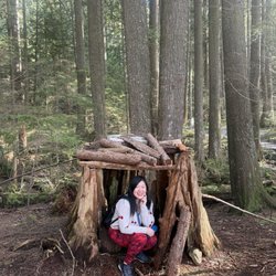
    A little hut along the trail

    Belcarra Park - Woodhaven Swamp Loop Trail.

    Belcarra Park

    4.3(12 reviews)
    4.4 km

    Belcarra Regional Park (now re-named to acknowledge the Tsleil-Waututh peoples*) is a 1,100-hectare…read moreregional park. It is an extremely popular regional park with beaches, picnic areas, a lake, and numerous hiking trails of various difficulty levels. There is something for everyone at the park, including decent washrooms. The various trails within the park are: Bedwell Bay Trail, Woodhaven Swamp Loop Trail and Woodhaven Trail, Sasamat Lake Loop Trail, Springboard Trail, Admiralty Point Trail, Jug Island Beach Trail, Sugar Mountain Trail, and Buntzen Ridge Trail (and the nearby Buntzen Lake and Diez Vistas trails). Until recently, I had only hiked the Jug Island and Admiralty Point trails (both excellent, easy to intermediate hikes), and on Sunday I had planned to hike around the Woodhaven Swamp Loop, continue along the Woodhaven Trail to Sasamat Lake, and around the lake with my hiking group. Unfortunately due to a recent windstorm, the Woodhaven Trail leading to Sasamat Lake was closed, but we still enjoyed the lovely hike along the Springboard Trail and around the swamp. It was a very easy hike (pretty much a walk), but the trails were beautiful, and being the off-season, very peaceful. I love Belcarra Regional Park and would like to eventually hike all the trails, as well as re-hike the ones I have already done. Unfortunately it is quite difficult to get there by transit, although it is technically possible -- the #182 bus runs from Moody Centre Station to the park, but it only runs once an hour. During the summer months, the #150 runs to White Pine Beach and the #179 runs to Buntzen Lake (I don't recall if it is once an hour or every half an hour). So because transit is so lousy, most people drive, but parking is very limited -- good luck finding parking after 8am on a weekend during the non-winter months! IDEA: to alleviate the parking issue, have transit run more than once an hour! Despite the horrible transit to the park, at least it is technically possible to get there by bus, and with my hiking group (which focuses on transit accessible hikes), I will definitely be going back to Belcarra. *I cannot include the name in my review as Yelp does not recognize Indigenous script. [Yelp collections: Hiking; Parks and Gardens]

    This review is about Admiralty Point Park. For return 6km…read morehike, 2 hours to Burns point. Some sections follow rocky shoreline, beautiful view of Burrard inlet. There are some wooden bridges over creek and well maintained trail. Easy hike and good for family hike. You can find small beaches with clear water. I'm sure I will be back in spring time with kayak.

    Photos
    Belcarra Park - Woodhaven Swamp Trail -- bridge is crossable, just missing a couple of planks (May 30, 2026).

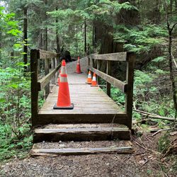
    Woodhaven Swamp Trail -- bridge is crossable, just missing a couple of planks (May 30, 2026).

    Belcarra Park - Woodhaven Trail - March 2, 2025.

    Woodhaven Trail - March 2, 2025.

    Belcarra Park

    See all

    Buntzen Lake - lakes - Updated July 2026

    Loading...
    Loading...
    Loading...