Bull Creek Greenbelt Photos




You might also consider


More like Bull Creek Greenbelt
Recommended Reviews - Bull Creek Greenbelt
Start your review...


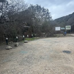


So take the right going south on 360 and then park somewhere along the road where the pavement turns into dirt as it starts to slope downward. Then you are left with decisions of if you want to cross the river to the other side or go along the Bull Creek trail (the option I chose). It's nothing but rocks, water, trees, plants, and sunlight. Quite the place to escape from the city life and be one with nature and it's personality. Recommend wearing hiking shoes and have some bug spray as the flies and mosquitoes can be out and about. One of Austin's beautiful secrets! Find out for yourself! read more


Bull Creek is a beautiful trail just off the Capitol of Texas Highway and offers a nice variety of water and streams for you and any furry friend to cool off in. The trail is very photogenic and has cute moments but beware the trash on the ground which can cause sporadic realizations that you aren't in the wilderness, but Austin instead. There are a few entry points to the trail so choose wisely but there is one with a parking lot that may provide better selections. Altogether the trail is very fun and allows for great photo ops with pets and family alike, with some even deciding to get in the water (if you do choose to do that be careful cause the rocks are slippery). read more

9 months ago

1 year ago
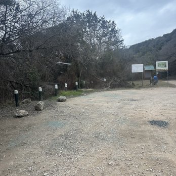
No clue of the hike. We drove 40 min to get here. The whole parking lot had glass and this man just had his window smashed. Every spot that could have a car had glass from smashed windows. So we left. read more

1 year ago

If I had to describe this place with one word, it would be this: "picturesque" This review is for part of the trail in the Lower Bull Creek Greenbelt. I started at Old Spicewood Springs Road and hiked down to Bull Creek Park (it's not a loop, so be prepared for the hike back). It's one of Austin's finest trails. If you're a hiker and you find yourself in the good ol' ATX, you MUST check this one out. You'll go back and forth between hiking along the creek and hiking through the woods. In the wooded areas, you'll find a few side trails that take you down to the creek, but besides that, it's pretty much a straight trail and you won't get lost on this one. IMPORTANT NOTE: You'll be crossing the creek at several places, so bring your waterproof hiking boots if you have them or deal with wet and soggy shoes. It's an easy to moderate hike with *beautiful* scenery as you travel alongside the creek. Most of it's on level terrain, but there are a couple of spots where you might have to climb up a couple of rocks to get back on the trail. There's a couple of spots that have good swimming holes and a couple of decent waterfalls. Before you go, use Google Maps satellite view to find the gravel parking lot at the intersection of Old Spicewood Springs Road and Spicewood Springs Road (yes, I know it sounds confusing). After parking, walk down the road a bit and go underneath 360 (N Capitol of TX Hwy). As soon as you get to the other side of 360, look for the trail and the creek on your right-hand side - it's not marked, so you'll need to pay attention. There's a couple of other parking lots along Old Spicewood Springs Road too. Many thanks to my Yelp friend Cat for telling me about this place! #HikeOnY'all read more


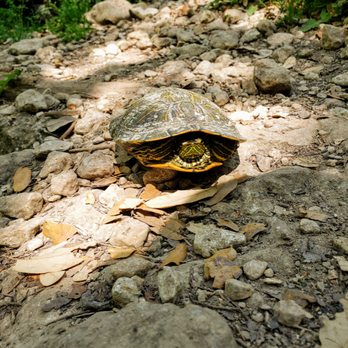


This was the first time I ever ventured to this spot. It is a bit hidden and lacking signage, to be sure, but that doesn't stop people from parking at will and popping in the creek off the roadside. Gotta love that about the Austin local pop! The trails from the "entrance" I found were either not well marked or just didn't lead anywhere. I was looking for the falls, but somehow ended up on a roadside by the entrance to what looked like a housing dev gate? I was following the map at the trailhead, but alas I guess it got the best of me. I did manage to find a little waterfall enclave by the parking lot on the way back to the car. There were also a lot of people w/unleashed dogs and children, so I decided to call it quits and head up the road and give St Edwards Park a try instead. I don't know that I'd be willing to come back to try and ferret out the trails to the falls. I think w/the amount of people, I might as well hit up the Barton Greenbelt. read more


6 years ago
This is the perfect river spot for a day out with your kids or dog. Not packed at all and so much convenient parking spots in the shade. It's about 10 mins off of highway 35 coming from San Antonio. Water is about knee and waist deep and there's a few waterfalls to jump off of. There is no entrance fee. Such a chill place! There's 3 parts to it that you can walk to or drive to. read more

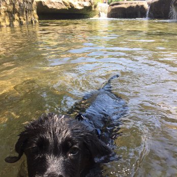


Nice casual location to take a small hike, walk the dog, or get away from the busy city. This park has a small stream of water that runs though and turns into a small water fall near the parking lot. I've seen a few people get into the water and play under the fall (it looks fun but also can be dangerous if you slip or dive in shallow water). There is a trail that leads you to the top of the "mountain". It's not too high up, but it can give you a good healthy walk. There are sections of the trail that may require climbing on elevated stones so be careful and use three points of contact at all times. As you go deeper into the trail, it gets super quiet and peaceful. No more road noise and plenty of shade to walk under. Unfortunately, there are sections with freeway noise. It's kind of an unavoidable thing for this park, but like I said earlier, there are parts inside the trail that are quiet. I still had a good time here. Tips: -Use three points of contact when climbing rocks. -Be careful when crossing the shallow stream of water as it may be slippery. -Carry some water with you and stay hydrated. Do not litter the park so others can enjoy it the same way you are. read more


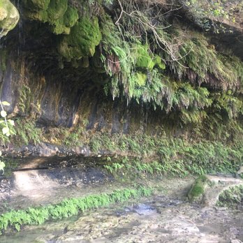
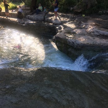
This is a fun place to swim but not so much going on the trail. It is a little confusing to find the entrance but once you do it's easy. Someone wrote a review on here and we followed those directions. you'll know you're at the right place because you'll see volleyball net and this tennis ball sculpture and picnic tables I think. Where we went is not near a housing development! If the map tells you to go to housing development you are probably at the wrong place. The trail was narrow and muddy after all this rain, however when we went it was so nice out that we just walked in the water most of the time. Kids were playing in the smaller waterfalls and it was a lot of fun. There is a magical gardeny cave area just around the bend of the trail head on the water bank. read more






7 years ago
I have been discovering new hiking locations and visiting them with my wife. This is a great hiking location. It is easy and lots of good spots to see small waterfalls. I would recommend to all for few hours to meditate and energize. read more


4 years ago
The trail and scenery is absolutely beautiful. The water is clear. BUT BEWARE OF CRIME! The day I went there were multiple car windows smashed and looted including mine. It is obviously a big problem with the signs everywhere but not big enough to install cameras or put a park security something. Please be careful coming here! read more


16 years ago
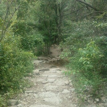
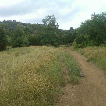
I've driven through this part of Bull Creek via Spicewood Springs a million times, but I'd only ever stopped at Bull Creek Greenbelt once before, and that was to sit by the creek and write. Today, I decided to go hiking. I don't live very far from the greenbelt. In fact, if I had the mind to do so, I bet I could walk there. It would take a while, but I know I could do it. Today, though, I drove. When I got about halfway there, I realized I'd left my MP3 player at home, but I was too focused [read: lazy] to go back and get it. I took Spicewood Springs over there, to underneath the 360 bridge. Parked and eyed a trail leading up the hill that I wanted to travel. But it's across the creek. Hmmm... I guess I'm going in! The water was amazingly cool, so I stood there moaning in sheer pleasure for at least five minutes. My eyes were closed and I was concentrating on other things, when suddenly I heard, "Are you okay?!" from behind me. Scared the cream cheese outta me! The guy behind me thought I was in pain, apparently. (You don't get laid much, do ya, guy?) I assured him I wasn't in pain and then I sneaked off in embarrassment. Made it to the trail -- Inga's Trail -- and followed it up. You'll see the occasional bench for your sitting pleasure. I didn't walk the entirety of Inga's Trail because I didn't have time, but the part I did tour was beautiful. I took more than a dozen pictures. I eventually ended up at a different part of the creek that was GORGEOUS! I camped out there for a while before I decided to get in the water again. This time I looked all around and made sure I was alone before I closed my eyes and moaned away with a big smile on my face. It's the simple pleasures that please me the most. On my way back, it occurred to me that this hiking trail really is a butterfly den. They were everywhere! That unfortunately brings me to the only bad point about Bull Creek Greenbelt: other bugs. I saw several HUGE wasps that succeeded in making me nervous, and at one point when I stopped to take a picture, I felt something chomping on my knee. I didn't really see what it was because, by the time I looked down to see it, I'd slapped the black 1" circumference fucker off my knee. Bastard actually made me bleed a little. So, word to the wise: Wear bug spray when you go hiking here. Once I got back to the car, I realized just how filthy the water must be because my shoes royally stunk. They're in the washing machine at this very moment. Enough about the bad stuff... If I was a photographer, I'd be here every day taking pictures. Beauty really abounds at Bull Creek Greenbelt. Beneath the 360 bridge that spans Spicewood Springs lies a treasure trove of nature at its most glorious. Well, except for the bugs. read more






4 years ago

11 years ago
This technically was my 3rd time here. But 1st time to have the opportunity to park and get out of the car. We tried on 2 times before but there was no parking available along the street or given parking areas. Both times we tried were on weekends between 11 am and 3 pm. Today my cousin and I got here about 11 am there were some cars here already. But no where as packed as it is on the weekend. There is 4 separate parking areas along the bull creek in this area and we were able to have choice parking in all 4 parking lots. 1st stop was immediately right off the 360. Let me tell you this parking lot is not recommended for smaller cars because it is uneven parking. You better have great shocks. or be prepared for some off road terrain We got out and started our search for the way for the water. Which by the way the water is clear and see through. Tennis shoes or hiking shoes are a must for the 1st part of being able to get to the water. At least a 3 foot drop to the next level of rocks. If you have knee problems, feet problems or ankle problems I do not advise trying this area. if you walk a little further down the river toward the 360 you will find a easier wading in section that is more shallow looks to be easy walk across. Now this is the time to change to water shoes or water socks. Upon stepping in the water is a nice cold. NO freezing or hurt your feet cold. Problem is when you start to walk across its the rocks are slippery and if your a big person like my self its not recommended in less you want to be feet over head and flat on your back. SO if your bringing little ones be ready to see them fall. and the same might be true for elderly. While we where here we seen 1 adults and 1 child fall hard. We moved on to the parking area with restroom and this by far is the easiest parking most easiest for the bathrooms and easiest to get in to the water. But immediately there are tons of lots of un even rocks here so make sure you have the water shoes on. this area is easier for family of all ages. Great picnic area with volley ball net. The next parking lot is a small parking lot maybe 6 - 8 cars only. Entering in to the bull creek here will require water shoes and socks un even rocks on floor. Great area for lawn picnics. There is 1 picnic table area on a stage area. There are stairs here that lead to a trail area to check out its pretty and great shaded areas. Over here we were able to see turtles and fish in the water clearly swimming. This entire area is great for pictures, picnics, bring your dogs for walk and water play as well as Hiking and bird watching we seen Hawks, road runners and various other birds. read more


I like being outside. I have an entire list devoted to being outside! Is there anything worse than succumbing to four walls on a beautiful day that deserves your attention? Having never been to this part of the greenbelt, the location to park was a bit tricky. Once we found where to park, we were left with the decision of where to begin! We decided to take the road less traveled and went under the 360 bridge. Parts of the "path" were overgrown to the due recent rain, which produced a good amount of slippery mud! Who's afraid of a little mud? Not me. The views were beautiful, and it's easy to forget you're in northwest Austin. Lots and lots of water made Bull Creek quite a sight! The falls were beautifully surrounded by greenery and had very few people. Now that's what I call a weekend well spent. read more


4 years ago
tranquil place. set up a camp two separate occasions here and enjoyed waking up to the symphonies of waterfalls and mockingbirds. will always return here when i need a getaway. read more


4 years ago

5 years ago


8 years ago
Great hike! It was a little confusing to start with but I just followed the creek up and it was beautiful. Tons of people which I didn't love but I can't blame everyone for wanting to enjoy a place like this! My dog loved it. The water was clear and the entire place was very pretty. Would love to go back on a week day when it isn't as busy. read more


9 years ago
Great hiking option around Austin! Not too hard to get to, just off 360 with several parking lot access points. Really lovely in nice weather with water you can wade in or even swim in. May be a little busy in really good weather. Some of the trail can be a tad wet and precarious if it's rained recently, but it's fine if your at least a little nimble. Beautiful views for photography lovers! read more


13 years ago


16 years ago

10 years ago
Bull Creek is one of the best greenbelts in Austin. There is a beautiful waterfall and swimming hole with cliffs you can jump off right by the parking lot just SW of Spicewood Springs Rd on 360. The turn off 360 to this parking lot is an unmarked right, but it's the first right after Spicewood Springs Rd as you travel SW on Highway 360. It's a beautiful spot, and then if you hike the trail from there, you'll come across lots of additional smaller waterfalls, swimming holes, ancient limestone formations, and a wide array of wildlife. read more


12 years ago
Gorgeous. Hiked a good portion of the hike along the creek barefoot. That says a lot about a place. read more


11 years ago
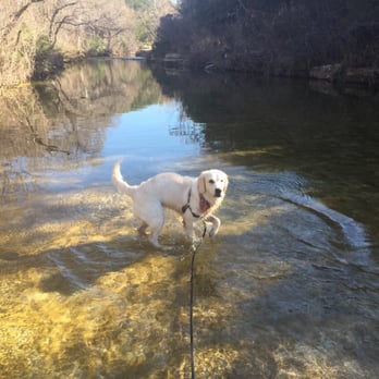
I was very impressed by the beauty of this park. The waterfalls are hypnotic! I took the pup here and he thoroughly enjoyed taking a dip in the water. I came on an early weekday morning and found the place to be so serene. After an hour a group of people, apparently a photography class, came to shoot pictures of the waterfalls. Simply gorgeous, definitely check this out if you haven't. read more



10 years ago
Ingas trail area is our favorite part of Bull Creek. Seems to be fairly understood to be an off leash trail and the dogs we meet are all wonderfully behaved - leaps and bounds better than what we find at the dog parks. We love being able to make a morning of it and the pups love all the space and of course the water. It's very clean as well. read more


12 years ago
I love this place! Great place to hike, picnic and swim. Beautiful waterfall with rope swing, cliffs to jump from and cool water to splash in. The trail is an easy hike. There are a few places that you may need to climb up or down but its not hard. A few water crossings so wear shoes you don't mind getting wet or muddy. Lots of friendly Austin people on the weekends having fun with their families or walking their dogs. read more


12 years ago
A great place for a hike! Although, there is a sign that says no dogs allowed, I saw plenty of people breaking the rules. City of Austin should come here if they want to give out tickets....mo money for the city, ha ha. I didn't mind the occasional curious pooch. There's definitely a lot to explore. I only hiked one trail. At some points along the creek, you may attempt to cross. There are a few picture, selfie moments along the hike. I wouldn't recommend biking. Too many ups and downs. However, if you're a pro mtn biker, go for it! Overall, I would recommend this place to anyone looking to escape the city life. read more


14 years ago
Page 1 of 2
More info about Bull Creek Greenbelt
7806 N Capital Of Texas Hwy
Austin, TX 78731
Directions
Hours
Indoor Amenities
Outdoor Amenities
Ask the Community - Bull Creek Greenbelt
I want to find this off 360. Where do I turn when on am on 360?
Is there any water at Bull Creek now? If so, how much? Is it worth going?
None. And what you find are very shallow puddles. 8/11/20
Review Highlights - Bull Creek Greenbelt
You might also consider



















Why does Yelp recommend reviews?
2 reviews that are not currently recommended
The reviews below are not factored into the business's overall star rating.

10 years ago

9 years ago
Bull Creek Greenbelt - parks - Updated May 2026
Best of Austin
People found Bull Creek Greenbelt by searching for…
Trending Searches in Austin, TX
Baseball Fields near Bull Creek Greenbelt
Boat Rental near Bull Creek Greenbelt
Botanical Gardens near Bull Creek Greenbelt
Bounce House Rentals near Bull Creek Greenbelt
Campgrounds near Bull Creek Greenbelt
Cliff Jumping near Bull Creek Greenbelt
Dog Friendly Things To Do near Bull Creek Greenbelt
Fishing Spots near Bull Creek Greenbelt
Flower Shop near Bull Creek Greenbelt
Hair near Bull Creek Greenbelt
Hidden Gems near Bull Creek Greenbelt
Lakes near Bull Creek Greenbelt
Lookout Points near Bull Creek Greenbelt
Movie Theatre near Bull Creek Greenbelt
Night View near Bull Creek Greenbelt
Nurseries & Gardening near Bull Creek Greenbelt
Off Leash Dog Parks near Bull Creek Greenbelt
Outdoor Activities near Bull Creek Greenbelt
Outdoor Basketball Courts near Bull Creek Greenbelt
Outdoor Furniture Stores near Bull Creek Greenbelt
Parks With Pull Up Bars near Bull Creek Greenbelt
Party Equipment Rentals near Bull Creek Greenbelt
Pedicure near Bull Creek Greenbelt
Pick Your Own Farms near Bull Creek Greenbelt
Picnic Areas near Bull Creek Greenbelt
Public Beaches near Bull Creek Greenbelt
Rainy Day Activities near Bull Creek Greenbelt
Rock Quarry near Bull Creek Greenbelt
Romantic Activities near Bull Creek Greenbelt
Scenic Drive near Bull Creek Greenbelt
Splash Pad near Bull Creek Greenbelt
Stair Climbing near Bull Creek Greenbelt
Strawberry Picking near Bull Creek Greenbelt
Swimming Holes near Bull Creek Greenbelt
Things To Do Alone near Bull Creek Greenbelt
Browse Nearby
Browse Brands
Related Searches in Austin, TX
Best Nature Trails for Hiking in Austin, Texas
Best Off Leash Dog Parks in Austin, Texas
Best Parks for Parties and Events in Austin, Texas
Best Water Parks for Kids in Austin, Texas
Check Out Great Playgrounds in Austin, Texas
Discover Baseball Fields Around Austin, Texas
Discover Fun Toddler Parks in Austin, Texas for Your Little One
Discover Lakes & Ponds to Explore in Austin, Texas
Discover Popular Photo Spots in Austin, Texas
Discover Public Beaches to Visit in Austin, Texas
Discover Soccer Fields in Austin, Texas Near You
Discover Top Nature Parks to Visit in Austin, Texas
Discover Top Scenic Spots to Visit in Austin, Texas
Discover Top State Parks to Visit in Austin, Texas
Discover the Best Beaches in Austin, Texas
Discover the Best Kids Park Spots in Austin, Texas
Enjoy the Best Picnic Spots and Ideas in Austin, Texas
Enjoy the Best Walking Trails in Austin, Texas
Explore Family-Friendly Zoos and Wildlife in Austin, Texas
Explore Free Picnic Areas Around Austin, Texas
Explore Fun Activities to Do in Austin, Texas
Explore Parks With Pull Up Bars in Austin, Texas
Explore Popular Campgrounds Near Austin, Texas
Explore Popular Picnic Areas Around Austin, Texas
Explore Popular RV Parks Around Austin, Texas
Explore Popular Recreation Centers Around Austin, Texas
Explore Popular Scenic Views Near Austin, Texas
Explore Scenic Lakes to Visit in Austin, Texas
Explore Top Dog Parks in Austin, Texas Near You
Explore Top Water Parks in Austin, Texas Today
Explore the Best Trail Options in Austin, Texas
Find Parks and Recreation Activities in Austin, Texas
Find Top Dog Friendly Parks to Visit in Austin, Texas
Find Top Skate Parks in Austin, Texas for All Skill Levels
Find a Park With BBQ Pits in Austin, Texas
Find the Best Parks BBQ Grills in Austin, Texas
Find the Best Parks for Picnics in Austin, Texas
Have Fun at a Splash Pad in Austin, Texas
Locate Tennis Courts Around Austin, Texas
Parks With Basketball Courts for Games in Austin, Texas
Picnic Areas With BBQ Pits Available in Austin, Texas
Play at a Splash Pad Park in Austin, Texas
Popular Children Playgrounds to Visit in Austin, Texas
Popular Fishing Spots to Explore in Austin, Texas
Popular Outdoor Activities to Try in Austin, Texas
Top Hiking Trails to Explore in Austin, Texas
Top Running Trails to Explore in Austin, Texas
Top Swimming Lakes to Enjoy in Austin, Texas
Browse Articles
People who viewed Bull Creek Greenbelt also viewed

Walnut Creek Metropolitan Park
221 reviews

Inga's Trail
7 reviews

River Place Nature Trail
252 reviews

Emma Long Park Turkey Creek Trail
52 reviews

Creekside Park
4 reviews

Walnut Creek Greenbelt
12 reviews

Allen Park
8 reviews
Far West/Northwest Hills

Stillhouse Hollow Nature Preserve
7 reviews

Wild Basin Creative Research Center
69 reviews

Spicewood Valley Trail
19 reviews