Big Creek Greenway Photos


You might also consider


More like Big Creek Greenway
Recommended Reviews - Big Creek Greenway
Start your review...


Reviews With Photos




I used to park at parking lot off Kimball Bridge, there are plenty of parking spaces there. At winter time, specially after heavy rain, fewer walkers or hikers were around. Middle of road was blocked by water, so only about 2 miles was walkable. But still, I enjoyed walking in the winter fresh air, and even saw a deer, they used to goofing around in group of 4 or 5. I definitely will come back very often during summer. I'm glad that we have such a nice trail in the neighborhood. read more


1 year ago
I usually hike around Stone Mountain Park but I was lucky I king for flat trails to jog and take up biking again. this park blows me away, this will be my new jogging and biking park and Stone Mountain will be for hiking up the mountain. read more


3 years ago

2 years ago

5 years ago
Very nice fully paved trail head accessible from old Alabama road. Full trail is 15.8 miles from Roswell all the way to Alpharetta. When you turn in from old Alabama road there's a small parking lot, but keep on driving for ~0.5 mile or so there's another bigger parking lot right at the start of the trailhead. The parking is free and there's a bathroom, bike rack at the trailhead. read more


9 years ago
This has quickly become my family's favorite place to ride our bikes. The trail splits three ways at the trail head and you can head toward Roswell or two separate points in Alpharetta. There is an abundance of wild life and beautiful tree cover on the paved paths. There are several spots to look out on small bridges over the water. You can even rent a bike if you don't have one and there are bathrooms! read more


5 years ago
Awesome beginners dirt trail... pretty short though. Challenging enough to be exciting, yet manageable for our 12 and 9 year olds https://www.alpharetta.ga.us/government/departments/recreation-parks/facilities/big-creek-greenway "Dirt mountain bike trails are located on the east side of the creek 2/5 mile south of Webb Bridge Road." read more


6 years ago
We are so lucky to have this beautiful Greenway in our community! It runs along a small river. Approximately 8 miles of paved walking/bicycling trail. Some areas even have separate paths for bicyclists. read more


6 years ago

10 years ago
Walker? Runner? Biker? Skater? All of the above? Head to the Big Creek Greenway to get some exercise and enjoy the great outdoors. An 8 mile stretch beginning at the Roswell/Alpharetta line and wandering along Big Creek in Alpharetta, the Greenway has a paved path for use by all, certain paths for use by walkers/runners only and an off road mulched path for mountain bikes. The Greenway has multiple entry points with plentiful parking and (usually) bathrooms, water fountains and a few tables and benches. In addition, there are benches placed strategically throughout the path (along with trash cans - keep the Greenway green, people!) At selected locations, you can also rent a bike to take on the paved portions. This is also a popular place for residents to walk their dogs, giving the pooches new territory to mark...for the most part, people pick up behind their dogs, but there are always one or two that just don't give a damn, so keep your eyes open if you wander off onto the shoulders. Long range plans include connecting it to the Forsyth county greenway for a total of almost 15 miles of wooded trail. This is how I want my tax dollars spent! Note that there the weekends are pretty busy so if you want to avoid the crowds, go super early. read more


10 years ago
Much like the Forsyth County counterpart, Alpharetta's section of BCG is well paved and quite well maintained. Although as it's even more convenient to get to as its quite close to 400, I personally think the road noises are louder too since there are more traffic nearby. Still this is quite an oasis in the suburban town filled with cars and shopping centers. I had a quite nice walk from the Rock Mill Park entrance all the way up to Webb Bridge Road but had to turn back since they were doing maintenance construction. Through out the trail I saw evidence of tractor clearing the path after a night of rain that mudded up the trail. I found it quite nice that they work feverishly to clear the trail even on a weekday when pedestrian traffic was quite low. Although I think I prefer the quieter Forsyth section of the trail, this is quite a nice trail especially if you live nearby. Perfect way to get some great cardio exercise while enjoying the scenery and nature read more


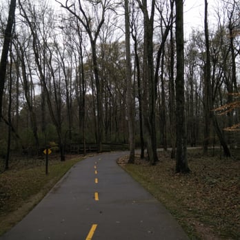


This review is primarily for the Haynes Bridge parking lot. It has ample parking including bike rack, trash cans, & a porta-potty. It has no running water, which would be nice so that you don't have to bring full water bottles. It does have a nice light and safety camera. I love this access point since it's close to 400, and it gives you options for going multiple directions for a few miles. The Greenway itself is well signed (markers every .5mi). The area is well maintained, as I have seen workers regularly blowing off the leaves, edging the path, and removing trash from the trash cans. read more


6 years ago

8 years ago


8 years ago
I live off the Mill Creek Lake or whatever the pond's name is. This is a great area for many types of shoots. I see many prom photo shoots, engagement and as well the sunsets here are amazing. I walked outside and shot this with minimal edits. There are a ton of geese and as well occasional deer. The locals are reasonably friendly. read more


11 years ago
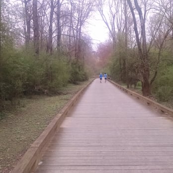
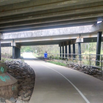
MCFARLAND ROAD ACCESS I really enjoy walking on this stretch of the Greenway. It is easily accessible from McFarland Rd just east of 400. It is not as populated as the other areas so you can actually experience a bit of serenity. When the weather is really nice, there are lots of kids on bikes and other toys so you just have to be a little cautious. It is great for running, walking and biking. There is a port-a-potty at the entrance and there are a couple of covered areas along the route in case of rain. I love the amenities such as benches, (for resting or reading) and waste stations to clean up after your pets. They also have very visible mile markers to help you keep track of your distance as you walk. When you start your walk, you will encounter a paved sidewalk but much of the walkway is a boardwalk, (wooden slabs). This may be an issue if you prefer a smoother surface. This place can be a little isolated and creepy in the evening as it gets later and darker. You will look up and suddenly it has gotten very dark and you are a mile away from your car. Just be mindful of this and plan accordingly. 5/29/15 My rating has not changed but I just wanted to add a couple of notes: If you can wait to use the restroom, you will find nice gender specific ones at the end of the 2.2 mile mark or you have the option of the unfortunate port-a-potty at the beginning of the McFarland Road entrance. The beginning of the walkway can be muddy after significant rain and the planks can be very slippery so be careful. Just prior to the 2.2 mile mark, you can sometimes spot deer grazing. They are beautiful and if it is quiet, they will not run away and you can quietly take a picture. read more


7 years ago

7 years ago


16 years ago

15 years ago
Great running or biking trail. Be sure to get a map though. Don't want to run 5 miles in the wrong direction :-( read more


16 years ago

15 years ago

11 years ago
I love this trail, except when is flooded due to heavy rain. Early mornings you can spy dear, hawks, I have even seen an owl fly right over me in the middle of the day! Is great for biking walking and jogging, except it can get pretty busy on the weekends when the weather is pretty so make sure you stay to the right and be conscientious of other people. read more


9 years ago
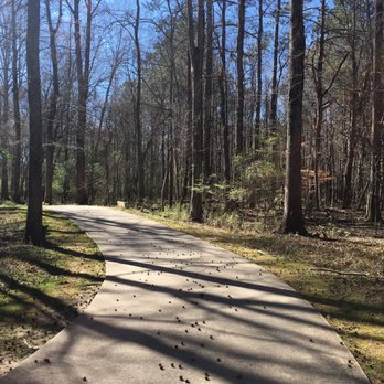
Looking for somewhere to hike, bike & workout; here is the place! Great place to walk on a paved trail through a forest. read more


12 years ago

8 years ago

Page 1 of 2
More info about Big Creek Greenway
Alpharetta, GA 30023
Directions
Visit Website
http://www.bigcreekgreenway.com/
Hours
Outdoor Amenities
Ask the Community - Big Creek Greenway
Review Highlights - Big Creek Greenway
You might also consider
















Why does Yelp recommend reviews?


Big Creek Greenway - hiking - Updated May 2026
Best of Alpharetta
People found Big Creek Greenway by searching for…
Places to Take Pictures in Alpharetta, GA
Scenic Drive in Alpharetta, GA
Running Track in Alpharetta, GA
Walking Trails in Alpharetta, GA
Dirt Bike Riding in Alpharetta, GA
Hiking Trails With Waterfalls in Alpharetta, GA
Watch Sunset in Alpharetta, GA
Things to Do in Alpharetta, GA
River Swimming in Alpharetta, GA
Off Road Trails in Alpharetta, GA
Mountain Biking in Alpharetta, GA
Beautiful Views in Alpharetta, GA
Rollerblading in Alpharetta, GA
Flower Fields in Alpharetta, GA
Trending Searches in Alpharetta, GA
Baseball Fields near Big Creek Greenway
Boat Rental near Big Creek Greenway
Botanical Gardens near Big Creek Greenway
Bounce House Rentals near Big Creek Greenway
Campgrounds near Big Creek Greenway
Cherry Picking near Big Creek Greenway
Cliff Jumping near Big Creek Greenway
Dog Friendly Things To Do near Big Creek Greenway
Fishing Lake near Big Creek Greenway
Flower Fields near Big Creek Greenway
Flower Shop near Big Creek Greenway
Garage Sales near Big Creek Greenway
Nurseries & Gardening near Big Creek Greenway
Off Leash Dog Parks near Big Creek Greenway
Outdoor Activities near Big Creek Greenway
Outdoor Basketball Courts near Big Creek Greenway
Outdoor Furniture Stores near Big Creek Greenway
Party Equipment Rentals near Big Creek Greenway
Pedicure near Big Creek Greenway
Pick Your Own Farms near Big Creek Greenway
Picnic Areas near Big Creek Greenway
Places To Take Pictures near Big Creek Greenway
Places To Walk Around near Big Creek Greenway
Rainy Day Activities near Big Creek Greenway
Rock Quarry near Big Creek Greenway
Running Trails near Big Creek Greenway
Scenic Drive near Big Creek Greenway
Secret Spots near Big Creek Greenway
Splash Pad near Big Creek Greenway
Strawberry Picking near Big Creek Greenway
Sunrise View near Big Creek Greenway
Swimming Holes near Big Creek Greenway
Tennis Courts near Big Creek Greenway
Browse Nearby
BEST of Alpharetta, Georgia Coffee near Big Creek Greenway
BEST of Alpharetta, Georgia Things to Do near Big Creek Greenway
BEST of Alpharetta, Georgia Restaurants near Big Creek Greenway
BEST of Alpharetta, Georgia Walking Trails near Big Creek Greenway
BEST of Alpharetta, Georgia Breakfast near Big Creek Greenway
BEST of Alpharetta, Georgia Parks near Big Creek Greenway
Browse Brands
Related Searches in Alpharetta, GA
Affordable Kayak Rental Services in Alpharetta, Georgia
Best Fishing Locations and Guides in Alpharetta, Georgia
Best Nature Trails for Hiking in Alpharetta, Georgia
Best Off Leash Dog Parks in Alpharetta, Georgia
Best Parks for Parties and Events in Alpharetta, Georgia
Best Places for Horseback Riding in Alpharetta, Georgia
Best Water Parks for Kids in Alpharetta, Georgia
Best Waterfalls and Swimming Holes in Alpharetta, Georgia
Check Out Great Playgrounds in Alpharetta, Georgia
Check Out Off Road Trails in Alpharetta, Georgia
Discover Baseball Fields Around Alpharetta, Georgia
Discover Beautiful Garden Spots in Alpharetta, Georgia
Discover Dog Friendly Trails to Explore in Alpharetta, Georgia
Discover Free Parking Options in Alpharetta, Georgia
Discover Fun Toddler Parks in Alpharetta, Georgia for Your Little One
Discover Lakes & Ponds to Explore in Alpharetta, Georgia
Discover Popular Photo Spots in Alpharetta, Georgia
Discover Scenic Mountain Bike Trails Near Alpharetta, Georgia
Discover Scenic Waterfall Spots in Alpharetta, Georgia
Discover Soccer Fields in Alpharetta, Georgia Near You
Discover Top Nature Parks to Visit in Alpharetta, Georgia
Discover a Hiking Trail in Alpharetta, Georgia
Discover the Best Beaches in Alpharetta, Georgia
Discover the Best Kids Park Spots in Alpharetta, Georgia
Discover the Best Night Hike Trails in Alpharetta, Georgia
Dog-Friendly Hikes With Dogs in Alpharetta, Georgia
Enjoy Exciting Mountain Biking Adventures in Alpharetta, Georgia
Enjoy Kayaking Adventures in Alpharetta, Georgia
Enjoy Tent Camping Spots Around Alpharetta, Georgia
Enjoy a Beautiful Waterfall Hike in Alpharetta, Georgia
Enjoy the Best Picnic Spots and Ideas in Alpharetta, Georgia
Enjoy the Best Tubing Experiences in Alpharetta, Georgia
Enjoy the Best Walking Path in Alpharetta, Georgia
Enjoy the Best Walking Trails in Alpharetta, Georgia
Exciting Cliff Jumping Spots in Alpharetta, Georgia
Experience Thrilling White Water Rafting in Alpharetta, Georgia
Explore Beautiful Botanical Gardens in Alpharetta, Georgia
Explore Beautiful Parks and Green Spaces in Alpharetta, Georgia
Explore Easy Hikes Perfect for All in Alpharetta, Georgia
Explore Family-Friendly Zoos and Wildlife in Alpharetta, Georgia
Explore Free Picnic Areas Around Alpharetta, Georgia
Explore Fun Activities to Do in Alpharetta, Georgia
Explore Parks With Pull Up Bars in Alpharetta, Georgia
Explore Popular Campgrounds Near Alpharetta, Georgia
Explore Popular Picnic Areas Around Alpharetta, Georgia
Explore Popular RV Parks Around Alpharetta, Georgia
Explore Popular Recreation Centers Around Alpharetta, Georgia
Explore Scenic Lakes to Visit in Alpharetta, Georgia


