Beales's Cut Photos


You might also consider
More like Beales's Cut
Recommended Reviews - Beales's Cut
Start your review...

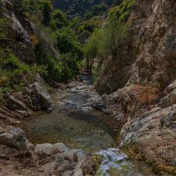
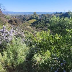
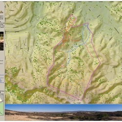
Long before the 14 freeway existed, the only way to travel north past the Santa Susana and San Gabriel Mountains to central and northern California was through a narrow 70 foot tall pass called Beale's Cut (also known as both the San Fernando Pass and the Newhall Pass). Completed in 1859, this pass was used up to 1910 until it was abandoned after the Newhall Tunnel was built located ¼ mile to the west of the site. Through the years the site has been used for a number of western movies. William S Hart supposedly jumped his horse across the gap. The land around Beale's Cut was used by a refinery until the 1980's. The land currently remains vacant. You can still see various concrete foundations and pipes from the oil refinery. In the spring of 1998 a massive landslide filled in nearly half of the cut. This site was designated as California Registered Historic Landmark No. 1006 on May 11, 1992. A marker base and plaque for this historical landmark was unfortunately never erected. The entrance to the site is located 1 mile south of Eternal Valley Cemetery. You'll see a metal fence on the east side of the road. From there you walk up the hill for another 1,000 ft. read more


If you like odd bits of history this is a fun one. Only takes a minute to get find, and you don't have to hike. From Sierra Highway and the first instersection with Highway 14 go north and stop just short of the Welcome to Santa Clarita sign. There will be the remains of a stone monument on your right. Walk back down the road and look back. You will see the cut. read more


11 years ago
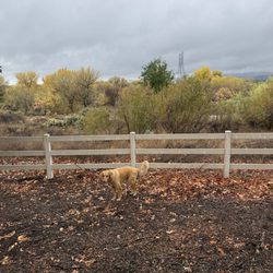
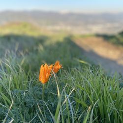
Nice piece of history. The land needs some cleaning. The hike to it is uphill, but is short enough. The felt like we were trespassing, but I read online that it's open to the public. There won't be any signs for it. Park on Sierra by these areas on my pics, then walk a little downhill towards the right. You will see a road that's going uphill to your right. It looks like it'll end, but keep going until you see 2 roads meeting. DO NOT go here when it's dark or hot unless you take extra precaution. There are quite a few areas with broken glass & I heard snakes come around when it's hot. read more


More info about Beales's Cut
Newhall, CA 91321
Directions
Visit Website
http://www.hmdb.org
Hours
Outdoor Amenities
You might also consider


Beales's Cut - hiking - Updated July 2026
Best of Newhall
People found Beales's Cut by searching for…
Snow Play in Newhall, California
Things to Do in Newhall, California
Places to Take Pictures in Newhall, California
Hiking Trails With Waterfalls in Newhall, California
Fishing Spots in Newhall, California
Stargazing in Newhall, California
Abandoned in Newhall, California
Star Gazing in Newhall, California
Beautiful Views in Newhall, California
Scenic Overlook in Newhall, California
Abandoned Buildings in Newhall, California
Secret Spots in Newhall, California
Gold Panning in Newhall, California
Things to Do on a Rainy Day in Newhall, California
Lakes & Ponds in Newhall, California
Sunrise View in Newhall, California
Photo Spots in Newhall, California
Scenic View in Newhall, California
Waterfalls and Swimming Holes in Newhall, California
Basketball Courts in Newhall, California
Picnic Areas in Newhall, California
Browse Nearby
BEST of Newhall, California Coffee near Beales's Cut
BEST of Newhall, California Restaurants near Beales's Cut
BEST of Newhall, California Things to Do near Beales's Cut
BEST of Newhall, California Walking Trails near Beales's Cut
BEST of Newhall, California Parks near Beales's Cut
BEST of Newhall, California Breakfast near Beales's Cut
BEST of Newhall, California Hot Springs near Beales's Cut
Browse Brands
Browse Articles
People who viewed Beales's Cut also viewed
East Walker Ranch
5 reviews
Hasley Canyon Trail
1 review
Castaic Rock Trail
1 review
Gates King Open Space
6 reviews
Quigley Canyon Open Space
3 reviews
Whitney Canyon Park
66 reviews
Towsley Canyon Park
81 reviews
Placerita Canyon Nature Center
140 reviews
Bouquet Canyon Abandoned Campgrounds
30 reviews
Plum Canyon Fire Road
4 reviews