Bay Bridge Trail - Shellmound Photos

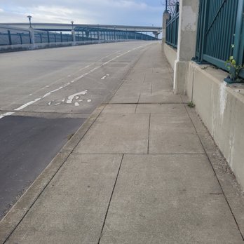


You might also consider


More like Bay Bridge Trail - Shellmound
Recommended Reviews - Bay Bridge Trail - Shellmound
Start your review...


Reviews With Photos


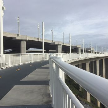
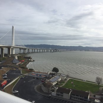
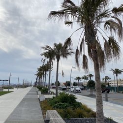
The Bay Bridge Trail is a trek that any lover of walking, running, biking or surveying the things that make San Francisco Bay so amazing, should partake in at least once in their lifetime. It's an easy hike really with just the length and the wind out on the bay, not to mention the traffic on the Bay Bridge whizzing by being the only intimidating factors. This roughly six mile trek total has only a minor steep incline as one comes closer to the Bay Bridge's new tower, which seemed like a lot of hard work for those who were on bicycle heading towards Yerba Buena Island and then a slightly scary free for all when they headed back down the slope towards the Oakland side of the Bridge. The day I went with friends, we decided to meet up at the Ikea parking lot as that's where the trail's technical starting point is, but from there I told my friends that there was a parking lot located at an event space called The Bridge Yard where the trail continues and is closer to the actual Bay Bridge. What's nice is that parking is free at the the Bay Bridge Trail Parking Lot and you get a little bit of the history and background of the building of the bridge that connects the city of San Francisco and the East Bay. Once we got out on the trail they have a lot of nice markers on how far you have to go to get to Yerba Buena Island. You'll notice all of the nice landscaping that they done around the Oakland side of the bridge and how well maintained things are. They also have a really nice observation deck jutting out of the Oakland side of the bridge with tables and chairs for people to look out over the water and see the bridge in all its glory, but I wouldn't know as that area was closed off with a fence and doesn't look like it has ever been opened for the public to see. Whether you are hiking or biking you will really get an appreciation of how long your trip is either by foot or pedal and the beautiful views of the bay that are underfoot or "underbridge" as the case may be. After our five and half mile walk west towards Yerba Buena Island we finally arrived at our destination and first made a pit stop at an area with a map and cement benches and we found at there were a lot of area cordoned off by fences and a long roadways on the island that were so slopped uphill that even by bicycle it looked like a challenge. As we sat there enjoying our lunch looking out over the bay, we noticed that the skies above were changing on a dime, and as the grayer the weather got, we decided to high-tail back to the parking lot located by the Bay Bridge toll plaza. As it started raining, it luckily didn't get too cold out there, but it was wet, which only made me sympathize with the bicyclists even more as riding downhill with pathway wet with a mere shoulder length bridge that separates you from the water below can be quite scary! But ironically, the only accident we saw was a pile up on the actual Bay Bridge freeway which was interesting to see firsthand how traffic bottles up as you walk by it with nothing but you and a gate separating you from the speeding traffic next to you. The Bay Bridge Trail - Shellmound is something that I would totally walk through again as the hike is an easy straight slightly uproad climb in which bicyclists and walkers share a small pathway evenly, which is a nice change of pace versus that of the Golden Gate Bridge, which is overwrought with tourists and sharing the path can get really complicated. Here's to hoping that more observation decks and pathway open up so one can enjoy their adventure walking or biking on the bridge even further. The new Bay Bridge is here to stay and ready to be explored by more people, locals and tourists alike!


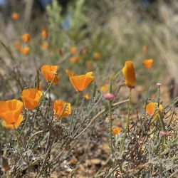
This particular trails starts at the ikea Way. It's the street right off ikea. It's a clear path to follow. Best parking tip would be the Emery Bay Parking lot which is the parking garage for the mall and the AMC theater. The only clear designated area here is for cyclist. If you're walking you mainly share the trail with them. I would design this trail differently as: Each designated space for both. It's big enough. There's one last porta potty before you start the actual two miles or so of the trail. Before that from the ikea way entrance it's another close to two miles give or take. Also thats your first chance to use the bathroom. It's breath taking. Always is when you can enjoy a bridge on foot. It's a different experience. More profound. I'm very appreciative of the design with this consideration in mind. The tower that holds the cables together is mighty looking. It stands tall and is a very photogenic subject for all. I must've taken an infinite amount of photos today! Lastly this path is lined with wild flowers and greens. As well as mostly buildings that was there way before this path ever existed. So the old and new to me merged quiet well here. Easy walk overall. It's a total of about close to ten miles from start to finish. Layer up as the gust of wind from the bay can swiftly change the temperature. Enjoy the view of the old bridge next to the new one. It's pretty historic losing that old behemoth. I do welcome the new span and eagerly await the completion of the trail to the Yerba Buena Island. I know to me the end came so quickly. I was still so eager to walk some more but alas! Every good path must come to an abrupt end at least here.


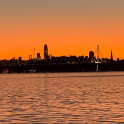
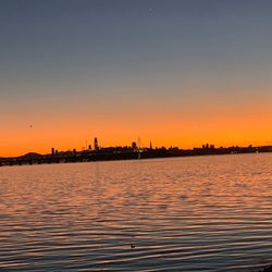
Pretty cool trail. I would suggest doing this right before sunset. Gorgeous orange and red skies. Not sure how long the trail is. I would say round trip maybe four miles
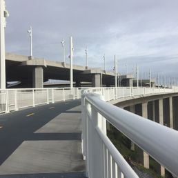

I've wanted to take this trek since it opened a few years ago. I was finally given the opportunity to do it as part of my run/walk group. It was a beautiful day. The wind was blowing but there was no rain. The run was amazing. I couldn't help but stop and admire the bay on a few occasions. I will certainly return and make this a regular part of my routine.


I wasn't able to run my last half-marathon to this awful flu/cough that's been going around nor was I able to get past the feeling of failure. Having trained for and run multiple half-marathons, I decided to create my own. I began my journey a block from the IKEA parking lot(lots of side street parking) and then made my way onto the trail which is literally across the street. It's a fast flat route but felt awfully lonely around 7am Saturday. Several cyclists passed me but I was the lone runner. There was a man sitting on one of the benches along the trail and I definitely got anxious. I carried on and saw many more walkers and runners at the Oakland parking lot. From there you can take the trail to a fishing pier or go onto the bridge. This was the highlight of the route as you get amazing views of Oakland and San Francisco and appreciate the structure of the "new" bridge. For those of you wanting to increase miles, add on Yerba Buena Island and Treasure Island. There are steep inclines so they were fun challenges. I also checked out the fishing pier when I came back. read more

This trail starts at the IKEA parking lot in Emeryville and goes all the way to Treasure Island. It goes under the freeway maze and along the Bay Bridge. Round trip from the start at the parking lot to the Treasure Island entrance and back is about 6 miles. It's a great place to run or bike, there are some bathrooms halfway along the trail. I've run here a few times, and running under the freeways and along the Bay Bridge is a good change of pace!! read more

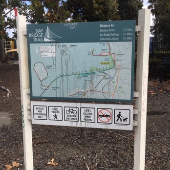
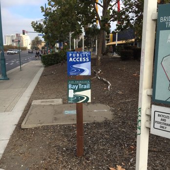


The stretch of the Bay trail between Emeryville and Richmond Marina is fantastic for a bike ride. It would be a little bit flat and boring for a hike, but I see plenty of people out there walking dogs and pushing babies. read more
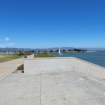
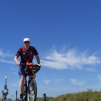


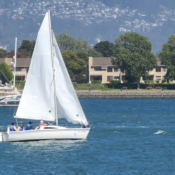




The Bay Bridge Trail is a trek that any lover of walking, running, biking or surveying the things that make San Francisco Bay so amazing, should partake in at least once in their lifetime. It's an easy hike really with just the length and the wind out on the bay, not to mention the traffic on the Bay Bridge whizzing by being the only intimidating factors. This roughly six mile trek total has only a minor steep incline as one comes closer to the Bay Bridge's new tower, which seemed like a lot of hard work for those who were on bicycle heading towards Yerba Buena Island and then a slightly scary free for all when they headed back down the slope towards the Oakland side of the Bridge. The day I went with friends, we decided to meet up at the Ikea parking lot as that's where the trail's technical starting point is, but from there I told my friends that there was a parking lot located at an event space called The Bridge Yard where the trail continues and is closer to the actual Bay Bridge. What's nice is that parking is free at the the Bay Bridge Trail Parking Lot and you get a little bit of the history and background of the building of the bridge that connects the city of San Francisco and the East Bay. Once we got out on the trail they have a lot of nice markers on how far you have to go to get to Yerba Buena Island. You'll notice all of the nice landscaping that they done around the Oakland side of the bridge and how well maintained things are. They also have a really nice observation deck jutting out of the Oakland side of the bridge with tables and chairs for people to look out over the water and see the bridge in all its glory, but I wouldn't know as that area was closed off with a fence and doesn't look like it has ever been opened for the public to see. Whether you are hiking or biking you will really get an appreciation of how long your trip is either by foot or pedal and the beautiful views of the bay that are underfoot or "underbridge" as the case may be. After our five and half mile walk west towards Yerba Buena Island we finally arrived at our destination and first made a pit stop at an area with a map and cement benches and we found at there were a lot of area cordoned off by fences and a long roadways on the island that were so slopped uphill that even by bicycle it looked like a challenge. As we sat there enjoying our lunch looking out over the bay, we noticed that the skies above were changing on a dime, and as the grayer the weather got, we decided to high-tail back to the parking lot located by the Bay Bridge toll plaza. As it started raining, it luckily didn't get too cold out there, but it was wet, which only made me sympathize with the bicyclists even more as riding downhill with pathway wet with a mere shoulder length bridge that separates you from the water below can be quite scary! But ironically, the only accident we saw was a pile up on the actual Bay Bridge freeway which was interesting to see firsthand how traffic bottles up as you walk by it with nothing but you and a gate separating you from the speeding traffic next to you. The Bay Bridge Trail - Shellmound is something that I would totally walk through again as the hike is an easy straight slightly uproad climb in which bicyclists and walkers share a small pathway evenly, which is a nice change of pace versus that of the Golden Gate Bridge, which is overwrought with tourists and sharing the path can get really complicated. Here's to hoping that more observation decks and pathway open up so one can enjoy their adventure walking or biking on the bridge even further. The new Bay Bridge is here to stay and ready to be explored by more people, locals and tourists alike! read more


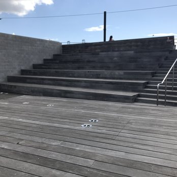


This particular trails starts at the ikea Way. It's the street right off ikea. It's a clear path to follow. Best parking tip would be the Emery Bay Parking lot which is the parking garage for the mall and the AMC theater. The only clear designated area here is for cyclist. If you're walking you mainly share the trail with them. I would design this trail differently as: Each designated space for both. It's big enough. There's one last porta potty before you start the actual two miles or so of the trail. Before that from the ikea way entrance it's another close to two miles give or take. Also thats your first chance to use the bathroom. It's breath taking. Always is when you can enjoy a bridge on foot. It's a different experience. More profound. I'm very appreciative of the design with this consideration in mind. The tower that holds the cables together is mighty looking. It stands tall and is a very photogenic subject for all. I must've taken an infinite amount of photos today! Lastly this path is lined with wild flowers and greens. As well as mostly buildings that was there way before this path ever existed. So the old and new to me merged quiet well here. Easy walk overall. It's a total of about close to ten miles from start to finish. Layer up as the gust of wind from the bay can swiftly change the temperature. Enjoy the view of the old bridge next to the new one. It's pretty historic losing that old behemoth. I do welcome the new span and eagerly await the completion of the trail to the Yerba Buena Island. I know to me the end came so quickly. I was still so eager to walk some more but alas! Every good path must come to an abrupt end at least here. read more


10 years ago
I've wanted to take this trek since it opened a few years ago. I was finally given the opportunity to do it as part of my run/walk group. It was a beautiful day. The wind was blowing but there was no rain. The run was amazing. I couldn't help but stop and admire the bay on a few occasions. I will certainly return and make this a regular part of my routine. read more

13 years ago

11 years ago
First time here and started at Shellmound St/IKEA. First leg of the trip has a plethora of stink! But once we passed the first mile, it was an enjoyable ride. The ride is a steady climb the entire way but enjoyable since we stopped to take in the views and pictures. It was great to see the old bridge being taken apart, view of the City & steady flow of traffic. It's just as noisy as when you're in the car with the windows down. Planning to do this again. read more


13 years ago
More info about Bay Bridge Trail - Shellmound
Ask the Community - Bay Bridge Trail - Shellmound
Review Highlights - Bay Bridge Trail - Shellmound
You might also consider





















Bay Bridge Trail - Shellmound - parks - Updated September 2026
Best of Emeryville
People found Bay Bridge Trail - Shellmound by searching for…
Running Trails in Emeryville, CA
River Swimming in Emeryville, CA
Walking Trails in Emeryville, CA
Sunset Views in Emeryville, CA
Closest Beach in Emeryville, CA
Fishing Pier in Emeryville, CA
Fishing Spots in Emeryville, CA
Parks for Kids in Emeryville, CA
Scenic Drive in Emeryville, CA
Watch Sunset in Emeryville, CA
Things to Do in Emeryville, CA
Dog Walking Areas in Emeryville, CA
Running Routes in Emeryville, CA
Hiking Trails in Emeryville, CA
Picnic Areas in Emeryville, CA
Trending Searches in Emeryville, CA
Apple Orchards near Bay Bridge Trail - Shellmound
Apple Picking near Bay Bridge Trail - Shellmound
Archery near Bay Bridge Trail - Shellmound
Barbershop near Bay Bridge Trail - Shellmound
Baseball Fields near Bay Bridge Trail - Shellmound
Blow Dry Bar near Bay Bridge Trail - Shellmound
Consignment Shops near Bay Bridge Trail - Shellmound
Corn Maze near Bay Bridge Trail - Shellmound
Dog Friendly Things To Do near Bay Bridge Trail - Shellmound
Dog Parks near Bay Bridge Trail - Shellmound
Eyelash Extensions near Bay Bridge Trail - Shellmound
Fishing Ponds near Bay Bridge Trail - Shellmound
Formal Wear near Bay Bridge Trail - Shellmound
Kids Birthday Party near Bay Bridge Trail - Shellmound
Makeup Artists near Bay Bridge Trail - Shellmound
Mens Suits near Bay Bridge Trail - Shellmound
Photo Spots near Bay Bridge Trail - Shellmound
Picnic Areas near Bay Bridge Trail - Shellmound
Places To Take Pictures near Bay Bridge Trail - Shellmound
Playgrounds near Bay Bridge Trail - Shellmound
Private Schools near Bay Bridge Trail - Shellmound
Public Running Track near Bay Bridge Trail - Shellmound
Public Shower near Bay Bridge Trail - Shellmound
Pumpkin Patches near Bay Bridge Trail - Shellmound
River Swimming near Bay Bridge Trail - Shellmound
Scenic Overlook near Bay Bridge Trail - Shellmound
Sunrise View near Bay Bridge Trail - Shellmound
Browse Articles
Browse Nearby
BEST of Emeryville, California Coffee near Bay Bridge Trail - Shellmound
BEST of Emeryville, California Restaurants near Bay Bridge Trail - Shellmound
BEST of Emeryville, California Things to Do near Bay Bridge Trail - Shellmound
BEST of Emeryville, California Playgrounds near Bay Bridge Trail - Shellmound
BEST of Emeryville, California Breakfast near Bay Bridge Trail - Shellmound
BEST of Emeryville, California Picnic Areas near Bay Bridge Trail - Shellmound
BEST of Emeryville, California Star Gazing near Bay Bridge Trail - Shellmound
BEST of Emeryville, California Campgrounds near Bay Bridge Trail - Shellmound
BEST of Emeryville, California Sightseeing near Bay Bridge Trail - Shellmound
Browse Brands
Related Searches in Emeryville, CA
Best Off Leash Dog Parks in Emeryville, California
Best Parks for Parties and Events in Emeryville, California
Best Water Parks for Kids in Emeryville, California
Check Out Great Playgrounds in Emeryville, California
Discover Baseball Fields Around Emeryville, California
Discover Fun Toddler Parks in Emeryville, California for Your Little One
Discover Lakes & Ponds to Explore in Emeryville, California
Discover Popular Bike Trails in Emeryville, California
Discover Popular Photo Spots in Emeryville, California
Discover Soccer Fields in Emeryville, California Near You
Discover Top Nature Parks to Visit in Emeryville, California
Discover Top State Parks to Visit in Emeryville, California
Discover Walking Parks in Emeryville, California Near You
Discover the Best Beaches in Emeryville, California
Discover the Best Kids Park Spots in Emeryville, California
Enjoy Scenic Places to Walk in Emeryville, California
Enjoy the Best Picnic Spots and Ideas in Emeryville, California
Enjoy the Best Walking Trails in Emeryville, California
Explore Free Picnic Areas Around Emeryville, California
Explore Fun Activities to Do in Emeryville, California
Explore Parks With Pull Up Bars in Emeryville, California
Explore Picnic Parks Near Emeryville, California
Explore Popular Campgrounds Near Emeryville, California
Explore Popular Kids Parks Throughout Emeryville, California
Explore Popular Picnic Areas Around Emeryville, California
Explore Popular RV Parks Around Emeryville, California
Explore Scenic Lakes to Visit in Emeryville, California
Explore Top Dog Parks in Emeryville, California Near You
Explore Top Water Parks in Emeryville, California Today
Find Great Places to Feed Ducks in Emeryville, California
Find Parks and Recreation Activities in Emeryville, California
Find Top Dog Friendly Parks to Visit in Emeryville, California
Find Top Skate Parks in Emeryville, California for All Skill Levels
Find a Kids Birthday Party Park in Emeryville, California
Find a Park With BBQ Pits in Emeryville, California
Find the Best Parks BBQ Grills in Emeryville, California
Find the Best Parks for Picnics in Emeryville, California
Find the Best Playgrounds to Visit in Emeryville, California
Have Fun at a Splash Pad in Emeryville, California
Locate Tennis Courts Around Emeryville, California
Picnic Areas With BBQ Pits Available in Emeryville, California
Play at a Splash Pad Park in Emeryville, California
Popular Picnic Spots to Visit in Emeryville, California
Relax in Parks With Shade Areas in Emeryville, California
Safe and Fun Parks for Kids in Emeryville, California
Top Hiking Trails to Explore in Emeryville, California
Top Playgrounds for Kids to Enjoy in Emeryville, California
Top Running Trails to Explore in Emeryville, California


