Bay Bridge Trail Photos


You might also consider
More like Bay Bridge Trail
Recommended Reviews - Bay Bridge Trail
Start your review...

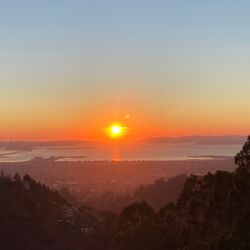
Reviews With Photos

It's free to walk or bike, it's really nice, and the views are great if you come on a day with good weather. It's fully paved and really easy. I walked the whole thing with my dog. The big issue I have is the noise resulting from the proximity to traffic, making it difficult to enjoy. It's not a hike and it's certainly not peaceful or serene. I'd come for the photos but I wouldn't do the walk again. I'd recommend headphones or earplugs to cancel the noise. I did not like the noise and I don't think my dog did either. It's impossible to hear much between the traffic and the wind. I'm glad I got some nice pictures for Instagram though!

They did a very nice job with the bike trail on the Bay Bridge. We walked from Oakland side to Treasure Island. It's about 8 miles back and forth. We got lucky with not so hot weather. Next time we visit, it will be on a bike. It was tough finding a place to park but it was all worth it when we did. The view is simply amazing on the bridge trail.

Great adventure and an exhilarating bike ride. We may a couple stops to rest our legs on the way to treasure island. The ride back was a breeze as it was downhill. We enjoyed the cruise and breeze on the way back. We didn't enjoy the fumes from the freeway but overall we enjoyed it and will likely ride again when we return to the area. We also enjoyed rented Lyft bikes, so the ride was 4.5 miles each way. Back and forth, the ride was close to 2 hours

This is a cool trial, an awesome experience and for sure a "must do" This trail is very easy to bike ride, jog or walk. Very clean and safe trail with awesome views of the bay. There is a dedicated parking area for your vehicle that seemed safe and secure. I did see a police car patrolling the area which I thought was great. There are several benches and call boxes along the trail. At the other end of the trial there is a snack shop (closed due to COVID) I cant wait to come back and do this again.

So I finally got over my fear of noxious vehicular fumes to brave the current extent of the Bay Bridge Trail from the Bridge Yard Building at the Port of Oakland to Yerba Buena Island. I guess they built the path five feet away from the bridge so that the fumes get sucked under the bridge. I didn't make that up. That's what I read. Anyway it didn't smell too badly on a brisk Friday afternoon where there was nary a soul on the five-mile round trip. Just one jogger with flailing arms and a trio of bicyclists who looked like they just graduated from training wheels. Granted it was cold and windy but not totally unbearable. What I appreciated the most was the 15-1/2-foot width of the pathway with a clear line of demarcation between the bike and pedestrian lanes. It was much wider than I expected with some unexpected views underneath like the two observation piers that have been built from the remnants of the old bridge. One is PIer E-2 which juts out westward from the port on the east side, and the other stretches out to the east on Yerba Buena Island. I liked how boats and tankers would suddenly appear from underneath the bridge. There are benches along the way though I don't see how relaxing it would be to sit while hearing the speeding cars just a few yards away. I could finally appreciate the single tower that anchors the suspension of the entire eastern span. Up close it's almost an sculptural art piece. There isn't that much to do once you're on Yerba Buena Island unless you walk toward the observation pier. However, I walked on the decidedly pedestrian-unfriendly Hillcrest Road to get the spectacular view of the western span pouring into San Francisco. By the way, it was quite easy to park at the lot next to the Bridge Yard Building, and they even turned some of the bridge cabling into pieces of art. Getting to the lot was also a cinch as you turn on Maritime Street toward the port and make a right on Burma Road. RELATED - Wanna take a hike? Here's a collection of trails I've walked and reviewed: http://bit.ly/2OrC8nU

So this new span (the eastern span) of the Bay Bridge seemed to have been built pretty quickly and fairly recently, like within the last 10 years. Growing up here in the Bay Area, I have driven over this bridge hundreds of times. The old span used to be heavy and industrial. Very fitting as that's when it was built, in the first half of the 20th century. Lots of steel and lots of rivets. It was so thick and solid that it was often hard to spot cars on it because of all the steel. The new incarnation is so much more modern and light, aesthetically. It is much more exposed to the air and the bay. And being so light, the bridge is almost stealthy, blending into the surroundings seamlessly. I'm sure it can hold a lot more traffic as well. I'm still trying to get used to it, as it simply doesn't have that classic look that pulls at my heartstrings...yet. Only time can adjust that. But what this new span has, that the old span didn't, is a pedestrian friendly trail that can take you to Yerba Buena Island, about 2 miles into the bay. You can start this trail in Emeryville, super close to the Mac Arthur Maze which will also add to your mileage. But if you want to just get the gist of this hike, you can start where the ports of Oakland lie. It's a bit tricky finding the parking as these industrial streets are rarely roamed by the public, but with gps, makes it a non-issue these days. Once on the trail, it is straight forward. 1 trail, wide enough to fit foot traffic and bike traffic. The way up to the island you will be going against the wind, so it is quite breezy. Definitely more relevant if you're biking. It is also slightly on an incline, but nothing that will knock your breath away. So the way back is crazy easy, downhill and with the wind. The views are great, especially as you stand right above the bay. The view looking towards the San Francisco skyline, with Yerba Buena in front of it, and Karl the Fog looming in the background is crazy classic. It is what makes the Bay Area so scenic, on how intertwined we are despite a major body of water separating us all. There are 2 cons though that I observed. One is the noise level is obnoxiously loud because you are literally within about 20-30 feet from the freeway. It is so loud that you can't really hold a conversation, unless you yell the whole time, which I'm never inclined to do. The other is once on Yerba Buena Island, there is no pedestrian access to explore the island. I'm sure you can find a way down there, but I didn't want to walk on the shoulder of a narrow road, that was somewhat under construction. So once touching the island, I literally just headed back. Kinda left me hanging. So far from the nature hikes that I normally embark on. But an urban hike with an intimate view on modern engineering, that should still be mentioned and noted. It's an available resource that makes Bay Area living so diverse.


A MUST for all locals and visitors! I love me a good bridge walk lol. Hands up if ya'll have done the Brooklyn Bridge walk and photos! #basic #nyc #travel lol. But for real, it's always cool to walk under a bridge structure and admire it's grandeur up-close! This trail is a little tricky to define, so I've been doing a lot of research! The Bay Bridge Trail is a part of a larger San Francisco Bay Trail. To just accomplish the Bay Bridge Trail, it's an out-and-back trail - 2.2 miles one way and 4.4 miles round trip. However, including the walk from the parking lot and extending into Vista Point at the Yerba Buena Island end, I tracked a total of 5.57 miles on the Runkeeper app. It took us two hours, and that includes stops for photos. It is pretty flat all the way through. Supposedly, towards SF there is a subtle, slight incline but I didn't notice and it felt flat! To get to the trailhead on the Oakland side, head to 210 Burma Rd, Oakland. This address is associated with the Bridge Yard building and also Judge John Sutter Regional Shoreline. There is a decent-size parking lot and parking is free. Gates for the parking lot are open 7am-5pm daily. We went on a Sunday around 1pm. Unfortunately at that time, the freeway was SUPER congested going to SF and we were caught up in traffic. If you happen to go at a time when there will be traffic on the bridge to SF, I highly recommend avoiding the freeway - take roads if you can. Before starting the hike, I used the bathrooms right at the parking lot. They are surprisingly clean and new. The toilets got that nice white toilet bowl and seat lol! Often, park bathrooms have the black seats and the silver bowl, lol and it's like you can't tell how dirty it might be lol. But this bathroom felt clean and sanitary. My only critique was there was no soap - but I just used my own hand sanitizer so no biggie. The beginning of the path has a lot of greenery. The pedestrian path is on the left, and bike paths are on the right in both directions. The total path is wide at 15.5 feet. There was plenty of space for distancing and it felt very safe. It was cool to walk alongside the freeway and watch all the cars drive by in the opposite direction. It's a bit freaky looking down lol you'll see the water below the freeway. It's a bit loud but not that bothersome. In any case, we had ear buds in and my partner and I were listening to our own audio. I listened to audiobooks throughout our walk. The view from Oakland to Yerba Buena was beautiful. We went on a day where the SF skyline was particularly pretty, with a lot of beautiful, wispy clouds. You can see the Salesforce tower and all the other tall skyscrapers on the walk. Yerba Buena Island is connected to Treasure Island, and there is usually a pedestrian access to Treasure Island but it is closed right now through April 2021: https://511.org/biking/bay-bridge-trail. In any case, the end point of the trail is at Yerba Buena Island. They have a little landing area at the end - follow signs for Vista Point. There are a couple of benches and restrooms, as well as a lookback at the trail you've just walked so far! The walk back to the Oakland has less of a nice view. I took most of my photos in the SF direction haha. But it's still a nice walk and it goes by quickly. The Bay Bridge Trail (the 5.57 mile one I described) is open 6am-9pm daily. It's called the "east span" on their website. The part of the trail that is 24/7/365 is just from Shellmound-Emeryville to 210 Burma Rd, Oakland: "open 24 hours a day, 7 days a week from the trailhead on Shellmound Street in Emeryville to the Caltrans Bridge Yard building at 210 Burma Road, Oakland." Also, 15 mph is the speed limit encouraged for bicyclists! This site has a lot of handy info: https://www.baybridgeinfo.org/path. I highly recommend walking this trail and getting up-close and personal with this bridge!

The Bay Bridge Bike Trail starts across the street from the Ikea store in Emeryville and winds its way to the base of the Bay Bridge where the moderate but long climb up the bridge begins. There is also a parking lot near the base of the bridge if you prefer not to bike the extra miles from the start across the street from Ikea to the base. The shear length of the climb can be intimidating if you're on a bike, but if you keep your gears low and take your time, it's not so bad. The views as you get closer to the top are spectacular, all the while hearing and seeing the Bay Bridge traffic whiz by. It's exhilarating! Once at top or end of the trail, you're on Yerba Buena Island and there is a Bay Bridge Trail Lookout where you can take in the spectacular panoramic views of the bridge, bay and the East Bay. You'll definitely want to take a few selfies there! You can continue your bike ride down to Treasure Island but keep in mind, whatever elevation you bike down, you will have to bike back up or at least push your bike back up! If you decide to turn and go back down the Bay Bridge, your speeds can go in excess of 20 mph! Keep in mind, the speed limit on the trail is only 15 mph. https://sanfrancisco.wingsdomain.com

Just driving to work. I thought I would leave early so I could be traffic but I'm still in traffic. At least it's a beautiful scenery is so beautiful relaxing. I love swimming I rather be swimming and watching the water but watching it is beautiful as well in the mountains in the sky gorgeous.

I used to park at the IKEA lot to hit the trailhead. This time I tried the Burma road parking lot. Much easier! Now that I know where it is I will no longer deal with the traffic of the IKEA lot. Riding the trail is too short. It's only about a half hour of moving time. In my opinion, walking the trail allows for a better experience except for the first mile which involves nothing but construction rubble and a sewage treatment facility. It's cool to be able to see the progress of demolition on the old eastern span. Every time I've ever been it's always windy so dress appropriately. It will be great once the trail completes to treasure island. Take the family for a walk & get some pictures along the way!

A little over 2 months old this trail is just awesome to bike, walk, run, or walk your dog. Take advantage of the beautiful bay and bridge scenery! Just B-E-A-utiful! Especially on a great summer day or night. The fact that its November and we are still having awesome weather helps out! As you get close to the middle pillar of the bridge it starts to get hard to hold a conversation with the person next to you due to the cars passing by at a fast pace. It can get chilly, so take something warm. If you're running then you'll get warmed up pretty quick. If you start your destination around IKEA then you'll encounter a foul smell passing by the EBMUD facility. Once you pass that then everything is fine. The trail along the bridge stops just short of treasure island. I can't wait until it is expanded. Round trip I say is about 5-7 miles? I'm not too sure. My friends and I started & finished running from guitar center at the Emeryville market and that was 10 miles. Just do it! Get out of the house, take a walk, enjoy what the Bay Area has to provide. Take advantage of this trail/walkway. The bridge is beautiful and take in the smell of the bay. The bridge is already distracting enough when you're driving, so park your car, take a walk and THEN take your pictures or selfies!

Great trail! No shade, so make sure you apply sunblock. It's about a 5 mile round trip. Maybe a little bit less. It's a nice paved trail, and perfect for a nice walk/jog, or an easy bike ride. We walked to Yerba Buena Island and took a little break there. It was so pretty. You can start from Emeryville or Oakland. Look up the Bay Bridge Trail website because it gives the exact address for both locations.

3 years ago
When I was a resident of the Bay Area (up until mid-2001), I took full advantage any chance I got to go mountain biking, hiking, and enjoy all the picturesque views that the Bay had to offer. This takes me to the one and only "Bay Bridge Trail", one of the most anticipated trails to open in the 21st century. And I have got to say that this is something I highly recommend everyone should try at least once. The trail that I am focusing and reviewing on here is a 2.2 mile span that starts in Oakland and eventually ends at Yerba Buena Island. As many people are wondering, where exactly is the easiest place to park? The answer to that is there are various access points to get here. Some of the closest that I recommend are Shellmound St. in Emeryville which is across the street from IKEA. I do not advise parking at IKEA since parking enforcement may ticket your vehicle. A few other access points are Burma Road Trailhead as well as the Eastbound Bay Bridge Toll Plaza which is accessible via-AC Transit. As far as the trail itself, the foot wide path stretches to a reasonable 15.5 feet wide going each direction; one for bicyclists and an outside lane designated for pedestrians. This path also has fairly decent hours on the East Span of the Bay Bridge as it is open daily from 6:00am to 9:00pm. Dogs are permitted; however they do not allow skateboards, scooters, or rollerblades. This trail also has a maximum speed enforcement of 15 mph. Since this is totally free, I would have to say that this is one of the best places you could go for your workout. Keep in mind that the trail does run parallel to the San Francisco-Oakland Bay Bridge and it can get very noisy due to how close you are to the traffic. My advise is if you bring earplugs or noise-cancelling headphones, this will eliminate a considerable amount of noise. Furthermore, it is extremely windy (no matter what time of year it is) so make sure to bring a windbreaker and an extra layer since this area can get very foggy and cold. The panoramic views of the Bridge and the skyscrapers of San Francisco from a distance are absolutely beautiful and surreal; especially on a clear sunny day. Once going up the steeper incline (by bike), make sure you take your time and use the lowest possible gear. Since I have a mountain bike, this was a task all in itself. But I have got to say, this was well worth it in every way possible. My rating for the "Bay Bridge Trail", a unanimous five stars. read more


To see a beautiful view of the new span of the Bay Bridge, take this trail. Talk a stroll. Take your bike and go to Treasure Island and have lunch. I don't know why it took me so long to come but glad I did! It was a nice clear weather late Sunday morning but it was a little windy and to be expected. There was no fog in site! though and we were lucky today. We parked at the Bay Bridge Parking lot where there is about 50 slots and a nice clean bathroom. It's well marked so it's easy to find. We can late about 10am and there is only about 7 cars so not to worry about not having a parking space. There is a small incline going up towards Treasure Island but can be difficult if you are biking against the wind. It was easy going back but make sure to keep your speed to 15 mph and watch out for people walking. Pass by the Observation Pier to chill and see more views of Treasure Island and SF views. Definitely a must bookmark and come for some exercise! [84th R] read more


It's free to walk or bike, it's really nice, and the views are great if you come on a day with good weather. It's fully paved and really easy. I walked the whole thing with my dog. The big issue I have is the noise resulting from the proximity to traffic, making it difficult to enjoy. It's not a hike and it's certainly not peaceful or serene. I'd come for the photos but I wouldn't do the walk again. I'd recommend headphones or earplugs to cancel the noise. I did not like the noise and I don't think my dog did either. It's impossible to hear much between the traffic and the wind. I'm glad I got some nice pictures for Instagram though! read more


They did a very nice job with the bike trail on the Bay Bridge. We walked from Oakland side to Treasure Island. It's about 8 miles back and forth. We got lucky with not so hot weather. Next time we visit, it will be on a bike. It was tough finding a place to park but it was all worth it when we did. The view is simply amazing on the bridge trail. read more

2 years ago
Great adventure and an exhilarating bike ride. We may a couple stops to rest our legs on the way to treasure island. The ride back was a breeze as it was downhill. We enjoyed the cruise and breeze on the way back. We didn't enjoy the fumes from the freeway but overall we enjoyed it and will likely ride again when we return to the area. We also enjoyed rented Lyft bikes, so the ride was 4.5 miles each way. Back and forth, the ride was close to 2 hours read more


This is a cool trial, an awesome experience and for sure a "must do" This trail is very easy to bike ride, jog or walk. Very clean and safe trail with awesome views of the bay. There is a dedicated parking area for your vehicle that seemed safe and secure. I did see a police car patrolling the area which I thought was great. There are several benches and call boxes along the trail. At the other end of the trial there is a snack shop (closed due to COVID) I cant wait to come back and do this again. read more


So I finally got over my fear of noxious vehicular fumes to brave the current extent of the Bay Bridge Trail from the Bridge Yard Building at the Port of Oakland to Yerba Buena Island. I guess they built the path five feet away from the bridge so that the fumes get sucked under the bridge. I didn't make that up. That's what I read. Anyway it didn't smell too badly on a brisk Friday afternoon where there was nary a soul on the five-mile round trip. Just one jogger with flailing arms and a trio of bicyclists who looked like they just graduated from training wheels. Granted it was cold and windy but not totally unbearable. What I appreciated the most was the 15-1/2-foot width of the pathway with a clear line of demarcation between the bike and pedestrian lanes. It was much wider than I expected with some unexpected views underneath like the two observation piers that have been built from the remnants of the old bridge. One is PIer E-2 which juts out westward from the port on the east side, and the other stretches out to the east on Yerba Buena Island. I liked how boats and tankers would suddenly appear from underneath the bridge. There are benches along the way though I don't see how relaxing it would be to sit while hearing the speeding cars just a few yards away. I could finally appreciate the single tower that anchors the suspension of the entire eastern span. Up close it's almost an sculptural art piece. There isn't that much to do once you're on Yerba Buena Island unless you walk toward the observation pier. However, I walked on the decidedly pedestrian-unfriendly Hillcrest Road to get the spectacular view of the western span pouring into San Francisco. By the way, it was quite easy to park at the lot next to the Bridge Yard Building, and they even turned some of the bridge cabling into pieces of art. Getting to the lot was also a cinch as you turn on Maritime Street toward the port and make a right on Burma Road. RELATED - Wanna take a hike? Here's a collection of trails I've walked and reviewed: http://bit.ly/2OrC8nU read more


5 years ago
So this new span (the eastern span) of the Bay Bridge seemed to have been built pretty quickly and fairly recently, like within the last 10 years. Growing up here in the Bay Area, I have driven over this bridge hundreds of times. The old span used to be heavy and industrial. Very fitting as that's when it was built, in the first half of the 20th century. Lots of steel and lots of rivets. It was so thick and solid that it was often hard to spot cars on it because of all the steel. The new incarnation is so much more modern and light, aesthetically. It is much more exposed to the air and the bay. And being so light, the bridge is almost stealthy, blending into the surroundings seamlessly. I'm sure it can hold a lot more traffic as well. I'm still trying to get used to it, as it simply doesn't have that classic look that pulls at my heartstrings...yet. Only time can adjust that. But what this new span has, that the old span didn't, is a pedestrian friendly trail that can take you to Yerba Buena Island, about 2 miles into the bay. You can start this trail in Emeryville, super close to the Mac Arthur Maze which will also add to your mileage. But if you want to just get the gist of this hike, you can start where the ports of Oakland lie. It's a bit tricky finding the parking as these industrial streets are rarely roamed by the public, but with gps, makes it a non-issue these days. Once on the trail, it is straight forward. 1 trail, wide enough to fit foot traffic and bike traffic. The way up to the island you will be going against the wind, so it is quite breezy. Definitely more relevant if you're biking. It is also slightly on an incline, but nothing that will knock your breath away. So the way back is crazy easy, downhill and with the wind. The views are great, especially as you stand right above the bay. The view looking towards the San Francisco skyline, with Yerba Buena in front of it, and Karl the Fog looming in the background is crazy classic. It is what makes the Bay Area so scenic, on how intertwined we are despite a major body of water separating us all. There are 2 cons though that I observed. One is the noise level is obnoxiously loud because you are literally within about 20-30 feet from the freeway. It is so loud that you can't really hold a conversation, unless you yell the whole time, which I'm never inclined to do. The other is once on Yerba Buena Island, there is no pedestrian access to explore the island. I'm sure you can find a way down there, but I didn't want to walk on the shoulder of a narrow road, that was somewhat under construction. So once touching the island, I literally just headed back. Kinda left me hanging. So far from the nature hikes that I normally embark on. But an urban hike with an intimate view on modern engineering, that should still be mentioned and noted. It's an available resource that makes Bay Area living so diverse. read more


Still my favorite place for an urban hike after work. Yes it's a bit noisy with the traffic, but the view is always nice and when it's blazing hot everywhere else, it tends to be comfortable with a nice breeze here. read more


A MUST for all locals and visitors! I love me a good bridge walk lol. Hands up if ya'll have done the Brooklyn Bridge walk and photos! #basic #nyc #travel lol. But for real, it's always cool to walk under a bridge structure and admire it's grandeur up-close! This trail is a little tricky to define, so I've been doing a lot of research! The Bay Bridge Trail is a part of a larger San Francisco Bay Trail. To just accomplish the Bay Bridge Trail, it's an out-and-back trail - 2.2 miles one way and 4.4 miles round trip. However, including the walk from the parking lot and extending into Vista Point at the Yerba Buena Island end, I tracked a total of 5.57 miles on the Runkeeper app. It took us two hours, and that includes stops for photos. It is pretty flat all the way through. Supposedly, towards SF there is a subtle, slight incline but I didn't notice and it felt flat! To get to the trailhead on the Oakland side, head to 210 Burma Rd, Oakland. This address is associated with the Bridge Yard building and also Judge John Sutter Regional Shoreline. There is a decent-size parking lot and parking is free. Gates for the parking lot are open 7am-5pm daily. We went on a Sunday around 1pm. Unfortunately at that time, the freeway was SUPER congested going to SF and we were caught up in traffic. If you happen to go at a time when there will be traffic on the bridge to SF, I highly recommend avoiding the freeway - take roads if you can. Before starting the hike, I used the bathrooms right at the parking lot. They are surprisingly clean and new. The toilets got that nice white toilet bowl and seat lol! Often, park bathrooms have the black seats and the silver bowl, lol and it's like you can't tell how dirty it might be lol. But this bathroom felt clean and sanitary. My only critique was there was no soap - but I just used my own hand sanitizer so no biggie. The beginning of the path has a lot of greenery. The pedestrian path is on the left, and bike paths are on the right in both directions. The total path is wide at 15.5 feet. There was plenty of space for distancing and it felt very safe. It was cool to walk alongside the freeway and watch all the cars drive by in the opposite direction. It's a bit freaky looking down lol you'll see the water below the freeway. It's a bit loud but not that bothersome. In any case, we had ear buds in and my partner and I were listening to our own audio. I listened to audiobooks throughout our walk. The view from Oakland to Yerba Buena was beautiful. We went on a day where the SF skyline was particularly pretty, with a lot of beautiful, wispy clouds. You can see the Salesforce tower and all the other tall skyscrapers on the walk. Yerba Buena Island is connected to Treasure Island, and there is usually a pedestrian access to Treasure Island but it is closed right now through April 2021: https://511.org/biking/bay-bridge-trail. In any case, the end point of the trail is at Yerba Buena Island. They have a little landing area at the end - follow signs for Vista Point. There are a couple of benches and restrooms, as well as a lookback at the trail you've just walked so far! The walk back to the Oakland has less of a nice view. I took most of my photos in the SF direction haha. But it's still a nice walk and it goes by quickly. The Bay Bridge Trail (the 5.57 mile one I described) is open 6am-9pm daily. It's called the "east span" on their website. The part of the trail that is 24/7/365 is just from Shellmound-Emeryville to 210 Burma Rd, Oakland: "open 24 hours a day, 7 days a week from the trailhead on Shellmound Street in Emeryville to the Caltrans Bridge Yard building at 210 Burma Road, Oakland." Also, 15 mph is the speed limit encouraged for bicyclists! This site has a lot of handy info: https://www.baybridgeinfo.org/path. I highly recommend walking this trail and getting up-close and personal with this bridge! read more


4 years ago
The Bay Bridge Bike Trail starts across the street from the Ikea store in Emeryville and winds its way to the base of the Bay Bridge where the moderate but long climb up the bridge begins. There is also a parking lot near the base of the bridge if you prefer not to bike the extra miles from the start across the street from Ikea to the base. The shear length of the climb can be intimidating if you're on a bike, but if you keep your gears low and take your time, it's not so bad. The views as you get closer to the top are spectacular, all the while hearing and seeing the Bay Bridge traffic whiz by. It's exhilarating! Once at top or end of the trail, you're on Yerba Buena Island and there is a Bay Bridge Trail Lookout where you can take in the spectacular panoramic views of the bridge, bay and the East Bay. You'll definitely want to take a few selfies there! You can continue your bike ride down to Treasure Island but keep in mind, whatever elevation you bike down, you will have to bike back up or at least push your bike back up! If you decide to turn and go back down the Bay Bridge, your speeds can go in excess of 20 mph! Keep in mind, the speed limit on the trail is only 15 mph. https://sanfrancisco.wingsdomain.com read more


Just driving to work. I thought I would leave early so I could be traffic but I'm still in traffic. At least it's a beautiful scenery is so beautiful relaxing. I love swimming I rather be swimming and watching the water but watching it is beautiful as well in the mountains in the sky gorgeous. read more


I used to park at the IKEA lot to hit the trailhead. This time I tried the Burma road parking lot. Much easier! Now that I know where it is I will no longer deal with the traffic of the IKEA lot. Riding the trail is too short. It's only about a half hour of moving time. In my opinion, walking the trail allows for a better experience except for the first mile which involves nothing but construction rubble and a sewage treatment facility. It's cool to be able to see the progress of demolition on the old eastern span. Every time I've ever been it's always windy so dress appropriately. It will be great once the trail completes to treasure island. Take the family for a walk & get some pictures along the way! read more


13 years ago
A little over 2 months old this trail is just awesome to bike, walk, run, or walk your dog. Take advantage of the beautiful bay and bridge scenery! Just B-E-A-utiful! Especially on a great summer day or night. The fact that its November and we are still having awesome weather helps out! As you get close to the middle pillar of the bridge it starts to get hard to hold a conversation with the person next to you due to the cars passing by at a fast pace. It can get chilly, so take something warm. If you're running then you'll get warmed up pretty quick. If you start your destination around IKEA then you'll encounter a foul smell passing by the EBMUD facility. Once you pass that then everything is fine. The trail along the bridge stops just short of treasure island. I can't wait until it is expanded. Round trip I say is about 5-7 miles? I'm not too sure. My friends and I started & finished running from guitar center at the Emeryville market and that was 10 miles. Just do it! Get out of the house, take a walk, enjoy what the Bay Area has to provide. Take advantage of this trail/walkway. The bridge is beautiful and take in the smell of the bay. The bridge is already distracting enough when you're driving, so park your car, take a walk and THEN take your pictures or selfies! read more

8 years ago
Great trail! No shade, so make sure you apply sunblock. It's about a 5 mile round trip. Maybe a little bit less. It's a nice paved trail, and perfect for a nice walk/jog, or an easy bike ride. We walked to Yerba Buena Island and took a little break there. It was so pretty. You can start from Emeryville or Oakland. Look up the Bay Bridge Trail website because it gives the exact address for both locations. read more


8 years ago
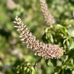
Nice easy trail for a walk along the bridge from Oakland to Yerba Buena Island. Great views of the East bay area. About an hour walk each way. At 210 Burma Road there is a new dedicated parking lot for trail access. It seemed safe and secure. Before you reach the bridge the trail is landscaped with a bunch of native plants and flowers. Traffic on the trail was busy with cyclists and light w walkers/joggers. Vehicle traffic on the bridge is a bit loud and constant. Once you reach the island you can hop in a shuttle that takes you to Treasure Island. read more


Running, biking, or walking from IKEA to Yerba Buena Island is a little over an 8 mile roundtrip! I felt like I ran faster on the trail, than anytime I'm driving over the bridge ! It really is a unique experience with amazing views. Be mindful of trail hours due to ongoing construction. read more


8 years ago
12 years ago
I parked at the corner of Burma Road and Mandela Parkway, and started at that trail head. I brought my camera along and spent hours on the trail, photographing all sorts of things - especially the old span of the Bay Bridge which is being disassembled as I type here. Makes for such compelling photography! And the views of all of these things that I've only seen for a split second while crossing the bridge in my car are wonderful to pause and contemplate, and on this trail you have a chance to do just that! As for hiking, it's hardly an ideal trail - all concrete, minimal shade, and the incessant noise of the passing multitude of cars make it anything but a peaceful hike, so if you are a regular hiker, you probably won't be doing this one every weekend. However, everyone should give it a look, especially now while the old span is still there. read more

8 years ago
More info about Bay Bridge Trail
Ask the Community - Bay Bridge Trail
Review Highlights - Bay Bridge Trail
You might also consider


Why does Yelp recommend reviews?
Bay Bridge Trail - hiking - Updated July 2026
Best of Oakland
People found Bay Bridge Trail by searching for…
Trending Searches in Oakland, CA
Black Owned Nail Salons near Bay Bridge Trail
Boat Rental near Bay Bridge Trail
Cliff Jumping near Bay Bridge Trail
Day Trips near Bay Bridge Trail
Dog Swimming near Bay Bridge Trail
Jet Ski Rental near Bay Bridge Trail
Kayak Rental near Bay Bridge Trail
Lakes & Ponds near Bay Bridge Trail
Off Road Trails near Bay Bridge Trail
Outdoor Activities near Bay Bridge Trail
Picnic Spots near Bay Bridge Trail
Places To Walk Around near Bay Bridge Trail
Public Pools near Bay Bridge Trail
Public Shower near Bay Bridge Trail
River Swimming near Bay Bridge Trail
River Tubing near Bay Bridge Trail
Rock Quarry near Bay Bridge Trail
Running Trails near Bay Bridge Trail
Scenic Night View near Bay Bridge Trail
Scenic Overlook near Bay Bridge Trail
Soccer Store near Bay Bridge Trail
Splash Pad near Bay Bridge Trail
Sunrise View near Bay Bridge Trail
Swimming Holes near Bay Bridge Trail
Swimming Lakes near Bay Bridge Trail
U Pick Farms near Bay Bridge Trail
Watch Sunset near Bay Bridge Trail
Browse Articles
Browse Nearby
BEST of Oakland, California Coffee near Bay Bridge Trail
BEST of Oakland, California Things to Do near Bay Bridge Trail
BEST of Oakland, California Restaurants near Bay Bridge Trail
BEST of Oakland, California Walking Trails near Bay Bridge Trail
BEST of Oakland, California Breakfast near Bay Bridge Trail
BEST of Oakland, California Parks near Bay Bridge Trail
BEST of Oakland, California Hot Springs near Bay Bridge Trail
BEST of Oakland, California Campgrounds near Bay Bridge Trail
Browse Brands
Related Searches in Oakland, CA
Affordable Kayak Rental Services in Oakland, California
Best Fishing Locations and Guides in Oakland, California
Best Nature Trails for Hiking in Oakland, California
Best Places for Horseback Riding in Oakland, California
Check Out Off Road Trails in Oakland, California
Discover Dog Friendly Trails to Explore in Oakland, California
Discover Kid Friendly Hiking Trails in Oakland, California
Discover Scenic Hiking Trails in Oakland, California
Discover Scenic Mountain Bike Trails Near Oakland, California
Discover Scenic Waterfall Spots in Oakland, California
Discover Walking Parks in Oakland, California Near You
Discover a Hiking Trail in Oakland, California
Discover the Best Night Hike Trails in Oakland, California
Discover the Best Running Track in Oakland, California
Dog-Friendly Hikes With Dogs in Oakland, California
Enjoy Camping Adventures Around Oakland, California
Enjoy Exciting Mountain Biking Adventures in Oakland, California
Enjoy Kayaking Adventures in Oakland, California
Enjoy Tent Camping Spots Around Oakland, California
Enjoy a Beautiful Waterfall Hike in Oakland, California
Enjoy the Best Picnic Spots and Ideas in Oakland, California
Enjoy the Best Walking Path in Oakland, California
Enjoy the Best Walking Trails in Oakland, California
Explore Beautiful Parks and Green Spaces in Oakland, California
Explore Easy Hikes Perfect for All in Oakland, California
Explore Fun Activities to Do in Oakland, California
Explore Popular Campgrounds Near Oakland, California
Explore the Best Beach Spots in Oakland, California
Explore the Best Swimming Holes Around Oakland, California
Explore the Best Trail Options in Oakland, California
Family Friendly Hiking With Kids in Oakland, California
Find Beautiful Views in Oakland, California
Find the Best Parks for Picnics in Oakland, California
Find the Best Scenic View Locations in Oakland, California
Great Places to Walk in Oakland, California
Hike the Popular Waterfall Trail in Oakland, California
Hiking Trails With Waterfalls in Oakland, California
Off Leash Dog Hiking Trails in Oakland, California
Plan a Scenic Drive Route Near Oakland, California
Popular Outdoor Activities to Try in Oakland, California
Popular Picnic Spots to Visit in Oakland, California
Safe River Swimming Areas in Oakland, California
Safe and Fun Parks for Kids in Oakland, California
Top Climbing Spots and Gyms in Oakland, California
Top Paddleboarding Activities in Oakland, California
Top Running Trails to Explore in Oakland, California
Top Swimming Lakes to Enjoy in Oakland, California
Top Swimming Spots and Pools in Oakland, California
People who viewed Bay Bridge Trail also viewed
Shoreline Trail
4 reviews
Grizzly Peak
143 reviews
Oakland Hills
Albany Waterfront Trail
2 reviews
Cesar Chavez Park
186 reviews
West Berkeley
Berkeley Fire Trails
110 reviews
Oakland Hills
Indian Rock Park
237 reviews
Berkeley Hills
Berkeley Aquatic Park
80 reviews
West Berkeley
Point Emery
3 reviews
Albany Hill Park
26 reviews
Jewel Lake
3 reviews