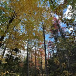
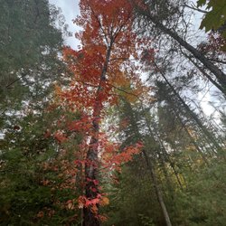
Baxter State Park Photos


More like Baxter State Park
Recommended Reviews - Baxter State Park
Start your review...


Reviews With Photos


I love New England, however, I wasn't always in love with it. It took me moving out of New England to realize how much I loved it and that I needed to come back. Baxter State Park is one of the many, many reasons why I love New England, and more importantly, Maine. Baxter State Park houses Mount Katahdin's hiking trails, and it is the most beautiful hike I have experienced. For one, the park is extremely remote and void of a lot of humans, which means that there is a ton of wildlife. The park is always, ALWAYS clean and the people who work the park ensure that it stays that way, which is something I appreciate! The trails of Mount Katahdin are no joke, especially if you climb Cathedral or Knife's Edge. Both are physically exhausting, but they have the most amazing views you could ever think to have. If you are looking to climb and be back at a reasonable hour AND get parking, MAKE SURE TO GET THERE EARLY! My friends and I ended up getting to the park around 4:30/5:00am to ensure that we had parking and so that we could get back at a reasonable time. The hiking trails normally take 8-10 hours, so make sure to plan accordingly. I honestly can't wait to come back and hike Mount Katahdin again and see the beautiful views. I would HIGHLY suggest this hike to any experienced hiker looking for a great place to hike in Maine!


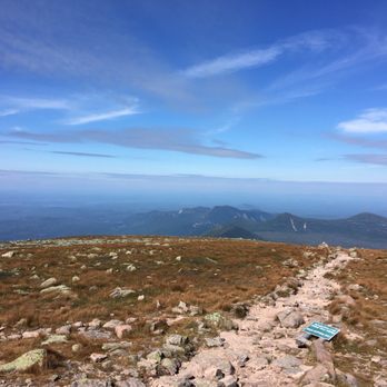
Though smaller in stature, Katahdin makes New Hampshire's Mt. Washington seem like a foothill. It is by far a much more strenuous and thrilling ascent than anything else New England has to offer. My wife and two friends camped outside of Baxter State Park at the Wilderness Edge Campground in Millinocket, which was close enough to get to the Roaring Brook Ranger Station early in the morning. We used the Baxter State Park official website in advance to make parking reservations, which are required to park at the station, and we made sure to carry flashlights, which the park also requires for hikers to have on their person when on the mountain. All the trails are magnificent, but the Knife Edge is Katahdin's crown jewel. No wider than a skateboard in some parts, the vertigo-inducing path will have you triple-checking your footing before each step. The drops are sheer in many places, making for a truly awe-inspiring view. And where the trail is most narrow, you can see down both sides of the mountain without even leaning or turning your head. Reaching the summit, unlike with other smaller peaks in the region, feels like a genuine accomplishment. The experience is one you and your fellow nature-lovers will never forget. Climb with some new acquaintances. You'll walk out of the park lifelong friends. I recommend bringing sunscreen and plenty of water. The ascent and descent can take nine hours or more in total, and there is no running water on the mountain. Even four or five full water bottles won't be enough on a hot day.


In New England, there exists a small, though militant, minority that insists everything about the West is superior to the East, and specifically, New England. Especially the hiking. New England-haters, I raise you: Baxter State Park. Baxter has the wild, untamed feel that pervades some of the great parks of the west. Read: trees, trees, moose, bears, coyotes, snowshoe hares, picturesque and pure lakes/ponds/streams, gorgeous mountain vistas with sheer exposed rock faces, and more trees. It's almost obsessively primitive, to boot: the gravel roads twist and turn, there are no lights at night, and there's no running water, only (well-maintained) outhouses with pits. Some, though not all, campgrounds are accessible by car. And there's no cell service-- duh-- though I did get 5 bars of that mysterious provider "US CELLULAR" on the peak of Katahdin. 'Cause Katahdin is tall and stuff, and cell service is the 21st century treat you get when you summit a mountain. Anyhow, the rewards for sacrificing your creature comforts are great. The views, the smells, and even the fresh smell of the air is unparalleled. These are the woods, rocky and muddy and green and largely untouched, as nature intended them to be. Notable things to consider before your trip: --Campground reservations should be made months in advance. Check out the park website for details on when reservations open up for specific time periods, and be on a computer the moment they open, if you can. Early fall is ideal, IMO, since temps are still mild but the buggos are mainly gone. --Roaring Brook to Chimney Pond is about a 2-3 hour hike depending on your skill level and the size of your pack (we had huge packs since we spent the night at Chimney Pond-- it'd be far less daunting with a daypack). Chimney Pond to Baxter Peak (the top of Katahdin) is 3-4 hours, depending on your route. Expect the hike back to Roaring Brook to be roughly the same, perhaps an hour or so shorter. In summary: if you're day-hiking from Roaring Brook, you need to leave early, as your journey will literally take all day. Depending on the time of year, I would not recommend starting later than 7 AM, and bring a headlamp just in case. You do NOT, I repeat, do NOT, want to be hiking in the woods after dark. --NO potable water available on-site means you should bring at least three liters of your own and/or a water filter. I recommend both, just in case. --NO electricity. So keep your phone on airplane to save battery, and consider bringing an extra camera to take photos! --Bring bags to hang your food if you're staying overnight and can't put things in the car, 'cause bears. --You can't do the Knife's Edge unless the weather is ideal, so be prepared to do the Saddle Trail, or just chill out at Chimney Pond, in the case of inclement weather. --Topo maps are available at the park gate. The gate closes promptly at 8:30, and after that, you can't get in, so budget your travel time accordingly. Our trip from Boston was about 5.5 hours.


Be forewarned - There is no potable water. The road is dirt, narrow, and curvy; it also definitely gets slick in the rain. You aren't going to have any cell service. Beyond that, this place is magic. Baxter hosts a very healthy forest so this park is teeming with wildlife. I walked down to Moose Point off of the Kidney Pond Campground. I sat down on the bench. There was the moose. Of course, this happened because I didn't have my camera. But still, it was a great experience. From that same bench, I got to watch three or four endangered loons and a small heron called a Least Bittern took off from the reeds. Drive around at night and your headlights will fill with small hopping frogs. By a parking spot, I watched a painted tortoise build a nest. I saw an arctic hare, a downy woodpecker (the smallest woodpecker in North America), lady slipper orchids, and tons of ground squirrels just walking to my lean-to. There are plenty of easy hikes as long as you aren't hiking Katahdin. As other reviewers mentioned, the hikes around the ponds are nice and flat. If you hike out to Daicey Pond from Katahdin Stream there are a bunch of boards laid as rustic foot bridges, which is fun. I was super sad that nobody else was playing around at The Ledges on the weekdays while I was in the park. It looks like such a fun series of pools and seems perfect for inter-tubing. Baxter has a bear problem. They do need to fix it better than they are, simply for the bear population's health and safety. They need bear boxes. Stop messing around and telling people to put food in their cars. That isn't best practices for bears and is bad practice when you have people that are hiking into your park. At the very minimum, install bear boxes at any walk-in site. But, truthfully, there should be a bear box at every site. Beyond that, Baxter is simply fantastic. I can't wait to go back and Baxter will absolutely embody Maine to me.


This is an absolutely magical place filled without absolutely draconian rules! You can maybe argue that the second thing enables the first thing but...that is not an argument I would make. I find it a bit silly that a state park in rural Maine built around a 5,000+ peak would model its park rules after Denali National Park, centered around the tallest mountain in North America. I think rules this restrictive only serve to make our parks less accessible to people who aren't affluent white liberals but...enough of my soapboxing. We came here to climb Mt Katahdin. And, for once in my life, when I say "climb", I actually mean it! We did a technical rock climbing route on the peak called "The Armadillo": https://www.mountainproject.com/route/106020335/the-armadillo We stayed at a luxurious lean-to at Chimney Pond. The rangers there were very helpful and friendly. They made the drudgery of the various oppressive rules almost...fun? I highly recommend staying at Chimney Pond yourself, climber or not. The views here feel nothing like New England. They feel more like Alaska, north of the arctic circle. Katahdin is only a little over 5,000 feet but it has big granite walls of rock unlike an other mountain in New England. (yes, including Mt Washington) My only complaint is that I got an insane amount of insect/arachnid bites on this trip. If you're staying in a lean-to, it might be helpful to have some sort of bug net! so many rules, so magical read more




3 years ago
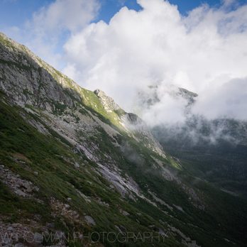
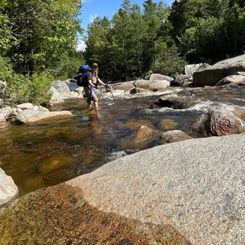
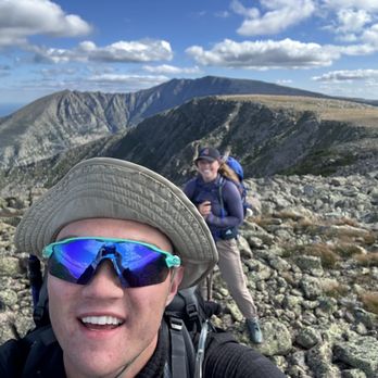
Park was great, went on a three day two night trip. Only knock was our hike from Roaring Brook to Hamlin peak and back was previously reviewed as intermediate to hard. After my trip I would absolutely say difficulty should be changed to hard to expert, the trip down from Hamlin peak was two miles down the mountain and extremely time consuming. All in all an amazing experience just be prepared for a long, challenging, but rewarding trip! read more





7 years ago
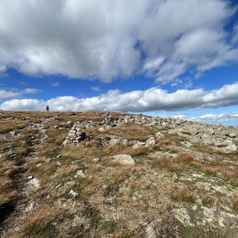
Mt. Katahdin is probably the pinnacle of hiking in New England. More of a climb than a hike at certain parts, so be prepared to use all four limbs. We brought gloves with rubber padding for the toughest sections and were glad we did. From Roaring Brook we took the Helon Taylor up across Knife Edge and came down Saddle. Started just before 7am and it took us about 12 hours to complete. Make sure to bring plenty of water (more than you think you need) and first aid supplies are also a good idea as you are hours away from help if anything were to happen. Knife Edge was a great challenge and the views along the top were amazing. Campgrounds were nice but fairly primitive, so don't expect what you find around Acadia. read more

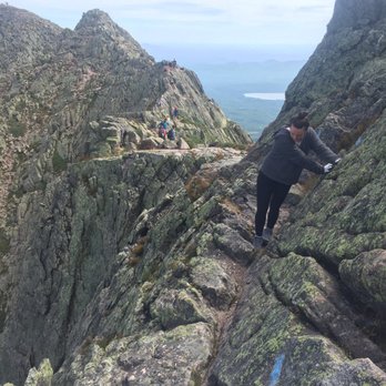


I love New England, however, I wasn't always in love with it. It took me moving out of New England to realize how much I loved it and that I needed to come back. Baxter State Park is one of the many, many reasons why I love New England, and more importantly, Maine. Baxter State Park houses Mount Katahdin's hiking trails, and it is the most beautiful hike I have experienced. For one, the park is extremely remote and void of a lot of humans, which means that there is a ton of wildlife. The park is always, ALWAYS clean and the people who work the park ensure that it stays that way, which is something I appreciate! The trails of Mount Katahdin are no joke, especially if you climb Cathedral or Knife's Edge. Both are physically exhausting, but they have the most amazing views you could ever think to have. If you are looking to climb and be back at a reasonable hour AND get parking, MAKE SURE TO GET THERE EARLY! My friends and I ended up getting to the park around 4:30/5:00am to ensure that we had parking and so that we could get back at a reasonable time. The hiking trails normally take 8-10 hours, so make sure to plan accordingly. I honestly can't wait to come back and hike Mount Katahdin again and see the beautiful views. I would HIGHLY suggest this hike to any experienced hiker looking for a great place to hike in Maine! read more




9 years ago
Though smaller in stature, Katahdin makes New Hampshire's Mt. Washington seem like a foothill. It is by far a much more strenuous and thrilling ascent than anything else New England has to offer. My wife and two friends camped outside of Baxter State Park at the Wilderness Edge Campground in Millinocket, which was close enough to get to the Roaring Brook Ranger Station early in the morning. We used the Baxter State Park official website in advance to make parking reservations, which are required to park at the station, and we made sure to carry flashlights, which the park also requires for hikers to have on their person when on the mountain. All the trails are magnificent, but the Knife Edge is Katahdin's crown jewel. No wider than a skateboard in some parts, the vertigo-inducing path will have you triple-checking your footing before each step. The drops are sheer in many places, making for a truly awe-inspiring view. And where the trail is most narrow, you can see down both sides of the mountain without even leaning or turning your head. Reaching the summit, unlike with other smaller peaks in the region, feels like a genuine accomplishment. The experience is one you and your fellow nature-lovers will never forget. Climb with some new acquaintances. You'll walk out of the park lifelong friends. I recommend bringing sunscreen and plenty of water. The ascent and descent can take nine hours or more in total, and there is no running water on the mountain. Even four or five full water bottles won't be enough on a hot day. read more


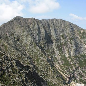


In New England, there exists a small, though militant, minority that insists everything about the West is superior to the East, and specifically, New England. Especially the hiking. New England-haters, I raise you: Baxter State Park. Baxter has the wild, untamed feel that pervades some of the great parks of the west. Read: trees, trees, moose, bears, coyotes, snowshoe hares, picturesque and pure lakes/ponds/streams, gorgeous mountain vistas with sheer exposed rock faces, and more trees. It's almost obsessively primitive, to boot: the gravel roads twist and turn, there are no lights at night, and there's no running water, only (well-maintained) outhouses with pits. Some, though not all, campgrounds are accessible by car. And there's no cell service-- duh-- though I did get 5 bars of that mysterious provider "US CELLULAR" on the peak of Katahdin. 'Cause Katahdin is tall and stuff, and cell service is the 21st century treat you get when you summit a mountain. Anyhow, the rewards for sacrificing your creature comforts are great. The views, the smells, and even the fresh smell of the air is unparalleled. These are the woods, rocky and muddy and green and largely untouched, as nature intended them to be. Notable things to consider before your trip: --Campground reservations should be made months in advance. Check out the park website for details on when reservations open up for specific time periods, and be on a computer the moment they open, if you can. Early fall is ideal, IMO, since temps are still mild but the buggos are mainly gone. --Roaring Brook to Chimney Pond is about a 2-3 hour hike depending on your skill level and the size of your pack (we had huge packs since we spent the night at Chimney Pond-- it'd be far less daunting with a daypack). Chimney Pond to Baxter Peak (the top of Katahdin) is 3-4 hours, depending on your route. Expect the hike back to Roaring Brook to be roughly the same, perhaps an hour or so shorter. In summary: if you're day-hiking from Roaring Brook, you need to leave early, as your journey will literally take all day. Depending on the time of year, I would not recommend starting later than 7 AM, and bring a headlamp just in case. You do NOT, I repeat, do NOT, want to be hiking in the woods after dark. --NO potable water available on-site means you should bring at least three liters of your own and/or a water filter. I recommend both, just in case. --NO electricity. So keep your phone on airplane to save battery, and consider bringing an extra camera to take photos! --Bring bags to hang your food if you're staying overnight and can't put things in the car, 'cause bears. --You can't do the Knife's Edge unless the weather is ideal, so be prepared to do the Saddle Trail, or just chill out at Chimney Pond, in the case of inclement weather. --Topo maps are available at the park gate. The gate closes promptly at 8:30, and after that, you can't get in, so budget your travel time accordingly. Our trip from Boston was about 5.5 hours. read more


12 years ago
Be forewarned - There is no potable water. The road is dirt, narrow, and curvy; it also definitely gets slick in the rain. You aren't going to have any cell service. Beyond that, this place is magic. Baxter hosts a very healthy forest so this park is teeming with wildlife. I walked down to Moose Point off of the Kidney Pond Campground. I sat down on the bench. There was the moose. Of course, this happened because I didn't have my camera. But still, it was a great experience. From that same bench, I got to watch three or four endangered loons and a small heron called a Least Bittern took off from the reeds. Drive around at night and your headlights will fill with small hopping frogs. By a parking spot, I watched a painted tortoise build a nest. I saw an arctic hare, a downy woodpecker (the smallest woodpecker in North America), lady slipper orchids, and tons of ground squirrels just walking to my lean-to. There are plenty of easy hikes as long as you aren't hiking Katahdin. As other reviewers mentioned, the hikes around the ponds are nice and flat. If you hike out to Daicey Pond from Katahdin Stream there are a bunch of boards laid as rustic foot bridges, which is fun. I was super sad that nobody else was playing around at The Ledges on the weekdays while I was in the park. It looks like such a fun series of pools and seems perfect for inter-tubing. Baxter has a bear problem. They do need to fix it better than they are, simply for the bear population's health and safety. They need bear boxes. Stop messing around and telling people to put food in their cars. That isn't best practices for bears and is bad practice when you have people that are hiking into your park. At the very minimum, install bear boxes at any walk-in site. But, truthfully, there should be a bear box at every site. Beyond that, Baxter is simply fantastic. I can't wait to go back and Baxter will absolutely embody Maine to me. read more


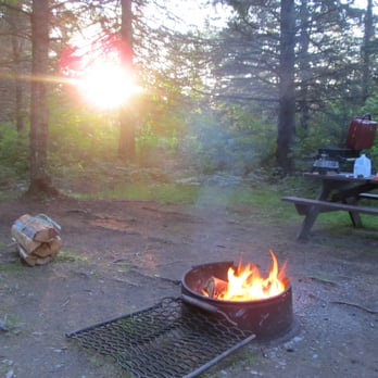
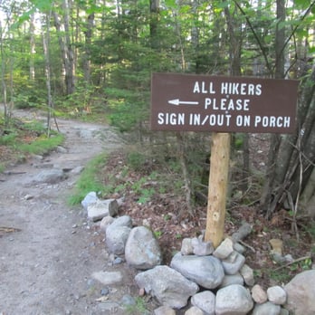
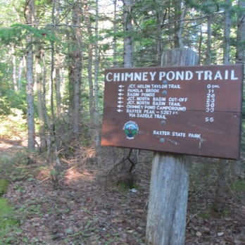
Baxter State Park is almost beyond description... for the outdoors lover, this place is the pinnacle of nature's beauty. Over 200,000 acres in size, there are limitless adventures, sights, sounds, and experiences awaiting you. I visited this park recently on an all too short but exciting camping trip. With last minute plans to climb Maine's highest peak, Mount Katahdin (at 5,268 feet), a friend and I booked one of the last remaining campsites available at Trout Brook Campgrounds. Our generous plot of land was located in the northern-most section of the park... a good 2-hour drive on a dirt road from the southern park entrance where we entered. I didn't mind though, it gave us a chance to take in the changing scenery amongst various sections of the park. Within an hour of entering, we even encountered a moose! Speaking of the wild... on visiting, it is quite clear you are in the wilderness. Being prepared is key. There is no running water or electricity. Any water obtained within the park must be treated before drinking. In a short three-day trip we encountered not only a moose, but black bears, deer, heard howling coyotes, and listened to something scratching at our car overnight. While the park rangers are beyond helpful and generous in their information and support for your stay, you may have to travel a distance if anything happens. Some ranger stations are not manned 24-hours, and though they are quite open about their schedules, it can be a bit disconcerting at times knowing you are essentially on your own if an emergency occurs at an off-hour. Firewood is sold at these stations as you cannot bring in your own. The fees for entry and stay are quite reasonable... there is a $14 entrance fee, $5 parking reservation fee if you so choose (the lots can fill up fast so this isn't such a bad option!), $30 for a summer camping site, and so on. There are bunkhouses, cabins, tent-sites, lean-tos, and the like with varying rental fees. While there are a number of trails throughout the park for use, as well as activities ranging from fishing, hunting, kayaking, hiking, and so on and so forth, my primary experience was an attempt at Katahdin's summit. The ranger stations ask that you sign in/out at each crossing in case of emergency to keep better track of your location in the mountains. My friend and I chose to start at Roaring Brook, make our way up the Helon Taylor Trail, climb Mount Pamola and continue on towards Katahdin from there. Summitting Pamola (4,919 feet) was a feat in itself. Crossing streams, fighting off brush, scaling boulders, and everything else associated with climbing a mountain left us cut, bruised, and beaten. Assessing our water supply and time left before nightfall, we made the difficult decision to turn down Dudley Trail to catch Chimney Pond back to the parking lot. If you choose this route, be forewarned... these trails are not for the faint of heart!! When they say intermediate to advanced hikers they mean it! I lost 17lbs and built up quite the endurance at the gym prior to this attempt and I am still nursing ridiculously sore muscles and minor injuries sustained on those rock faces. You are responsible for yourself up there... do not take that lightly. I am determined to return here again someday to stand on the peak of Mount Katahdin... although I'll probably change my route to Chimney Pond then Saddle. As long as you adequately prepare, I whole-heartedly encourage you to visit and experience all that Baxter State Park has to offer. It is absolutely worth the trip!!! read more





16 years ago

12 years ago

11 years ago


12 years ago

6 years ago


13 years ago
7 years ago
12 years ago

13 years ago

13 years ago

12 years ago
10 years ago
8 years ago
15 years ago