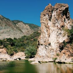
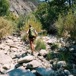
Andrée Clark Bird Refuge Photos


You might also consider
More like Andrée Clark Bird Refuge
Recommended Reviews - Andrée Clark Bird Refuge
Start your review...

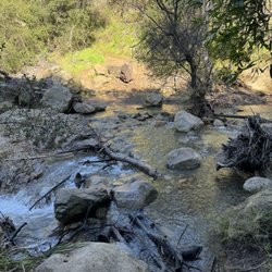
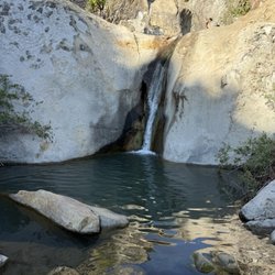
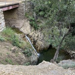
Reviews With Photos

Absolutely stunning! I greatly appreciate that there is a walk way around the body of water. The were plenty of people out on bikes, skates and walking this path. It was great to hear different birds chirping away. I saw birds on two opposing sides of the water - sun bathing! Excellent location to take a stroll and the plus is the beach is right across the street!!!

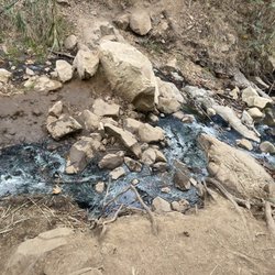
I used to live very close to the bird refuge and walk my pup along the outskirts walking path every few days. I liked it alright because there is usually a lot of activity, things to look at, and people to say hi to. But the stinky stench and the grimey mud got to be a little too much. The resting place, where you can park and sit on a bench, use the stretching machines, or stand and watch the birds fly in over the slimy toxic looking bay is really nothing too amazing and definitely not a recommend "tourist attraction." During the summer it can be pretty beautiful to just get off Carrillo and drive around to East Beach because the sun reflecting off the water with the palm background is a sight to see, but no need to stop and see the bay or the birds.. You can see plenty of birds at East Beach right across the street. I would love to see some sort of restoration done, maybe by a bird rescue non-profit(?), to put some effort into making the bay less toxic looking and stinky. Maybe have them clean up the greenery as well and put in some less odorous plants that don't need as much water supply - Kill two birds with one stone, not literally of course.

Not the cleanest of spots, but still a nice place to visit. To put it politely, the Bird Refuge is very "natural." It doesn't appear to have been improved or enhanced with man-made conveniences, but does offer a glimpse into unobstructed nature. It wraps around the eastern end of Cabrillo Blvd. and Los Patos Way and can be seen from the road. There's a walking path that lines most of the perimeter, and there are a few benches and docks for your viewing pleasure. Los Patos is somewhat awkward as it juts from the freeway, but you'll be able to find street parking nearby. As other reviewers have stated, the body of water at the center of the park is dirty and gives off an unpleasant odor. I suppose that this is how you'd find it in a natural setting so in theory, it doesn't bother me. I've seen more ducks than traditional birds congregate here. Maybe I'm just coming on the wrong days. Overall, a decent spot certainly worth a visit if you happen to be walking along the Cabrillo path.

I've been meaning to Meander this bird refuge for sometime and today was the day. Parking was simple, then my pup and I headed down the paved road to see what birds where out and about. It's a pleasant stroll, lined on either side by flora and trees and varying species. Many ducks and rare and beautiful bird types are in the lake and along the grassy knolls. Stranger Things style, a group of pre-teen kids whizzed by us on bikes. This is a great option if you'd like to get in a chill, light workout. And the lake closes at 10pm, which a great option when the tides run high on the beach and it's much too dark to hike. And it basically falls around the bend from where northern Coast Village Road ends. FYI: just saw a post on Nextdoor w/neighbors, car break-ins+stolen credit cards happened today @@11am. Don't bring yr wallet.


I bike or rollerblade here on every visit to Santa Barbara; it's a beautiful, peaceful destination, and enjoy seeing the plants, trees and birds. I agree with Douglas M that last summer, it was very stinky. Articles said it was due to poor water circulation and a rapid algae bloom and decay, resulting in noxious odors. Don't know about that, but I'd agree w/ the smelly part. They must have come up with a solution, because when I visited most recently, it was just fine. Check it out!


I thought this was a pleasant place to take a nice walk in the Santa Barbara area. There is an easy trail to follow along the perimeter of the lake and there are also numerous storyboards which help explain the natural environment for you. There are also a few viewing platforms where you can look out at the lake. I did find a small parking lot adjacent to the refuge along the road. Parking was free, but I suppose on a busy day, it may be hard to actually nab a spot. read more


2 years ago
Absolutely stunning! I greatly appreciate that there is a walk way around the body of water. The were plenty of people out on bikes, skates and walking this path. It was great to hear different birds chirping away. I saw birds on two opposing sides of the water - sun bathing! Excellent location to take a stroll and the plus is the beach is right across the street!!! read more


I used to live very close to the bird refuge and walk my pup along the outskirts walking path every few days. I liked it alright because there is usually a lot of activity, things to look at, and people to say hi to. But the stinky stench and the grimey mud got to be a little too much. The resting place, where you can park and sit on a bench, use the stretching machines, or stand and watch the birds fly in over the slimy toxic looking bay is really nothing too amazing and definitely not a recommend "tourist attraction." During the summer it can be pretty beautiful to just get off Carrillo and drive around to East Beach because the sun reflecting off the water with the palm background is a sight to see, but no need to stop and see the bay or the birds.. You can see plenty of birds at East Beach right across the street. I would love to see some sort of restoration done, maybe by a bird rescue non-profit(?), to put some effort into making the bay less toxic looking and stinky. Maybe have them clean up the greenery as well and put in some less odorous plants that don't need as much water supply - Kill two birds with one stone, not literally of course. read more


Not the cleanest of spots, but still a nice place to visit. To put it politely, the Bird Refuge is very "natural." It doesn't appear to have been improved or enhanced with man-made conveniences, but does offer a glimpse into unobstructed nature. It wraps around the eastern end of Cabrillo Blvd. and Los Patos Way and can be seen from the road. There's a walking path that lines most of the perimeter, and there are a few benches and docks for your viewing pleasure. Los Patos is somewhat awkward as it juts from the freeway, but you'll be able to find street parking nearby. As other reviewers have stated, the body of water at the center of the park is dirty and gives off an unpleasant odor. I suppose that this is how you'd find it in a natural setting so in theory, it doesn't bother me. I've seen more ducks than traditional birds congregate here. Maybe I'm just coming on the wrong days. Overall, a decent spot certainly worth a visit if you happen to be walking along the Cabrillo path. read more

I've been meaning to Meander this bird refuge for sometime and today was the day. Parking was simple, then my pup and I headed down the paved road to see what birds where out and about. It's a pleasant stroll, lined on either side by flora and trees and varying species. Many ducks and rare and beautiful bird types are in the lake and along the grassy knolls. Stranger Things style, a group of pre-teen kids whizzed by us on bikes. This is a great option if you'd like to get in a chill, light workout. And the lake closes at 10pm, which a great option when the tides run high on the beach and it's much too dark to hike. And it basically falls around the bend from where northern Coast Village Road ends. FYI: just saw a post on Nextdoor w/neighbors, car break-ins+stolen credit cards happened today @@11am. Don't bring yr wallet. read more


I bike or rollerblade here on every visit to Santa Barbara; it's a beautiful, peaceful destination, and enjoy seeing the plants, trees and birds. I agree with Douglas M that last summer, it was very stinky. Articles said it was due to poor water circulation and a rapid algae bloom and decay, resulting in noxious odors. Don't know about that, but I'd agree w/ the smelly part. They must have come up with a solution, because when I visited most recently, it was just fine. Check it out! read more

I actually found this park while making a wrong turn trying to find the freeway entrance. I sat on the bench that overlooked the pond covered in different species of birds. Lots of families rode by on their bicycles, or were on their Sunday run/walk. Very peaceful place if you're looking for some "me time" like I was to read my book read more

14 years ago
12 years ago
11 years ago
10 years ago
More info about Andrée Clark Bird Refuge
Ask the Community - Andrée Clark Bird Refuge
Review Highlights - Andrée Clark Bird Refuge
You might also consider


Andrée Clark Bird Refuge - parks - Updated May 2026
Best of Santa Barbara
People found Andrée Clark Bird Refuge by searching for…
Skate Parks in Santa Barbara, CA
Easy Hikes in Santa Barbara, CA
Hiking Trails in Santa Barbara, CA
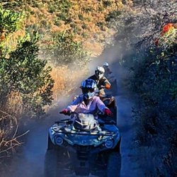
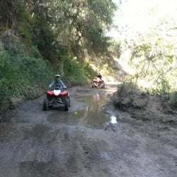
Off Road Trails in Santa Barbara, CA
Bird Sanctuary in Santa Barbara, CA
Scenic Drive in Santa Barbara, CA
Lakes & Ponds in Santa Barbara, CA
Cliff Jumping in Santa Barbara, CA
Kid Friendly Beaches in Santa Barbara, CA
Playgrounds in Santa Barbara, CA
Carousels in Santa Barbara, CA
Free Campgrounds in Santa Barbara, CA
Water Parks in Santa Barbara, CA
Public Beaches in Santa Barbara, CA
Running Trails in Santa Barbara, CA
Scenic View in Santa Barbara, CA
Free Parking in Santa Barbara, CA
Walking Trails in Santa Barbara, CA
Volleyball Courts in Santa Barbara, CA
Things to Do With Kids in Santa Barbara, CA
Trending Searches in Santa Barbara, CA
Baseball Fields near Andrée Clark Bird Refuge
Boat Rental near Andrée Clark Bird Refuge
Botanical Gardens near Andrée Clark Bird Refuge
Bounce House Rentals near Andrée Clark Bird Refuge
Campgrounds near Andrée Clark Bird Refuge
Cheap Plants near Andrée Clark Bird Refuge
Cherry Picking near Andrée Clark Bird Refuge
Cliff Jumping near Andrée Clark Bird Refuge
Flower Fields near Andrée Clark Bird Refuge
Flower Shop near Andrée Clark Bird Refuge
Garage Sales near Andrée Clark Bird Refuge
Garden Center near Andrée Clark Bird Refuge
Lakes near Andrée Clark Bird Refuge
Lakes & Ponds near Andrée Clark Bird Refuge
Nurseries & Gardening near Andrée Clark Bird Refuge
Off Leash Dog Parks near Andrée Clark Bird Refuge
Outdoor Activities near Andrée Clark Bird Refuge
Outdoor Basketball Courts near Andrée Clark Bird Refuge
Outdoor Furniture Stores near Andrée Clark Bird Refuge
Parks near Andrée Clark Bird Refuge
Parks For Parties near Andrée Clark Bird Refuge
Party Equipment Rentals near Andrée Clark Bird Refuge
Pedicure near Andrée Clark Bird Refuge
Photo Spots near Andrée Clark Bird Refuge
Picnic Areas near Andrée Clark Bird Refuge
Places To Take Pictures near Andrée Clark Bird Refuge
Playgrounds near Andrée Clark Bird Refuge
Public Running Track near Andrée Clark Bird Refuge
Public Shower near Andrée Clark Bird Refuge
Rock Quarry near Andrée Clark Bird Refuge
Running Trails near Andrée Clark Bird Refuge
Rv Rental near Andrée Clark Bird Refuge
Scenic Drive near Andrée Clark Bird Refuge
Sunrise View near Andrée Clark Bird Refuge
Swimming Holes near Andrée Clark Bird Refuge
Table And Chair Rentals near Andrée Clark Bird Refuge
Tennis Courts near Andrée Clark Bird Refuge
Browse Nearby
BEST of Santa Barbara, California Restaurants near Andrée Clark Bird Refuge
BEST of Santa Barbara, California Coffee near Andrée Clark Bird Refuge
BEST of Santa Barbara, California Playgrounds near Andrée Clark Bird Refuge
BEST of Santa Barbara, California Things to Do near Andrée Clark Bird Refuge
BEST of Santa Barbara, California Picnic Areas near Andrée Clark Bird Refuge
BEST of Santa Barbara, California Breakfast near Andrée Clark Bird Refuge
BEST of Santa Barbara, California Campgrounds near Andrée Clark Bird Refuge
BEST of Santa Barbara, California Sightseeing near Andrée Clark Bird Refuge
BEST of Santa Barbara, California Natural Hot Springs near Andrée Clark Bird Refuge
Browse Brands
Related Searches in Santa Barbara, CA
Affordable Kayak Rental Services in Santa Barbara, California
Best Fishing Locations and Guides in Santa Barbara, California
Best Off Leash Dog Parks in Santa Barbara, California
Best Parks for Parties and Events in Santa Barbara, California
Best Places for Horseback Riding in Santa Barbara, California
Best Water Parks for Kids in Santa Barbara, California
Best Waterfalls and Swimming Holes in Santa Barbara, California
Check Out Great Playgrounds in Santa Barbara, California
Check Out Off Road Trails in Santa Barbara, California
Discover Baseball Fields Around Santa Barbara, California
Discover Beautiful Garden Spots in Santa Barbara, California
Discover Dog Friendly Trails to Explore in Santa Barbara, California
Discover Free Parking Options in Santa Barbara, California
Discover Kid Friendly Hiking Trails in Santa Barbara, California
Discover Lakes & Ponds to Explore in Santa Barbara, California
Discover Popular Photo Spots in Santa Barbara, California
Discover Public Beaches to Visit in Santa Barbara, California
Discover Scenic Bike Paths in Santa Barbara, California
Discover Scenic Waterfall Spots in Santa Barbara, California
Discover Soccer Fields in Santa Barbara, California Near You
Discover Top State Parks to Visit in Santa Barbara, California
Discover a Hiking Trail in Santa Barbara, California
Discover the Best Beaches in Santa Barbara, California
Discover the Best Kids Park Spots in Santa Barbara, California
Discover the Best Night Hike Trails in Santa Barbara, California
Dog-Friendly Hikes With Dogs in Santa Barbara, California
Enjoy Camping Adventures Around Santa Barbara, California
Enjoy Exciting Mountain Biking Adventures in Santa Barbara, California
Enjoy Kayaking Adventures in Santa Barbara, California
Enjoy Tent Camping Spots Around Santa Barbara, California
Enjoy a Beautiful Waterfall Hike in Santa Barbara, California
Enjoy a Peaceful Nature Walk in Santa Barbara, California
Enjoy the Best Picnic Spots and Ideas in Santa Barbara, California
Enjoy the Best Walking Path in Santa Barbara, California
Enjoy the Best Walking Trails in Santa Barbara, California
Exciting Cliff Jumping Spots in Santa Barbara, California
Explore Beautiful Botanical Gardens in Santa Barbara, California
Explore Beautiful Parks and Green Spaces in Santa Barbara, California
Explore Easy Hikes Perfect for All in Santa Barbara, California
Explore Family-Friendly Zoos and Wildlife in Santa Barbara, California
Explore Free Picnic Areas Around Santa Barbara, California
Explore Fun Activities to Do in Santa Barbara, California
Explore Parks With Pull Up Bars in Santa Barbara, California
Explore Popular Campgrounds Near Santa Barbara, California
Explore Popular Picnic Areas Around Santa Barbara, California
Explore Popular RV Parks Around Santa Barbara, California
Explore Popular Recreation Centers Around Santa Barbara, California
Explore Scenic Lakes to Visit in Santa Barbara, California