Anasazi State Park Museum
Anasazi State Park Museum Photos


More like Anasazi State Park Museum
Recommended Reviews - Anasazi State Park Museum
Start your review...

Reviews With Photos


This is a good place to get your basic education on the tribes of Native Americans who settled the four states of Utah, Colorado, New Mexico and Arizona about 1000 years ago. http://www.yelp.com/biz_photos/anasazi-state-park-museum-boulder?select=GbBfgoOqcCLtK_MxnI0fDA#GbBfgoOqcCLtK_MxnI0fDA At this museum they have a series of short videos which explain the native people's migration and expansion in terms of how the people saw it within the context of their religious beliefs. The Hopi (Anasazi group) believed that their people came out of the ground from a hole in the Grand Canyon. Their religious belief is that they were directed to wander and move to expand their territories, leaving behind the many buildings which are still found today in the four states. At this museum, there is an excavated example of one of these villages. At the end of their life, they returned to the underworld from which they came to join the others from their society. Today, the petroglyphs and buildings provide the testimony to their drive to establish their society and way of life. It was very helpful to have this as a backdrop as we started our personal journey to many of the now-protected and preserved communities which were built by the Anasazi (ancient Pueblo tribes).

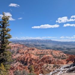
Anasazi State Park Museum is a small, but pretty cool, museum off scenic Highway 12 near Boulder, UT. They have loads of baskets, tools, pottery, and other amazing Native American artifacts and lots of information on the history of the people and the surrounding area. Right out back of the museum are a few archaeological sites. Boulder is pretty out of the way, so I can't imagine making the trip all the way out there just to see this museum. However, Highway 12 between Cannonville, UT (near Bryce Canyon National Park) and Torrey, UT (near Capitol Reef National Park) has got to be one of the most gorgeous drives in the country...so if you're going that way anyway then it's definitely worth it to stop at this neat, little museum.

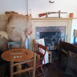
We saw a sign on the road, and I have always been interested in the Anasazi Indians, so we stopped. I was hoping to see ruins, but I didn't see any signs to let us know there were any, so we only saw the indoor museum part. There were some nice displays of arrowheads, pottery, statues, mini replicas of dwellings, etc. The gift shop seemed well stocked, and I bought use ancient Utah sea salt (no iodine). It was free entry, and I made a donation. Clean bathroom. No movies. What I got most of out of this visit, that Anasazi is not politically correct anymore. The Navajo who were helping excavate used this term but it means "enemy," so the correct term is "Ancestral Puebloans" or "Pueblo people" (such as the Hopi, Zuni, etc). Outside was a food truck. Nearby was a gas station. read more


4 years ago
My wife was very interested in coming to this museum based on her vacation research. It was quite the hike to get here from our rental, but it was a nice museum. The museum explains the Anasazi Indians and their life here at one time. All artifacts were excavated in the area or donated. They also have a conservation area. Unfortunately, a lot of the interactive exhibits were non-operative. There is an outside attraction of an actual excavation. They also have a gift shop, a lot of very nice paintings for sale, and a 20 minute video you can sit and watch. They also had legit Navajo woven blankets if you had almost $2000 to spend. $10 family rate to come in. Original Artwork ranged from $85 to $1500. We spent about an hour and a half checking things out. Staff was friendly and was able to answer our questions. read more


12 years ago
This is a good place to get your basic education on the tribes of Native Americans who settled the four states of Utah, Colorado, New Mexico and Arizona about 1000 years ago. http://www.yelp.com/biz_photos/anasazi-state-park-museum-boulder?select=GbBfgoOqcCLtK_MxnI0fDA#GbBfgoOqcCLtK_MxnI0fDA At this museum they have a series of short videos which explain the native people's migration and expansion in terms of how the people saw it within the context of their religious beliefs. The Hopi (Anasazi group) believed that their people came out of the ground from a hole in the Grand Canyon. Their religious belief is that they were directed to wander and move to expand their territories, leaving behind the many buildings which are still found today in the four states. At this museum, there is an excavated example of one of these villages. At the end of their life, they returned to the underworld from which they came to join the others from their society. Today, the petroglyphs and buildings provide the testimony to their drive to establish their society and way of life. It was very helpful to have this as a backdrop as we started our personal journey to many of the now-protected and preserved communities which were built by the Anasazi (ancient Pueblo tribes). read more

5 years ago
8 years ago
14 years ago
Anasazi State Park Museum is a small, but pretty cool, museum off scenic Highway 12 near Boulder, UT. They have loads of baskets, tools, pottery, and other amazing Native American artifacts and lots of information on the history of the people and the surrounding area. Right out back of the museum are a few archaeological sites. Boulder is pretty out of the way, so I can't imagine making the trip all the way out there just to see this museum. However, Highway 12 between Cannonville, UT (near Bryce Canyon National Park) and Torrey, UT (near Capitol Reef National Park) has got to be one of the most gorgeous drives in the country...so if you're going that way anyway then it's definitely worth it to stop at this neat, little museum. read more


10 years ago
This is the actual site of an ancient Indian village and has been extensively excavated and studied. Outside exhibits include exposed outlines of the rooms used. Over 160,000 artifacts have been found to date. A BLM office is also inside to find local free camp spots. read more

10 years ago
8 years ago
13 years ago
More info about Anasazi State Park Museum
12 Utah
Boulder, UT 84716
Directions
(435) 335-7308
Call Now
Visit Website
http://stateparks.utah.go
Hours
Other Amenities
From the Business
Ask the Community - Anasazi State Park Museum
Review Highlights - Anasazi State Park Museum


Anasazi State Park Museum - landmarks - Updated May 2026
Best of Boulder
People found Anasazi State Park Museum by searching for…
Arts & Entertainment in Boulder, UT
Places to Take Pictures in Boulder, UT
Hiking Trails With Waterfalls in Boulder, UT
Religious Organizations in Boulder, UT
Nice View Restaurant in Boulder, UT
Dinosaur Museum in Boulder, UT
Playgrounds for Kids in Boulder, UT
Things to Do on a Rainy Day in Boulder, UT
Beautiful Views in Boulder, UT
Browse Articles
Browse Nearby
BEST of Boulder, Utah Coffee near Anasazi State Park Museum
BEST of Boulder, Utah Things to Do near Anasazi State Park Museum
BEST of Boulder, Utah Restaurants near Anasazi State Park Museum
BEST of Boulder, Utah Hiking near Anasazi State Park Museum
BEST of Boulder, Utah Shopping near Anasazi State Park Museum
BEST of Boulder, Utah Star Gazing near Anasazi State Park Museum
BEST of Boulder, Utah Breakfast near Anasazi State Park Museum
BEST of Boulder, Utah Lodging near Anasazi State Park Museum
Browse Brands
Related Searches in Boulder, UT
Best Lookout Points to Visit in Boulder, Utah
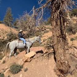
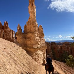
Best Places for Horseback Riding in Boulder, Utah
Best Places for Stunning Views in Boulder, Utah
Best Spots for Star Gazing in Boulder, Utah
Best Things to Do on a Rainy Day in Boulder, Utah
Browse Top Hotels in Boulder, Utah for Your Stay
Discover Charming Historic Homes in Boulder, Utah
Discover Historic Sites and Places in Boulder, Utah
Discover Popular Landmarks in Boulder, Utah
Discover Popular Photo Spots in Boulder, Utah
Discover Romantic Views in Boulder, Utah
Discover Top Nature Parks to Visit in Boulder, Utah
Discover the Best Caves to Explore in Boulder, Utah
Discover the Best Night Hike Trails in Boulder, Utah
Enjoy Arts & Entertainment in Boulder, Utah
Enjoy Hiking Adventures in Boulder, Utah
Enjoy a Relaxing Bed & Breakfast Experience in Boulder, Utah
Enjoy the Best Night View Spots in Boulder, Utah
Enjoy the Best Walking Trails in Boulder, Utah
Experience Stunning Sunset Views in Boulder, Utah
Explore Beautiful Castles and Landmarks in Boulder, Utah
Explore Easy Hikes Perfect for All in Boulder, Utah
Explore Free Things to Do Around Boulder, Utah
Explore Landmarks & Historical Buildings in Boulder, Utah
Explore Nature Spots Around Boulder, Utah
Explore Popular Day Trips From Boulder, Utah
Explore Popular Scenic Overlook Points in Boulder, Utah
Explore Popular View Points Around Boulder, Utah
Explore Scenic Lakes to Visit in Boulder, Utah
Explore Scenic National Park Locations in Boulder, Utah
Explore Sunday Fun Things to Do in Boulder, Utah
Explore Top Art Galleries Located in Boulder, Utah
Explore Top Bus Tours Around Boulder, Utah
Explore Top History Museums in Boulder, Utah
Explore Top Walking Tours in Boulder, Utah
Explore the Best Trail Options in Boulder, Utah
Explore the Rich History in Boulder, Utah
Find Beautiful Views in Boulder, Utah
Find Exciting Tours to Take in Boulder, Utah
Find Top Art Museums in Boulder, Utah
Find Top Libraries to Visit in Boulder, Utah
Find Top Restaurants in Boulder, Utah for Every Taste
Find Top-Rated Waterfalls in Boulder, Utah Now
Find a Public Library Near You in Boulder, Utah
Find the Best Scenic View Locations in Boulder, Utah
Find the Best Shopping in Boulder, Utah Today
Get Your City Pass for Attractions in Boulder, Utah
Must-See Tourist Attractions Around Boulder, Utah