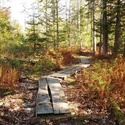
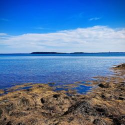
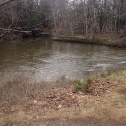
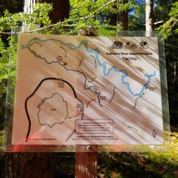
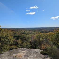
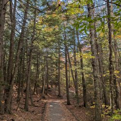
Alice's Awesome Adventures Rafting/Kayaking Photos


You might also consider
More like Alice's Awesome Adventures
Recommended Reviews - Alice's Awesome Adventures
Start your review...

5 years ago
Alice was such a wonderful guide. Great kayaking experience. Alice gave excellent instructions for first timer on a kayak, very knowledgeable with the area and why surrounding wildlife. She has a good barometer to how much you can go on your journey and won't exhaust you. We docked at a small island and she got some live farm oysters to shuck. Went into details on how to shuck it. Simple to follow and now I feel like can go back and start shucking some . Nothing more rewarding than live fresh oysters shuck with your own hard work and that yummy blueberry mignonette (Alice's personal recipe). read more


More info about Alice's Awesome Adventures
Brunswick, ME 04011
Directions
(207) 729-6333
Call Now
Visit Website
http://www.amaineguide.com/
Hours
Outdoor Amenities
From the Business
Ask the Community - Alice's Awesome Adventures


Why does Yelp recommend reviews?
2 reviews that are not currently recommended
The reviews below are not factored into the business's overall star rating.
10 years ago
9 years ago
Alice's Awesome Adventures - rafting - Updated May 2026
Best of Brunswick
People found Alice's Awesome Adventures by searching for…
Paddleboarding in Brunswick, Maine
Playgrounds in Brunswick, Maine
Kayak Rental in Brunswick, Maine
Hiking Trails With Waterfalls in Brunswick, Maine
Sunset View in Brunswick, Maine
Outdoor Gear in Brunswick, Maine
Things to Do on a Rainy Day in Brunswick, Maine
Sunrise View in Brunswick, Maine
Secret Spots in Brunswick, Maine
Things to Do With Teenagers in Brunswick, Maine
Lighthouses in Brunswick, Maine
Scenic Overlook in Brunswick, Maine
Walking Trails in Brunswick, Maine
Canoe Rental in Brunswick, Maine
Lookout Points in Brunswick, Maine
Lakes & Ponds in Brunswick, Maine
Waterfalls in Brunswick, Maine
View Points in Brunswick, Maine
Scenic View in Brunswick, Maine
Easy Hikes in Brunswick, Maine
Trending Searches in Brunswick, ME
Botanical Gardens near Alice's Awesome Adventures
Bounce House Rentals near Alice's Awesome Adventures
Campgrounds near Alice's Awesome Adventures
Cheap Plants near Alice's Awesome Adventures
Cherry Picking near Alice's Awesome Adventures
Cliff Jumping near Alice's Awesome Adventures
Dog Friendly Things To Do near Alice's Awesome Adventures
Flower Fields near Alice's Awesome Adventures
Flower Shop near Alice's Awesome Adventures
Garage Sales near Alice's Awesome Adventures
Garden Center near Alice's Awesome Adventures
Lakes & Ponds near Alice's Awesome Adventures
Nurseries & Gardening near Alice's Awesome Adventures
Outdoor Activities near Alice's Awesome Adventures
Outdoor Furniture Stores near Alice's Awesome Adventures
Parks near Alice's Awesome Adventures
Party Equipment Rentals near Alice's Awesome Adventures
Pedicure near Alice's Awesome Adventures
Photo Spots near Alice's Awesome Adventures
Picnic Areas near Alice's Awesome Adventures
Places To Take Pictures near Alice's Awesome Adventures
Rock Quarry near Alice's Awesome Adventures
Running Trails near Alice's Awesome Adventures
Rv Rental near Alice's Awesome Adventures
Spray Tanning near Alice's Awesome Adventures
Sunrise View near Alice's Awesome Adventures
Swimming Holes near Alice's Awesome Adventures
Table And Chair Rentals near Alice's Awesome Adventures
Browse Articles
Browse Nearby
BEST of Brunswick, Maine Restaurants near Alice's Awesome Adventures
BEST of Brunswick, Maine Coffee near Alice's Awesome Adventures
BEST of Brunswick, Maine Things to Do near Alice's Awesome Adventures
BEST of Brunswick, Maine Breakfast near Alice's Awesome Adventures
BEST of Brunswick, Maine Shopping near Alice's Awesome Adventures
Browse Brands
Related Searches in Brunswick, ME
Affordable Kayak Rental Services in Brunswick, Maine
Best Fishing Locations and Guides in Brunswick, Maine
Best Places for Horseback Riding in Brunswick, Maine
Check Out Off Road Trails in Brunswick, Maine
Discover Dog Friendly Trails to Explore in Brunswick, Maine
Discover Public Beaches to Visit in Brunswick, Maine
Discover Scenic Waterfall Spots in Brunswick, Maine
Discover Top Boat Tours in Brunswick, Maine for All Ages
Discover a Hiking Trail in Brunswick, Maine
Discover the Best Night Hike Trails in Brunswick, Maine
Dog-Friendly Hikes With Dogs in Brunswick, Maine
Enjoy Camping Adventures Around Brunswick, Maine
Enjoy Exciting Mountain Biking Adventures in Brunswick, Maine
Enjoy Kayaking Adventures in Brunswick, Maine
Enjoy Tent Camping Spots Around Brunswick, Maine
Enjoy a Beautiful Waterfall Hike in Brunswick, Maine
Enjoy the Best Walking Trails in Brunswick, Maine
Exciting Cliff Jumping Spots in Brunswick, Maine
Experience Thrilling White Water Rafting in Brunswick, Maine
Explore Beautiful Parks and Green Spaces in Brunswick, Maine
Explore Bike Rentals Throughout Brunswick, Maine
Explore Easy Hikes Perfect for All in Brunswick, Maine
Explore Fun Activities to Do in Brunswick, Maine
Explore Popular Campgrounds Near Brunswick, Maine
Explore Top Dog Parks in Brunswick, Maine Near You
Explore the Best Beach Spots in Brunswick, Maine
Explore the Best Boating Spots in Brunswick, Maine
Explore the Best Swimming Holes Around Brunswick, Maine
Explore the Best Trail Options in Brunswick, Maine
Family Friendly Hiking With Kids in Brunswick, Maine
Find Beautiful Views in Brunswick, Maine
Find Popular Ziplining Spots Around Brunswick, Maine
Find the Best Scenic View Locations in Brunswick, Maine
Hiking Trails With Waterfalls in Brunswick, Maine
Plan a Scenic Drive Route Near Brunswick, Maine
Popular Fishing Spots to Explore in Brunswick, Maine
Popular Outdoor Activities to Try in Brunswick, Maine
Popular Picnic Spots to Visit in Brunswick, Maine
Popular Things to Do in Brunswick, Maine
Popular Things to See in Brunswick, Maine
Safe River Swimming Areas in Brunswick, Maine
Safe and Fun Parks for Kids in Brunswick, Maine
Top Climbing Spots and Gyms in Brunswick, Maine
Top Paddleboarding Activities in Brunswick, Maine
Top Places for Snorkeling in Brunswick, Maine
Top Running Trails to Explore in Brunswick, Maine
Top Swimming Lakes to Enjoy in Brunswick, Maine
Top Swimming Spots and Pools in Brunswick, Maine
People who viewed Alice's Awesome Adventures also viewed
Sail Muscongus!
10 reviews
Lazy Jack Cruises
16 reviews
Tidal Transit Kayak
32 reviews
Sebago Lake Boat Rentals
1 review
Seaspray Kayaking Rentals & Tours
20 reviews
Johnson Field Preserve and Mackerel Cove
3 reviews
Swan Island Maine IF&W
1 review
Town Mall
5 reviews
Out in the Open Adventures
2 reviews
Pott's Point Preserve
4 reviews