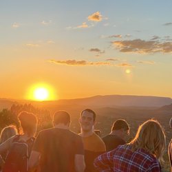
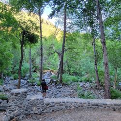
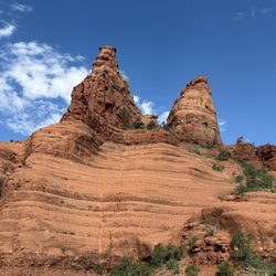
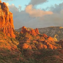
West Fork Trail Photos


You might also consider
More like West Fork Trail
Recommended Reviews - West Fork Trail
Start your review...

Reviews With Photos

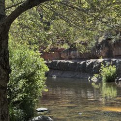
The West Fork hike in Sedona is absolutely beautiful! We must have come at a drier time (mid-September), because we didn't need to wade ankle- or knee-deep in water to get through the trail. Though there are some water crossings if you want to take them. For us, water shoes weren't really necessary at that time of year. The weather and water level felt perfect. The trail is mostly shady, with no real incline, and we saw people of all ages enjoying it. My friend and I even ended up trail running back and found it quite easy. Overall, a gorgeous and accessible hike that I'd definitely recommend!

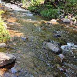
The views were amazing. We hiked roundtrip 6.9 miles and some water crossing spots were trickier than other reviewers claimed. There were 13 small creek bed water crossings so wearing water proof shoes/boots. Most families turned around about 1.5 miles in. I personally wouldn't take a child under 7. If I were to come back I would wear rubber boots and actually walk down the creek bed. You get the same views less effort - my opinion.

One of the more crowded trails we experienced in our Arizona hiking exploration- but we enjoyed the incredibly scenic and diverse experience Arriving the park, it was a bit frustrating to discover this particular trail was outside all the trail park system passes we purchased- requiring it's own $12 parking entry fee- on top of that, the woman told us there were currently not spots available but we could pay & wait- unsure how long the wait was, we decided to park about half a mile up along the roadside on a pull off & walked down to the entrance, paying $3 per person for entry walk-ups instead- At the beginning of the trail, we encountered the remnants of old stone foundations, and abandoned homesteads, with intriguing historical story signage providing insight- The trail then weaves through rocky outcroppings, dense forest, and open meadows moving back and forth along the creek- Arriving in the winter season, we luckily didn't have to experience much snow, there was a decent amount of ice build up within the river, but luckily was still easy to cross- though with the higher level of crowds, & most crossing areas only having 1-2 passable paths this created a bit of a bottleneck (I agree with fellow reviewers on the lack of trail etiquette, as an avid hiker there was a bit of frustration navigating this trail with the average tourist non-hikers out on a walk) The end of the trail was a beautiful expansive viewpoint of the river-a stunning panoramic surrounding scenery- Overall, I loved the shaded creek ambiance after so many AZ trails in the hot open dessert- it felt very immersive nature exploration, and while crowded offered its own element of solitude

We took our Littles 2 and 4. They loved the creek crossings! We went 3 miles in and 3 back. Minimal elevation. A little rocky and can be hard to get around if you want a more flat terrain. Very rocky at some areas. Not hard to cross creeks since the water was not high. Used the rocks or logs. Hiking sticks are helpful!


This place is very crowded and the path is super sandy for a while, but it's worth it for the views at the end. It's just getting there that can be annoying. The first half was bad, second half was much better. What I liked: I hiked in the water toward the end and it was very quiet. The slot canyon past the "end" was beautiful. Almost the entire hike was shaded. Most people seemed to turn back before the better views. What I didn't like: It was very crowded. Trail etiquette was basically non-existent. The sand was so deep in spots, that it was difficult to maintain a steady pace. Every water crossing was a bottleneck, even though you can stay dry on most crossings, people couldn't seem to figure that out. Parking gets full very quick, you need to get there at sunrise for a close spot. Let me share a longer story. I arrived at 9 AM on a Thursday and the main lot was already full and closed. I went up the road for another short hike at Harding Springs. I got back to my car and there were vehicles lined up everywhere. Knowing there was no shot to get closer parking, I walked about just under a mile to the trailhead. Luckily, there was a makeshift path on the west side of the road, on the safe side of the guardrail. Don't even attempt to walk on the east side, as it's mostly cliffs and you'll be walking in the road. Once I arrived, it was only $2 to walk in, so that was nicer than having to pay for parking. The trail started paved and shaded, then it turned to a wide (maybe 8 feet) sandy path in the sun. It was very crowded at 11 AM on a Thursday. The path gradually got narrower and more sandy, but at least the shade returned before too long. The first thing that I noticed was that there was virtually no trail etiquette. It seems like a lot of newbie hikers, tourists and families come here. That's fine, but you had people blocking the path taking selfies, while kids literally sat in the sand like it was a sandbox, blocking your way. It felt very weird and frustrating. When you wanted to pass, many groups wouldn't move aside to let you. About a mile before "the end" I got in the water to hike up the rest of the way. This is when things got much better. Not a single person was walking up the creek. It was peaceful and quiet. The water was generally no higher than knee deep. When I got to the end, there were several people hanging around a pool of water. I continued up and once again, I was the only person there. Within a few hundred yards, I was treated to a beautiful slot canyon. The water was almost waist deep in a few spots here, but you could keep it shallower if you were careful. I kept hiking for maybe a mile or so up. The views were stunning. I probably could have gone further up, but I didn't have a ton of time and I think I already saw the best views. On the way back, I started to see a few people walking in the water. I also noticed several people lose the trail. Apparently the trail gets harder to follow around the last mile, but since I was in the water most of the time, I didn't notice that. I walked back at a fast clip, power walking really, to get by the crowds of people. Once I hit the deeper sand, it was difficult to go fast. Every water crossing was frustrating, as people were either overly cautious or downright confused. I wore hiking shoes and barely got them wet at all. Yes, I wore water shoes while hiking UP the creek at the end, but crossing it is easy if you stay on the rocks or walk over one of the many logs. By the end, I had clocked in just over 9.4 miles. Keep in mind that I added nearly 2 miles for where I parked and I went beyond the end of the trail to explore the slot canyon. If I hadn't made it to the end, I might have rated this trail 3 or even 2 stars. There's not much to see for the first half and it's so crowded that you can't really enjoy it. I like kids, but there were too many of them here. Kids playing in the sand, blocking the path taking selfies and families who had trouble making it over the shallow water crossings. The end felt like a mini Narrows-like adventure. I didn't see a single person past the end of the trail, so I had the slot canyon all to myself. This was definitely a roller coaster experience, between no parking and inconsiderate crowds, then having spectacular views at the end. If I came here again, I'd probably arrive at sunrise. Even if you get there ahead of the crowds, you'll have to hike up a sandy mess for a few miles, before getting to the best views.

Beautiful hike. Mostly flat so it wasn't hard on my legs nor my lungs that much. Although I love hiking, elevation gain still kicks my behind so this wasn't too bad of a hike. We did not finish though. The creek was very beautiful as well. The distance was pretty long and we didn't allot that much time for the hike so we had to turn around. Someday we may finish this hike :)

One of the nicest trails in Sedona. Perhaps one of the most scenic in the nation. Your jaw drops upon entering and you pick it back up when you leave. Breathtaking. This is also a great trail to take on a hot day as there is almost constant tree cover as well as the possibility of swimming at the end in one of the several pools. Some caveats: 1. Either wear waterproof hiking shoes or bring a set of water shoes. You will cross the Brook repeatedly. 2. Bring a camera. You'll be upset if you miss the scenery 3. Bring plenty of drinking water. 4. Come early and miss the crowds There's plenty of parking at the state park. Once ready, there are many signs for the trail. It initially goes through an old apple orchard before getting into the canyon area. Then it meanders more or less upstream around the river. There are some climbs through rocks as the trail continues, each step seeing the canyon becoming narrower and the cliffs becoming taller. The halfway point is a huge - HUGE - rock. The end is where a sign stating that the trail is not maintained, meaning you'll have to bushwhack your way. The rock formations form several pools in beautiful surroundings. Then you go back. Unforgettable hike.

This review is for the West Fork Of Oak Creek Trail #108 (~5.6 miles, ~3.5 hours to complete). Limited parking availability and $12 entry fee. Plenty of beautiful greenery and canyon wall views throughout the hike. Most of the river crossings can be done without getting wet. Soft sand for the majority of the trail making it difficult and longer to complete. Unfortunately, couldn't find any accessible trail near the end without getting completely wet in the river. Short video of the hike for those interested: https://youtu.be/qQAIO2agZkY

I have introduced so many people to this hike. It's probably the most popular Fall hike to do in Arizona and my personal favorite hike. If you come here in October, you'll see the leaves turn yellow and red. It is just a short drive north of Sedona on State Route 89A. The drive on 89A is gorgeous with huge trees that shade your drive with little mom and pop stores along the way. The nice thing about this hike is you can make it a long hike or a short slow scenic one. You will see lots of people (all ages) and pets on this hike. At the start of the trailhead is a bridge that goes over Oak Creek. It's a popular spot for pictures. There is also a bathroom at the start of the trailhead. The trail itself is easy to moderate and about 7 miles round trip. West Fork Trail has an entrance fee of $11 cash to park (as of 2021). They will close the parking area if it gets full and will only allow a car in when another car leaves. You can drive up further and park on the side of the road and walk in. They do charge a couple bucks to walk in. I would say that the best time to get here for a parking spot is early morning or late afternoon. Keep in mind that weekends are very crowded at West Fork Trail. But making the trek up here is all worth the hassle for this beautiful hike. There are some spots on the trail that you have to cross over the creek by walking on strategically placed rocks. The water is usually about ankle deep unless there was a huge rainstorm the night before. I personally think it adds to the fun of the hike when you slip and step in the water. The canyon walls will begin to close in as you continue on the hike and will provide shade. This is the part where you might want to bring a light jacket. People like to pick up and collect the colorful leaves during Fall season. You will also notice that people will actually smile and say hi to you as they pass. There is just something about being in nature that brings out the good in people. Overall this is amazing hike and makes for a fun day trip if you are coming from the Valley. I highly suggest bringing a nice camera. The cool part is you can stop in beautiful Sedona afterwards and grab lunch or an early dinner before you head home.

A scenic thirty minute drive North of Sedona towards Flagstaff. The trail is little over 6 miles in and out. It would be a great trail during the summer in the shade of the many deciduous trees. You feel like you are in a canyon with the mountains rising above you. You pass the creek 13 times. Don't worry it is only ankle deep, but they do seem like obstacle courses along the way as you judge the best way to cross. I brought a change of clothes just in case but did not need it. In March it was a trail of two seasons. At 70 degrees it was spring-like until you reached the last mile, it turned into a wintry forest. A nice contrast with snow laden crests and paths. I did not do the last quarter mile when it became a solid sheet of ice. Relatively flat throughout. On a Tuesday morning at 9AM there were about five parking spaces left and a few more three hours later. The parking fee is $11 plus fee for additional people in your car. There are pull out sections outside the park but it is a switchback area so I don't recommend it unless you get the three outside the gate. Walk-ins pay $2 per person. Pleasant woman at the kiosk as you check in.


4 months ago
My favorite Arizona hike because it makes you cross the creek 13 times, meaning you are hopping on rocks across the creek, 13 times. Plus it's beautiful. You start low in the gorgeous canyon and get higher, the creek gets wider. Very beautiful where ever you look at any point. Wear hiking boots, or water resistant hiking sneakers in case you miss a rock. $15 parking free at the park, national parks pass does not work here, it's a local park. Enjoy! Soak it all in. read more


This is one of the more popular trails in the area for good reason! It is an absolutely stunning hike along Oak Creek surrounded by the towering red walls and many trees. I hiked 7.5 miles and counted 13 creek crossings today so be prepared to walk through the water! Otherwise it's pretty easy as there is minimal elevation gain. The parking lot fills up early on the weekends, especially in fall when the leaves change color. Also, the cost to park has gone up since I was here last and is now $15/car. read more


This is a must do visit in the Fall for fabulous color with red, orange and yellow maples, yellow ash, burgundy oaks and of course red rocks. The trail has little elevation gain and is relatively easy. There are some river crossings and hiking poles are helpful. We went just before Halloween and the colors were nearly at peak. It is hard to find a parking spot so go just after lunch on a weekday as most people go in the morning. read more


9 months ago
The West Fork hike in Sedona is absolutely beautiful! We must have come at a drier time (mid-September), because we didn't need to wade ankle- or knee-deep in water to get through the trail. Though there are some water crossings if you want to take them. For us, water shoes weren't really necessary at that time of year. The weather and water level felt perfect. The trail is mostly shady, with no real incline, and we saw people of all ages enjoying it. My friend and I even ended up trail running back and found it quite easy. Overall, a gorgeous and accessible hike that I'd definitely recommend! read more


2 months ago
The views were amazing. We hiked roundtrip 6.9 miles and some water crossing spots were trickier than other reviewers claimed. There were 13 small creek bed water crossings so wearing water proof shoes/boots. Most families turned around about 1.5 miles in. I personally wouldn't take a child under 7. If I were to come back I would wear rubber boots and actually walk down the creek bed. You get the same views less effort - my opinion. read more

1 year ago
One of the more crowded trails we experienced in our Arizona hiking exploration- but we enjoyed the incredibly scenic and diverse experience Arriving the park, it was a bit frustrating to discover this particular trail was outside all the trail park system passes we purchased- requiring it's own $12 parking entry fee- on top of that, the woman told us there were currently not spots available but we could pay & wait- unsure how long the wait was, we decided to park about half a mile up along the roadside on a pull off & walked down to the entrance, paying $3 per person for entry walk-ups instead- At the beginning of the trail, we encountered the remnants of old stone foundations, and abandoned homesteads, with intriguing historical story signage providing insight- The trail then weaves through rocky outcroppings, dense forest, and open meadows moving back and forth along the creek- Arriving in the winter season, we luckily didn't have to experience much snow, there was a decent amount of ice build up within the river, but luckily was still easy to cross- though with the higher level of crowds, & most crossing areas only having 1-2 passable paths this created a bit of a bottleneck (I agree with fellow reviewers on the lack of trail etiquette, as an avid hiker there was a bit of frustration navigating this trail with the average tourist non-hikers out on a walk) The end of the trail was a beautiful expansive viewpoint of the river-a stunning panoramic surrounding scenery- Overall, I loved the shaded creek ambiance after so many AZ trails in the hot open dessert- it felt very immersive nature exploration, and while crowded offered its own element of solitude read more


3 months ago
We took our Littles 2 and 4. They loved the creek crossings! We went 3 miles in and 3 back. Minimal elevation. A little rocky and can be hard to get around if you want a more flat terrain. Very rocky at some areas. Not hard to cross creeks since the water was not high. Used the rocks or logs. Hiking sticks are helpful! read more


Nice change of scenery, away from all the red rock views in sedona. This hike is like the narrows, not nearly as good, but also not as crowded. The parking was full when we went and we had to wait for someone to leave to go in. read more


This place is very crowded and the path is super sandy for a while, but it's worth it for the views at the end. It's just getting there that can be annoying. The first half was bad, second half was much better. What I liked: I hiked in the water toward the end and it was very quiet. The slot canyon past the "end" was beautiful. Almost the entire hike was shaded. Most people seemed to turn back before the better views. What I didn't like: It was very crowded. Trail etiquette was basically non-existent. The sand was so deep in spots, that it was difficult to maintain a steady pace. Every water crossing was a bottleneck, even though you can stay dry on most crossings, people couldn't seem to figure that out. Parking gets full very quick, you need to get there at sunrise for a close spot. Let me share a longer story. I arrived at 9 AM on a Thursday and the main lot was already full and closed. I went up the road for another short hike at Harding Springs. I got back to my car and there were vehicles lined up everywhere. Knowing there was no shot to get closer parking, I walked about just under a mile to the trailhead. Luckily, there was a makeshift path on the west side of the road, on the safe side of the guardrail. Don't even attempt to walk on the east side, as it's mostly cliffs and you'll be walking in the road. Once I arrived, it was only $2 to walk in, so that was nicer than having to pay for parking. The trail started paved and shaded, then it turned to a wide (maybe 8 feet) sandy path in the sun. It was very crowded at 11 AM on a Thursday. The path gradually got narrower and more sandy, but at least the shade returned before too long. The first thing that I noticed was that there was virtually no trail etiquette. It seems like a lot of newbie hikers, tourists and families come here. That's fine, but you had people blocking the path taking selfies, while kids literally sat in the sand like it was a sandbox, blocking your way. It felt very weird and frustrating. When you wanted to pass, many groups wouldn't move aside to let you. About a mile before "the end" I got in the water to hike up the rest of the way. This is when things got much better. Not a single person was walking up the creek. It was peaceful and quiet. The water was generally no higher than knee deep. When I got to the end, there were several people hanging around a pool of water. I continued up and once again, I was the only person there. Within a few hundred yards, I was treated to a beautiful slot canyon. The water was almost waist deep in a few spots here, but you could keep it shallower if you were careful. I kept hiking for maybe a mile or so up. The views were stunning. I probably could have gone further up, but I didn't have a ton of time and I think I already saw the best views. On the way back, I started to see a few people walking in the water. I also noticed several people lose the trail. Apparently the trail gets harder to follow around the last mile, but since I was in the water most of the time, I didn't notice that. I walked back at a fast clip, power walking really, to get by the crowds of people. Once I hit the deeper sand, it was difficult to go fast. Every water crossing was frustrating, as people were either overly cautious or downright confused. I wore hiking shoes and barely got them wet at all. Yes, I wore water shoes while hiking UP the creek at the end, but crossing it is easy if you stay on the rocks or walk over one of the many logs. By the end, I had clocked in just over 9.4 miles. Keep in mind that I added nearly 2 miles for where I parked and I went beyond the end of the trail to explore the slot canyon. If I hadn't made it to the end, I might have rated this trail 3 or even 2 stars. There's not much to see for the first half and it's so crowded that you can't really enjoy it. I like kids, but there were too many of them here. Kids playing in the sand, blocking the path taking selfies and families who had trouble making it over the shallow water crossings. The end felt like a mini Narrows-like adventure. I didn't see a single person past the end of the trail, so I had the slot canyon all to myself. This was definitely a roller coaster experience, between no parking and inconsiderate crowds, then having spectacular views at the end. If I came here again, I'd probably arrive at sunrise. Even if you get there ahead of the crowds, you'll have to hike up a sandy mess for a few miles, before getting to the best views. read more


Beautiful hike. Mostly flat so it wasn't hard on my legs nor my lungs that much. Although I love hiking, elevation gain still kicks my behind so this wasn't too bad of a hike. We did not finish though. The creek was very beautiful as well. The distance was pretty long and we didn't allot that much time for the hike so we had to turn around. Someday we may finish this hike :) read more


One of the nicest trails in Sedona. Perhaps one of the most scenic in the nation. Your jaw drops upon entering and you pick it back up when you leave. Breathtaking. This is also a great trail to take on a hot day as there is almost constant tree cover as well as the possibility of swimming at the end in one of the several pools. Some caveats: 1. Either wear waterproof hiking shoes or bring a set of water shoes. You will cross the Brook repeatedly. 2. Bring a camera. You'll be upset if you miss the scenery 3. Bring plenty of drinking water. 4. Come early and miss the crowds There's plenty of parking at the state park. Once ready, there are many signs for the trail. It initially goes through an old apple orchard before getting into the canyon area. Then it meanders more or less upstream around the river. There are some climbs through rocks as the trail continues, each step seeing the canyon becoming narrower and the cliffs becoming taller. The halfway point is a huge - HUGE - rock. The end is where a sign stating that the trail is not maintained, meaning you'll have to bushwhack your way. The rock formations form several pools in beautiful surroundings. Then you go back. Unforgettable hike. read more


This review is for the West Fork Of Oak Creek Trail #108 (~5.6 miles, ~3.5 hours to complete). Limited parking availability and $12 entry fee. Plenty of beautiful greenery and canyon wall views throughout the hike. Most of the river crossings can be done without getting wet. Soft sand for the majority of the trail making it difficult and longer to complete. Unfortunately, couldn't find any accessible trail near the end without getting completely wet in the river. Short video of the hike for those interested: https://youtu.be/qQAIO2agZkY read more


I have introduced so many people to this hike. It's probably the most popular Fall hike to do in Arizona and my personal favorite hike. If you come here in October, you'll see the leaves turn yellow and red. It is just a short drive north of Sedona on State Route 89A. The drive on 89A is gorgeous with huge trees that shade your drive with little mom and pop stores along the way. The nice thing about this hike is you can make it a long hike or a short slow scenic one. You will see lots of people (all ages) and pets on this hike. At the start of the trailhead is a bridge that goes over Oak Creek. It's a popular spot for pictures. There is also a bathroom at the start of the trailhead. The trail itself is easy to moderate and about 7 miles round trip. West Fork Trail has an entrance fee of $11 cash to park (as of 2021). They will close the parking area if it gets full and will only allow a car in when another car leaves. You can drive up further and park on the side of the road and walk in. They do charge a couple bucks to walk in. I would say that the best time to get here for a parking spot is early morning or late afternoon. Keep in mind that weekends are very crowded at West Fork Trail. But making the trek up here is all worth the hassle for this beautiful hike. There are some spots on the trail that you have to cross over the creek by walking on strategically placed rocks. The water is usually about ankle deep unless there was a huge rainstorm the night before. I personally think it adds to the fun of the hike when you slip and step in the water. The canyon walls will begin to close in as you continue on the hike and will provide shade. This is the part where you might want to bring a light jacket. People like to pick up and collect the colorful leaves during Fall season. You will also notice that people will actually smile and say hi to you as they pass. There is just something about being in nature that brings out the good in people. Overall this is amazing hike and makes for a fun day trip if you are coming from the Valley. I highly suggest bringing a nice camera. The cool part is you can stop in beautiful Sedona afterwards and grab lunch or an early dinner before you head home. read more


A scenic thirty minute drive North of Sedona towards Flagstaff. The trail is little over 6 miles in and out. It would be a great trail during the summer in the shade of the many deciduous trees. You feel like you are in a canyon with the mountains rising above you. You pass the creek 13 times. Don't worry it is only ankle deep, but they do seem like obstacle courses along the way as you judge the best way to cross. I brought a change of clothes just in case but did not need it. In March it was a trail of two seasons. At 70 degrees it was spring-like until you reached the last mile, it turned into a wintry forest. A nice contrast with snow laden crests and paths. I did not do the last quarter mile when it became a solid sheet of ice. Relatively flat throughout. On a Tuesday morning at 9AM there were about five parking spaces left and a few more three hours later. The parking fee is $11 plus fee for additional people in your car. There are pull out sections outside the park but it is a switchback area so I don't recommend it unless you get the three outside the gate. Walk-ins pay $2 per person. Pleasant woman at the kiosk as you check in. read more


9 months ago
3 years ago
Give your self a good 3 hrs. 30mins to sit and r only the area. We took pictures along the way, but only did 2miles of the total 3. read more


West Fork Trail was picturesque to say the least. This was the first trail we hiked during our stay in Sedona back in April of this year, with low's in the 40's and high's in the mid-70's. It was a fairly manageable hike with the exception of the rocks and creeks you must walk through. I highly recommend water proof hiking boots and hiking sticks. Depending on the time that you arrive, if before 11a, I would also advise bringing a light jacket. It did get chilly in some shady parts of the mountain. The hike averaged around 3 miles one way. We were able to complete about 6.8 miles in 4 hours. When it comes to parking and if the lot is full, there is free parking alongside the road to your right by the mountainside about .8 miles north of the main entrance. I also suggest not eating a heavy breakfast before your hike and to make sure you have 1L of water per mile of the hike. #womenwhohike read more


10.19 Got in Sedona a few hours early prior to checking in so we hit this trail around 2:30. The parking lot was full and entrance taped off so we had to park off the side of the road about .8 mile away. This trail was BUSY!!! Super SANDY! Extremely BEAUTIFUL! It was all sorts of fall color from the trees and the red rock walls on both sides of the canyon was stunning. This hike was easy but long, 8 miles out and back. Hardly elevation gain, but you do criss cross Oak Creek every 1/4 mile. Where to cross can be confusing at times so make sure to make a mental note. Especially at the end of the day when there's not a lot of people around. We took some off shoot twice, luckily it doesn't get far off the main trail. We made it to the canyon pool which was the end of the trail. No one was around so we got to enjoy the serenity for a few minutes. On our way back were less hikers, the sun had already set and temp dropped significantly. By the time we got to the car it was dark. read more


My new favorite! Law school had gotten the best of me and I'd really been slacking on hikes, which I used to do every weekend or so. When I graduated, I decided to do a quick trip to Arizona so I could get back in the hiking scene. While there were many national forests in the area, I decided with Coconino so I could see Sedona again on my way there. (Who doesn't love those Sedonian rocks!?) Plus, Coconino has some of the top trails in the U.S. so there's no question that you've got to check it out. I would call this an easy-moderate hike, only about 6.5-8 miles roundtrip (depending on whether you keep going past the trail end). There is hardly any incline, although the creek crossings and rock placements make up for the lack of challenge. Do make sure to give yourself enough time to be out of there by sundown. While the trail is easy enough to spot in the day, you can easily lose sight of it with the multiple ways to cross the creeks and the endless trees and rocks. And you obviously want to give yourself enough time to take photos along the way, which can end up eating a lot into your daylight. I did see most people carrying huge, heavy backpacks filled with too many goodies. I think that's HIGHLY unnecessary for this hike, and may end up bogging you down. I had only my bottle of water and cell phone, and that lightness kept me breezing by the creeks with no problem. Hey, I even saw a 5-year-old walking this trail in his crocs so if he can do it, you can too. No jazz necessary. If you want to pack food to picnic, choose one person to take one for the team. Otherwise it looks like you are training for a triathlon when in reality, it's not even a 5k. It's your choice whether you want water shoes (how's your balance and ability to tiptoe on tiny rocks?)... I went with normal shoes and walked out with absolutely no water on them. Some people intentionally get their feet wet and walk the trail barefoot. That's cool too. If your balance is bad, you obviously want to prepare for these obstacle course-like creeks. Some people say there are 13, but you can skip and hop around (or go farther) so don't start counting and freaking out because you aren't hitting a magic number. read more


It was super cold as it's winter now. I got to the parking lot at 6:50AM on a Sunday morning, but nobody was there (and it was still dark). Waited for hiking buddy until around 7:25AM, still empty parking lot. Started the hike, it was really cold, everything in the shade. Views were alright, lots of dead trees. I can see how this would be very pretty when the trees are alive though and in the sunlight. Lots of creek crossings, many of which were icy so bring a hiking pole or walking stick to help balance. Some creek crossings required going off-trail a bit to find a better place to cross that wasn't freezing cold water and ice. Cool hike, wish I were here to do this again in warmer weather! The sun came out on the way back and it was much more enjoyable then. Parking lot had maybe 10-15 cars when we got back at around 11AM, but still had lots of spots. read more


West Fork Trail located on Hwy 89A around mile marker 384 just pass Slide Rock. This is a state park so parking or entrance fee is collected, $10 per car. The 2014 Oak Creek Canyon fire has decimated alot of the natural beauty of the hiking sites but it is still beautiful. Still winter conditions so not much greenery. Expect around a four hour hike if you go all the way to the end or 13 creek crossings. Recommend going to the area where the canyon narrows. We hiked in the beginning of March and there was remnants of the last snow storm so it was cold melting snow so the trail was muddy and slushy, plus icy and slippery, so be prepared, trekking poles are suggested along with a small backpack. It was amazing that half way into the hike we hit a icy and melting ice patch for about a 20 minute stretch where there were some slippery ice spots but more very muddy and guey slush. Each side before and after was moist to wet dirt and also dry dirt but was perplexing why just this one are was so icy. There are some spectacular views along the trail and the creek crossings are very shallow when we went, just enough to soak your shoes. Some areas and depending on what time of the year you go can be calf to hip deep of water. I actually did this trail about 10+ years ago when my son was in the boy scouts, was alot different then as the boys just wanted to hike as fast as possible rather than just taking their time and appreciate God's creation. I am not an advid hiker, but would recommend this trail for it's pure beauty. read more


7 years ago
This is the THE Sedona trail to hike in the fall. The canyon is filled at every turn with vibrant color set against the towering canyon rocks and creek running through. When getting GPS directions, put in Call of the Canyon trailhead. The entry is well signed but be cautious on that section of road since cars slow down and hikers are on the median. It's a fairly easy hike but you do end up hiking about 6.5 miles if you go all the way to the end and do the full out and back. On Friday morning in late October, trailhead parking was already full by 9:45 am and there was a line of cars waiting to get in. I opted to look for street parking (there's not much) and lucked out, with a space about a 5 minute walk from parking lot. It's $2 per hiker to walk in and there's also a fee for dogs. Not sure how much parking was since I didn't use the lot. The trail is well signed and maintained with a ton of other hikers using it. I believe there are at least 10 creek crossings of varying difficulty but none that aren't manageable when the water level is low. Still, be prepared to possibly get your feet wet. Better yet, come with water proof hiking boots. Most of the trail is heavily shaded and it's cooler in the canyon than in Sedona-dress is layers and still be sure to bring enough water. The dryness and length of hike can still sneak up on you. It was a stunning colorful hike (10/25/19) that has mostly flat terrain but some boulder hopping and some areas that are sandy (and can seem like a slog on the way back when you're tired.) Still, I loved every minute of this beautiful canyon and took my time to enjoy the stunning scenery. Absolutely must do in Sedona-especially in the fall! read more


4 years ago
Loved loved this trail, easy and absolutely beautiful! My husband and I voted this trail is the most beautiful trail that we ever hike in AZ so far ( we already hiked more than a dozen since we moved to Scottsdale from Aspen, CO 3 years ago). This is what I've learned about going places in Arizona either you are going outdoor activities or shopping that you have to arrive early to beat the traffic ( vehicles or people). We arrived here around 8:00am during the Labor Day weekend and we got a good parking spot. We loved the shadiness of this trail covered by the pine trees and other shrubs. The river crossings were fun and we admired the beauty of the red rocks were so incredible! My favorite part was when you get to the end of the trail it's just another beginning of new adventure by walking in the pool of water surrounding by the cliffs. Will definitely comeback to hike farther beyond. read more


Wow what a treat! Hiked West Fork today with some hiking buddies and felt like I had found paradise! It was about 20° cooler than the Valley which started things off right. We hit the trail around 8:30 and finished around noon, but that was with us stopping numerous times to admire the scenery and pick some ripe fruit! Yes you heard that right--this trail has a good amount of apple trees with plenty of ripe apples this time of year! They also have blackberries down by the creek close to the old lodge/chicken coop when you first start out. This trail can seem like it goes on forever but in this case it's not a bad thing as it's a fairly easy hike with not a lot of elevation gain. There are multiple creek crossings which are easy, and towards the end there are spots where you'll either need water shoes or skilled feet to step on just the right stones without plunging your foot into the water. Just watch out for the poison oak on part of the trail. Make sure you don't rub against that stuff or you'll find yourself itchy for a while. All in all I'd say we hiked about 5.5 miles roundtrip. It was a simple hike that easily can be made into a day hike if you continue on down the creek once the official trail ends. Get out there into nature and see paradise for yourself! read more


Get here early so you dont have to worry about parking . 8 am is ideal! You can bring dogs but they must be on leash and hopefully are spayed or neutered! The trail maybe tricky to follow for most people, as it crosses the creek several times. Love West Fork! I could give a ton of details but to see the beauty you must work for it. Not recommended for children under 10! read more


7 years ago
By far my favorite hike I've ever done in Sedona. Out of all the years we've been coming this was my first time on this trail. It's pretty easy to get to, but I recommend slowing down close to the turn off because it's a sharp turn coming from Sedona. Be prepared to pay $11 cash to park. No redrock pass needed for this area, but you won't be allowed in without cash. There's bathrooms in the parking lot well kept as well. Once starting on the trail head you'll start on a sidewalk and go across a bridge. You'll come right to the Mahew Lodge ruins that were burned in a suspected arson fire. This place once had visitors like Walt Disney, Clark Gable and Jimmy Stewart. There a cellar built into the rock and the fireplace and chicken coop still stand. The trail itself is about 7.2 miles if you stick to the trailhead, but you can go much farther if willing to cross the creek sometimes wading depending on time of year. We went about 8.5-9 miles and crossed the creek 11 times. Tons of shade, well kept trails and I'd recommend coming early if you want to beat the heat and the less people. This is a very popular trail. A few things I'd recommend would be hiking boots to keep your ankles safe and waterproof for crossing the creek in certain areas. There's tons of poison oak so wear pants or watch your steps and what you rub against. Tons of shade most of the trail, but a wonderful hike with awesome views. Bring a lunch and make a day of it. read more


7 years ago
Lovely trail! Easy to moderate level, several stream crossings but we were able to do all of them without our poles. Dress in layers in the fall. Some of the shadier parts of the trail can get chilly. We hiked on a Tues during Fall Break, got there right when the trail opened at 8am, and found parking easy. Lot parking is $11. Gorgeous trail that we'll definitely be visiting again. read more


I've been on this trail several times over the years. I find late October to late November to be the best time to go. The leaves are turning the temperature is perfect for hiking. The trail itself is relatively flat, well marked and well traveled. You cross the stream 13 times during the hike before it ends st a big rock wall. The stream varies in height but usually doesn't get much deeper than ankle height. Nonetheless the rocks can be slippery. I highly recommend carrying a hiking stick to help you with your balance while negotiating the rocks in the stream. It's like having another leg/foot that you're not afraid to get wet. Bring a lunch and relax at the big rock after the 12th crossing of the stream and just before the end of the hike. I find this location to be quite spiritual and peaceful. Please be sure to carry out all your rubbish from lunch. I found myself picking up a plastic water bottle and candy wrappers. Parking is limited but you can drive north about 200 feet and park in the right side of the road. Just make sure there's not a "No Parking" sign there. Follow my food adventure on Instagram @tazebudshawaii Happy Hiking!! read more


A perfect fall hike. The parking lot was full when we arrived at 8. Parking was available on 89A one mile from the trail. By the time it was said and done, we hiked 10.5 miles. The trail was relatively flat with creek crossings. The scenery was beautiful with the cliffs and fall leaves. The only thing is the crowds. Social distancing was very difficult and we were in the mask wearing minority. Overall, a fall hike not to be missed. read more


2 years ago
4 years ago
Very different trail. Almost like you are back on the east coast. Thick with vegetation. My son and I hiked to the Narrow Canyon Pool, which is worth the 3.5 mile plus trek. Only thing to note is that it takes about a 1/2 Mike to get to the trailhead. read more


Pros: Beautiful area Easy for any skill range/ age/ shape Can go as far or as short as you'd like The streams are pretty and you see the red rocks from inside as opposed to looking out at them, which is very cool. Very shaded and cool Cons: Parking!! You will not find parking and have to park on the street , we walked a mile to the trail head. 10$ to get in. POISON OAK everywhere! They should really have signs up. Wear pants. The rocks you use to get across the streams are very slippery. I fell and almost broke my wrist. Another lady fell in the water completely, she was soaked. Bring another pair of socks with you Easy to get lost, we were lost for over an hour. No obvious trail signs. The view stays the same the entire path. Once you've walked for 20 minutes, I promise, you've seen everything. Bottom line, pretty but dangerous and not worth the parking hassle and cost to get in. However if you have children, or cannot do harder trails this would be perfect. read more


Well aware that this is a popular hike, we decided live on the edge and arrived around 12:15 on a Thursday. A sign indicated that the parking lot was full. We found a site on the side of road about ¼ mile further north. Make sure you park completely off the main road. A state trooper was giving tickets and enforcing towing. We walked to the entrance on an unmaintained trail by the guard rail. We paid the $4 fee for two people. Low and behold, we saw at least 4 parking spots available in the main lot. Apparently, they are not vigilant about checking for vacancies. It was fairly busy at the beginning but many people turned around after the first mile. The trail is mostly shady with a little sun. We wore layers and were happy that we did. It is mostly an easy trail with a few short climbs. Bugs were not noticeable. This is a very beautiful hike, and we got neck aches from looking up so much at the towering cliffs. The trail could use some more signs as we got off of it a couple times. In October, there were lots of leaves covering the rocks to cross the water. We did get our feet a bit wet! You'll think you've reached the end when you come to a pool of water. However, it if you look to the left in the rocks there is a cairn. We went to the end of the maintained trail where you have to start wading. It was rather disappointing and probably only worth it if you plan to continue on. The hike took us 4 hours but we stopped a lot to take pictures ... and just to stare in awe! read more


Page 1 of 4
More info about West Fork Trail
1703 Shady Ln
Sedona, AZ 86336
Directions
Hours
Outdoor Amenities
Ask the Community - West Fork Trail
Are dogs allowed?
Can I take a stroller on this trail?
I would say no. There's a small portion at the start that's flat and could handle a stroller but after that there are numerous creek crossings and rocky trails. For strollers I'd try either Bell Rock Pathway or there's a great park at Red Rock… Read more
Review Highlights - West Fork Trail


Why does Yelp recommend reviews?
West Fork Trail - hiking - Updated July 2026
Best of Sedona
People found West Fork Trail by searching for…
Swimming Holes in Sedona, Arizona
Hiking Trails With Waterfalls in Sedona, Arizona
Campgrounds in Sedona, Arizona
Things to Do in Sedona, Arizona
Fishing Spots in Sedona, Arizona
Dog Swimming in Sedona, Arizona
River Swimming in Sedona, Arizona
Watch Sunset in Sedona, Arizona
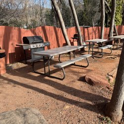
Picnic Areas in Sedona, Arizona
Scenic Night View in Sedona, Arizona
Natural Hot Springs in Sedona, Arizona
Swimming Lakes in Sedona, Arizona
Visitor Centers in Sedona, Arizona
Dog Friendly Hiking Trails in Sedona, Arizona
Camping Sites in Sedona, Arizona
Dog Friendly Things to Do in Sedona, Arizona
Scenic Drive in Sedona, Arizona
Trending Searches in Sedona, AZ
Boat Rental near West Fork Trail
Cliff Jumping near West Fork Trail
Dog Friendly Trails near West Fork Trail
Fireworks near West Fork Trail
Fruit Picking near West Fork Trail
Kayak Rental near West Fork Trail
Lakes & Ponds near West Fork Trail
Off Road Trails near West Fork Trail
Outdoor Activities near West Fork Trail
Places To Swim near West Fork Trail
Pool Day Pass near West Fork Trail
Public Pools near West Fork Trail
Public Shower near West Fork Trail
River Swimming near West Fork Trail
River Tubing near West Fork Trail
Scenic Night View near West Fork Trail
Scenic Overlook near West Fork Trail
Secluded Spots near West Fork Trail
Splash Pad near West Fork Trail
Sunrise View near West Fork Trail
Swimming Holes near West Fork Trail
Swimming Lakes near West Fork Trail
U Pick Farms near West Fork Trail
Watch Sunset near West Fork Trail
Browse Articles
Browse Nearby
BEST of Sedona, Arizona Coffee near West Fork Trail
BEST of Sedona, Arizona Restaurants near West Fork Trail
BEST of Sedona, Arizona Breakfast near West Fork Trail
BEST of Sedona, Arizona Things to Do near West Fork Trail
BEST of Sedona, Arizona Fishing near West Fork Trail
Browse Brands
Related Searches in Sedona, AZ
Affordable Kayak Rental Services in Sedona, Arizona
Best Fishing Locations and Guides in Sedona, Arizona
Best Places for Horseback Riding in Sedona, Arizona
Best Waterfalls and Swimming Holes in Sedona, Arizona
Check Out Off Road Trails in Sedona, Arizona
Discover Dog Friendly Trails to Explore in Sedona, Arizona
Discover Kid Friendly Hiking Trails in Sedona, Arizona
Discover Scenic Mountain Bike Trails Near Sedona, Arizona
Discover Scenic Waterfall Spots in Sedona, Arizona
Discover a Hiking Trail in Sedona, Arizona
Discover the Best Night Hike Trails in Sedona, Arizona
Dog-Friendly Hikes With Dogs in Sedona, Arizona
Enjoy Camping Adventures Around Sedona, Arizona
Enjoy Exciting Mountain Biking Adventures in Sedona, Arizona
Enjoy Kayaking Adventures in Sedona, Arizona
Enjoy Tent Camping Spots Around Sedona, Arizona
Enjoy the Best Picnic Spots and Ideas in Sedona, Arizona
Enjoy the Best Walking Trails in Sedona, Arizona
Exciting Cliff Jumping Spots in Sedona, Arizona
Experience Thrilling White Water Rafting in Sedona, Arizona
Explore Beautiful Parks and Green Spaces in Sedona, Arizona
Explore Bike Rentals Throughout Sedona, Arizona
Explore Easy Hikes Perfect for All in Sedona, Arizona
Explore Fun Activities to Do in Sedona, Arizona
Explore Popular Campgrounds Near Sedona, Arizona
Explore Top Dog Parks in Sedona, Arizona Near You
Explore the Best Boating Spots in Sedona, Arizona
Explore the Best Swimming Holes Around Sedona, Arizona
Explore the Best Trail Options in Sedona, Arizona
Family Friendly Hiking With Kids in Sedona, Arizona
Find Beautiful Views in Sedona, Arizona
Find Parks and Recreation Activities in Sedona, Arizona
Find Popular Ziplining Spots Around Sedona, Arizona
Find the Best Parks for Picnics in Sedona, Arizona
Find the Best Scenic View Locations in Sedona, Arizona
Hiking Trails With Waterfalls in Sedona, Arizona
Off Leash Dog Hiking Trails in Sedona, Arizona
Plan a Scenic Drive Route Near Sedona, Arizona
Popular Fishing Spots to Explore in Sedona, Arizona
Popular Outdoor Activities to Try in Sedona, Arizona
Popular Picnic Spots to Visit in Sedona, Arizona
Popular Things to Do in Sedona, Arizona
Safe River Swimming Areas in Sedona, Arizona
Safe and Fun Parks for Kids in Sedona, Arizona
Top Climbing Spots and Gyms in Sedona, Arizona
Top Running Trails to Explore in Sedona, Arizona
Top Swimming Spots and Pools in Sedona, Arizona
Top Things to Do With Kids in Sedona, Arizona